
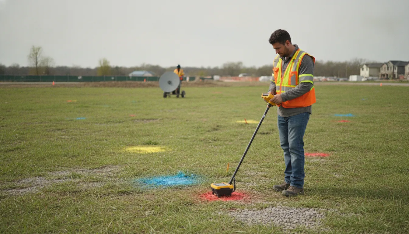
Private utility locating is a field investigation of privately owned or uncertain underground utilities within a defined project area. It helps homeowners, contractors, engineers, developers, municipalities, and facility teams identify subsurface information that public utility records or an 811 notification may not cover. SafeLine uses electromagnetic (EM) locating and ground penetrating radar (GPR) as appropriate for the site, utility type, access, and project question.
Tell SafeLine about your project and request a scoped investigation
Call 811 before digging where required. 811 and private locating serve different purposes: 811 coordinates public utility markings, while private locating investigates privately owned lines or uncertain infrastructure within an agreed scope. Neither a clear 811 ticket nor one private locate guarantees that every buried object will be identified.
This guide explains how to define the work area, prepare useful information, select an appropriate investigation, and interpret field markings. It also explains how to keep the results useful as a project changes. A responsible investigation establishes a clear scope, uses methods suited to the site, documents observations, and communicates limitations.
What a Private Utility Locating Service Delivers for a Project
Private locating is a site investigation focused on underground utilities and other buried infrastructure within an agreed work area. The provider reviews the project context and examines accessible portions of the property. The team applies appropriate detection methods and communicates indications through field marks and documentation. Deliverables depend on the project, surface conditions, records, and requested level of detail.
The service is valuable when utility-company records do not answer the project team's questions. A property may contain a private electrical feed to an outbuilding, an irrigation route, a communications line, a storm-drain connection, or a water or sewer lateral installed as part of an earlier improvement. These assets can matter to the next excavation even when their route is not obvious from the surface.
A private locate can support several decisions:
- Where should a proposed trench, footing, bore, pool, fence, or drainage feature be placed?
- Which parts of a site require additional utility coordination before construction?
- Which visible marks correspond to a line that must be protected during the work?
- What subsurface information should be added to a plan, site map, or facility record?
- Has a changed excavation limit created a new area that needs investigation?
For a small property project, the deliverable may center on visible mark-outs and practical site guidance. A commercial, engineering, or development project may need verification photos, mapping, reports, and coordination with design or construction teams. For an overview of the service and its project inputs, review SafeLine's private utility locating service. SafeLine also provides utility mapping and documentation when a lasting record is part of the project need.
The service does not transfer excavation responsibility to the locator. Owners, contractors, and other responsible parties still need to follow applicable notification, tolerance-zone, exposure, and safe-digging requirements. The locate is one source of field information that supports those decisions.
Which Projects Benefit Most From a Planned Locate?
The strongest use case is a project where a buried line could change safety, design, sequencing, access, or rework. This includes more than large construction. A private line serving a detached structure can matter as much to a homeowner installing a fence as a feeder does to a commercial site expansion.
Residential work
Homeowners and residential contractors should consider a private locate before installing fences, decks, pools, irrigation, landscape lighting, drainage features, additions, retaining structures, or footings. The risk is not limited to a large excavation. A series of post holes or a narrow trench can still cross a private service route.
Private locating is especially useful when a property has changed hands, an addition was built after the original utility installation, or the current owner lacks reliable as-built information. Detached garages, sheds, workshops, gates, pool equipment, and landscape features often create routes that are hard to infer from the main building connection. A field investigation can replace an assumption with documented observations before the crew starts work.
Commercial, civil, and development work
Contractors, developers, and engineers can use private locating during due diligence, early design, utility coordination, site work, building additions, road improvements, grading, boring, and facility expansion. Earlier information gives the team more options for adjusting a design or construction sequence. Waiting until equipment is mobilized can make a conflict more expensive to resolve.
Facility managers also benefit when repairs, equipment installation, pavement work, or maintenance will disturb an active campus. A private locate can help the team account for lines that serve buildings, site systems, or other private improvements. SafeLine supports residential and commercial utility locating across Virginia, Maryland, Washington, D.C., and North Carolina.
In every case, describe the actual work area rather than simply asking for a general locate. The quality of the project information affects how a provider scopes the investigation and explains the field findings.
How Should You Define the Locate Scope?
A clear scope turns a broad concern into a field assignment. Call 811 before digging where applicable, then identify where people or equipment may disturb the ground, what work will occur, and what buried assets are already suspected. 811 addresses the public utility marking process; the private investigation should be scoped to the privately owned or uncertain infrastructure and work area that still need review.
Start with the planned disturbance
Mark the proposed excavation, drilling, trenching, grading, or foundation limits on a current site plan or aerial image. Include access routes, staging areas, temporary roads, bore paths, laydown areas, and locations where equipment may need to be anchored. If the work will happen in phases, show each phase rather than treating the entire property as one undifferentiated area.
Note the depth or method of work when known. A shallow landscape installation, a deep footing, a directional bore, and a broad grading operation create different questions. The requested locate should cover the area where the work will actually occur, plus any route needed to connect the new improvement to an existing structure or service point. Use SafeLine's contact form to share the address, work area, planned activity, and available records so the investigation can be scoped around the real project.
List suspected private infrastructure
Gather what is known about electric, gas, water, communications, fiber, irrigation, storm drainage, lighting, and other site systems. Include the locations of meters, panels, wells, control boxes, cleanouts, valves, transformers, generators, pool equipment, outbuildings, and utility entry points. A visible feature is not proof of a line route, but it gives the locator a useful starting point.
Also identify uncertainties. Tell the provider if a previous owner described a buried line, if a plan conflicts with field conditions, or if a service interruption suggests an undocumented route. The goal is not to pre-diagnose the site. It is to make the questions visible before the investigation begins.
Define the expected output
Ask whether the project needs field markings only, verification photos, a written report, a map, or a combination. If a designer or construction manager will rely on the findings, explain the format and coordinate system they use. When several parties will receive the result, identify who should attend the handoff and who can authorize a scope adjustment.
A scope can be summarized in a simple table:
| Scope item. | What to document. | Why it matters. |
|---|---|---|
| Work area. | Limits, access, phases, and proposed disturbance. | Defines where the investigation is needed. |
| Known features. | Meters, buildings, panels, boxes, drains, and prior marks. | Provides context for tracing and interpretation. |
| Suspected utilities. | Type, likely destination, and known uncertainty. | Helps match methods and field questions. |
| Deliverables. | Marks, photos, report, map, or handoff. | Aligns the field work with project use. |
This preparation does not need to be perfect. It gives the provider enough context to ask better questions and reduces the chance that an important work zone is left outside the agreed scope.
What Information Should You Provide Before the Site Visit?
Useful records improve the conversation between the project team and the locator, even when the records are incomplete. Send the site address, a current plan or aerial image, the proposed work limits, and the target schedule. Include the name and contact information of the person who can provide site access and answer questions in the field.
Where available, provide:
- Recent civil, architectural, landscape, or utility plans.
- As-built drawings, previous survey information, and prior locating reports.
- Photos showing meters, service entrances, outbuildings, equipment, and unusual surface features.
- Information about ownership, tenants, facility operations, or access restrictions.
- The proposed excavation method, approximate depth, and construction sequence.
- Details about known outages, abandoned improvements, remodels, or past utility work.
Records are evidence, not a guarantee. A drawing may show the intended route rather than the route that was installed. A previous mark may have faded or may cover a different work area. A locator uses the available information as one part of the assessment, then compares it with visible conditions and field responses.
Access planning matters as well. GPR requires a surface that can be scanned, while EM locating may require access to a conductive line. A suitable connection point, or a route that can be traced. Vehicles, stored materials, dense vegetation, standing water, construction debris, and locked areas can limit what can be examined. Tell the provider about these conditions before the visit so the scope and limitations are realistic.
If the site is active, establish a safe working arrangement. Identify who controls the work area, where the technician can park, which areas require an escort, and whether equipment or operations must be paused. A safe and orderly site visit produces better information than a rushed inspection around moving equipment.
For larger projects, make one person responsible for consolidating records and questions. Multiple versions of a plan can create confusion if the locator receives an outdated drawing or an excavation limit that no longer matches the current design. Send the latest revision and note any changes since earlier conversations.
How Are EM, GPR, and Records Combined Into a Site Picture?
Technology selection should follow the suspected utility, the surface, the soil, the level of access, and the question the project needs answered. SafeLine uses electromagnetic, or EM, locating equipment alongside ground penetrating radar, or GPR. These methods provide different types of information and are often more useful when interpreted together with records and visible site evidence.
EM locating for conductive routes
EM locating can help trace a conductive line through a site when the line and conditions provide a usable signal. It is useful for investigating certain metallic utilities, conductors, and lines with tracer wire. The technician interprets the signal in context, rather than treating every response as proof of a complete route.
Signal strength, access, line construction, interference, and connections can affect the result. A nonconductive line without a traceable conductive path may require a different investigation. The absence of an EM response does not establish that the ground is clear.
GPR for additional subsurface investigation
GPR sends radar energy into the subsurface and interprets reflections from changes or features below the surface. It can support investigation of metallic and nonmetallic targets, including situations where an EM signal is not available. Soil composition, moisture, surface material, depth, clutter, and access affect how clearly a feature can be interpreted.
GPR responses still require professional interpretation. A reflection indicates an area for review, not an automatic identification of a specific utility. The field team considers the response alongside records, visible structures, EM results, and the planned work.
Why the combined approach matters
EM and GPR answer related but different questions. EM can help follow a conductive route. GPR can add subsurface information where the route or target does not produce the same kind of signal. Records and site features provide context for both. The result is a reasoned site picture that acknowledges uncertainty instead of forcing every observation into a predetermined answer.
SafeLine's GPR service information provides more detail about the radar side of this work. A provider should also explain which method was used, which areas were accessible, what was marked, and what conditions limited the investigation.
Calling 811 is still required before digging where applicable. Virginia guidance explains that public utility marking does not necessarily identify every privately owned line on a property. The Virginia utility safety guidance is a useful reminder to account for private facilities separately. A private investigation supplements that process and does not replace it.
Ask SafeLine to scope EM and GPR locating for your work area
How Should Teams Use Markings and Documentation?
Field markings are most useful when the people planning and performing the work understand what they represent. Before construction starts, walk the work area with the responsible supervisor or project contact. Review the mark colors or symbols used, the approximate routes, areas that could not be accessed, and any questions that remain unresolved.
Do not move, paint over, or treat a mark as permanent without a documented reason. Weather, traffic, grading, landscaping, and other construction activity can disturb marks. If the work will continue over time, photograph the marked area and preserve the report or map in the project record. A map can provide a durable reference after paint has faded, but it does not make a changed work area automatically covered.
Use the results in coordination with the project plan:
- Compare the marked routes with the proposed excavation limits.
- Identify conflicts, clearance questions, and areas where the design needs review.
- Share the field documentation with the superintendent, foreman, designer, owner, and relevant subcontractors.
- Keep required public utility notifications and other safety procedures active.
- Pause and reassess if the work area, method, or site conditions change.
For a design team, the important question may be whether a utility corridor affects the location of a footing or new service. For a field crew, it may be where hand exposure or another verification step is required. For a facility manager, it may be how the information should be added to the campus record. The same locate can serve each group when the handoff explains the result in practical terms.
Documentation should also preserve limits. A report that clearly states the investigated area, accessible surfaces, methods used, and observed constraints is more useful than a vague statement that a site was located. The purpose is to support a decision, not to create a false sense of certainty.
When Does a Locate Need to Be Updated?
A private locate should be revisited when the project no longer matches the original scope. An update may be appropriate when excavation limits expand, the design changes, a new phase begins. Marks are disturbed, the site is regraded, or a previously inaccessible area becomes part of the work.
Time alone is not the only reason to reassess. Consider an update when:
- The contractor changes from a shallow installation to deeper excavation or boring.
- A new structure, utility connection, drainage route, or temporary facility is added.
- Construction activity has covered, removed, or damaged the original marks.
- New records conflict with the earlier field interpretation.
- The original locate excluded a portion of the property now included in the plan.
- A utility strike, outage, or unexpected subsurface feature changes the risk picture.
- Another contractor will perform work in an area that was not part of the first request.
When conditions change, do not extend the old marks by assumption. Give the provider the revised plan and explain what changed. The new scope may be narrow, or it may require a broader review depending on the conflict.
Project records should identify the date of the investigation, the work area, the documents used, and any stated limitations. That information helps later teams understand whether a map applies to their work or whether a new investigation is needed. SafeLine can help project teams determine whether the locating process should be adjusted for a new phase.
What Should You Ask a Private Utility Locating Provider?
A useful provider conversation is specific about the work, not just the property address. Ask how the company will define the work area, which records it wants, what field methods may be appropriate, and what the final deliverables will include. The answers should help you understand both the value and the limits of the proposed service.
Questions to ask include:
- What should be included in the marked work area and access route?
- Which privately owned utility types or site systems are relevant to this project?
- Will the investigation use EM locating, GPR, or both, and why?
- What site conditions could limit access or interpretation?
- Will the deliverables include photos, maps, a report, or a project handoff?
- How should the field marks be preserved and communicated to the crew?
- What should happen if the excavation plan changes after the visit?
- How can the findings be added to the property's future utility records?
Be cautious with any provider that treats a locate as a universal guarantee. Responsible subsurface work recognizes that methods have limits and that conditions vary from site to site. Clear communication about scope is a sign that the provider is planning for the actual project rather than selling an undefined result.
SafeLine serves contractors, engineers, developers, municipalities, utility companies, facility teams, and property owners in Virginia, Maryland, Washington, D.C., and North Carolina. The team can discuss private utility locating, GPR, concrete scanning, subsurface utility engineering, utility mapping, and emergency locating needs. A project conversation should begin with the address, work area, planned activity, timing, and records available.
Frequently Asked Questions
What is the first step when requesting private utility locating?
Define the proposed work area and the activity that may disturb the ground. Gather the site address, current plans or aerial images, known utility information, access details, and the deliverables your team needs. Call 811 separately wherever required. The private locator can then help refine the scope around the actual project.
Does a private locate replace calling 811?
No. Calling 811 remains an essential or required step before digging where applicable. Private locating addresses a different need by investigating privately owned or uncertain infrastructure that may fall outside public utility marking. Use the two processes together and follow the applicable excavation requirements.
Should a project request EM locating, GPR, or both?
The answer depends on the suspected utility, site conditions, access, and project question. EM locating can help trace conductive routes. GPR can provide additional subsurface information, including where a conductive signal may not be available. A qualified provider can explain why one method or a combined EM and GPR approach fits the proposed work.
What happens if the construction plan changes after the locate?
Compare the revised plan with the original investigated area and contact the locating provider before extending the work. A new excavation limit, deeper method, disturbed mark, or added utility route can create a new scope. Do not assume that original field markings cover an area or activity that was not part of the request.
Plan the Next Step Before Ground Disturbance
A private utility locating service is most useful when it is connected to a real project decision. Define the work area, provide current records, use methods suited to the site, preserve the field information, and update the investigation when the plan changes. That workflow helps owners and project teams use underground utility information responsibly.
Tell SafeLine about your private utility locating project through the contact form
Share the site address, planned work area, activity, available records, and the output your team needs. SafeLine can help determine what information to prepare and what scope may fit the site. The contact form does not replace 811 or other required safety procedures. It gives your team a clear way to discuss the next step before excavation, construction, or other ground-disturbing work begins.