GPR investigation, interpreted by specialists

Pre-construction subsurface intelligence for project teams in Virginia and Washington, DC.

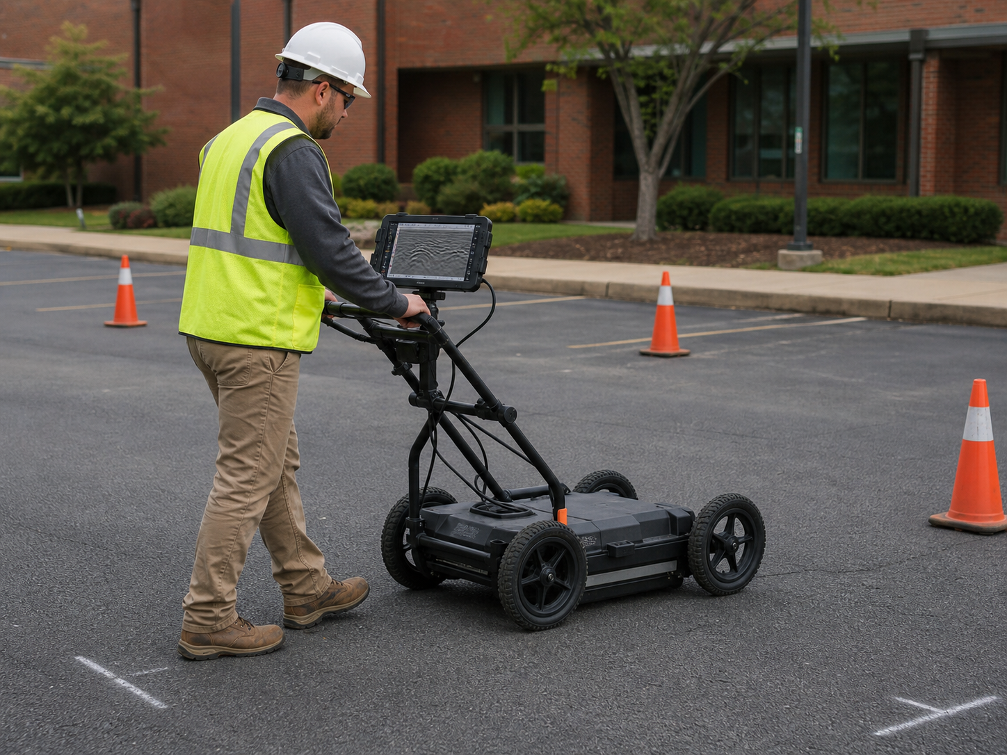
A SafeLine specialist operating a ground-penetrating radar unit on a commercial site

What it reveals

What GPR investigation reveals

Findings are confidence-classified, not presented as exact locations or guaranteed depth. Credibility comes from honesty about what the investigation confirms.

  • Possible buried utilities
  • Non-conductive or untraceable lines
  • Subsurface anomalies
  • Conditions requiring further investigation

When to use GPR

  • Pre-excavation investigation
  • Untraceable or non-conductive lines
  • Anomalies affecting project decisions

Related: Private utility locating

Site conditions

What affects a GPR investigation

GPR is an interpreted geophysical method. Ground conditions, target material and orientation, congestion, surface access, and the survey pattern all influence what the evidence can support.

Ground and surface
Soil, moisture, pavement, fill, and surface obstructions can change signal quality and accessible coverage.
Target characteristics
Material, size, orientation, depth, and contrast with surrounding conditions affect whether a reflection can be interpreted.
Survey design
A measured grid or targeted passes organize coverage around the project question rather than scanning without a defined decision.
Finding language
SafeLine reports interpreted, confidence-classified findings—not a promise of exact depth, exact location, or complete detection.

Process

Scope, investigate, classify, document.

GPR work runs inside the same methodical investigation sequence as the rest of the service line, with deliverables structured for contractor and engineering workflows.

ASCE 38-aligned methodology

  1. 01Scope

    Understand the site, intended work, and decisions the project team needs to make.

  2. 02Investigate

    Apply the field methods appropriate to the site and the infrastructure in question.

  3. 03Classify

    State confidence in findings instead of presenting uncertainty as exactness.

  4. 04Document

    Deliver a defensible record in formats that fit contractor and engineering workflows.

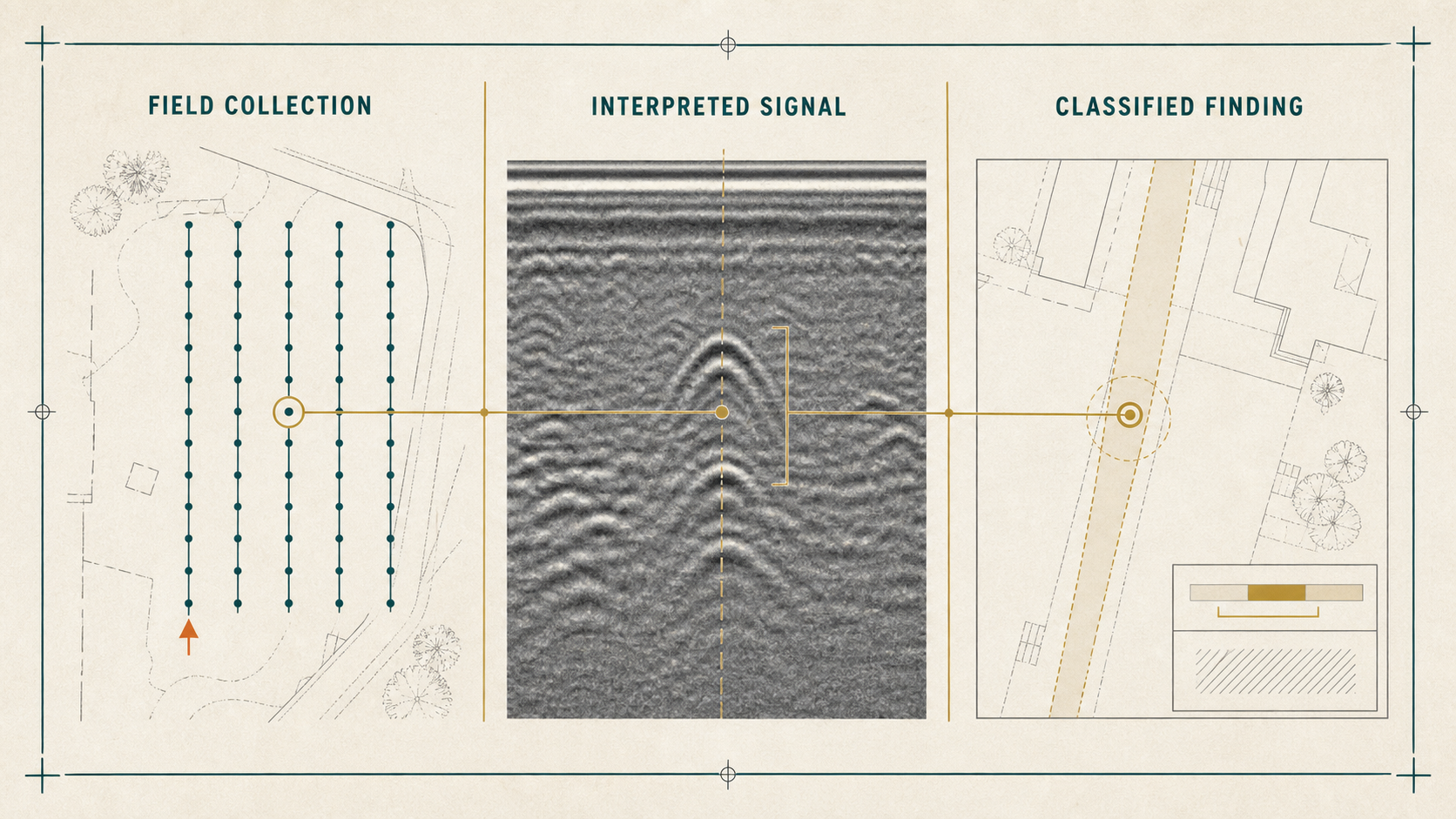
Methodology plate connecting a measured GPR survey grid to an interpreted signal response and a confidence-classified project record
  1. 01Field collection
  2. 02Interpreted signal
  3. 03Confidence-classified finding

Field position and signal response are interpreted in site context, then documented with confidence and limitations stated.

Interpretation is part of the finding.

Site conditions affect what GPR can confirm. Findings are confidence-classified rather than presented as exact locations or guaranteed depth.

Deliverables

Deliverables for contractor and engineering workflows

Deliverables are structured for contractor and engineering firm workflows, drawing on the documentation range from KMZ files to pre-construction intelligence reports.

  • 01KMZ files
  • 02Pre-construction intelligence reports
  • 03Congestion mapping
  • 04Verification recommendations
Utility mapping and documentation

GPR questions

Can GPR provide exact depth?

No. Findings are confidence-classified, and site conditions affect what can be confirmed.

What affects confidence?

Ground conditions, congestion, material, and access can change what a GPR investigation can confirm on a given site.

Where does GPR fit in scope?

It supports the investigation when the target or condition calls for it, alongside utility designation and mapping.

Is GPR the same as utility designation?

No. GPR is one investigation method within the service line. Private utility designation covers the designation and documentation of privately owned lines.

Full FAQ

Method fit

Choose the method that fits the project question

GPR may stand alone for a defined subsurface question or work alongside electromagnetic designation and mapping. The scope should follow the evidence needed, not a preferred piece of equipment.

01

Conductive utility with an accessible connection

Investigation
Electromagnetic designation may provide a direct locating response.
Usable record
Designated alignment and documented finding.
Decision supported
Plan around a traceable private utility.

02

Non-conductive or untraceable target

Investigation
GPR can investigate for a plausible subsurface reflection when conditions permit.
Usable record
Interpreted anomaly with stated confidence.
Decision supported
Determine whether further verification is warranted.

03

Congested or uncertain site

Investigation
Use complementary methods and a deliberate survey pattern.
Usable record
Combined field evidence, mapping, and limitations.
Decision supported
Coordinate work without treating uncertainty as exactness.

Plan a Subsurface Investigation

Tell SafeLine where the project is, what work is planned, and what the project team needs to know before excavation or construction begins.