
Choosing a locating method is not simply a matter of picking the newest equipment. Contractors, engineers, and property owners need to understand what the site can transmit. What the utility is made of, and what documentation the project requires before excavation or design decisions move forward. The private utility locating guide explains why a public 811 mark may not show every line on a property.
Need help deciding which method fits your site? Contact SafeLine Subsurface with the project location, planned work, and any known utility information.
The difference between GPR and electromagnetic locating comes down to how each method reads the subsurface. EM follows conductive lines or tracer wires that can carry a signal. GPR sends electromagnetic pulses into the ground and interprets reflected signals. Because those conditions vary across a site, the two methods are often more useful together than as competing choices.
SafeLine Subsurface uses Ground Penetrating Radar (GPR) and Electromagnetic (EM) locating to investigate private utilities beyond public 811 marking. The field approach can include markings, mapping, verification photos, and project documentation. Start with how EM locating works and where signal access affects the result.
What Is Electromagnetic (EM) Utility Locating?
Electromagnetic locating uses a receiver to detect a signal traveling along a conductive utility or tracer wire. The signal may come from an energized line, or a technician may introduce a controlled signal. That signal creates an electromagnetic field that the receiver follows across the surface, helping the technician trace the utility's path and mark it in the field.
There are several ways to apply the signal. With a direct connection, the technician connects the locating equipment to an accessible conductor. A clamp can transfer the signal around a cable without a direct electrical connection. Induction applies the signal from above when direct access or clamping is not practical. The appropriate method depends on the utility, available access, selected frequency, and surrounding site conditions.
What EM locating can and cannot detect
EM locating is well suited to metallic pipes, cables, and nonmetallic facilities installed with tracer wire because those systems can carry or respond to the signal. It is not a universal method for every buried utility. A nonconductive pipe without tracer wire, an inaccessible connection point, signal distortion, nearby reinforcement, or other electromagnetic interference can limit the usefulness of a reading.
Induction can also couple through the air near the signal source and create a misleading response. For that reason, technicians interpret signal strength, depth estimates, line direction, and behavior across multiple passes. A single receiver response should not automatically be treated as a confirmed utility.
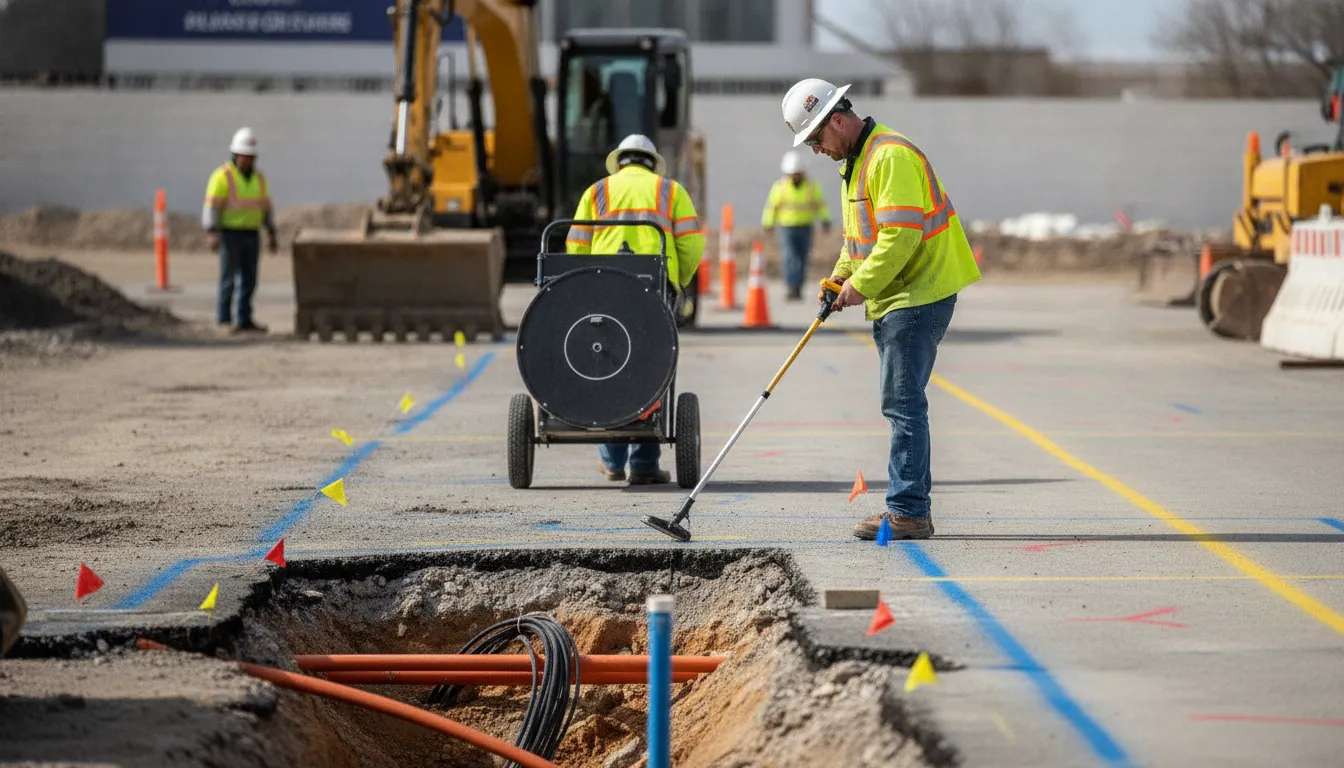
Handheld EM locating equipment is one of the tools SafeLine uses for private utility locating. The company evaluates the utility type, signal conditions, terrain, and project needs before selecting a locating approach. Private utility locating services can supplement public marking by investigating privately owned lines and other infrastructure that may fall outside a standard 811 locate.
What Is Ground Penetrating Radar (GPR) Scanning?
Ground Penetrating Radar is a nondestructive method for investigating what lies below a surface without excavation. A GPR antenna sends electromagnetic pulses into the ground and records energy reflected by changes in subsurface materials. An operator interprets those responses to identify potential pipes, conduits, slabs, voids, or other features.
GPR responds to contrasts with the surrounding material, so the target does not have to be conductive. This is why GPR can support investigations involving metallic and nonmetallic infrastructure. Plastic pipe, fiber-optic conduit, and other nonmetallic facilities may produce a detectable response even when they cannot carry an EM locating signal. The result is a subsurface response pattern, not a direct electronic trace of the target.
The Federal Highway Administration describes GPR as a nondestructive evaluation technique that uses changes in subsurface properties to identify features such as plastic pipe. Its GPR overview provides additional technical context.
Frequency, depth, and image detail
Antenna frequency involves a practical tradeoff. Higher frequencies generally produce more detail at shallower depths, while lower frequencies can reach farther with less resolution. The appropriate choice depends on the target, surface, and project objective. A concrete scanning investigation may prioritize detail near the surface, while utility mapping may require a different balance between depth and image definition.
Why site conditions matter
GPR is not a universal see-through tool. Moisture, clay, conductive soil, surface clutter, reinforcement, and closely spaced buried features can weaken or complicate radar responses. In some clay-rich or highly conductive materials, useful penetration may be limited. Dry, resistive materials may permit greater penetration, but actual results depend on conditions at the site.
Professional interpretation is essential because a radar image must be evaluated in context, correlated with visible evidence, and documented for the project team. A qualified provider can use ground penetrating radar investigations to support field markings, mapping, and decisions about whether GPR should be paired with EM locating.
The Difference Between GPR and Electromagnetic Locating
The difference between GPR and electromagnetic locating is primarily the way each method interacts with buried infrastructure. EM locating follows a signal on a conductive line, while GPR sends energy into the ground and interprets reflections from subsurface materials. Neither method is the universal answer. The right choice depends on the utility, access, soil, surface, and information the project requires.
| Consideration | Electromagnetic locating | GPR |
|---|---|---|
| Signal basis | Detects an electromagnetic field carried or induced on a conductive utility. | Sends electromagnetic pulses into the ground and interprets reflected responses from subsurface interfaces. |
| Target material | Best suited to metallic lines, cables, and nonmetallic utilities installed with tracer wire. | Can support investigation of metallic and nonmetallic objects when they create a detectable contrast with surrounding material. |
| Access requirement | Results depend on a conductive path and, where applicable, access for a direct connection, clamp, or induction. | Does not require the target itself to carry a locating signal, but the antenna and survey path must be suitable for the site. |
| Site conditions | Can perform across many field conditions, although interference and signal distortion still require interpretation. | Performance can be reduced by conductive or clay-rich soils, moisture, and other conditions that attenuate the signal. |
| Typical outputs | Useful line paths, field marks, and signal information for tracing conductive utilities. | Subsurface response data that can support locating, marking, and mapping buried features. |
| Main limitation | May not identify a nonconductive utility when no tracer wire or usable signal is available. | Reflections require skilled interpretation, and depth or visibility varies with equipment and ground conditions. |
On an active site, professionals may use EM first to trace conductive lines, then use GPR to investigate areas where material, signal access, or site conditions create uncertainty. A combined approach addresses different blind spots rather than forcing a choice between technologies.
When Should You Use EM Locating or GPR Scanning?
The right method depends on what is buried, whether a usable signal can be applied, and what the project needs from the final locate. Use this framework before excavation or design coordination:
- Identify the likely utility material. EM locating is a strong starting point for conductive utilities, including metallic pipes, cables, and facilities installed with tracer wire. GPR sends radar pulses into the ground and reads reflected responses, so it can support investigation of nonmetallic infrastructure when a conductive signal is not available.
- Check access to the conductor or tracer wire. Ask whether the line can be reached for a direct connection, signal clamp, or induction. Without a practical way to apply or trace a signal, EM may not provide the information the project requires. Nearby conductors, rebar, mesh, and induction around a signal source can also affect interpretation.
- Evaluate the ground and work area. Soil moisture, clay content, conductivity, terrain, surface access, and obstructions can affect GPR penetration and image quality. Conductive or clay-heavy soils may limit radar investigation, while EM can perform across many soil and field conditions.
- Define the project scope. A small excavation may need clear field marks, while a roadway, addition, commercial site, or design project may also need depth information, verification photos, and mapped documentation. If the subsurface picture is complex, using EM and GPR together can address different materials and signal conditions.
- Complete required public and private locating steps. Contact 811 wherever legally required. Private locating supplements public marks by addressing utilities that may fall outside one-call coverage. Review the project plans and property information, then document the locate in a format the crew and design team can use.
There is no universal rule that makes one technology better for every project. A professional assessment should account for the target, the surface, the expected depth, access, and the consequences of an incomplete locate.
Planning excavation or construction? Share the site conditions and scope with SafeLine before scheduling field work so the locating approach can be matched to the project.
Why Using Both Technologies Gives You a More Complete Picture
EM locating and GPR examine the subsurface from different angles. EM follows a signal associated with a conductive utility, such as a metallic pipe, cable, or line installed with tracer wire. GPR sends pulses into the ground and interprets reflected signals created by changes between subsurface materials. Because the methods respond to different physical conditions, using both can reduce blind spots that may occur when a project relies on one technology alone.
For example, an EM sweep may help trace a conductive line across a site. GPR can then investigate nearby areas for objects or utility materials that do not provide a usable conductive signal. GPR may also show responses from contrasts in the surrounding soil. The quality and depth of those responses depend on moisture, clay content, conductivity, surface materials, and the selected equipment.
From signals to decisions
The value of a combined approach depends on how the information is interpreted in the field. A trained locator considers signal behavior, surface conditions, site history, access to conductors or tracer wires, and the relationship between readings from both technologies. Apparent conflicts or ambiguous responses may require additional passes, alternate settings, exposure by an appropriate method, or coordination with the project team before excavation proceeds.
The finished result should be useful beyond the day of the locate. Clear field markings, verification photos, and organized documentation help contractors and engineers connect what was observed underground with the plans and work taking place above ground. Combined methods complement required 811 procedures and do not replace them where one-call notification is required.
How SafeLine Combines EM and GPR for Utility Detection
Every locate begins with the project context, not a default piece of equipment. SafeLine clarifies the work area, planned excavation or construction, known utilities, and whether 811 has been contacted where required. Public marking remains an important part of damage prevention, but private utilities and site infrastructure may fall outside 811 coverage.
Next, the field team considers site conditions and the types of infrastructure that may be present. A conductive electric, gas, water, communications, or tracer-wire line may respond to an electromagnetic signal, making EM locating useful for tracing its path. GPR adds another perspective by sending pulses into the ground and interpreting reflected signals. That can support investigation of metallic and nonmetallic infrastructure, including plastic utilities, fiber, irrigation, storm drains, and other buried features.
SafeLine can use EM equipment and GPR sequentially or together, rather than treating the difference between gpr and electromagnetic locating as a winner-takes-all decision. EM may help follow a line when a usable signal is available. GPR may help investigate areas where a line is nonconductive or where the signal path is uncertain. Professional interpretation remains essential because neither method should be presented as a universal guarantee under every site condition.
After the investigation, the deliverable is more than a device reading. SafeLine can provide field markings, verification photos, utility mapping, and documentation for project coordination and future reference. SafeLine supports residential and commercial work across Virginia, Maryland, Washington, DC, and North Carolina, with the scope of each project determining the appropriate combination of services.
Frequently Asked Questions
How does electromagnetic locating work?
EM locating follows a signal carried by a conductive utility, such as a metallic pipe, cable, or facility with tracer wire. The signal may be applied through a direct connection, clamp, or induction, then traced at the surface. Results depend on access to the line, signal strength, nearby conductors, and site conditions. EM is not a universal method for nonconductive utilities that cannot carry or respond to a signal.
What can GPR not detect?
GPR does not guarantee detection of every buried object or utility. Its performance can be limited by conductive, clay-rich, or highly moist soils, as well as target depth, material contrast, antenna selection, and site interference. GPR can support investigation of nonmetallic infrastructure, but an experienced operator must interpret the data in context rather than treating every response as a confirmed utility.
How do you choose between GPR and EM locating?
Start with the utility material, whether a conductor or tracer wire is accessible, soil and surface conditions, the expected depth, and the documentation the project requires. EM may be an efficient choice for conductive lines with a usable signal. GPR may add value when the target is nonmetallic or signal access is uncertain. The right method depends on the site, not on a universal ranking between technologies.
Should contractors use GPR and EM together?
Often, using both methods can reduce blind spots because the technologies respond to different characteristics. EM can trace a conductive path, while GPR can help investigate subsurface contrasts and nonconductive infrastructure. A professional can compare the results, mark findings, and document uncertainty. Combined methods complement required 811 procedures and do not replace them where one-call notification is required.
Ready to Plan Your Utility Investigation?
Choosing between GPR and electromagnetic locating depends on the utilities, site conditions, and documentation your project requires. A combined approach may help your team build a clearer picture before excavation or construction moves forward. To request a project quote for private utility locating, GPR, or utility mapping, contact SafeLine Subsurface with your project details.