
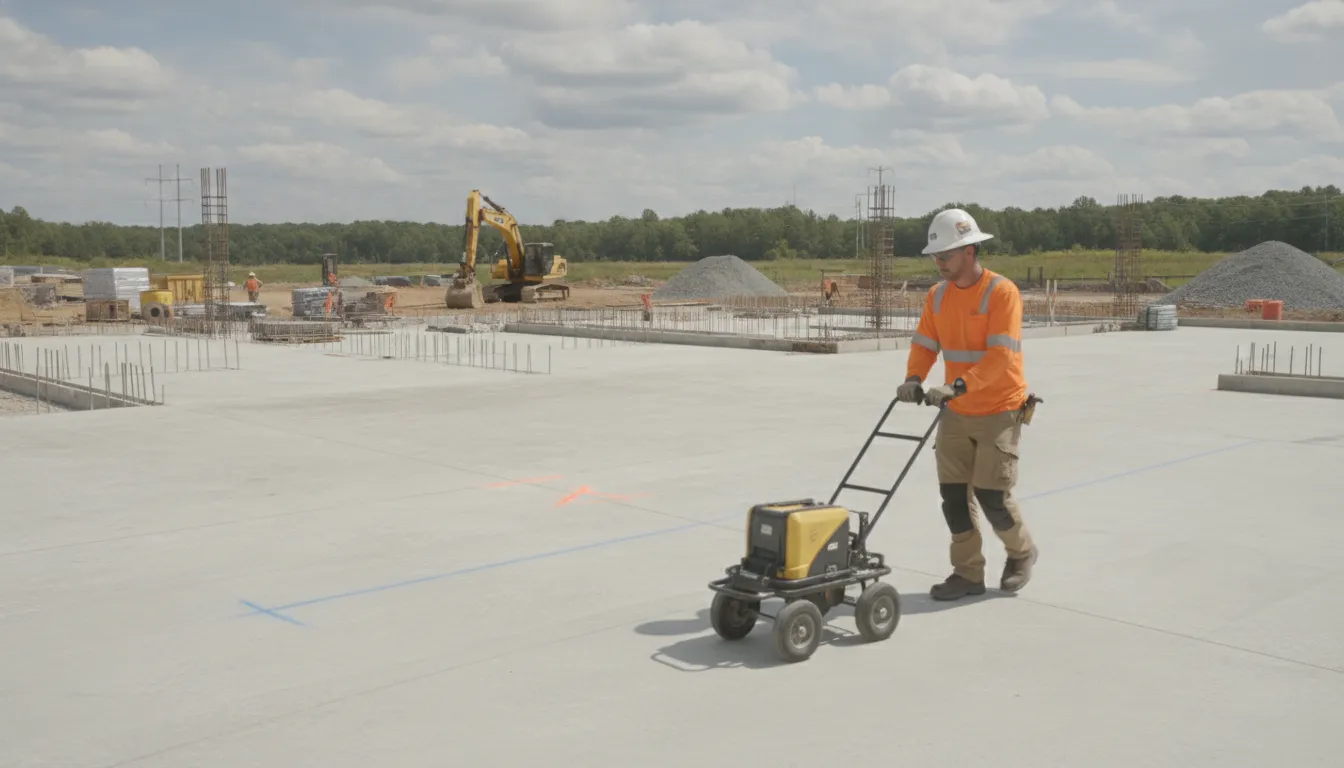
Before a crew drills, cores, cuts, or anchors into concrete, the visible surface rarely tells the full story. Reinforcing steel, conduits, post-tension elements, voids, and other embedded features can affect both the work plan and the risk of striking critical infrastructure.
A gpr concrete scanning service uses high-frequency electromagnetic waves and reflected signals to help identify subsurface features without destructive excavation. It can support decisions about reinforcement layout, concrete thickness, cover, and embedded anomalies. But results depend on site conditions and should be interpreted as part of a broader investigation. Where conductive lines are involved, EM locating can complement GPR.
For engineers and contractors, the useful question is not simply whether GPR is available. It is what the scan needs to reveal, which method fits the target, and what documentation the project requires. Start with how this technology works and what a properly scoped scan can contribute before selecting the field approach.
What Is a GPR Concrete Scanning Service?
A GPR concrete scanning service uses ground penetrating radar to examine concrete and other subsurface materials without cutting, drilling, or otherwise damaging the structure. The goal is to give a project team a clearer picture of what may be concealed before work begins. That information can support safer decisions about coring, anchoring, saw cutting, penetrations, repairs, and modifications.
How ground penetrating radar works
A GPR antenna transmits high-frequency electromagnetic waves into the structure and records the signals that return. Those reflections occur at boundaries where electrical properties change, such as the interface between concrete and an embedded object or a change within the concrete itself. A trained professional interprets the resulting data in the context of the surface, construction, and requested work area.
GPR is therefore an imaging and investigation method, not a simple yes-or-no detector. Depending on the project and the available access, systems may use ground-coupled or air-coupled antennas. The selected equipment and scanning approach should match the surface and the question the project needs to answer. The Federal Highway Administration describes GPR as a rapid, nondestructive testing method with applications across structures and subsurface investigations: FHWA guidance on GPR and reinforcement locating.
What the service can help a project understand
Concrete scanning may help identify and map reinforcement, estimate concrete thickness and reinforcement cover, and locate embedded cables, conduits, and other objects. It can also reveal indications of concrete conditions such as voids, honeycombing, or other material changes. These findings can help engineers and contractors refine a work area before a planned operation reaches the concrete.
The deliverable is not necessarily a universal map of every condition below the surface. Results depend on site and subsurface conditions, target materials, access, and the scope of the scan. Surface conditions and construction details can affect how signals are collected and interpreted. A responsible provider explains those limits rather than presenting a scan as a guarantee.
How GPR fits with electromagnetic locating
GPR and electromagnetic, or EM, locating answer different questions and can complement one another. GPR can support detection of metallic and non-metallic infrastructure. EM locating is used for conductive lines. SafeLine uses a dual-technology approach that combines both methods when the site and project needs call for it.
That broader view matters when a project involves both concrete work and underground utility coordination. The Federal Highway Administration recommends using GPR as a complementary engineering tool rather than a complete standalone solution: FHWA's complementary-tool guidance. The right service begins with a clear scope, the planned work, and the conditions that may influence the investigation.
What Can GPR Concrete Scanning Find?
A concrete scan helps reveal the features and changes hidden below a slab, wall, deck, or pavement surface. The radar response is interpreted to identify likely subsurface elements, not to create a perfect picture of every condition. Depending on the project and the material, a scan may help locate:
- Rebar and other reinforcement, including its general configuration and cover.
- Post-tension cables, conduits, and other embedded objects.
- Voids, honeycombing, rock pockets, and other concrete heterogeneity.
- Changes that may indicate deterioration, corrosion, delamination, or debonding.
- Variations that help estimate concrete or deck thickness.
- Buried utilities and other anomalies where the site conditions support detection.
These findings can inform decisions about proposed coring, drilling, cutting, anchoring, repairs, and further investigation. A provider can mark relevant indications on the surface and document them for the project team, subject to the scope and conditions of the scan.
Reinforcement, cables, and conduits
Rebar is one of the most common targets. GPR can support mapping the reinforcement layout and estimating concrete cover, which helps the team understand where steel may be present before work disturbs the structure. The scan may also identify post-tension cables, conduits, and other embedded objects. A commercially available concrete scanning service describes these targets as including rebar, post-tension cables, conduits, and voids, but target identification still depends on the actual surface, material, access, and surrounding conditions.
Conduits can be especially important where electrical, communications, or other building systems pass through concrete. Their presence may not be apparent from visible plans or finishes. A scan gives the project team additional information to coordinate penetrations and avoid relying on assumptions about what is inside the concrete.
Voids, deterioration, and embedded anomalies
GPR can also help identify changes in the concrete itself. FHWA lists rock pockets, honeycombing, and voids as examples of concrete heterogeneity that GPR may identify: FHWA guidance on GPR and reinforcement locating. In reinforced concrete pavement slabs, FHWA also identifies possible corrosion, delamination, deterioration, debonding, honeycombing, and voids as applications for nondestructive evaluation: FHWA guidance on concrete defect detection.
Those signals are indicators for interpretation and decision-making. They do not automatically establish the cause, severity, or structural consequence of a condition. The appropriate next step may include engineering review, targeted opening, material testing, or another inspection method.
Thickness and cover estimates
Where the response is suitable, GPR can support estimates of deck or concrete thickness and reinforcement cover. This information is useful when the planned work depends on the space between the surface and embedded elements. It should be treated as project-specific interpreted information rather than a universal guarantee of depth or accuracy.
For that reason, the best deliverable connects each marked or mapped indication to the planned work. A clear scope, careful field interpretation, and documentation help engineers and contractors decide where additional verification is warranted before proceeding.
When Should Engineers and Contractors Schedule a Scan?
Schedule a scan before work that will disturb concrete or depend on knowing what is inside it. That includes drilling, coring, cutting, anchoring, and creating penetrations for conduit, piping, fasteners, or other building systems. The objective is to give the project team better information before a planned location becomes a field decision.
Before drilling, coring, or creating penetrations
Engineers and contractors should include scanning during planning for openings, equipment supports, sleeves, anchors, and core holes. A scan can help identify conditions that affect the proposed work and support decisions about where cutting, coring, or anchoring can proceed. Findings can be marked on the surface and paired with estimated depths, giving the crew a clear reference at the work area. These findings support safer decisions, but they do not replace engineering judgment or a broader site investigation.
Provide the scanning team with the planned work and its locations. The more clearly the scope identifies what will be cut, cored, drilled, or anchored, the more useful the field survey can be. The planned opening size, layout, and work sequence may also affect which areas need to be surveyed.
During renovations, expansions, and site investigations
Scanning is relevant when an existing facility is being renovated, expanded, or adapted for new systems. It can be part of early project planning, before drawings are finalized, or a focused field check immediately before construction. Contractors may need it for additions, facility expansions, excavation, and related site work. Engineers may use it while coordinating design, subsurface investigations, and construction activities.
Concrete scanning applies across different structural surfaces, including slabs, walls, and elevated decks. The work may be especially useful where drawings are incomplete, conditions have changed, or the proposed work crosses a high-consequence area. It can also support investigations when the team needs to understand existing conditions without immediately opening the structure.
When the facility is occupied or the job site is active
Occupied buildings, hospitals, schools, and active job sites require careful coordination because access, noise, scheduling, and work-area controls matter. GPR is commonly used for concrete imaging in these environments, according to industry guidance from Rainier GPR: https://rainiergpr.com/. Schedule early enough to coordinate access with facility staff, isolate the survey area, and avoid sending a crew into an inaccessible or unsafe work zone.
Plan the method around the site rather than treating GPR as a standalone guarantee. SafeLine combines GPR with EM locating where the project calls for both technologies. Review the GPR and concrete scanning service options, then share the surface type, target locations, planned work, access limitations, and desired documentation when requesting a scoped service.
How Does the Scanning Process Work?
A useful scan is a planned field process, not simply moving a device across a slab. The technician first defines the work area and the decision the scan needs to support, then selects and combines methods that fit the site. SafeLine uses Ground Penetrating Radar (GPR) alongside Electromagnetic (EM) locating. These technologies provide different information, so one does not replace the other.
From project scope to usable records
GPR transmits high-frequency electromagnetic pulses and interprets reflections caused by changes in subsurface materials. It can support the detection of metallic and non-metallic infrastructure. EM locating is used for conductive lines. Together, the methods can help build a more complete picture of what is present before drilling, cutting, coring, excavation, or other work. The exact approach depends on the scope, access, surface conditions, target materials, and project requirements.
- Scope intake. The process starts with the planned work and its location. The project team identifies whether the area includes a slab, wall, deck, pavement, or another surface, along with the planned cut, core, penetration, excavation, or anchor points. Existing drawings, prior markings, access restrictions, and coordination requirements are useful at this stage. Clear scope helps the field team focus the survey on decisions that matter.
- Surface scan. The technician surveys the defined area using the appropriate equipment. High-frequency GPR sweeps may be performed across a slab or site to identify subsurface reflections and potential targets. EM locating is used where conductive lines can be traced or verified. GPR can support work involving metallic and non-metallic infrastructure, while EM is directed at conductive lines. The methods are complementary rather than interchangeable.
- Interpretation. Field data is reviewed in the context of the surface, materials, and project scope. The technician interprets reflections and signals to distinguish likely targets and identify areas requiring attention. Results depend on site and subsurface conditions, so GPR should be treated as one method within a broader investigation. Not a guarantee that every target will be found. [FHWA explains GPR's complementary engineering role.]
- Markings. Interpreted targets are transferred to the work surface in a way the project team can use. Markings can identify detected lines, embedded features, or areas to avoid, with estimated information included when supported by the survey. This gives the crew a practical reference before work begins. Markings are part of the communication process, not a substitute for following the project's safety and excavation procedures.
- Documentation. The findings are converted into records that can be reviewed after the field visit. Depending on the scope, utility mapping documentation can include site maps, verification photos, field markings, and permanent utility records for future reference. Documentation preserves what was observed and helps communicate the scan results to engineers, contractors, facility teams, and later project phases.
- Coordination. The final step is connecting the findings to the planned work. The project team reviews markings and records with the people responsible for design, sequencing, excavation, coring, or other activities. If the scope changes, access changes, or new work areas are added, the survey may need to be revisited. Good coordination keeps the field information aligned with the work actually being performed.
Why both methods may matter
GPR responds to reflections from subsurface material changes, while EM locating helps trace conductive lines. A project involving concrete imaging and utility coordination may therefore benefit from both perspectives. The right combination is determined during scope review rather than assumed in advance. SafeLine's service information describes the dual-technology approach and the distinction between GPR-supported detection of metallic and non-metallic infrastructure and EM locating for conductive lines: review the service methodology.
The result is a field process that moves from a defined question to marked conditions and records the team can coordinate around. That sequence makes the scan more useful to the people who must decide where work can proceed and what information should be retained for the next stage.
GPR vs. X-Ray for Concrete: Which Method Fits?
Both GPR and concrete X-ray can support safer decisions before drilling, coring, cutting, or anchoring. The right choice depends on the structure, the work area, access, safety requirements, and the level of information the project needs. There is no universal winner.
GPR sends high-frequency electromagnetic pulses into the concrete and interprets reflected signals from changes in subsurface materials. X-ray uses radiographic imaging to produce a different kind of view of the slab or wall. A qualified provider should review the planned work and site conditions before recommending a method.
| Consideration | GPR | Concrete X-ray |
|---|---|---|
| Access | May require access to only one side of the slab or wall, depending on the scope and conditions. | Typically requires planning around the imaging setup and the areas on either side of the concrete. |
| Radiation | Does not use ionizing radiation. This can simplify planning where occupants, adjacent work, or public access must be considered. | Uses radiation and therefore requires controlled work areas, safety procedures, and coordination with the people using nearby spaces. |
| Workflow disruption | Can be a practical option when the site needs a scan with limited interruption, subject to the provider's assessment. | May require more extensive site controls and scheduling to protect workers and occupants during imaging. |
| Best-fit considerations | Useful when the project needs non-destructive investigation, surface markings, or information about likely reinforcement and embedded features. | May fit projects where radiographic imaging is specifically required and the site can support its access and safety controls. |
One industry comparison states that GPR can need access to only one side and involves no radiation compared with concrete X-ray. Treat that as a planning consideration, not a guarantee that GPR will answer every question on every site. The Federal Highway Administration likewise describes GPR as a complementary engineering tool rather than a complete standalone solution: FHWA guidance on GPR and reinforcement locating.
Before selecting a method, share the planned penetration locations, concrete type if known, available access, occupancy constraints, and required deliverables. A GPR and concrete scanning provider can then determine whether GPR, X-ray, or a coordinated approach best fits the project.
What Affects Results and Project Planning?
A useful scan begins before equipment reaches the site. The information available to the technician, the condition of the surface, the material being evaluated, and the decision the project must support all shape the approach. That is why a gpr concrete scanning service should be scoped around the work, not ordered as a generic pass over an isolated area.
Site conditions shape the interpretation
Access is a practical starting point. The provider needs to understand whether the work area is exposed, obstructed, occupied, or subject to scheduling and safety controls. Surface conditions also matter. Coatings, rough or uneven surfaces, moisture, congestion, and other site characteristics can affect how the scan is performed and how findings are interpreted. The target material matters as well. A concrete slab, wall, deck, soil area, or mixed subsurface environment may call for a different plan.
Project scope is equally important. Identify the planned activity, the target locations, and the level of documentation the team needs. A small penetration and a broad investigation for design or utility coordination do not create the same field or reporting requirements. Clear scope helps the provider determine where to scan, how to coordinate access, and whether surface markings, maps, photographs, or other records will be useful deliverables.
Plan around decisions, not just detection
GPR can contribute valuable information, but it is not a guarantee that every target will be found or perfectly characterized. SafeLine describes GPR results as dependent on site and subsurface conditions and recommends presenting GPR as one method within a broader investigation. The Federal Highway Administration similarly describes GPR as a complementary engineering tool rather than a complete standalone solution: FHWA guidance on GPR's role.
That distinction matters when results will guide excavation, concrete work, design decisions, or utility coordination. A responsible plan connects the scan to the next action and identifies what additional verification or coordination may be needed. For subsurface work involving multiple utility owners or design-stage decisions, review SafeLine's guide to subsurface utility engineering for broader planning context.
811 is not the private-utility boundary
Calling 811 remains an important step for public utility marking within its coverage. However, 811 does not mark every line on a property. Private infrastructure such as irrigation, private electrical feeds, private laterals, pool equipment lines, landscape lighting, and some communication lines may remain unmarked. Treating a cleared 811 ticket as a complete site investigation can therefore leave a gap between public coverage and the actual work area.
Independent 811 mark verification and private utility identification are distinct services. Include both the public ticket information and any known private systems in the project brief. This gives the locating team a clearer basis for planning the work and producing deliverables that support safer, better-coordinated decisions.
What Should You Request From a Scanning Provider?
A useful request gives the provider enough project context to recommend the right approach. Scope, access, surface conditions, target materials, and project requirements can affect both the field work and the deliverables. Sharing those details early helps engineers and contractors avoid a vague scan that does not answer the construction question.
Start with the site and the work plan
- Address and site: Provide the project address, site name, a contact person, and any site-specific access or security instructions.
- Concrete elements: Identify whether the work involves a slab, wall, footing, deck, pavement, or another structure. Note the approximate areas and dimensions to be reviewed.
- Planned work: Explain whether the team will drill, core, cut, anchor, penetrate, excavate, renovate, or investigate an existing condition. Include the planned work date and any sequencing constraints.
- Target locations: Mark the proposed core holes, penetrations, excavation limits, or other locations that need review. A plan, sketch, or field layout can make this information clearer.
- Available drawings: Send structural, architectural, utility, as-built, or renovation drawings when available. They provide context, but field conditions should still be evaluated rather than assumed from plans alone.
- Access and conditions: Describe occupied areas, restricted rooms, traffic, surface coatings, standing water, equipment, floor coverings, or other conditions that could affect access and scanning.
Specify the output your team needs
Ask whether the project requires field markings, annotated photos, a map, a written report, or records that can support future work. Private utility mapping can include detailed site maps, verification photos, precise field markings, and permanent utility records. If buried infrastructure is part of the risk, request utility mapping documentation as a possible deliverable.
Also explain who must coordinate the work: the structural engineer, general contractor, owner, facility manager, surveyor, or other trades. SafeLine uses GPR alongside electromagnetic, or EM, locating. GPR can support detection of metallic and non-metallic infrastructure, while EM locating is used for conductive lines. That dual-technology approach may be relevant when a project includes both concrete scanning and underground utility concerns.
Finally, ask for a quote based on the defined scope rather than relying on a generic price. For broader site risk or private lines beyond public 811 coverage, state exactly where markings or verification are needed. Clear inputs produce a more useful plan for the people making the next construction decision.
Frequently Asked Questions
How much does a GPR concrete scanning service cost?
There is no useful one-size-fits-all price. A quote depends on the scan area, access, surface, target materials, project scope, and requested deliverables. Share the work location, planned cutting or coring, and whether you need markings, maps, photos, or a report so the provider can scope the service accurately. SafeLine pricing is quote-based and available upon request.
Can GPR scan through concrete?
Yes. GPR sends high-frequency electromagnetic pulses into concrete and interprets reflections from changes in subsurface materials. It can help map reinforcement, conduits, cables, voids, and other embedded features without destructive removal. Results depend on the concrete and site conditions, so scanning should support a broader investigation rather than serve as a guarantee that every target will be found. FHWA explains GPR's nondestructive concrete applications.
Should GPR be combined with electromagnetic locating?
Often, yes. The methods answer different questions. GPR can support detection of metallic and non-metallic infrastructure, while electromagnetic locating is used for conductive lines. Using both may provide a more complete picture when a project involves concrete, buried utilities, or uncertain target materials. The appropriate combination depends on the site, scope, and planned work.
What should I provide when requesting a scan?
Provide the site address, the slab, wall, or deck to be scanned, the planned work, target locations, available drawings, access conditions, schedule, and the documentation your team needs. Note whether crews will drill, core, cut, anchor, or excavate. This information helps the provider select methods and plan useful markings, maps, photos, or other deliverables.
Does calling 811 replace concrete scanning or private locating?
No. 811 marks public utility infrastructure within its coverage, but private electrical feeds, irrigation, landscape lighting, pool lines, and other private infrastructure may remain unmarked. Calling 811 remains an important public-utility safety step, but project-specific concrete scanning and private utility locating address different risks.
Ready to Plan Your Subsurface Investigation?
A scoped review can help align the scanning method, target areas, access needs, and documentation with your project before field work begins. To request a scoped quote or service consultation for GPR, concrete scanning, or related subsurface investigation, contact SafeLine Subsurface. Share the site location, planned work, and areas of concern so the team can understand what you need and recommend an appropriate next step.