
Construction teams need more than a general idea of what may be beneath a project site. Records may be incomplete, visible features may not reveal the full utility path, and site conditions can limit what a detection method can show. This is why understanding what is subsurface utility engineering (SUE) matters for responsible project planning.
SUE is a scope-defined process that combines records research, field observations, surveying, geophysical methods, engineering interpretation, and selected verification to develop useful utility information for a project. It improves the basis for design and excavation decisions, but it does not mean that every subsurface feature has been found or that uncertainty has disappeared.
Key Takeaways
- Treat SUE as project-specific risk management: The process organizes available records, observations, detection results, and survey information so your team can make better-informed decisions about the subsurface.
- Bring SUE into planning early: Early investigation can help designers identify potential conflicts and decide where additional locating or verification is warranted before plans and construction methods are fixed.
- Match the information to the decision: The four quality levels, from D to A, describe progressively stronger sources of utility information. They do not guarantee complete site coverage.
What Is Subsurface Utility Engineering (SUE)?
Subsurface Utility Engineering, or SUE, is a professional practice for developing and managing utility information during the design and construction lifecycle. The Federal Highway Administration describes SUE as an approach that brings together civil engineering, surveying, and geophysics to obtain better information about subsurface utilities. In practical terms, an investigation may combine records, visible features, geophysical designation, survey control, engineering review, and targeted exposure based on the project's needs.
The result is not simply a line on a map. A useful SUE deliverable should make clear what was investigated, which methods were used, how a feature was positioned, which attributes are supported by evidence, and what limitations or verification recommendations remain. The level of confidence depends on the project scope, records quality, site conditions, method suitability, and the quality level selected. SUE replaces unsupported assumptions with documented evidence, while keeping unresolved conditions visible to the project team.
SUE vs. Traditional Utility Locating
Calling 811 is a critical first step before excavation, but it answers a different question from a project-specific SUE investigation. One-call programs generally mark facilities in their service area according to the applicable state process. They may not identify private facilities on a property, and they do not replace the records review, surveying, geophysical investigation, engineering interpretation, or selected verification that a project may require.
SUE is best understood as a planned information and risk-management process, not a promise that one visit will identify every asset. Depending on the scope, it can help a project team compare records with field evidence, identify potential conflicts, and decide where a higher quality level or targeted verification is appropriate. SafeLine's private utility locating services can support project teams when additional investigation is needed beyond public marking.
Where SUE Fits into Your Project's Lifecycle
The best time to consider SUE is during preliminary design, before utility conflicts have constrained the project. When you integrate SUE into project planning early, engineers and architects can compare proposed work with the available subsurface evidence and identify areas that need additional investigation.
The value is practical: better information can support design decisions, reduce avoidable surprises, and give the project team time to plan around known limitations. Outcomes still depend on the investigation scope and field conditions, so SUE should be treated as one part of a broader project risk-management process rather than a financial guarantee.
Understanding the 4 SUE Quality Levels
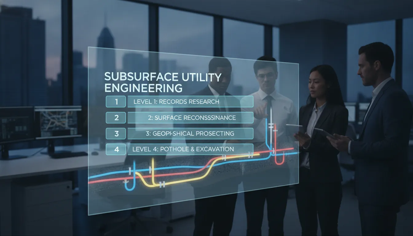
SUE is not a one-size-fits-all service. The quality levels describe the type and strength of information available for a feature or investigation area. They give project participants a shared way to discuss the evidence behind utility information, from record research to selected physical exposure. The levels progress from D, based on records, through C and B, to A, which is based on exposed and surveyed information at selected points.
Each level can support a different project decision. Choosing one depends on the design stage, the consequences of an incorrect assumption, the site conditions, and the locations that matter most. The levels should not be read as a guarantee that the entire site has been investigated to the same standard. Here is what each category generally represents.
Quality Level D: Starting with Existing Records
Quality Level D is based on information that already exists, such as utility records, as-built drawings, owner records, and credible information from people familiar with the site. It can help a team understand what may be present and where to focus later investigation. Records can be incomplete, outdated, or inconsistent with field conditions, so QL-D is a planning input, not a field confirmation and not a basis for assuming that an area is clear to excavate.
Quality Level C: Surveying Visible Surface Features
Quality Level C adds a survey of visible utility features, such as manholes, valve boxes, utility poles, hydrants, and pedestals, and correlates those observations with QL-D records. This can reveal inconsistencies and help a team interpret how a recorded facility may relate to the surface. It still relies on inference between visible features and does not directly establish the horizontal path of every buried line.
Quality Level B: Designating Utilities with Geophysical Methods
Quality Level B uses geophysical methods to designate the approximate horizontal position of a utility or other subsurface target, with the findings surveyed and documented. GPR and EM locating may both be useful, but they do not work in the same way and are not interchangeable. Results depend on the target, depth, material, soil, surface, interference, access, and other site conditions.
QL-B information can support design decisions when its scope and limitations are understood. Targeted verification may still be appropriate at critical crossings or other high-consequence locations. The FHWA SUE overview provides additional context on the quality-level framework.
Quality Level A: Locating Through Physical Exposure
Quality Level A is based on the physical exposure and survey of a selected utility point or critical location. Vacuum excavation or another approved exposure method may be used to observe and measure the facility at that point, including supported location and attribute information.
QL-A can provide strong evidence for a crossing or other defined decision point, but it does not mean that every utility across a project site has been exposed. The selected points, field observations, measurements, and any remaining recommendations should be documented so the project team understands exactly what the evidence covers.
The Tech and Methods Behind SUE
SUE professionals select methods based on the project question, the quality level needed, and site conditions. The goal is not to use every tool on every site. It is to combine suitable evidence, interpret it carefully, and document what the methods can and cannot establish.
Ground Penetrating Radar (GPR)
Ground Penetrating Radar (GPR) sends electromagnetic pulses into the subsurface and measures reflected energy. The resulting data can help investigate utility-related targets, voids, and other changes in subsurface conditions. GPR may help with metallic and nonmetallic targets, but performance depends on material, depth, soil, moisture, surface, target size, reinforcement, interference, and access.
Interpretation should distinguish a detected response from a confirmed utility and should identify where additional verification is recommended. SafeLine also provides GPR scanning services for project-specific investigation needs.
Electromagnetic (EM) Locating
Electromagnetic (EM) locating is a complementary method for traceable or conductive utilities. A locator and receiver can detect and trace an appropriate signal along a conductive path when the line, access, signal conditions, and surrounding environment support the investigation.
EM locating is different from GPR. It is not a universal substitute for subsurface imaging, and a response still requires interpretation. Using EM locating alongside GPR can give a project team different types of evidence, with the selected method and limitations recorded in the deliverable.
Vacuum Excavation
Vacuum excavation can support Quality Level A work by carefully exposing a utility at a selected test point. Air or water loosens the soil and a vacuum removes the debris, allowing the field team to observe and measure the exposed facility.
The result is valuable at a crossing, tie-in, or other defined critical location, but the exposure applies to the selected point and conditions observed there. A project team should follow its excavation and verification procedures rather than treat one exposure as proof about an entire site.
Utility Mapping and GIS
Mapping and documentation bring the investigation together in a format the project team can use. Depending on scope, this may include marked plans, field markings, survey points, CAD or GIS files, photographs, and notes about evidence quality or unresolved conditions.
A map is only as useful as the methods, scope, and assumptions behind it, so the deliverable should not imply coverage or precision that the investigation did not support. Clear documentation helps designers, contractors, owners, and facility teams understand what the information covers before they rely on it.
The Project-Support Benefits of SUE
Integrating SUE into a project plan gives designers and constructors a structured way to address subsurface information before work reaches a critical point. It is not a guarantee against conflicts, but it can help the team replace unsupported assumptions with documented evidence and make verification decisions earlier.
The benefits depend on project scope and execution. Better utility information can help a team compare alternatives, identify potential conflicts, plan targeted verification, and communicate known limitations before excavation. Those steps support safer and more predictable work without claiming that uncertainty can be eliminated.
Surface Potential Conflicts Earlier
An unexpected utility conflict can cause work stoppages, redesign, relocation decisions, or schedule pressure. SUE can surface potential conflicts earlier when the investigation is scoped to the project question, and it can show where records and field evidence do not agree. The team can then decide whether to adjust the design, investigate further, or plan controlled verification before work reaches the affected area.
Support a Safer Worksite
Subsurface information is one input to a safe excavation plan. A SUE investigation can help identify areas that need attention, document the evidence supporting a utility location, and communicate limitations to the people making design and field decisions.
Crews still need to follow applicable one-call, excavation, clearance, and verification procedures. SUE supports a safety culture by making the basis for decisions more explicit, not by promising that a site is risk-free.
Design Around Supported Information
For architects and engineers, the useful question is not whether a map looks detailed, but whether its evidence supports the decision being made. SUE can provide records, observations, designated locations, survey information, or selected exposed points according to the defined scope. Designers can use that information to evaluate alternatives and identify where more investigation is needed before finalizing a plan.
Document the Investigation and Its Limits
Incomplete or outdated utility information can create design, scheduling, and field risks. A documented SUE process helps a project team show what information was reviewed, which methods were used, what was observed, and where further verification was recommended.
That record supports informed project decisions, but it is not a substitute for following applicable safety requirements or for making a legal determination about responsibility.
The Risks of Inaccurate Utility Data
Going into excavation with incomplete or outdated utility information can create serious schedule, budget, and safety challenges. Records are useful evidence, but they may not reflect repairs, reroutes, abandoned facilities, undocumented work, or changes in site conditions. Understanding those limitations helps a project team decide what should be investigated and verified before work begins.
Utility Strikes, Budget Overruns, and Rework
Poor utility information can contribute to a strike or an unexpected conflict. The consequences may include emergency response, downtime, redesign, relocation, damage, or public disruption. A SUE investigation can help a team identify potential conflicts and focus additional work on critical locations, but the project must still use the investigation within its stated scope and follow field verification procedures.
Environmental Damage and Public Disruption
Utility damage can affect people and property beyond the immediate work area. An outage, service interruption, environmental release, or road closure may affect neighbors, occupants, customers, and public agencies. Better subsurface information supports earlier planning and communication, while the project team remains responsible for its required permits, controls, field procedures, and response plans.
Why Old Utility Maps Are Unreliable
As-built drawings and owner records are useful starting points, but they may not show every repair, reroute, abandoned facility, or undocumented change. A record should be treated as evidence with a source and date, not as a guarantee of current field conditions. Comparing records with visible features, locating results, survey information, and selected verification can help expose discrepancies before they become field surprises.
When Should You Use SUE?
Deciding whether to use SUE should follow the project question, site conditions, and consequences of an incorrect assumption. While 811 remains essential, a complex design or construction project may need additional records review, surveying, private utility locating, geophysical investigation, mapping, or selected exposure. SUE helps define and document that additional investigation.
Consider SUE when the project includes excavation, a congested corridor, a utility crossing or tie-in, incomplete records, a sensitive facility, or a design decision that depends on subsurface conditions. The right scope may be limited to a defined area or a set of critical points. The purpose is to obtain information that supports the decision, then document what remains uncertain.
Projects That Benefit Most from SUE
SUE can be useful for urban redevelopment, transportation work, campus expansions, commercial development, industrial facilities, crossings, tie-ins, and projects in areas with congested or inconsistent utility information. In those settings, a team may need different evidence at different locations.
The investigation should state whether a result comes from records, visible features, geophysical designation, survey, or selected exposure, rather than implying that every pipe or cable has the same level of support.
Why SUE Is Not Just for Large-Scale Jobs
The same reasoning can apply to smaller commercial or residential projects when work is near existing structures or known utilities. A smaller footprint does not remove the consequences of a mistaken assumption. The scope may be narrower than a major infrastructure investigation, but the team can still benefit from documenting records, locating relevant private utilities, and identifying where verification is needed before drilling, trenching, or installing new work.
How to Add SUE to Your Project Plan
The best time to discuss SUE is during preliminary design and planning. Add a subsurface investigation question to the pre-construction checklist, define the area and decisions that need support, and ask what methods and deliverables fit that scope. Early planning gives the team time to review evidence, adjust the design, or request targeted verification before the work reaches the field.
Finding the Right SUE Partner
A qualified provider should explain the proposed scope, methods, evidence, deliverables, and limitations in terms your project team can use. Ask how the provider distinguishes records from field observations, how GPR and EM locating will be selected, whether survey control or selected exposure is needed, and how unresolved areas will be identified.
SafeLine's Subsurface Utility Engineering service guide provides a commercial-intent overview for readers who need to discuss scope and deliverables.
Related Articles
- What Does 811 Not Cover?
- Private Utility Locating: What 811 Does Not Mark
- What Is GPR Scanning?
- Private Utility Locating Services
Frequently Asked Questions
Isn't calling 811 enough before I dig?
Calling 811 is a critical first step, but it does not answer every project-specific subsurface question. Depending on the site and applicable process, additional private utility locating, records review, surveying, geophysical investigation, or targeted verification may be needed. SUE helps define and document that additional investigation; it does not promise complete site detection.
My project is small. Is SUE still worth considering?
Project size is only one factor. If the work is near existing utilities, structures, or a sensitive crossing, a defined investigation may help the team identify information gaps before drilling or excavation. The appropriate scope can be smaller than a major infrastructure study. Discuss the project area, planned work, and consequences of an incorrect assumption with a qualified provider.
How do I know which SUE Quality Level my project needs?
The answer depends on the project stage, the decision being made, site conditions, and the consequence of an incorrect assumption. QL-D and QL-C may support early planning, QL-B may support designated utility information for design, and QL-A may support a selected critical point through physical exposure and survey. A provider should explain which areas and evidence each proposed level covers.
When is the right time to bring in a SUE specialist?
The preliminary design phase is often the most useful time because the team can use the findings while alternatives are still available. SUE may also be appropriate later for a crossing, tie-in, changed site condition, or unresolved conflict. The scope should match the decision and the locations that need support.
What kind of information will I actually receive from a SUE investigation?
Deliverables depend on the approved scope. They may include records research, field observations, marked plans, survey points, geophysical designation results, photographs, selected exposure measurements, CAD or GIS files, and notes about limitations or recommended verification. The important question is what each item is based on and which locations it covers, so designers and field teams can use the information appropriately.
Plan a Subsurface Investigation
If you are evaluating a design, crossing, tie-in, excavation area, or developed site, start by defining the project area and the decision that needs subsurface information. A clearly scoped conversation can identify which records, locating methods, survey work, mapping, or targeted verification may be appropriate. Contact SafeLine Subsurface to discuss the information your project needs before field work begins.