
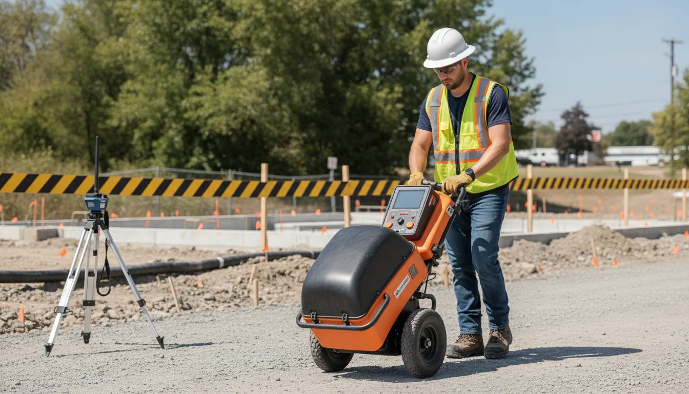
Before excavation, a line that carries no current can be just as important as a power or communications cable, yet it may not respond to standard electromagnetic locating. Plastic water lines, non-metallic conduit, and similar infrastructure can remain difficult to identify without a method that responds to differences in the surrounding ground.
Need help identifying buried utilities? Contact SafeLine Subsurface to plan a locate.
Ground penetrating radar utility locating non-metallic applications can help identify buried lines by sending radar energy into the subsurface and interpreting reflected signals where the utility differs from surrounding geology. It is a valuable complement to electromagnetic locating, but soil conditions and the material's properties affect whether a target produces a useful response. The GPR and Concrete Scanning: The Complete Guide for Engineers and Contractors provides broader background on the technology.
That distinction matters on projects where incomplete utility information can change design, drilling, trenching, or excavation decisions. To understand when GPR adds value, start with why a non-metallic line may be invisible to electromagnetic equipment in the first place.
Ground Penetrating Radar Utility Locating Non-Metallic Lines
Electromagnetic (EM) locating equipment works by detecting a conductive signal that can be traced along a buried line. That makes it highly useful for many metallic utilities and for systems with a conductive tracer wire. A standalone plastic or PVC pipe, however, does not necessarily carry or transmit the same type of signal. If there is no suitable conductive path, the locator may not respond in a clear, continuous way.
The limitation is not simply whether a pipe is present. Signal strength can also depend on the material, surrounding soil, depth, access points, and whether a tracer wire is intact and accessible. The Federal Highway Administration notes that PVC can produce a weak or indistinguishable GPR response when its dielectric properties are close to those of typical soils. That is one reason non-metallic utility locating requires careful method selection and interpretation, rather than reliance on a single instrument or mark.
Public utility notification is another separate issue. Calling 811 is an important step before excavation, but public 811 services generally mark public utilities. Private utilities beyond a meter or property line may remain outside that request. Private irrigation, water or sewer laterals, landscape lighting, and communication lines on private property are examples that may not be covered. An 811 mark therefore does not guarantee that every buried utility on a site has been identified.
For these conditions, ground penetrating radar utility locating non-metallic work can add another layer of investigation. GPR sends electromagnetic pulses into the ground and analyzes reflections from changes below the surface. It does not make every buried line automatically visible, but it can help identify non-conductive targets that EM methods may not trace. Used with site records, visual evidence, EM locating, and qualified interpretation, GPR supports a more complete picture before digging.
How Ground Penetrating Radar Detects Non-Metallic Lines
Ground penetrating radar does not need a pipe or conduit to conduct an electrical signal. Instead, the system sends high-frequency electromagnetic pulses into the ground and records reflections from subsurface interfaces or discontinuities. A buried line can create a response when its material and shape contrast sufficiently with the surrounding soil. Federal Highway Administration research identifies detection, location, and mapping of subsurface utilities as a major civil engineering use of GPR.
From pulses to a subsurface image
As an operator moves the antenna across the site, the system collects repeated samples along the scan path. Software combines those samples into a B-scan, an image that shows features within the subsurface material. A utility crossing the scan path may appear as a curved hyperbola rather than a simple line. The shape, continuity, strength, and position of that response help an experienced operator evaluate whether it may represent a buried utility or another subsurface feature.
Why shape and orientation matter
GPR is most informative when the scan pattern crosses a suspected line from multiple directions. A target that appears in one pass but disappears in another may need additional investigation. Scanning parallel to a utility can produce a less distinctive response, while crossing it can reveal a clearer geometric signature. Professionals use those patterns, antenna selection, surface conditions, available records, and site context together. The result is an interpretation, not a guarantee that every non-metallic line will be visible.
Plastic, clay, and concrete utilities can be difficult when their dielectric properties resemble the surrounding soil. For that reason, professional ground penetrating radar utility locating for non-metallic infrastructure should include deliberate coverage, careful interpretation, and appropriate limitations in the final markings or map.
Common Non-Metallic Utilities Found by GPR
GPR can help locate buried utilities that do not carry an electromagnetic signal, but the results depend on the contrast between the target and the surrounding soil. Common targets include PVC or HDPE water lines, sewer laterals and mains, irrigation piping, storm drainage, and plastic communication conduits. These lines may be especially important on private property, where public utility records or 811 markings may not show the complete underground picture.
Water, sewer, and irrigation lines
PVC and HDPE water lines are frequent non-metallic targets. GPR may reveal a pipe as a subsurface reflection or pattern that differs from the surrounding material. Plastic sewer lines, abandoned lines, and irrigation runs can also be investigated before trenching, additions, landscaping, or pavement work. However, a visible response indicates a subsurface feature, not automatically its material, function, or connection to a specific building. A locator must interpret the data in context and compare it with site plans, access points, surface features, and other locating results.
Storm drainage and communication conduits
Stormwater pipes, drainage structures, and continuous plastic communication conduits are other practical targets. Closely spaced conduits or duct banks may appear as grouped features rather than one clearly isolated line. This is where detection and identification must remain separate: GPR can indicate where a buried anomaly or utility may be located. While records, traceable conductors, daylighting, and field investigation may be needed to establish what it is.
Site conditions affect the outcome. The Federal Highway Administration notes that PVC can produce a weak or indistinguishable response because its dielectric properties may resemble typical soils. Dry, nonclay conditions are generally more favorable, while soil moisture, clay, depth, surface access, and utility geometry can reduce confidence. GPR should therefore be used as part of a documented locating process, alongside electromagnetic locating when conductive paths are available.
What Affects GPR Detection Depth and Accuracy?
GPR results depend on the relationship between the radar signal, the buried target, and the material around it. Soil composition is one of the biggest variables. Dry, nonclay ground can allow clearer differentiation between a utility and the surrounding geology, while clay-rich or highly conductive soils can weaken, scatter, or absorb the signal. Moisture can also change how energy travels through the ground. So conditions that look favorable on one site may produce a less distinct response after heavy rain or changes in groundwater.
Target characteristics matter just as much. A larger utility may create a stronger, easier-to-follow response than a small conduit. The target's depth, orientation, shape, and material affect how much of its signal is visible. A line crossing the scan path can create a recognizable response, while a line running parallel to the path may be harder to interpret without additional scan directions. Closely spaced utilities, duct banks, reinforcement, rocks, voids, and other subsurface clutter can overlap in the data and complicate interpretation.
Surface access and antenna selection shape the quality of the survey. Uneven ground, heavy vegetation, standing water, traffic, or surface obstructions may limit where an operator can collect consistent lines. Antenna frequency involves a practical tradeoff between penetration and detail. Lower frequencies are generally considered when the investigation requires greater reach, while higher frequencies can provide more detail for shallower targets. Multifrequency systems can help when the appropriate balance is uncertain before field testing, as described by the Federal Highway Administration.
GPR is not a guarantee that every buried feature will be clearly identified. A small, deep, weakly contrasting, or closely cluttered target may produce an ambiguous response. PVC can be especially difficult when its dielectric properties are similar to the surrounding soil. For that reason, experienced interpretation, multiple scan directions, site records, and complementary EM locating are important. When conditions limit confidence, the responsible result is to document the uncertainty and recommend additional verification rather than present an unclear signal as a confirmed utility.
Combining GPR with EM for Full-Spectrum Utility Detection
Ground penetrating radar and electromagnetic (EM) locating answer different questions in the same investigation. GPR sends high-frequency electromagnetic pulses into the ground and interprets reflections from subsurface interfaces or discontinuities. Because it responds to contrasts in the surrounding material, it can help identify metallic and non-metallic infrastructure. EM locating, by contrast, is especially useful for conductive lines that can carry or receive an electromagnetic signal.
That distinction matters when a site includes a mix of metallic pipe, PVC or HDPE water mains, sewer lines, communication infrastructure, and other buried assets. GPR can add coverage where a non-conductive line does not provide a usable EM response, while EM can help trace a conductive line beyond the immediate scan area. Neither method should be treated as a universal replacement for the other.
| Method | Best fit | Strength | Limitation |
|---|---|---|---|
| GPR. | Metallic and non-metallic utilities. | Shows subsurface responses. | Results vary with soil, depth, and coverage. |
| EM locating. | Conductive utilities or tracer wires. | Traces a conductive line. | Non-conductive lines may not respond. |
SafeLine uses both technologies as complementary parts of its locating methodology.
The team combines field observations, markings, mapping, and documentation into a practical site picture.
For a broader explanation of radar applications and concrete scanning, see GPR and Concrete Scanning: The Complete Guide for Engineers and Contractors. The goal is not to promise that every buried feature will be visible. It is to use appropriate tools together, recognize their limits, and reduce uncertainty before excavation or construction decisions are made.
What to Expect During a GPR Utility Locate
A professional locate is a field investigation, not a single pass with a scanner. The crew combines project information, site observations, GPR data, and complementary EM locating to develop the clearest practical picture of subsurface conditions.
- Define the scope. The locating team reviews the planned excavation, work limits, access points, expected utility types, and the decisions the results need to support. This helps focus the survey on areas where an unmarked line could affect digging, design, or construction sequencing.
- Review records and site conditions. Available drawings, prior surveys, 811 marks, visible utility features, and property information can provide useful context. The crew also assesses surface access, pavement, landscaping, obstructions, soil, and moisture. These conditions influence how data can be collected and interpreted.
- Scan accessible surfaces. The operator moves the GPR equipment across the approved search area in a planned pattern. GPR sends electromagnetic pulses into the ground and processes returning reflections from subsurface interfaces or discontinuities. Overlapping passes and different directions can help reveal linear targets, but access and site conditions may limit what can be observed.
- Interpret the data with EM and records. GPR can support investigation of metallic and non-metallic infrastructure, while EM locating helps trace conductive lines. Using the methods together provides complementary evidence rather than treating either technology as a guarantee. Results are reviewed against records, surface indicators, and the expected utility layout.
- Mark and map findings. Identified or suspected utility alignments may be marked in the field and recorded with measurements, GPS points, photographs, or map data. GPR imaging software can present findings in two-dimensional plan maps or three-dimensional views, depending on the project and available data. FHWA describes these mapping formats as ways to show utility orientation across the test area.
- Document results and next steps. The final documentation should distinguish observed, interpreted, and uncertain findings, while noting limitations that could affect detection. Call 811 as required before digging, but remember that 811 generally addresses public utilities. Private lines beyond a meter or property line may require a separate private locate. To discuss a project, access, or expected deliverables, use the SafeLine website contact form.
Frequently Asked Questions
What may GPR not detect clearly?
GPR results can be limited when a utility has little contrast with the surrounding soil. PVC, for example, may produce a weak or indistinguishable response because its dielectric properties can resemble typical soils. Clay-heavy or wet conditions, depth, small targets, and crowded subsurface areas can also reduce clarity. A qualified locator should treat the scan alongside site conditions and other available evidence, not as a guaranteed picture of every buried line. FHWA explains these GPR limitations.
Does GPR replace electromagnetic utility locating?
No. GPR and electromagnetic, or EM, locating serve complementary purposes. GPR can provide indications of metallic and non-metallic features, while EM equipment is useful for tracing conductive lines over distance. Using both methods can help address gaps that either method may have on its own. Public 811 marks should still be obtained when required, followed by private locating where utilities may fall outside public coverage.
Can GPR locate plastic and other non-metallic utilities?
It may. Common examples include PVC and HDPE water mains, PVC, clay, or concrete sewer lines, fiber and communication lines, irrigation, and storm drains. Detection depends on the target's size, depth, orientation, material contrast, and surrounding conditions. The goal is to identify and map likely utility features so the project team can make better excavation decisions. Not to assume that every non-metallic line will produce the same response.
Why does professional interpretation matter for a GPR scan?
A GPR unit records reflections, but the data still needs to be interpreted in context. An experienced professional reviews scan patterns, site conditions, utility records, EM results, surface access, and available marks before identifying likely lines. That process helps distinguish a possible utility from other subsurface features and supports clearer field markings, mapping, photos, and documentation. Interpretation is especially important where utilities are deep, grouped, or close together.
What should I provide before scheduling a locate?
Share the project address, planned work area, excavation or construction scope, expected dig depth, available utility plans, and any existing 811 marks. Note known private lines, access restrictions, recent site changes, and areas where non-metallic utilities may be present. These details help the locating team plan the scan and determine where GPR, EM locating, or both are appropriate.
Get started with a qualified project review
Ground penetrating radar utility locating can be one part of a practical plan for investigating non-metallic utilities. Especially when project conditions and utility records need to be reviewed together. Share your project location, planned excavation, and utility questions so SafeLine Subsurface can assess the scope and recommend an appropriate locating approach. For a qualified project review, contact us through the SafeLine Subsurface website form. Providing those details upfront helps the team understand what is at stake before field work is planned. GPR and electromagnetic locating may serve different roles, so the recommended approach should reflect the site and the utilities involved.