
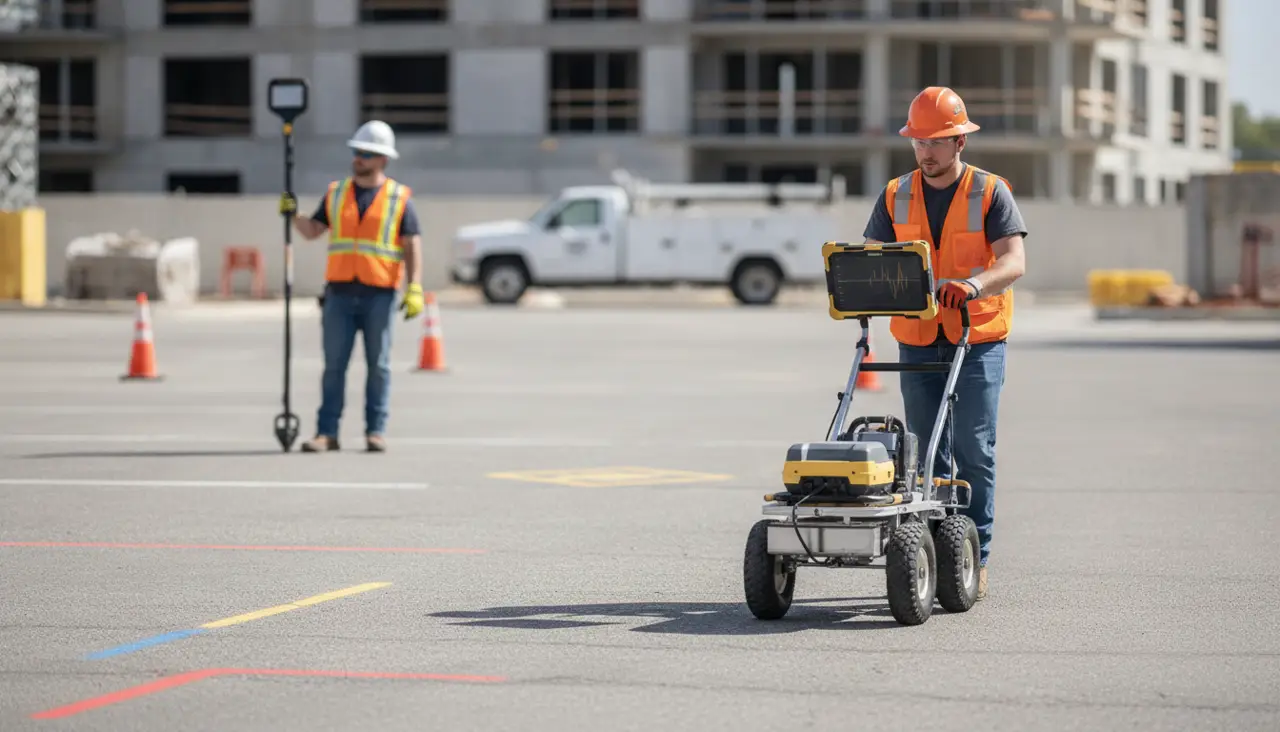
If you are asking, how much does ground penetrating radar cost, the honest answer is that there is no useful single price for every site. A focused investigation of one small work area is not the same scope as surveying a large property, tracing several possible utility routes, or preparing mapped deliverables for a design team. The best way to understand the cost is to define what needs to be investigated, where, and what decisions the results must support.
Request a project-specific GPR investigation quote
Why does ground penetrating radar cost vary by project?
Ground penetrating radar, or GPR, sends electromagnetic pulses into the ground and records reflections from subsurface interfaces. The method can help investigate buried features, but the work is not simply a matter of switching on a scanner and covering a fixed number of square feet. Survey planning, field access, the type of target, site conditions, interpretation, and the requested final product all affect the amount of work involved.
The U.S. Environmental Protection Agency describes GPR as an electromagnetic geophysical method that transmits radio wave pulses into the subsurface. That basic principle helps explain why conditions and survey objectives matter: the instrument records responses that a trained operator must interpret in context, rather than producing an automatic, complete inventory of every buried object. Read the EPA overview of ground penetrating radar.
For utility investigations, GPR is one tool in a planned subsurface investigation. SafeLine describes using GPR alongside electromagnetic (EM) locating equipment, which can help locate conductive utilities. What combination is suitable depends on the target and the site. Learn more about the company's GPR investigation service and utility locating and mapping services.
What project details affect a GPR quote?
A useful quote starts with the question the investigation needs to answer. The following factors help define the field effort and reporting scope. They are not a price list. Each one can change the work required, and several often apply at the same time.
| Quote factor | Why it matters | Helpful information to provide |
|---|---|---|
| Survey area | More area or multiple separated zones can require more systematic coverage and field time. | Site plan, dimensions, work limits, and priority locations. |
| Access and surface | Fences, parked vehicles, active operations, landscaping, and surface changes can affect where and how equipment can be moved. | Access hours, restrictions, obstacles, and surface types. |
| Target and objective | A focused question differs from a broad investigation of potential subsurface features. | What you need to locate or understand, and what decision depends on the result. |
| Site conditions | Ground materials, moisture, clutter, and other local conditions can affect signal quality and interpretation. | Known site history, fill or paving details, and previous investigation records. |
| Locating methods | EM locating may complement GPR for conductive utilities; the appropriate method depends on the target. | Known utility types, records, visible access points, and prior marks. |
| Deliverables | Field marks, photographs, mapping, and written documentation require different levels of processing and presentation. | Required file formats, map scale, coordinate needs, and intended users. |
1. How large is the survey area?
Survey size affects how much ground must be covered, but area alone does not define the scope. A compact area with many obstacles or a precise investigation objective can take more planning than a larger, open and accessible space. A site may also have several separate zones, such as a planned excavation, a utility corridor, and an area reserved for future construction.
Rather than sending only a parcel address, identify the actual limits of work. A marked-up plan, aerial image, or sketch can show the investigation boundary and any no-access zones. If the project will disturb only one part of a large property, be clear about that. If the work area may change, explain which areas are essential and which are optional. This lets the scope distinguish required coverage from possible additions.
2. What are the access and surface conditions?
GPR equipment needs to be moved across the area being surveyed. Staging, gates, slopes, landscaping, standing water, vehicles, stored materials, active work, and restricted hours can affect site logistics. A paved surface, lawn, gravel, and uneven ground may each present different practical conditions for the field team. Share what is present rather than assuming the site is clear because it looks open on a map.
Access planning also includes coordinating with the site contact. If the site is active, explain when equipment or vehicle movement is permitted and whether an escort, safety orientation, or other site procedure is required. A clear site plan and a named point of contact can help avoid lost time on the investigation date. The investigation process and deliverables page explains how to plan the work and discuss the expected output.
3. What are you trying to locate or determine?
A quote is more useful when it addresses a specific decision. For example, a contractor may need to investigate a proposed excavation zone, while a designer may need subsurface information along a planned alignment. These are different questions, even if the locations overlap. A request to investigate a defined area for potential utilities also differs from asking for a comprehensive map of everything underground.
Describe the planned activity, the target feature if known, and the consequence of not resolving the uncertainty. Include any drawings, utility records, previous survey results, or public utility marks available to you. Do not assume records confirm the exact position of a line in the field. SafeLine's overview of private utility locating and 811 explains why public utility marks and private locating address different parts of a site.
4. What site conditions could affect detection?
Subsurface conditions influence how GPR signals travel and what responses can be interpreted. Ground composition, moisture, buried debris, reinforcement, and closely spaced features can complicate interpretation. The effect is site-specific. A quote should not promise that every buried object will be detected or that all conditions will allow the same confidence or depth of investigation.
Give the locating provider relevant site history, such as known fill, previous construction, or prior utility work. Photos and plans can help flag clutter, paving transitions, or areas that cannot be accessed. If the site has already been investigated, share the previous results and explain what remains unresolved. This supports a realistic scope instead of repeating work without understanding the original findings.
5. Would EM locating complement GPR?
GPR and electromagnetic locating do not operate in the same way. EM equipment is used to trace conductive utilities when a usable signal or connection is available; GPR can help investigate subsurface features based on reflected radar energy. Using the methods together may provide complementary information, but neither method guarantees detection of every utility in every condition. The appropriate approach depends on the target, access, surface, records, and project objective.
Tell the provider what utilities are expected and whether access to a known line or structure is available. If you are unsure whether the request calls for GPR, EM locating, or both, describe the project rather than choosing a technology on your own. This is especially useful when non-metallic utilities, abandoned infrastructure, or undocumented site changes are a concern. Read more about the difference between GPR and electromagnetic locating.
6. What report or mapping do you need?
Field investigation and final deliverables are related but separate parts of project scope. Some projects need field indications and photographs for an immediate work area. Others need findings organized in a report or incorporated into a utility map for planning and coordination. The more specific the required output, the easier it is to define the time and processing needed.
Before requesting a quote, ask the project team how it will use the results. Does the contractor need to see marks in the field? Does an engineer need a drawing, location references, photographs, or a written summary? Will information be shared with multiple trades or used in design coordination? Specify required formats and any mapping standards already set by the project. SafeLine's page on utility mapping and documentation outlines the related service scope.
Does a GPR survey quote include utility locating?
Not automatically. The word “GPR survey” can refer to different objectives, and a request should state whether it concerns general subsurface investigation, utility locating, or a specific project question. If the goal is to plan excavation, say so and describe the work area. A provider can then clarify whether the requested scope includes GPR, EM locating, utility marking, mapping, or another deliverable.
Public utility marking through 811 and private utility locating are not interchangeable. Call 811 as required before excavation, and understand the scope of the marks returned for your site. Private locating may be needed for privately owned infrastructure or other project questions not addressed by public utility marks. Use the pre-excavation utility locate checklist to organize information before work begins, and review subsurface investigation information for contractors if you are coordinating a construction project.
Is concrete scanning part of a GPR utility investigation?
Concrete scanning is a separate scope from locating underground utilities in soil or other ground surfaces. Do not assume it is included in a GPR utility investigation quote. SafeLine does not provide concrete scanning as a service. If your project involves drilling or cutting into concrete, make that requirement clear when contacting a qualified provider for that distinct service, rather than treating it as an add-on to a SafeLine utility-locating request.
How can you request a useful, comparable quote?
When asking how much does ground penetrating radar cost for your project, provide enough information for providers to price the same scope. A low figure that excludes required reporting or misses the intended work area may not be comparable with a complete proposal. Share the following details where available:
- Project location: Address, site access details, and the site's general work schedule.
- Survey limits: A plan or marked image showing dimensions, priority zones, and any areas to exclude.
- Project purpose: The work planned and the decision the investigation must support.
- Known information: Utility records, 811 ticket or marks, previous drawings, reports, photos, and known site history.
- Access constraints: Surface types, obstacles, gates, work hours, safety procedures, and point-of-contact details.
- Expected deliverables: Field marks, photographs, written findings, mapping, file formats, and who will use them.
- Schedule: Desired field date, project milestones, and any time-sensitive constraints.
Ask what the proposed scope includes and excludes. Also ask what happens if the team reaches an inaccessible area, encounters a condition that differs from the records, or cannot resolve the project question with the planned approach. A quote should set practical expectations for those situations. For example, the work may need a revised boundary, additional records, a different deliverable, or a separate follow-up before the project can proceed. Do not assume such work is included unless the proposal says so. If your project has phases, identify which phase the current request covers and whether findings from one phase will inform the next. This helps keep the initial scope focused while giving the owner, designer, and contractor a shared understanding of what remains uncertain. It also makes it easier to request a change when the actual field conditions differ from the assumptions used to prepare the quote. Confirm the survey area, locating methods, reporting format, assumptions, and any site conditions that may limit access or interpretation. If the scope depends on a site visit or additional records, ask what is needed to finalize it. For projects across the region, you can also review SafeLine's service area information.
SafeLine does not publish a universal GPR price because the investigation scope is site-specific. Use the contact form to describe your work area and request a project-specific quote. For general questions about the service and what to expect, visit the SafeLine FAQ.
Send your site details to request a GPR quote
Frequently Asked Questions
Can I get a GPR price based only on the property address?
An address is a helpful starting point, but it usually does not define the survey area, target, access, or required deliverable. Share a site plan or marked-up image and explain the project objective so the scope can be evaluated more accurately.
Does a larger survey always cost more?
A larger area can require more field coverage, but total scope also depends on access, obstacles, target complexity, and reporting. A small, obstructed or highly specific investigation may require substantial planning and interpretation. Compare quotes based on included work, not area alone.
Can GPR find every underground utility?
No locating method should be treated as a guarantee that every buried utility or object will be detected. Ground conditions, target characteristics, access, and other site factors can affect results. A project-specific plan may combine GPR and EM locating, review available records, and define the limits of the investigation.
What should I send before requesting a quote?
Send the address, investigation boundary, project purpose, available plans and records, known access restrictions, desired schedule, and required deliverables. Note whether 811 has been contacted and what marks or information are available. These details help clarify whether the request is for GPR, utility locating, mapping, or a combination.
The most reliable way to understand GPR survey cost is to define the site, question, methods, and deliverables before comparing proposals. With a clear scope, you can request a quote that reflects the actual investigation your project needs. When reviewing proposals, compare the boundaries, locating methods, assumptions, and reporting included rather than treating different scopes as equivalent. Clarify any access limits or conditions that could change the work, and confirm what information the field team needs before arriving. Those practical details help your project team make a more informed comparison and prepare for the investigation.