
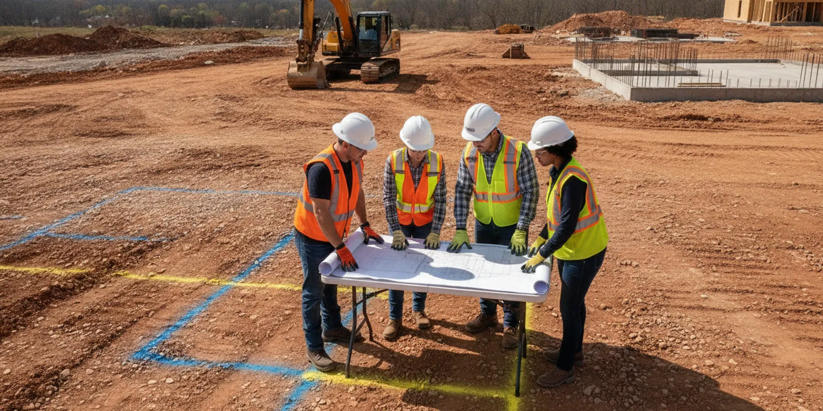
Planning private utility locating in Maryland starts with a simple distinction: public utility markings and private-site investigation answer different questions. If your Virginia team is managing construction, design, or excavation across the state line, identify the project limits, what 811 will address, and what private infrastructure still needs investigation before the schedule is fixed. Early coordination gives the team time to resolve gaps before equipment or crews arrive.
Discuss your Maryland project scope
Why plan locating before Maryland site work begins?
Utility information affects more than the moment an excavator breaks ground. Existing lines can shape grading, foundations, access routes, drainage, landscaping, and the placement of new utilities. When a potential conflict appears late, the team may need to revisit design, sequence work differently, or investigate an area that was not included in the original scope.
That is why locating belongs in project planning, not only in a last-minute pre-dig checklist. A civil engineer may need usable information while evaluating alternatives. A general contractor may need it before subcontractors finalize means and methods. An owner may need to understand whether records and surface markings are enough for the decisions at hand, or whether mapping or a more targeted investigation is appropriate.
Private utility locating addresses infrastructure on private property that may not be included in public utility marking. Depending on the site, relevant features can include irrigation, private service lines, site lighting, communications, and utilities serving detached structures. The actual scope depends on the project boundary, available records, site conditions, and the question the team needs to answer. Do not assume that an absence of visible markings means an area has no underground infrastructure.
For teams coordinating between Virginia and Maryland, establish one project owner for utility information. That person can align the owner, designer, excavation contractor, and locating provider on the current plan, schedule, and deliverable needs. SafeLine describes its coverage as including Virginia and Maryland; project teams can confirm location and scope through its service area information.
How do 811 and private locating fit together?
Start with the local one-call process and follow the applicable requirements and timing for the work location. A one-call request is an important step before excavation, but it does not necessarily account for privately owned lines beyond a utility's service responsibility. Private locating is a complementary investigation, not a replacement for an 811 ticket or the project's own safety procedures.
Write down what each process is expected to cover. Ask the project team to identify the limits of the one-call request, the facilities expected to respond, and any areas or systems that fall outside those responses. Then compare that information with the construction or design footprint. Where there is a gap between the planned work and known public markings, evaluate whether a private investigation is needed.
Do not treat paint from a prior project as current confirmation. Conditions and project limits change, and markings are tied to a particular request and site activity. Coordinate with the one-call center and the relevant utility owners for their current requirements; then plan private work for the remaining questions. SafeLine's overview of private locating versus 811 can help teams frame that distinction.
For a practical pre-work review, use a private utility locate checklist to organize the areas and information that need attention. It should support project coordination, not replace site-specific requirements, utility-owner instructions, or the excavator's safety plan.
What should a Maryland project scope define?
A useful scope connects the field effort to a decision. “Locate the utilities” can mean different things to a design team, an excavator, or an owner. Before requesting a quote, translate the project question into a defined area, a defined purpose, and a defined form of information. It can help to divide the site into named work zones rather than describe a large parcel as one undifferentiated area. For example, a project plan might distinguish a proposed building footprint, a utility corridor, a staging area, and a roadway crossing. The team can then explain which zones are priorities, where access is available, and whether some areas are for context only. Use consistent labels on the plan, in the inquiry, and in project meeting notes. Likewise, distinguish the question from the requested deliverable. A contractor planning a trench may prioritize the corridor and field markings, while a designer comparing route alternatives may need information organized across a wider area. If the project requires a particular drawing or data format, share that requirement before the scope is agreed. Avoid assuming that a field mark automatically includes a survey coordinate, a depth determination, or a complete record suitable for every later phase. Finally, list assumptions explicitly. Note whether the site plan is current, whether underground records are available, who will arrange access, and which areas are excluded. This gives the provider an opportunity to ask focused questions and helps the project team understand what a proposal does and does not include. If the scope changes after approval, document the revised limits and confirm whether the planned field effort still covers them.
- Project limits: Provide a marked-up site plan or drawing that shows the investigation boundary, work area, access points, and any priority zones. Identify whether the request covers the full parcel or only a corridor, building pad, proposed trench, or other defined area.
- Planned activity: Explain what is proposed, such as excavation, grading, a new service route, a foundation, paving, or site redevelopment. Include likely work depths or the kind of conflict the team is trying to assess when known.
- Known infrastructure: Share available as-builts, utility plans, previous surveys, one-call responses, record drawings, and information from facility owners. Label records as records; do not present them as field-verified locations.
- Site conditions: Note pavement, buildings, access limits, landscaping, active operations, fencing, traffic, and areas that cannot be reached. Tell the provider about scheduled site activity that could affect access or timing.
- Required output: State whether the team needs field markings, observations, mapping, documentation, or a combination. Clarify the coordinate or drawing format and the intended recipients if digital information will be used in design or construction.
- Schedule and decision date: Give the date when field access is possible and the date by which the information must inform a design, bid, or construction decision. Allow time for coordination and review, rather than treating the field visit as the only project milestone.
Scope boundaries matter. An investigation may identify indications that need interpretation or further follow-up; no single method should be described as a guarantee that every buried object will be found. Ask what conditions could limit the work, how uncertainties will be communicated, and how the team should use the results. SafeLine's investigation process and deliverables page is a useful place to review its stated process before setting expectations.
Which records and site context should the team gather?
Gather information that can make the scope more precise, but keep its reliability clear. Plans may be old, incomplete, or drawn for a different phase of development. A record can guide investigation without proving the exact location or depth of a line in the field.
Assemble the latest civil, utility, and site plans; available as-built drawings; prior survey or mapping files; one-call ticket information; and written input from the owner or facility manager. Note dates, sources, coordinate references, and whether a document is proposed, record-based, or field-collected. If two plans disagree, flag the discrepancy instead of choosing one silently.
Walk the site with someone who knows its operations when access allows. Ask about irrigation zones, outbuildings, generators, site lighting, private water or sewer infrastructure, and lines installed during later renovations. Look for visible appurtenances and changes in surface use, but treat them as clues rather than proof of an underground route. Identify locked areas, sensitive operations, and safety or access rules before the field team arrives.
Statewide context can also help with early desktop planning, though it is not a substitute for site records or field investigation. The Maryland Department of Planning says its land-use map illustrates the general location of developed lands. That broad land-use view may help a team understand development context; it does not show parcel-level utility alignments or verify underground conditions.
If a project crosses a property line, road, or jurisdictional boundary, show the limits clearly and identify the parties responsible for authorizing access. Keep a single current base plan available to the design team and field personnel. This reduces the risk of discussing one footprint while marking or designing another.
How can locating methods support the investigation?
Method selection should follow the target and the site conditions. Electromagnetic locating can help trace conductive utilities when a signal can be applied or detected. Ground penetrating radar (GPR) can help investigate subsurface features, including some non-metallic utilities, but results depend on soil, surface conditions, target characteristics, and other site variables. A method may be useful in one area and less informative in another.
A project can require one method, more than one method, or a staged approach. The question is not which tool sounds most advanced. It is what the planned work needs to know, what the available methods can reasonably contribute, and how results and limitations will be documented. For more detail, review SafeLine's pages on GPR investigation and GPR and electromagnetic locating.
Ask the provider to explain the proposed approach in plain language. Which target types are relevant? What conditions could affect detection? Will multiple passes or complementary methods be considered? What happens if the team encounters an anomaly or a conflict with the records? The answers help the owner and design team decide whether the proposed work matches the risk and the decision deadline.
Do not infer a precise depth, material, or ownership solely from a surface mark or a signal response unless that information is supported by the agreed method and deliverable. If the project needs a specific level of design information, say so early and confirm whether the proposed scope can provide it. SafeLine also describes utility mapping and documentation as a service area; discuss the intended use and format before requesting mapped output.
How do common project needs compare?
The table below is a planning aid, not a universal specification. The appropriate scope depends on the site and the decision to be made. A team can combine needs when a project has both design and excavation phases.
| Project need | Planning emphasis | Information to clarify | Possible output focus |
|---|---|---|---|
| Early design or site feasibility | Define broad study limits and areas where utility conflicts could affect alternatives. | Current concept plan, known records, design decision date, areas where alternatives remain open. | Investigative findings and mapped information that can support coordination and design review. |
| Defined excavation or installation | Focus the work on the actual dig footprint and sequence, while coordinating one-call requirements. | Work limits, access, expected timing, current ticket information, known public and private facilities. | Field information and markings relevant to the planned work area, subject to method and site conditions. |
| Existing site redevelopment | Reconcile legacy records, phased construction, and infrastructure added after original development. | As-builts, renovation history, owner knowledge, inaccessible or active areas. | Documented findings and questions requiring design-team or owner follow-up. |
| Utility route or conflict review | Examine a defined corridor or crossing where proposed work may interact with existing infrastructure. | Alignment alternatives, crossing locations, survey base, required coordinate or drawing format. | Location information organized for a stated coordination or design purpose. |
Before approving a proposal, compare like with like. One quote may cover a narrow excavation zone while another covers the whole site; one may include mapping and one may describe only field markings. Confirm boundaries, assumptions, access, output, schedule, and exclusions so the project team understands what each option addresses.
How should fieldwork fit the construction schedule?
Coordinate investigation with the design and construction sequence. Early design work may use a wider study area because alternatives are still being considered. Later preconstruction work can focus on locations where the current plan and known site information indicate a need for closer coordination. If the design changes after fieldwork, tell the provider and assess whether the revised footprint is still represented.
Choose a field window when the site can be accessed and the relevant surfaces are available. Coordinate escorts, traffic control, safety orientation, work-hour restrictions, and notification to occupants or tenants. Identify work that could obscure marks, alter a surface, or interrupt the investigation. A field crew should not have to discover access restrictions after mobilizing.
Make time for a findings review. The project manager, designer, and excavation lead should know where the current information is stored, which plan it references, and what unresolved items remain. If new conflicts or anomalies emerge during construction, stop and follow the project's procedures for evaluating the condition; do not treat an old drawing as a field clearance.
SafeLine offers private utility locating services for project-specific inquiries. A team planning work in Maryland should confirm the specific project location, schedule, and requested scope rather than assuming every site or deadline can be handled in the same way.
What should the team review after fieldwork?
Check that the information corresponds to the area and base plan the team supplied. Confirm what was investigated, what methods were used, where access or surface conditions limited coverage, and how findings are represented. Ask for clarification if a mark or mapped feature is ambiguous or if the field information appears inconsistent with the project drawings.
Record the date and source of the information in project files. Keep field observations, drawings, and supporting documentation together, and make the current version available to designers and field supervisors who need it. If the team receives a revised plan, compare it with the investigation boundary before relying on the prior work for a new area.
Use findings as one part of the project's risk-management and excavation-planning process. Communicate uncertainty rather than turning an indication into a certainty. Where the next action is unclear, bring the question to the locating provider, utility owner, designer, or site safety lead best placed to address it.
What should you include when requesting a project conversation?
A concise inquiry can help the provider understand whether the proposed work fits the requested service and what information is needed next. Include the Maryland site location, project type, approximate investigation boundary, current schedule, planned activity, records available, and the decision the team needs to make. Attach a marked-up plan when possible, and identify any access or operational constraints.
Also say whether the request is for early planning, a design milestone, or upcoming field work. Mention if the project crosses state or property boundaries, if several contractors need the result, and whether mapping or documentation is important. Do not send sensitive site information through a channel that is not appropriate for it; ask how the team should share files.
Share your project details with SafeLine
Frequently asked questions
Does private locating replace an 811 request?
No. Treat the one-call process and private locating as complementary steps. Follow the applicable one-call requirements for the work location, then identify private-site questions that remain outside the expected public utility markings.
Can a project team use old utility plans instead of field investigation?
Old plans can provide useful context, but they may not reflect later construction or exact field conditions. Share them as records and ask the project team to decide whether additional investigation is needed for the planned work and decision.
Will one locating method find every underground utility?
No method should be assumed to find every target in every condition. Detection depends on the target, site conditions, access, and the agreed scope. Ask which methods are proposed, what may limit them, and how uncertainty will be reported.
When should a commercial team request locating?
Start when utility information could affect site alternatives, design, sequencing, or bid assumptions. For construction, coordinate early enough to define the work limits, handle access, and review findings before the relevant activity begins.
For Maryland work managed from Virginia, a clear boundary, current records, coordinated 811 activity, and a decision-focused scope give the project team a stronger basis for planning the investigation. Confirm the specific work area and deliverable needs before fieldwork is scheduled.