
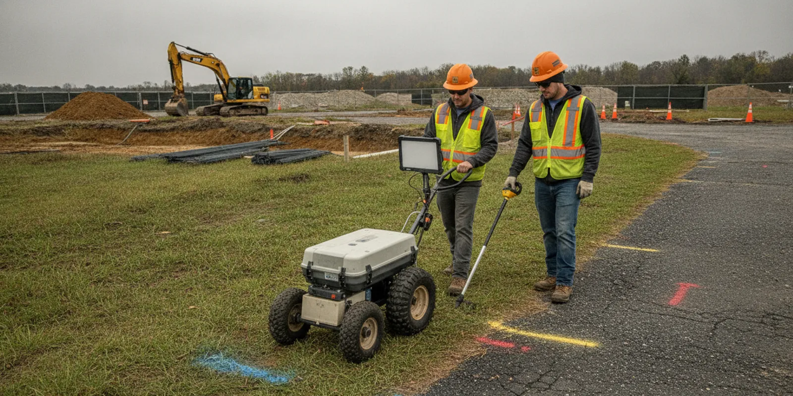
Choosing among subsurface utility engineering companies is not just a matter of comparing quotes. For a civil project, the right provider should match the investigation to the decisions ahead: where to design, where to dig, what utility data is needed, and how that information will reach the project team.
Discuss your project scope with SafeLine Subsurface
A useful evaluation starts with a defined scope, clear expectations for data quality, and deliverables your engineers can use. It also distinguishes a subsurface utility engineering (SUE) investigation from a basic locate request. The sections below offer a practical framework for engineers, developers, and municipalities comparing providers before design or construction.
Start with the project decision, not the equipment list
Before requesting proposals, write down what the utility information needs to help you decide. A roadway designer may need to assess conflicts along a proposed alignment. A developer may need an initial picture of existing site infrastructure before laying out a building. A municipality may need records that support a capital project or utility coordination. Each objective can call for a different survey area, investigation depth, data confidence, and level of documentation.
Share the current project limits, available utility records, design stage, schedule, known constraints, and the decisions the investigation must support. Mark areas where an unknown line could force a design change or create a construction conflict. If you are still shaping the request, SafeLine's investigation process and deliverables can help you understand the kinds of scope and handoff details to discuss.
A capable provider should ask questions before proposing a method. For example, are the limits defined by a parcel, a corridor, proposed excavation, or a set of design features? Are records available in CAD or GIS? Are there access restrictions, traffic-control needs, pavement, dense vegetation, or other site conditions? Is the work for early planning, final design, or a near-term excavation? These details affect what can reasonably be investigated and reported.
Translate the design question into a map or marked-up base plan. Identify the limits that matter most, such as proposed foundations, a drainage alignment, a new service route, or excavation near a known utility. If the project is phased, show which area must be understood first and which can follow later. This gives bidders a shared basis for estimating field effort and lets them explain whether the requested coverage is practical.
What should a SUE scope include?
A clear proposal describes the work boundary, utility types of interest, records review, field investigation methods, expected quality levels, mapping format, assumptions, exclusions, schedule, and coordination responsibilities. It should also state how the provider will report uncertainty or areas that could not be investigated. A quote that lists equipment but leaves these points unclear is difficult to compare with another proposal.
SUE combines engineering, surveying, and geophysics to investigate subsurface utilities. The Federal Highway Administration describes this combination and notes that the process uses multiple technologies, including vacuum excavation in appropriate contexts. Read the FHWA overview of Subsurface Utility Engineering for background on the discipline. The scope for an individual project should still specify what is and is not included; a general SUE description does not mean every provider performs every task.
Ask whether the proposal includes some or all of these stages:
- Records research: Collect and review available utility records, plans, as-builts, and other project information.
- Site reconnaissance: Identify visible utility features and field conditions that may help interpret records or guide investigation.
- Surface geophysical investigation: Use suitable equipment and methods to designate detectable utilities within the agreed limits.
- Survey and documentation: Record findings in the agreed coordinate system and format, with suitable field notes, markings, or photographs.
- Targeted verification: If higher confidence or precise depth and position are needed at a conflict point, define the verification approach, authorization, and responsibility separately.
- Project handoff: Deliver findings in a form that the design or construction team can review, coordinate, and maintain.
Not every project needs every stage. The important point is that the work plan connects each activity to a deliverable and to the decisions the project team must make. See the company's utility locating, GPR, and mapping services for a description of its service areas of focus, then confirm the precise scope for your site.
For example, a planning-level corridor study may prioritize records research, visible-feature review, and broad geophysical designation. A design team with a proposed storm line crossing a suspected water main may instead focus additional effort on the conflict area and define whether exposed-point verification is necessary. A proposal should make this distinction visible: identify each work area, what will be done there, and what information the team should expect afterward.
Also assign responsibilities before fieldwork. State who will provide current design files, obtain site access, coordinate with facility owners, arrange traffic control if needed, and approve any intrusive verification. If those tasks are excluded, identify who owns them and when they must be completed. Clear responsibility prevents a gap in which each party assumes the other has handled a prerequisite.
How do ASCE 38 quality levels affect provider selection?
ASCE 38 provides a framework for describing the quality of utility information. In general, its quality levels distinguish information gathered from existing records, visible surface features, geophysical designation, and precise verification at an exposed point. They are not interchangeable labels for a provider's overall skill, and they do not mean every utility has been found. Ask providers to state the quality level intended for each part of the work, rather than relying on a single project-wide phrase.
| Quality level | Typical information basis | Useful project role | Questions to clarify |
|---|---|---|---|
| QL-D | Existing records and other available information | Early planning and initial utility picture | Which records were reviewed? How are gaps or conflicting records shown? |
| QL-C | Visible surface features considered with records | Connecting surface evidence to mapped or documented utilities | Which features were observed? What is the basis for connecting them? |
| QL-B | Geophysical designation of utilities, typically with horizontal position information | Design coordination and identifying potential conflicts | What methods were used? What conditions limited detection or confidence? |
| QL-A | Precise information at a specific point, generally obtained by exposing the utility and surveying it | Resolving a critical conflict or obtaining precise position and depth at a defined location | Who authorizes and performs exposure? What point, utility, and survey details are included? |
Quality levels describe the basis and reliability of information, not a promise that every underground feature will be detected. A project may use different levels in different locations: for example, broad records review and geophysical designation along a corridor, with precise verification at a small number of design conflicts. State the required level and limits in the request for proposal, and ask bidders to identify exceptions explicitly.
Also check which edition of the ASCE standard the proposal references and how the provider will document its application. If a design specification requires a particular standard, edition, terminology, or survey basis, confirm that in writing. Avoid assuming that a provider offers a particular level of service just because its marketing uses the phrase “SUE.”
When reviewing bids, look for a clear relationship between the project need and the quality level. A broad QL-B designation may help a team coordinate an alignment, while a specific crossing with little room to shift may warrant discussion of a higher-confidence verification step. Conversely, requesting the highest level everywhere can add effort without answering a decision the design team actually faces. Define the critical locations and ask the engineer of record what uncertainty is acceptable at each stage.
Which field methods are appropriate for the site?
Equipment matters, but it should be selected for the utility types and ground conditions in the project area. Electromagnetic (EM) locating is useful for tracing conductive utilities or a conductive path that can be accessed and energized. Ground penetrating radar (GPR) can help investigate subsurface features, including some non-metallic utilities, but results depend on soil, moisture, site clutter, target properties, and the survey setup. No one method detects every utility in every condition.
The New York State Department of Transportation notes that SUE uses electromagnetic, magnetic, sonic, and other energy fields to determine approximate horizontal utility locations. See its overview of subsurface utility engineering methods. On a project, ask how a provider will combine records, visible evidence, EM locating, GPR, and any other proposed method, rather than assuming a single instrument is sufficient.
Ask the provider to explain:
- Which utility types each proposed method may detect and what conditions can limit it.
- How crews handle congested areas, access constraints, signal interference, pavement, or areas with poor surface access.
- How field observations are distinguished from record-only information.
- How inconclusive or inaccessible areas are represented in the report.
- Whether the field plan needs input from the designer, surveyor, utility owner, or site manager.
Good answers describe limits plainly. Be cautious of absolute claims that a method will find every line or establish exact depth everywhere. The University of Kentucky's SUE knowledge resource provides additional context on using utility investigation to inform planning and reduce conflicts. Treat method selection as a project-specific engineering decision, not a one-size-fits-all equipment comparison.
Ask for an example tied to your conditions. On an open, paved corridor with known conductive facilities, a provider might explain how EM tracing can help follow accessible lines and where GPR could add complementary evidence. In a landscaped site with incomplete plans and multiple private services, the investigation plan may need to account for access, soil conditions, and visible endpoints before deciding how to cover each area. The value is not the number of instruments named; it is a reasoned explanation of what each method can contribute and how gaps will be shown.
What mapping and documentation will your team receive?
Field marks can help a crew understand findings on site, but design and project coordination often require a durable record. Before hiring, ask to see a sample deliverable or a detailed description of the final package. Confirm file types, coordinate system, units, survey control, feature attributes, naming conventions, and how the provider will communicate confidence, source, or quality level for each item.
Depending on the agreed scope, deliverables may include a plan or map, digital files, field notes, photographs, markings, and a summary of methods and limitations. Do not assume all proposals include the same level of mapping or data integration. If your team needs CAD, GIS, or another format, name it in the request and specify how the data should align with the project base map. SafeLine's page on utility mapping and documentation is a useful starting point for discussing this handoff. SafeLine's guide to underground utility mapping deliverables explains how EM and GPR evidence, formats, reports, and limitations fit together.
Ask how revisions are handled if the design limits change, how newly identified information is shared, and who within your organization can answer questions during delivery. A good handoff makes it easier for engineers to see what was observed, what was inferred from records, where methods were used, and where uncertainty remains. That context matters as much as a line drawn on a plan.
Review a sample with the people who will use it, not only the person procuring the work. A CAD manager may need layers and attributes that differ from what a field superintendent needs for coordination. Agree whether the package should distinguish records-based features from field-designated features, identify gaps or inaccessible areas, and include a date or revision identifier. If the design changes after delivery, the project team should know whether the original scope can be extended and how updates will be labeled so old and new information are not confused.
How can you compare proposals fairly?
Use a common scope sheet when requesting quotes. Give each firm the same project boundary, available records, schedule, site constraints, required quality levels, file formats, and deliverable expectations. Then compare what each proposal actually includes. The lowest initial price may not be the lowest-cost choice if key investigation areas, mapping, or coordination tasks are excluded and must be added later.
| Comparison item | What to look for in the proposal | Why it matters |
|---|---|---|
| Scope and limits | Defined survey area, utility types, stages, and exclusions | Prevents bidders from pricing different work while appearing comparable |
| Quality levels | Level assigned by area or feature, plus stated exceptions | Shows whether the information fits design and conflict-resolution needs |
| Methods | Records review, reconnaissance, EM, GPR, and rationale for selection | Connects equipment to site conditions and likely targets |
| Deliverables | File formats, coordinate basis, map content, photos, and limitations | Determines whether information can be used by the full project team |
| Schedule and coordination | Mobilization assumptions, access needs, review points, and contacts | Reduces avoidable delay and clarifies client responsibilities |
| Commercial assumptions | Pricing basis, optional tasks, change conditions, and payment milestones | Makes exclusions and potential scope changes visible before award |
For mobile readability, the comparison table sits in a horizontally scrollable container. Your team can also turn the rows into a bid-review checklist. Record each provider's response in the same format, and flag any difference in survey limits, quality-level coverage, or digital handoff before comparing price.
Separate mandatory requirements from preferences before scoring responses. For example, coordinate system, project limits, and a required deliverable format may be pass-or-fail items. A proposed review meeting or a particular way of documenting field constraints might be a preference. This simple distinction keeps a polished proposal from obscuring a missing requirement and gives procurement a defensible basis for follow-up.
Questions to ask before hiring a provider
Use these questions in a proposal review or kickoff call. They help reveal whether the provider understands your project's decision points and whether both sides share the same expectations.
- What information do you need from us before finalizing scope? A provider should identify useful records, design files, access details, and project contacts.
- Which quality levels are included, and where? Request the answer by work area or utility feature, with exceptions stated clearly.
- Why are these field methods appropriate here? Listen for method-specific benefits and limits, including how EM and GPR may complement each other.
- How will you report uncertain, conflicting, or inaccessible information? The response should describe documentation, not imply uncertainty can be eliminated.
- What exactly will the final package contain? Confirm maps, digital formats, coordinate basis, field documentation, and any review meeting.
- What is outside the scope? Clarify survey, utility-owner coordination, traffic control, exposure, restoration, and other separately assigned tasks.
- How do you handle design changes or a newly identified conflict? Agree on communication and a process for deciding whether additional work is needed.
Ask for a recent, appropriately redacted example of a deliverable if one is available. You are looking for clarity and traceability, not a particular visual style. The record should let your team understand how information was obtained and where it can be used with confidence.
Use the kickoff to validate assumptions that affect the field plan: Are site gates accessible during the planned window? Will other contractors occupy the area? Has the design base changed since the records were assembled? Who can answer questions about a feature found in the field? Resolving these points early can keep crews focused on the agreed survey limits and help the project team interpret results without delay.
Keep public utility notifications and private investigation distinct
A private SUE or locating investigation complements the public one-call process; it does not replace required notifications or site-specific safety procedures. Confirm the applicable one-call requirements for the planned excavation and understand which facilities are within the public notification system's scope. Review SafeLine's explanation of private locating versus 811 to distinguish these roles.
Make the provider's work limits and the excavator's responsibilities explicit. Before construction, crews should use the required notifications, review current marks and project documents, and follow applicable safe-dig practices. A SUE deliverable is information for planning and coordination; it is not a blanket clearance to excavate outside the scope or assumptions documented for the project.
Choose the provider whose scope fits the decision
The most useful comparison of subsurface utility engineering companies is based on fit: a defined project need, appropriate quality levels, methods suited to the site, and deliverables the project team can actually use. Ask each firm to make its assumptions and limitations visible. Then select the proposal that provides the right information for the decisions ahead, rather than treating a device list or a low bid as the whole answer.
Send SafeLine your project limits and investigation needs
For a productive conversation, share the project location, current plans or records, schedule, known utility conflicts, and the intended use of the findings. Those details help define a practical scope for private utility locating, GPR, SUE, or mapping work.