
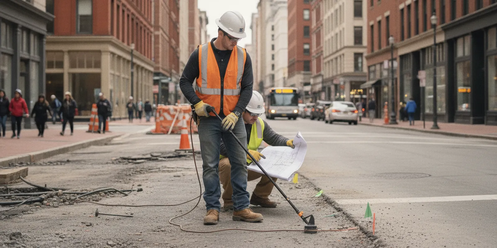
Planning subsurface utility engineering in Washington, DC takes more than collecting utility records and sending a crew to the site. Dense streets, layered infrastructure, limited access, and active public spaces can complicate how a project team investigates underground conditions. A thoughtful plan defines the area of interest, the decisions the information must support, and how field findings will be documented.
Plan a subsurface investigation with our team
Why does SUE planning matter on Washington, DC sites?
In a compact urban environment, a proposed excavation or design change can overlap with many existing systems. A street or parcel may contain public and private utilities, service connections, abandoned infrastructure, and facilities installed at different times. Records may be incomplete, show approximate alignments, or use different reference points. Conditions visible at the surface do not necessarily reveal what lies below it.
These uncertainties affect more than excavation. They can influence early layout decisions, the location of proposed structures, construction sequencing, access planning, and coordination with agencies or utility owners. If a conflict is discovered late, the team may need to revisit design assumptions or adjust field plans. Early subsurface utility engineering (SUE) helps project teams develop better-informed decisions by investigating utility information in relation to a defined project need.
Federal Highway Administration guidance describes SUE as an engineering process for identifying, verifying, and documenting underground facilities. Its SUE overview is a useful reference for understanding the role of the process. A Virginia Tech academic case-study collection also includes SUE work in Washington, DC involving drinking water, wastewater, and stormwater systems, illustrating the relevance of subsurface investigation to urban infrastructure planning.
For DC work, the first step is not to assume every project needs the same survey. It is to identify the decisions at stake, define the footprint and schedule, and select investigation and documentation appropriate to those needs.
What makes utility investigations in DC more complex?
Dense corridors and limited working room
Roadways, sidewalks, building frontages, alleys, and landscaped areas can leave little room for equipment or staging. A project footprint may touch several surface types and have restricted access windows. Pedestrian activity, traffic, loading needs, and nearby construction can also affect where and when field crews can work. These are planning considerations, not just day-of logistics: they can determine which areas are accessible and how to sequence the investigation.
Multiple records and uncertain alignments
Available plans may come from different owners, projects, or dates. They can use different coordinate references and levels of detail. A line drawn on a record should be treated as information to evaluate, not proof of its precise field position. Similarly, a visible feature such as a valve box, utility cover, or pole can help guide investigation but does not by itself establish the route or depth of every connected facility.
Bring together the records the project team already has, note their source and date, and identify gaps. This creates a starting point for field investigation and helps the team distinguish known information from assumptions. For a broader look at how private facilities may fall outside public utility marking, see how private utility locating and 811 differ.
Utility congestion and changing site conditions
Urban sites can have closely spaced or crossing utilities. Signals may overlap, access to a feature may be obstructed, or surface conditions may limit the usefulness of a particular detection approach. Construction can also change site conditions between the initial planning stage and fieldwork. A useful scope acknowledges that detection methods have limits and sets out how findings, uncertainty, and inaccessible areas will be reported.
How should a project team define the investigation area?
Start with the project footprint, then include the surrounding space that may affect design or construction. That does not mean investigating an arbitrary wide area. It means reviewing where excavation, grading, foundations, utility connections, temporary work, and equipment access may occur, and asking whether nearby facilities could create a conflict.
Give the investigator a current base plan or other usable project drawing when available. Mark the proposed work area, planned excavation limits, relevant design alternatives, and known constraints. If the design is still evolving, state which alternatives need to be considered. A plan that only shows a parcel outline may not make clear which part of the site matters or what decisions the findings need to inform.
- Define the project limits: identify streets, parcels, work zones, and any adjacent area relevant to the design.
- Show proposed work: include planned excavation, new infrastructure, structures, and likely access or staging locations.
- Identify decision points: describe where the team needs to assess potential utility conflicts or compare design options.
- Flag exclusions: state areas that cannot be entered, surveyed, or investigated and why, if known.
- Clarify the mapping basis: specify available coordinate, drawing, or survey control information so the team can discuss how results will align with project materials.
Scope can be refined as project needs become clearer. For an overview of how an investigation is organized and what documentation may be discussed, review the investigation process and deliverables.
What should the SUE scope specify?
A clear scope connects field effort to a project question. Instead of requesting a vague “utility sweep,” describe the site, intended use of findings, expected coverage, known information, and deliverable needs. The project team and provider can then agree on methods and limitations before mobilization.
Set quality-level objectives by area
SUE scopes commonly distinguish levels of utility information, often described as Quality Levels A through D. In broad terms, the levels represent different sources and degrees of verification, from existing records and visible evidence through geophysical investigation and physical exposure at selected locations. They are not interchangeable labels for one all-purpose scan. The project engineer should identify which level or combination of information is useful for specific design decisions and locations.
For example, early planning may benefit from assembling and reviewing records, while a suspected conflict at a critical crossing could require more focused verification. Do not assume that every line can be confirmed to the same degree across an entire corridor. The appropriate approach depends on the question, site access, utility characteristics, and project requirements. If physical exposure is contemplated, the project team must plan that work separately with appropriate authorization and procedures; locating alone is not excavation or exposure.
Describe methods and their limitations
Electromagnetic (EM) locating can help trace conductive utilities when suitable access and signal conditions are present. Ground penetrating radar (GPR) can help investigate subsurface features, including some non-metallic utilities, but results depend on site and material conditions. These methods complement one another; neither should be portrayed as a universal detector. A combined approach may be considered where the project question and conditions warrant it.
State whether the requested work includes surface markings, field observations, mapping, photographs, or a written record, and how findings will be tied to project plans. Ask how the provider will identify interpreted versus uncertain information and document inaccessible areas. SafeLine offers GPR investigation, private utility locating, and utility mapping and documentation; the right scope depends on project-specific needs.
How do SUE planning options compare?
The table below is a planning aid, not a substitute for a project-specific scope. It shows how common information sources and investigation activities can contribute different kinds of evidence. The project team should decide what is needed for each area and design decision.
| Planning input or activity | What it can contribute | Key limitation to account for | Useful planning question |
|---|---|---|---|
| Existing records and plans | Starting information about reported utility routes and system context | Records may be incomplete, approximate, dated, or based on differing references | What is the source and date, and how will record information be checked? |
| Surface feature review | Visible evidence such as covers or other accessible utility features | A surface feature does not establish the route or depth of every connected facility | Which features are accessible and relevant to the proposed work? |
| EM locating | Field tracing of suitable conductive utilities under workable signal conditions | Not every utility is conductive or traceable; interference and access can affect results | Which known or suspected facilities may be traced, and what constraints exist? |
| GPR investigation | Subsurface responses that may help identify or assess buried features | Results depend on site materials, conditions, target characteristics, and interpretation | Where is GPR most useful for the project question, and how will interpretations be described? |
| Focused verification planning | More targeted investigation at locations where design decisions or conflicts warrant added confidence | Requires a defined location, authorization, coordination, and an agreed method | Which conflict points need added verification before design or construction? |
| Mapping and reporting | Organized record of investigated features, observations, and stated limitations | Value depends on clear reference information, scope, and communication of uncertainty | What format and level of detail will the design and construction teams use? |
What should teams prepare before fieldwork?
Good preparation reduces avoidable back-and-forth and helps ensure field effort addresses the actual project. Before requesting a proposal or scheduling work, gather the materials below. If something is not available, note that rather than delaying the conversation; the gap itself may influence scope.
- Current site plans: provide a legible base drawing and any available survey control, coordinate information, or project reference system.
- Project description: explain whether the work supports concept planning, design development, a specific utility conflict, or construction preparation.
- Proposed work and schedule: identify anticipated disturbance areas, decision deadlines, and preferred or restricted access times.
- Existing utility information: share available plans, prior investigation records, public locate information, and known site observations, keeping each source identifiable.
- Access and site contacts: identify who can coordinate entry and communicate restrictions, work-hour limits, traffic or pedestrian considerations, and safety requirements.
- Required deliverables: tell the provider who will use the results, the drawing or data format needed, and whether the team expects photographs, markings, mapped features, or a narrative report.
For excavation, coordinate the applicable one-call notification process separately and allow the required time. A private investigation is not a replacement for calling 811, and a public marking response may not identify privately owned facilities beyond its scope. SafeLine's pre-excavation utility locate checklist can help organize information before work begins.
How can teams plan access and coordination in a dense corridor?
Access should be treated as part of the technical plan. Confirm which areas can be entered, whether permission is needed, and whether the field crew will encounter locked gates, occupied spaces, parked vehicles, temporary barriers, or active work. In a public-facing corridor, coordinate the investigation window with the people managing the site and any applicable traffic or pedestrian controls. Requirements vary by project and authority, so verify them with the responsible parties rather than assuming a standard arrangement.
Where a corridor includes multiple properties or work zones, create a simple access map and identify a point of contact for each relevant area. Note areas that cannot be surveyed during the planned visit and decide whether they should be handled later or recorded as limitations. If utility owners, design consultants, contractors, or public-sector stakeholders need to review findings, identify those participants early and establish how updates will be shared.
Schedule coordination also matters. A design deadline may call for preliminary information first and more focused investigation later, while a construction mobilization may require a different sequence. Tell the provider about decision dates and dependencies. If project limits or drawings change after the scope is set, communicate the change before assuming the original coverage still applies.
What should a useful SUE deliverable communicate?
A deliverable should help someone make a decision without confusing measured or observed information with assumptions. Confirm the agreed format in advance. Depending on scope, useful project documentation may include mapped utility indications, field markings, photographs, record-source notes, descriptions of methods, and a summary of constraints or areas not investigated.
Ask how the deliverable will describe confidence and uncertainty. Where an alignment is interpreted from field response rather than physically exposed, that distinction should be clear. Where records conflict with field observations, the report or map should make the discrepancy visible instead of silently choosing one source. A well-organized record also notes the survey limits and the basis on which locations are shown, so later users understand what the investigation did and did not establish.
Plan for the information to reach the people who need it. Designers may need mapping they can compare to proposed work; field supervisors may need clear marks and a concise explanation of constraints. Project teams can review SafeLine's subsurface utility resources and learn more about private utility locating in Virginia when coordinating work across the wider region.
How can a project team start planning?
Begin with three items: a clear project footprint, the decisions the investigation should support, and the records or drawings already available. Add access constraints and desired deliverables, then discuss which methods and level of verification fit each area. This gives an investigator a practical basis for discussing scope without assuming a single approach works everywhere in a dense city.
SafeLine Subsurface provides private utility locating, GPR, SUE, and underground utility mapping across Virginia, Maryland, Washington, DC, and North Carolina. To discuss a DC project, share its location and limits, schedule, known utility information, access conditions, and the decisions the team needs to make. Visit the service area page for coverage information.
Send your project details through the contact form
Frequently asked questions
Does SUE replace an 811 notification in Washington, DC?
No. Treat SUE and the applicable one-call notification as separate parts of excavation planning. Follow the relevant notification process and confirm what its response covers; a private investigation can address project needs that are outside the public marking scope, but it does not cancel required notifications.
Should every part of a DC project receive the same quality level?
Not necessarily. The project team should match the needed information to the decision and location. A broad planning area, a proposed excavation zone, and a suspected conflict point may have different requirements. Define those needs in the scope rather than applying one label to the whole site without considering purpose.
Can EM locating and GPR be used together?
They can be complementary tools. EM locating is used to trace suitable conductive utilities, while GPR can help investigate subsurface responses under appropriate conditions. Site characteristics and target utilities affect what each method can identify, so methods and limitations should be discussed for the specific project.
What if utility records are missing or inconsistent?
Share whatever records are available and identify their sources and dates. The investigation scope can then account for gaps and conflicts, and field findings can be documented alongside the record information. Avoid treating an incomplete plan as confirmation that no utility is present.
What information helps request a project-specific scope?
Provide a project plan or location description, proposed work limits, schedule and decision dates, available utility records, site-access constraints, and the format or detail needed for the deliverable. These details help the team discuss an appropriate investigation for the site.
Careful planning helps DC project teams turn scattered records and field observations into clearer information for design and construction decisions.