
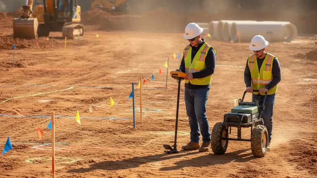
Underground utility information is rarely complete enough to support a major design or excavation decision on its own. A subsurface utility engineering service turns records, field observations, geophysical investigation, surveying, and carefully documented findings into usable project intelligence. For civil engineers, contractors, municipalities, and developers, the goal is not simply to draw lines on a plan. It is to reduce uncertainty before that uncertainty becomes a redesign, relocation, change order, delay, or utility strike.
Talk with SafeLine Subsurface about your SUE scope and documentation needs.
In this guide:
- What SUE is and what it is not
- How ASCE 38-22 quality levels work
- How records, EM locating, GPR, surveying, and exposure fit together
- What to expect in SUE documentation and deliverables
- How to scope a SUE investigation
- Frequently asked questions
What is subsurface utility engineering?
Subsurface utility engineering, or SUE, is a risk-management practice for finding, evaluating, mapping, and communicating information about existing utility infrastructure. A subsurface utility engineering service combines records research, site reconnaissance, surveying, surface geophysics, professional interpretation, and, when needed, non-destructive exposure. The resulting data helps a project team make better decisions during planning, design, procurement, construction, and future maintenance.
The Federal Highway Administration describes SUE as an engineering practice that combines civil engineering, surveying, and geophysics. It is a process, not a single machine or scan. The work is organized around the amount of information a project needs and the consequences of being wrong. A route-selection study may begin with records and visible features. A congested urban corridor or critical tie-in may justify geophysical designation and targeted test holes. For a concise introduction to the four levels, see SafeLine's overview of what subsurface utility engineering is.
That distinction matters. A locator may identify a signal or an anomaly, but the project team still needs to know how the finding was obtained, what it represents, how accurately it was positioned, what attributes are known, and where the method could not provide a reliable answer. Good SUE documentation keeps those facts visible instead of presenting every line as equally certain.
FHWA's SUE overview explains how quality levels help owners and designers decide how much utility information is needed for a particular risk-management problem. The American Society of Civil Engineers' ASCE/UESI/CI 38-22 provides the current framework for investigating and documenting existing utilities.
Why use SUE before design or construction?
SUE gives a project team a structured way to identify utility uncertainty while there is still time to change the design, coordinate with utility owners, plan safe excavation, or budget for verification. It can reduce avoidable conflicts, improve communication between designers and field crews, and create a defensible record of what was investigated, what was found, and what limitations remained.
- Improve early planning: Identify utility corridors, congestion, and likely conflicts before a route or site layout is fixed.
- Support design decisions: Give engineers better information for foundations, stormwater, road widening, utility crossings, tie-ins, and building service connections.
- Reduce relocation surprises: Surface conflicts early enough to evaluate avoidance, protection, relocation, or staged construction.
- Plan safer excavation: Combine public utility information, private utility investigation, and project-specific verification planning.
- Improve procurement: Define investigation limits, quality levels, deliverables, and assumptions clearly in an RFP or scope of work.
- Preserve project knowledge: Give future project teams a record that is more useful than paint marks or an unreferenced sketch.
FHWA identifies fewer unexpected utility conflicts, fewer redesign delays, reduced damage risk, and better design coordination as benefits of using SUE early in project development. Those benefits do not come from a label alone. They depend on matching the investigation effort to the project's risk, integrating the results into the plans, and clearly communicating the confidence and limitations of each finding.
SUE is particularly valuable when records conflict, utilities have been abandoned or rerouted, a project crosses an older developed corridor, the work area includes multiple owners, or construction will occur near a critical facility. It can also be useful on smaller projects when a single unknown service connection or shallow crossing could create disproportionate schedule or safety consequences.
How does ASCE 38-22 define SUE quality levels?
ASCE/UESI/CI 38-22 organizes existing utility information into four quality levels, from QL-D through QL-A. The levels communicate how the information was obtained and how much positional certainty it carries. They are not a simple score for an entire property. Different utility segments, features, or portions of a project may have different quality levels, and the final deliverable should preserve that distinction.
The current ASCE 38-22 standard replaced CI/ASCE 38-02 and added guidance on utility attributes, depth documentation, and three-dimensional information. The ASCE product description for Standard Guideline for Investigating and Documenting Existing Utilities explains that the standard provides both prescriptive actions and performance-based professional judgment about the timing, sequence, location, and scope of an investigation.
| Quality level | Primary information source | Typical project use |
|---|---|---|
| QL-D | Existing records, utility-owner information, historical plans, permits, and verbal accounts | Early planning, route screening, and a starting inventory of possible utilities |
| QL-C | Visible utility features correlated with records, such as manholes, valve boxes, poles, and meters | Improving the record picture where aboveground evidence can anchor subsurface segments |
| QL-B | Appropriate surface geophysical methods, such as EM locating and GPR, interpreted and positioned with survey control | Design-stage utility designation and horizontal conflict analysis |
| QL-A | Non-destructive exposure and measurement of a utility at a specific location | Precise plan and profile decisions, crossings, tie-ins, and high-consequence conflicts |
Quality levels should be selected by project need, not chosen automatically as a package. An engineer or owner may need QL-D and QL-C across a broad corridor, QL-B in the proposed construction area, and QL-A only at selected crossings. A well-written scope explains where each level is required and what the project team will do with the resulting information.
QL-D: records and existing information
QL-D is the starting point for most investigations. The team gathers available utility-owner records, historical plans, as-built information, permits, prior surveys, one-call information, service records, and informed recollections. QL-D can reveal the likely presence and general arrangement of utilities, but records may be incomplete, outdated, mis-scaled, or based on assumptions rather than a field-confirmed location.
QL-D is useful for building the initial utility inventory and identifying where additional work is justified. It is not a substitute for field designation when the project depends on the horizontal position of a utility. The deliverable should identify the source and vintage of records and distinguish documented information from interpretation.
QL-C: visible features correlated to records
QL-C adds site reconnaissance and survey information about visible utility features. The investigator may observe and measure manholes, vaults, hydrants, valve boxes, pedestals, poles, meters, cleanouts, markers, and other features. Those observations are correlated with records to infer the location and direction of the connected subsurface segment.
QL-C can expose contradictions that are invisible in a desktop records review. A visible feature may be missing from a plan, a recorded line may not align with the observed connection, or a utility may enter a structure from an unexpected direction. QL-C does not mean the entire connected line has been directly observed. The boundary between the visible anchor feature and the inferred segment should remain clear.
QL-B: geophysical designation
QL-B uses appropriate surface geophysical methods to identify the existence and approximate horizontal position of subsurface utilities. The work commonly includes electromagnetic locating for conductive utilities, GPR for subsurface reflections and non-metallic targets, or a combination of methods. The results are interpreted, correlated with available records and features, and positioned relative to project control.
QL-B is often the central field component of a subsurface utility engineering service, but it has important limits. A geophysical response is not automatically proof of utility material, ownership, condition, or exact depth. Soil conditions, interference, utility construction, access, signal coupling, surface conditions, and operator interpretation affect results. Depth information obtained during geophysical work should be labeled with appropriate caution and should not be presented as QL-A simply because a depth estimate is available.
QL-A: non-destructive exposure
QL-A confirms a utility's location and attributes at a specific point by physically exposing it through safe excavation practices, often with vacuum excavation or another approved method. The exposed utility can then be measured for horizontal and vertical position, outside dimensions, material, condition, and other attributes required by the scope. QL-A is the highest quality level for the exposed feature, not a blanket certification of every utility on the site.
QL-A is typically reserved for locations where uncertainty has a high consequence, such as a proposed crossing, deep foundation, major tie-in, congested corridor, or conflict that cannot be resolved through records and surface methods. A project may use QL-B to map the corridor and QL-A at the few points that control the final design. The decision should account for safety, access, permit requirements, surface restoration, schedule, and the value of the information.
How do EM locating, GPR, surveying, and exposure work together?
A reliable SUE investigation uses complementary methods rather than treating one technology as a universal answer. Records and visible features establish context. Electromagnetic locating traces conductive utilities. Ground penetrating radar can identify subsurface contrasts and support investigation of non-metallic utilities or objects. Survey control positions findings. Targeted exposure verifies high-consequence points when the project requires greater certainty.
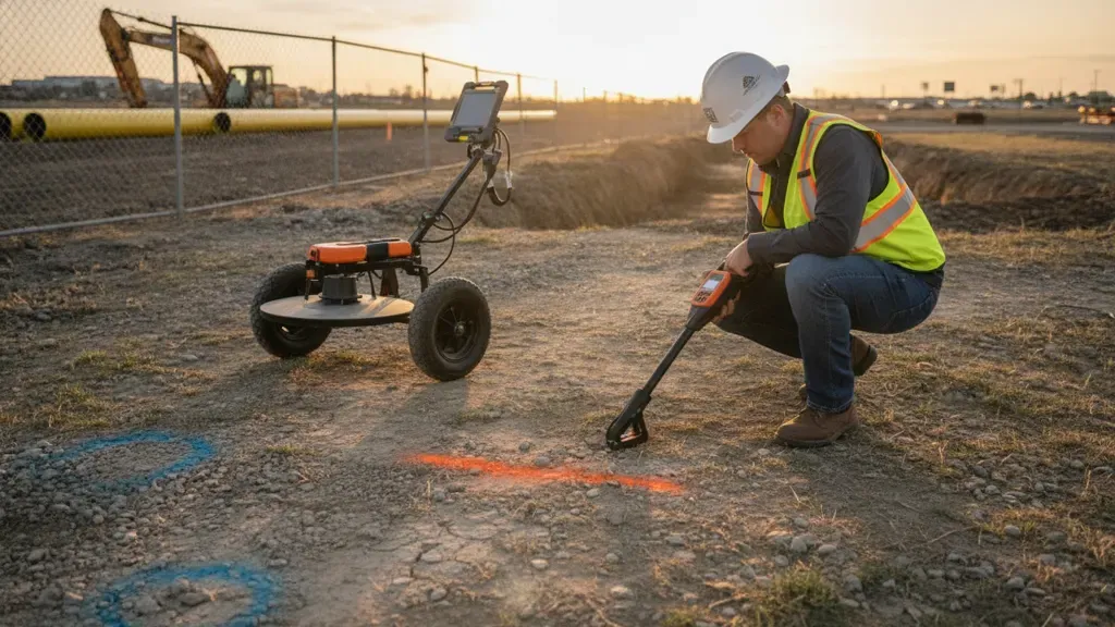
EM locating and GPR can contribute different evidence to the same utility investigation. The final report should explain which method supported each finding.
Records research and site reconnaissance
Before field scanning begins, the team defines the work area and assembles the information already available. Useful inputs may include civil plans, utility-owner records, prior survey data, as-built drawings, permits, one-call marks, site photographs, easement information, and facility records. The investigator then compares those sources with conditions on the ground, looking for meters, pedestals, poles, manholes, valve boxes, utility crossings, service entrances, and evidence of prior work.
This phase prevents a common failure: scanning a narrow area without understanding where utilities begin, end, change direction, or connect to a structure. It also gives the project team a list of discrepancies to resolve and a rational basis for selecting field methods.
Electromagnetic locating
Electromagnetic, or EM, locating detects electromagnetic fields associated with conductive utilities or an applied signal. Depending on the utility and access available, a locator may use passive modes, direct connection, induction, or a signal clamp. EM can be highly effective for conductive pipes, cables, and utilities with tracer wire. It does not directly locate every non-metallic line, and signal coupling can create ambiguity when nearby conductors share or carry a signal.
SafeLine Subsurface uses EM locating equipment alongside GPR and concrete scanning. That combined capability is important because a project may contain conductive electric or communications lines as well as plastic, fiberglass, clay, or concrete utilities that require another method. A professional report should state the EM method used, relevant access conditions, observed interference, and any limitations that affect interpretation. SafeLine's ground penetrating radar service page provides additional context on its GPR capability.
Ground penetrating radar
Ground penetrating radar sends electromagnetic pulses into the ground and records reflections from changes in subsurface materials. GPR can support investigation of metallic and non-metallic utilities, conduits, voids, tanks, and other anomalies. It is especially useful as a complementary method when an EM signal is absent or cannot be reliably applied.
GPR performance varies with soil conductivity, moisture, surface condition, target size, depth, antenna frequency, reinforcement, clutter, and the contrast between the target and surrounding material. Wet or conductive clay can limit penetration. A smooth, accessible surface generally supports better data collection than rough, obstructed ground. GPR findings require interpretation, and the report should distinguish a mapped utility interpretation from an unconfirmed anomaly.
Surveying, positioning, and project control
Investigation findings are more useful when they can be placed in the project's coordinate system and related to design features. Surveying may include visible utility features, geophysical marks, control points, offsets, and other field observations. The scope should identify the coordinate reference system, datum, units, horizontal and vertical control, and the level of survey support expected.
Positioning precision does not eliminate interpretation uncertainty. A point can be surveyed precisely while the underlying utility interpretation remains approximate. SUE documentation should keep those concepts separate by showing both the position of the finding and the quality level or confidence associated with the utility information.
Non-destructive exposure and verification
When a design decision depends on exact position, a project may require non-destructive exposure at a planned test-hole location. Exposure verifies the utility physically and can provide dimensions, material, depth, elevation, and condition observations that surface methods cannot establish with the same certainty at that point.
Exposure is not a reason to skip the earlier investigation steps. Records, reconnaissance, EM, GPR, and survey information help select safer and more efficient exposure points. The final scope should assign responsibility for permits, traffic control, excavation safety, utility-owner coordination, restoration, and the disposition of exposed locations.
What does a subsurface utility engineering service include?
A SUE service is a coordinated workflow from project definition through usable documentation. The exact tasks vary by project, but a complete scope normally addresses the study limits, records, field methods, survey control, quality levels, conflict analysis, deliverable format, assumptions, and limitations. The work should be planned early enough that findings can influence design instead of arriving after construction decisions are fixed.
- Project intake: Review the proposed work, schedule, plans, limits, access, utility owners, and decisions the investigation must support.
- Utility records review: Collect and organize available records, plans, permits, as-builts, one-call information, and owner data.
- Site reconnaissance: Observe visible features, access points, surface conditions, evidence of prior work, and possible utility connections.
- Investigation planning: Select methods and quality levels by area, utility type, consequence of conflict, and available project control.
- Field designation: Use EM locating, GPR, and other approved methods as appropriate, recording field conditions and method limitations.
- Survey and data control: Position findings, features, marks, and observations consistently with the agreed coordinate system.
- Conflict review: Compare utility information with proposed grading, foundations, drainage, roadwork, structures, and utility alignments.
- Verification planning: Recommend targeted QL-A exposure or other follow-up where uncertainty has a material effect on safety, cost, or constructability.
- Documentation and handoff: Deliver maps, reports, tables, photos, limitations, and source information in formats the project team can use.
The value of the process is cumulative. A scan without a defined purpose may produce data that no designer can confidently use. A map without method notes may hide uncertainty. A report without an agreed coordinate system may be difficult to reconcile with civil plans. Scoping the decision first helps the investigation produce evidence that is relevant to the project.
What documentation should a SUE project deliver?
SUE deliverables should let a project team answer four questions: What utilities or features were investigated? How were they found and positioned? What quality level or confidence applies to each result? What remains unknown or requires verification? The package may include maps and reports, but the exact contents should be agreed before field work so the investigator collects the right data.
Common deliverable components include:
- Utility investigation report: Project limits, scope, methods, dates, findings, quality levels, assumptions, discrepancies, and limitations.
- Utility plan or map: Utility lines, features, anomalies, labels, quality levels, and relationship to the proposed design.
- Source and method notes: Records consulted, field methods used, areas where a method succeeded or was limited, and interpretation notes.
- Survey data: Coordinates, control information, visible features, marks, offsets, and the coordinate reference system used.
- Photo documentation: Site conditions, access points, visible features, field markings, and verification locations where relevant.
- GPR or geophysical evidence: Trail images, interpretations, anomaly references, and supporting data when included in the scope.
- Utility attribute table: Utility type, owner if known, material if known, size, depth or elevation information, source, quality level, and confidence notes.
- Conflict and recommendation register: Crossings, potential clashes, unresolved discrepancies, recommended test holes, and design coordination items.
- Digital exchange files: PDF, CAD, GIS, KMZ, or another agreed format, with file naming and layer conventions defined in advance.
SafeLine's utility mapping and documentation service describes deliverables such as KMZ files, congestion mapping, pre-construction intelligence reports, RTK GPS precision, and confidence-classified findings. That kind of information is most useful when the project team also receives the definitions, coordinate reference, source notes, and limitations needed to interpret it correctly.
Do not judge a deliverable by file extension alone. A CAD file can be technically clean while still failing to explain whether a line was recorded, observed, geophysically designated, or physically exposed. A strong package combines geometry with metadata and a clear statement of what the information can support.
How should you scope a SUE investigation?
The best SUE scope starts with the decisions the project must make, then works backward to the information needed for those decisions. Instead of asking for "all utilities" without a defined boundary, identify the project limits, anticipated construction, utility conflict points, required quality levels, deliverables, schedule, and responsibilities. This makes proposals easier to compare and reduces the risk of paying for data that cannot be used.
Define the project and investigation limits
Provide the site or corridor limits, proposed work area, anticipated excavation or grading, construction access, known utility corridors, and any off-site tie-ins. Identify whether the work includes roadways, sidewalks, buildings, parking areas, landscaped zones, water features, private property, or restricted facilities. State whether the investigation must extend beyond the immediate footprint to understand utility approaches and connections.
Assign quality levels by decision
Specify where QL-D, QL-C, QL-B, and QL-A information is required, and explain why. For example, broad route planning may need records and visible-feature correlation, while a proposed storm drain crossing may need QL-B designation plus targeted QL-A verification. If the project team expects a provider to recommend levels, say so and request the recommendation with the assumptions behind it.
Identify utilities and stakeholders
List known public and private utility owners, facility operators, tenants, and other stakeholders. Clarify whether the scope includes private utilities beyond the public one-call mark, abandoned lines, site lighting, irrigation, communication infrastructure, drainage, process lines, or utilities inside structures. A public 811 ticket and a private SUE investigation address different information needs. Coordinate both when the project requires both.
Set survey and data requirements
State the coordinate reference system, datum, units, control, expected positional precision, vertical information, and file formats. Confirm whether the project needs a PDF plan, CAD layers, GIS data, KMZ, a report, a field mark-up, or some combination. If the data will be imported into an existing asset-management or design system, provide the required schema, layer names, attributes, and naming conventions before collection.
Require limitations and verification recommendations
Ask the provider to document areas that could not be investigated, utilities that were not detectable by a selected method, access restrictions, surface conditions, interference, record conflicts, unconfirmed anomalies, and recommended follow-up. A limitation is not a defect when it is disclosed and managed. Undisclosed uncertainty is what creates avoidable surprises.
Coordinate timing and site safety
Plan SUE early enough to influence design, and schedule field work around access, traffic control, weather, active construction, landscaping, security, and facility operations. The project owner and contractor should confirm who handles one-call tickets, permits, traffic control, work-zone protection, utility-owner coordination, test-hole approvals, restoration, and final design decisions.
When does a project need a SUE service?
A project should consider SUE when unreliable utility information could materially affect design, safety, cost, schedule, or stakeholder coordination. The need is strongest where construction is close to existing infrastructure, the record set is incomplete or contradictory, the work crosses a dense corridor, or a single conflict could trigger a major redesign or relocation.
- Road widening, interchange, bridge, rail, and transportation projects
- Site development, subdivisions, campus expansion, and commercial construction
- Stormwater, drainage, water, sewer, and utility corridor improvements
- Foundation, deep excavation, directional drilling, and trenchless work
- Utility crossings, tie-ins, relocations, and service upgrades
- Projects with older, incomplete, or conflicting as-built information
- Urban or institutional sites with dense and multi-owner infrastructure
- Facilities where outages, service interruptions, or access restrictions carry high consequences
- Design-build or accelerated projects where early conflict identification protects the schedule
Not every project needs the same investigation intensity. A small, low-consequence excavation may need a properly coordinated one-call process and a private locate. A major capital project may need a staged SUE program with records, reconnaissance, QL-B designation, targeted QL-A exposure, conflict management, and an electronic data package. The correct question is not whether the project needs every possible service. It is which unknowns could change the outcome and what evidence is needed to manage them.
How is SUE different from 811 or a private utility locate?
811, private utility locating, and SUE can support the same damage-prevention objective, but they are not interchangeable. 811 coordinates public utility owner responses under the applicable state process. A private utility locate investigates infrastructure that may not be covered by public marking. SUE adds a broader engineering workflow that organizes utility information by quality level, relates it to design, analyzes conflicts, and documents how the information should be used.
| Activity | Main purpose | Typical output |
|---|---|---|
| 811 one-call | Notify participating public utility owners before excavation and obtain their marks under local rules | Utility-owner marks or responses within the applicable process |
| Private utility locating | Find and mark private or site-owned utilities not covered by the public one-call response | Field markings, locate notes, photos, and sometimes a map or report |
| SUE | Manage utility risk through records, field investigation, quality levels, survey, conflict analysis, and documentation | Quality-classified utility information integrated with plans and project decisions |
OSHA's excavation standard requires employers to determine the estimated location of underground installations before opening an excavation and to determine the exact location by safe and acceptable means as excavation approaches. The OSHA standard is a safety requirement for employers. It does not turn a one-call mark, a geophysical estimate, or a SUE map into permission to excavate without following the applicable state and site procedures.
SafeLine's subsurface investigation services can be discussed alongside the project's 811 and utility-owner coordination process. Its private utility locating service addresses the additional field information that public marking may not provide. The scope should make clear which information comes from public utility owners, which comes from private investigation, and which project decisions remain with the owner, engineer, and contractor.
What should you ask a SUE provider?
Before selecting a subsurface utility engineering service, ask how the provider will match methods and quality levels to the project's decisions. The most useful proposal is not necessarily the one with the longest equipment list. Look for a clear work plan, experienced interpretation, documented limitations, consistent positioning, and deliverables that the engineer and contractor can use without guessing.
- Which project areas and utility segments are included in the investigation limits?
- What quality level is proposed for each area, and what decision does it support?
- How will records, visible features, EM locating, GPR, survey, and possible exposure be combined?
- How will non-metallic utilities, tracer-wire conditions, interference, and difficult soil conditions be handled?
- How will findings be positioned relative to project control?
- How will the report distinguish a utility interpretation from an unconfirmed anomaly?
- Will depth be reported, and how will the report explain the source and limitations of depth information?
- What photos, field notes, trail images, data tables, maps, and digital files are included?
- Which coordinate reference system, datum, units, layers, attributes, and file formats will be used?
- What areas or utilities may remain unresolved, and what verification is recommended?
- Who is responsible for one-call coordination, access, permits, traffic control, test holes, restoration, and design integration?
- What schedule assumptions could affect field work or delivery?
Ask for sample redacted deliverables when procurement rules allow it. A sample can show whether the provider communicates quality levels, source information, method limitations, confidence, and conflicts in a way your project team understands. It can also reveal whether a promised "map" is a decision-ready data package or simply a picture of field markings.
Plan a documented subsurface investigation with SafeLine Subsurface
SafeLine Subsurface supports private utility locating, GPR investigation, electromagnetic locating, concrete scanning, underground utility mapping, and documentation for project teams across Virginia, Maryland, Washington, D.C., and North Carolina. Its mapping and documentation approach is built around project-specific scope, field evidence, location data, and clear communication of confidence and limitations. The company's investigation process and deliverables page shows how those steps are organized for project teams.
For an engineering, municipal, commercial, institutional, or development project, start with the decision you need the underground information to support. Share the site limits, plans, known utility records, schedule, anticipated construction, requested quality levels, and desired deliverables. SafeLine can then discuss whether the scope calls for records review, site reconnaissance, EM and GPR field work, survey-referenced mapping, targeted verification, or a staged combination.
Request a project conversation with SafeLine Subsurface.
Frequently asked questions about SUE services
These common questions help project owners, engineers, and contractors evaluate the right level of subsurface utility investigation for a project.
Is SUE the same as utility locating?
No. Utility locating is one field activity within a broader SUE workflow. SUE can include records research, visible-feature reconnaissance, EM locating, GPR, survey, conflict analysis, targeted non-destructive exposure, quality-level classification, and documentation that connects the findings to design and construction decisions.
What is the most accurate SUE quality level?
QL-A is the highest quality level for a specific exposed utility feature or segment because it is based on non-destructive exposure and measurement. QL-A does not automatically apply to an entire site or corridor. Other segments may remain at QL-B, QL-C, or QL-D depending on the investigation scope and evidence available.
Does QL-B include exact utility depth?
No. QL-B primarily communicates the approximate horizontal position obtained through appropriate surface geophysical methods and professional interpretation. A geophysical depth estimate may be useful, but it should be labeled with appropriate limitations. Exact depth and other attributes at a high-consequence point may require QL-A exposure.
Can GPR find every underground utility?
No. GPR performance depends on soil, moisture, surface access, target characteristics, depth, interference, and other conditions. GPR is a valuable complementary method, especially for some non-metallic utilities and subsurface anomalies, but no single technology should be treated as universal. A qualified investigation documents where the method worked and where it was limited.
Do I still need 811 if I hire a SUE provider?
Usually, yes. 811 notification and utility-owner response requirements depend on the applicable state and local process. A SUE or private locating investigation addresses additional project information needs, including private utilities, design coordination, and documented uncertainty. Treat the two processes as complementary and follow the project owner's, engineer's, contractor's, and utility owner's requirements.
What files are included in SUE deliverables?
Files depend on the scope. A package may include an investigation report, PDF plan, CAD or GIS data, KMZ, coordinate tables, photos, field notes, GPR evidence, utility attributes, conflict notes, and verification recommendations. Confirm the coordinate system, layer structure, file types, metadata, and limitations before field work begins.