
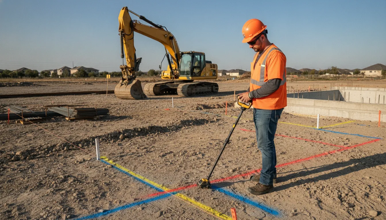
Underground utilities rarely follow the clean lines shown on an early plan set. Records may be incomplete, and older site work may be undocumented. A utility that is out of sight can become a design conflict or excavation hazard when construction begins. That uncertainty is why utility investigation belongs in civil-project planning, not only in the field before digging.
Planning a civil project? Contact SafeLine Subsurface to discuss your SUE investigation.
SUE investigations reduce project risk by giving owners, designers, and contractors better information before decisions become expensive. Records research, field locating with electromagnetic (EM) equipment and GPR, surveying, mapping. And targeted verification can help teams identify conflicts, adjust designs, coordinate relocations, and document what is known. The goal is not to eliminate every unknown, but to make important risks visible early enough to manage them.
The practical question is where that risk enters a project and how better subsurface information changes the choices made before construction starts.
What Utility Risk Looks Like Before Construction Starts
Utility risk often begins as an information problem, not a field incident. During planning and design, the project team may need to make decisions about alignments, excavation. Grading, drainage, foundations, or access without a complete view of what is below the surface. FHWA describes SUE as an engineering practice for identifying the quality of subsurface utility information needed for a project, then acquiring and managing that information during development. FHWA explains the role of SUE in project planning.
The first mechanism is simple: utilities are underground or otherwise out of sight. Their presence, route, depth, condition, and relationship to proposed work may not be apparent from a walk-through or a conventional surface survey. A line can therefore be absent from the working design without being absent from the construction area. That gap creates exposure when the team sets an excavation limit, selects a structure location, or coordinates work around an assumed corridor. SUE investigations reduce project risk by replacing some of that uncertainty with information the design and construction teams can evaluate.
Records are another common gap. Record drawings can be useful starting points, but ASCE notes that they are not always available or detailed enough for design purposes. They may not show later modifications, private facilities, abandoned infrastructure, or the precision needed to compare an existing utility with a proposed alignment. Treating a record set as complete when it is only partial can transfer an unresolved design question into the field.
These conditions do not mean an investigation can eliminate every underground uncertainty. They mean the project team can identify where uncertainty remains, decide which conflicts need more investigation, and document the information used for design and coordination. That distinction matters before plans are finalized, when changing an alignment or work area is generally a design decision rather than an emergency response.
How SUE Investigations Reduce Project Risk Before Construction
Effective subsurface utility engineering is a staged investigation, not a single pass with one piece of equipment. The project team first builds an information baseline, then tests that baseline in the field and documents what the design and construction teams need to know. That is how sue investigations reduce project risk: uncertainty is addressed while there is still time to adjust the plan.
- Research available records and project information. The investigation begins by gathering utility records, plans, prior surveys, site information, and stakeholder knowledge. Records research can reveal known facilities and likely connection points, but it should not be treated as a complete picture. Underground infrastructure may be absent from records, shown with limited detail, or positioned differently than expected. This first step helps define the areas and questions that require field verification.
- Survey visible utility features and site conditions. Field staff review surface evidence such as utility structures, marked features, access points, and site improvements. Survey and mapping place relevant observations in a project coordinate framework so the information can be used during design coordination. SafeLine's process can include utility mapping, field markings, and documentation that supports project records and future reference.
- Use complementary EM and GPR methods. Electromagnetic locating can help trace conductive utilities when the signal path and site conditions support it. Ground-penetrating radar can provide additional subsurface information in suitable soils and site conditions. These methods are complementary, not universal. Neither should be presented as capable of locating every utility in every environment. The appropriate method depends on the utility, material, depth, site conditions, access, and the question the project team needs answered.
- Resolve important conflicts with targeted verification. Surface geophysics generally helps identify the presence and approximate position of a utility. Where a design or excavation decision depends on more precise information, targeted exposure or another verification method may be appropriate. FHWA describes this progression as identifying a utility's approximate position and then exposing it when precise measurements and additional data are needed: FHWA guidance on surface geophysics and exposure.
- Map and communicate findings for decisions. The final value is not just a mark on the ground. The investigation should convey usable information to the owner, designer, utility coordinator, and constructor. If the team can shift excavation or grading away from an identified utility, the possibility of damage or injury is reduced, as FHWA explains: FHWA's SUE overview. The resulting maps and documentation give the project team a clearer basis for design changes, coordination, and safe work planning. For a closer look at how these activities fit together, review SafeLine's SUE investigation process and deliverables.
How Better Utility Data Changes Civil Engineering Design
Utility information becomes most valuable when the design team can use it before alignments, grades, foundations, drainage, and access plans are fixed. The Federal Highway Administration notes that accurate utility information obtained early can help designers work around potential conflicts rather than discovering them after the design is substantially complete. FHWA explains the design value of early utility information in its overview of subsurface utility engineering.
Avoid conflicts where the design has flexibility
Early investigation gives engineers a clearer basis for comparing alternatives. A utility corridor, structure location, trench, or proposed excavation can sometimes be shifted while the project is still being developed. That is avoidance: changing the design so the work does not occupy the same space as an existing utility. Avoidance can also reduce the need to plan around uncertain records or assume that an unmarked area is clear.
When moving the design is not practical, better data supports mitigation. Designers and coordinators can identify where a conflict needs additional verification, protection, exposure, relocation coordination, or a specific construction constraint. FHWA states that information gathered before final design allows project teams to adjust the design to avoid or mitigate utility conflicts during construction. That timing matters because a mitigation decision made on paper is usually easier to coordinate than an unexpected field change.
Make constructability decisions traceable
Constructability improves when the plans communicate not only where utilities are believed to be, but also how that information was developed and what limitations remain. Records research, field locating, mapping, and verification should be treated as connected parts of an investigation, not as interchangeable evidence. SafeLine uses electromagnetic locating and GPR as complementary field methods, with mapping and documentation to help project teams carry the findings into design and construction coordination.
For a practical view of how investigation findings can be organized for project use, review the SUE investigation process and deliverables and utility mapping and project documentation. Project-ready documentation can give the design team a clearer record of observed utility locations, field markings, photos, and areas requiring additional attention.
ASCE 38-22 is useful guidance for thinking about utility investigation and documentation. ASCE describes its standards as addressing redesign, unnecessary relocations, differing site conditions, and related costs, while putting significant constructability-risk control back in the design team's hands. That is guidance for structuring project decisions, not a claim that every investigation or deliverable automatically complies with the standard. The practical objective is to make uncertainty visible early enough for the team to manage it deliberately.
Can SUE Reduce Schedule Delays and Contractor Claims?
Utility-related problems are a leading cause of highway construction delays, according to the Federal Highway Administration (FHWA). The issue is not limited to a utility strike. A project can lose time while a conflict is investigated, a design is revised, a utility owner is contacted, or relocation work is scheduled. SUE can reduce this exposure by giving the project team better information before those decisions become urgent.
Early utility information can reduce delays caused by waiting for utility work before construction begins. It can also help designers identify conflicts on construction plans, reducing the need to redesign work that cannot be built as originally shown. These benefits depend on the investigation scope, the quality of available information, and how early the findings reach the people making design and construction decisions. FHWA identifies these delay-reduction mechanisms without presenting SUE as a guarantee of a particular schedule outcome.
How the coordination mechanism works
Investigation is most useful when its results are treated as coordination data, not as a report that sits apart from the project. The owner, designer, utility representatives, and contractor can use the mapped information to identify conflicts, discuss relocation or protection requirements, and sequence work with fewer unresolved assumptions. FHWA notes that early and frequent coordination among transportation agencies and utility personnel supports more timely and efficient relocation activities.
For contractors, this can make subsurface risk planning more practical during bid review, preconstruction coordination, and field execution. A contractor-facing subsurface risk planning resource can help connect investigation findings to actual construction decisions. Better information may also reduce claims tied to delays from unexpected utility encounters. Because the team has a clearer basis for assigning work, documenting conditions, and addressing conflicts before they interrupt production.
That distinction matters: SUE reduces exposure to delay, damage, discovery, and claim-related disruption, but it does not eliminate underground uncertainty or every project risk. The strongest result comes when investigation findings are reviewed early, coordinated with utility owners, and carried forward into design documents, schedules, and field planning.
What Is the Return on a SUE Investigation?
The return on a SUE investigation is better project control, not a guaranteed line-item savings figure. By replacing assumptions with documented utility information, the project team can make clearer decisions about design, coordination, relocation, verification, and construction sequencing. FHWA notes that SUE may reduce risks tied to utility mapping, coordination, relocation and adjustment, relocation design and cost estimates, and communication of utility data.
That value is especially important when several parties rely on the same plans. A documented investigation gives owners, designers, utility coordinators, and contractors a shared basis for discussing what is known. What remains uncertain, and what should be verified before work begins. The subsurface risk planning for contractors page provides a related view of how project-ready findings can support field planning.
| Project need | Investigation contribution | Decision supported |
|---|---|---|
| Uncertain utility locations. | Mapped findings with an assigned quality level. | Whether additional locating or exposure is warranted. |
| Potential design conflicts. | Organized utility information available during design. | Adjust, protect, relocate, or verify before construction. |
| Multiple teams and handoffs. | Reusable documentation and clearly communicated limitations. | Who needs to act, and what risk remains allocated to each party. |
| Schedule-sensitive work. | Earlier visibility into coordination and verification needs. | Sequence work and address utility issues before mobilization. |
Reliability makes the return actionable
Not every utility record carries the same weight. FHWA states that the assigned quality level represents the reliability of the information. That classification helps the team distinguish between a utility shown from records, a location supported by surface investigation, and information that requires more direct verification. The result is a more disciplined risk conversation. Teams can prioritize effort where uncertainty could affect a footing, bore, roadway section, excavation, or utility relocation, rather than treating every line on a plan as equally certain.
Documentation keeps value moving through the project
The return also comes from preserving useful findings after the field work is complete. DelDOT reported that more accurate utility information upfront saved time and money later and gave the agency more control of the schedule. That case does not establish a universal savings amount. But it illustrates the mechanism: earlier information gives decision-makers more options, while late discovery can force redesign or reactive coordination. A SUE deliverable should therefore be usable by the people making design, procurement, coordination, and construction decisions, with limitations visible instead of hidden.
When Should a Civil Project Require SUE?
The decision to use subsurface utility engineering is best made while the project can still change, not after the design has locked in conflicts. The Federal Highway Administration notes that an owner typically engages a SUE specialist before final design. Giving the project team time to investigate utilities and use the results in design decisions. That timing matters because moving a structure, road alignment, drainage feature, or excavation limit is usually more practical during design than during construction.
Start with project risk, not a one-size-fits-all level
A project deserves a closer SUE review when utility information could materially affect safety, constructability, schedule, or cost. Common indicators include:
- Dense or poorly documented utility corridors, especially in older developed areas.
- Deep excavation, directional drilling, pile work, roadway widening, or other work with limited tolerance for an unexpected utility.
- Multiple owners, public and private utilities, or a project boundary that crosses easements and developed parcels.
- Design elements whose location or elevation depends on knowing where utilities are horizontally and vertically.
- A high consequence if a utility is damaged, relocated, or discovered after bidding.
Quality-level information can help owners, engineers, and constructors develop a risk-reduction or risk-allocation strategy. The appropriate scope is not automatically the most extensive available scope. The owner and design team should select the investigation work that matches the project's uncertainty and consequences.
Match the scope to the decisions the project must make
A SUE scope may combine records research, field survey, surface locating, utility mapping, manhole or structure observations, and test holes or other exposure work. The right combination depends on what must be known. Records and survey may establish a useful starting point. Electromagnetic locating and GPR can help investigate accessible conditions in the field. While exposure or verification can provide more precise information where a proposed excavation or conflict makes uncertainty unacceptable. These methods are complementary, not interchangeable.
For background on the investigation categories, see this SUE overview and quality levels, then bring the project-specific questions to the design team and investigator. The goal is a defensible set of decisions about where more information is needed before the plans are finalized.
When a lighter approach may be reasonable
Not every small project requires an extensive investigation. If the work area is small, utility congestion is limited, existing information is reliable. And the consequences of an unexpected condition are manageable, the owner may consciously proceed with the information already available. That should be a documented risk decision, not an assumption that records are complete.
In practice, SUE investigations reduce project risk most effectively when their scope is set early and tied to specific design and construction decisions. A short project review can identify whether existing information is adequate, where field locating would add confidence, and where precise verification is warranted.
Frequently Asked Questions
How do SUE investigations reduce project risk?
SUE brings utility information into planning and design so the team can identify potential conflicts before construction. Designers can then adjust alignments, grading, excavation, or other work to avoid or mitigate conflicts. FHWA identifies reduced redesign, utility damage, discovery delays, and contractor claims as potential benefits of obtaining better utility information early: FHWA SUE guidance.
Is an 811 locate enough for a civil engineering project?
Not necessarily. 811 notification supports the public utility marking process, while private utility locating and SUE can investigate infrastructure that may not be covered by that request. The appropriate scope depends on the site, available records, project limits, and the decisions the design and construction teams need to make. A coordinated investigation can include records research, field locating, mapping, and verification.
When should a project team schedule a SUE investigation?
Schedule it early enough to influence the design, rather than waiting until construction conflicts are discovered. FHWA states that owners typically hire a SUE specialist to gather existing-utility information before design is finalized, allowing designers and coordinators to avoid or mitigate conflicts: FHWA utility engineering guidance. Additional investigation may be appropriate as the design develops or where higher confidence is needed.
How does ASCE 38-22 relate to SUE investigations?
ASCE 38-22 provides guidance for investigating and documenting existing utilities, including a framework for classifying the quality of utility-location information. It supports combining records research, geophysics, and utility feature surveys during project development. It should guide project scoping and documentation decisions, not be treated as proof that a particular company or deliverable is certified or compliant without project-specific verification.
Ready to Discuss Your SUE Investigation
A project review can help your team identify the investigation scope, site conditions, and documentation needs before those details affect design or construction decisions. To get started, request a project review through SafeLine's contact form and share the project context your team has available.