
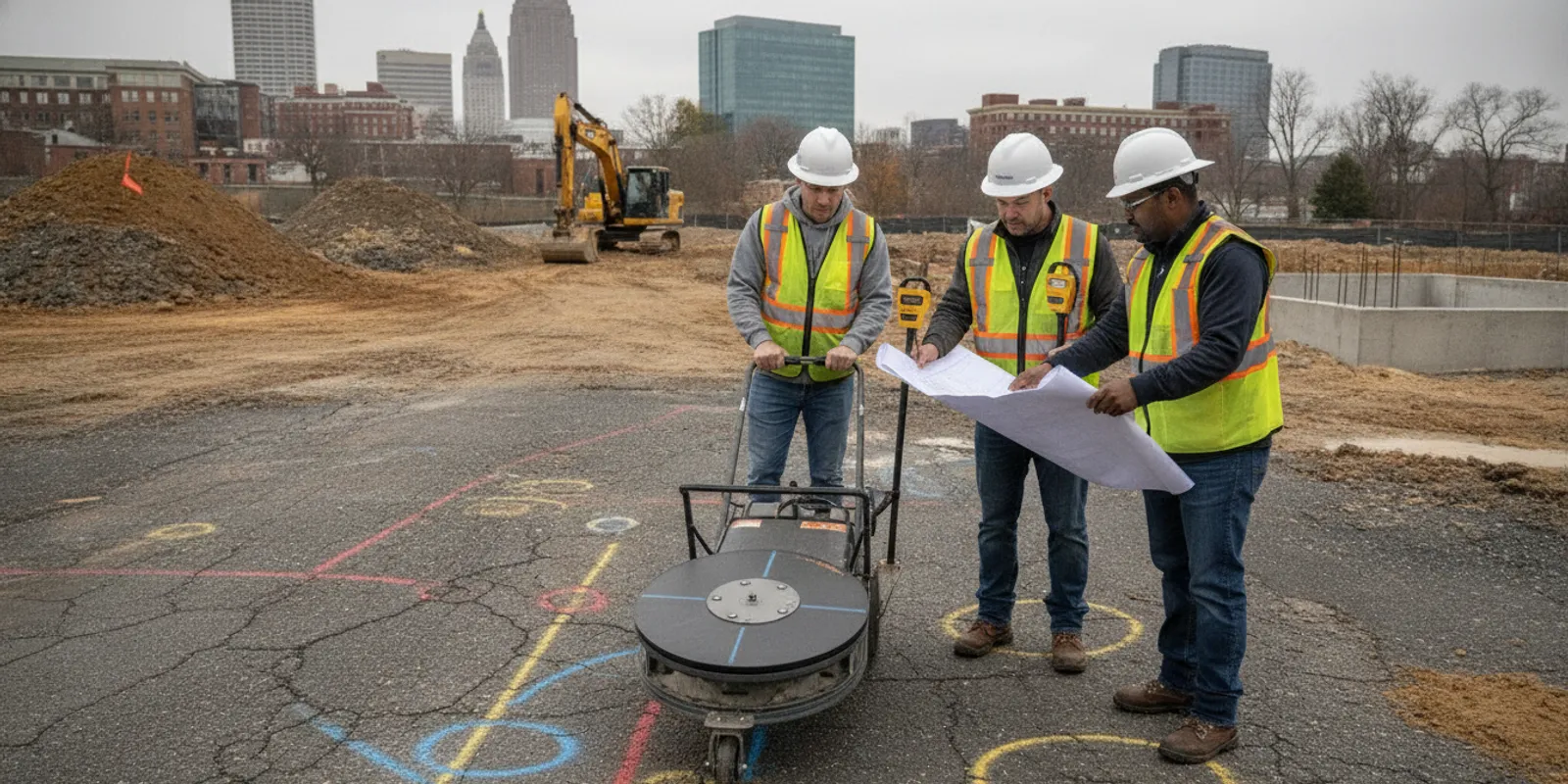
For teams planning SUE utility locating Richmond VA projects, the most useful starting point is a clear decision about the subsurface information needed for design, coordination, or excavation. A focused investigation scope connects the question on the plans to the records review, field methods, verification, and deliverables needed to answer it.
Request a project discussion through the contact form
This guide is for civil and environmental engineers, contractors, developers, and municipal project teams planning work in Richmond, Henrico, Chesterfield, Mechanicsville, and nearby communities. It focuses on local project planning: how to define the scope, prepare the site, coordinate investigation work, and use the resulting information. It is not a substitute for a project-specific engineering judgment or a promise that every buried feature can be detected.
When does SUE utility locating Richmond VA planning need a defined scope?
Consider a subsurface utility engineering investigation when existing utility information is incomplete, inconsistent, or too uncertain for the next project decision. The need often becomes clear during early design, site redevelopment, roadway or utility work, grading, drainage planning, or construction preparation. A useful starting question is not simply “Where are the utilities?” but “Which unknowns could change the design, schedule, construction method, or safety plan?”
That distinction helps the team avoid commissioning an investigation that is either too broad to be practical or too limited to resolve important conflicts. For example, a design team may need to understand the position of utilities in a proposed drainage corridor. A contractor preparing a defined excavation may need a focused investigation of a smaller work area. A municipality coordinating improvements across a constrained right-of-way may need records research and field information assembled for design coordination.
- Plan changes: A potential utility conflict may affect alignment, grade, structure placement, or construction sequencing.
- Uncertain records: Available plans do not show a utility, show conflicting locations, or lack useful location detail.
- Constrained work areas: Several utilities, structures, roadways, or other site features occupy the same corridor.
- Pre-construction coordination: The project team needs field information before finalizing access, excavation, or staging plans.
SUE can help organize evidence about subsurface conditions, but it does not eliminate uncertainty. Detection depends on such factors as the utility material, depth, access, surrounding conditions, and the information available to investigators. For an overview of how federal transportation guidance describes SUE, consult the Federal Highway Administration's Subsurface Utility Engineering resource.
What should the investigation answer?
Write down the project decision that depends on utility information before choosing methods or asking for a proposal. A focused brief gives the provider context to recommend an appropriate scope and helps the project team assess whether the final deliverable will answer its actual question.
Include the site limits, the proposed work, the design or construction milestone, and known utility concerns. If the team has a plan, survey, utility record, prior report, or marked-up conflict area, identify it and explain its status. Distinguish confirmed information from assumptions. A line shown on an old plan is a record indication, not automatically a field-verified location.
For each likely conflict, describe what information would be useful. The team may need a general indication of utility corridors, a more precise horizontal position, a verified position and elevation at a specific point, or mapped information suitable for coordination. Explain how the information will be used and who will rely on it. That context guides decisions about coverage, verification, survey control, and reporting.
At what project stage should you plan the work?
The best timing depends on which decisions remain open. Early investigation can inform corridor selection, preliminary layout, and the comparison of design alternatives. Later work may focus on a specific unresolved conflict or support construction planning. Waiting until a conflict is discovered during active construction can limit the available options, while investigating too early without a defined work area may produce information that does not align with the eventual design.
For a Richmond-area roadway concept, a team might first identify a broad area where proposed drainage or roadway features could interact with existing utilities. As the preferred alignment develops, the scope can be refined around actual crossings and structure locations. Before final design, selected locations may need a higher level of verification if the consequence of a position error would materially affect the design or construction approach. That sequence is an example, not a required formula; the design team should establish the timing that fits its project.
Build time for coordination into the schedule. The investigation may depend on getting plans, site access, approvals, field access around traffic or active operations, and agreement about survey references. If a milestone is fixed, tell the provider whether the team needs field information, a preliminary finding, or a final mapped package by that date. Those are different expectations. A schedule should also allow the design lead to review findings and identify any follow-up questions while there is still time to address them.
How do ASCE 38 quality levels shape SUE utility locating Richmond VA projects?
ASCE 38 quality levels describe different levels of information about existing utilities. They are a way to communicate the basis and confidence of utility data, not a simple ranking of providers or a guarantee that every utility will be found. A project may use different levels for different features or locations, depending on the decision at hand.
| Quality level | Typical information basis | Possible project use | Scope question |
|---|---|---|---|
| QL-D | Existing records and other available information | Early planning and identifying possible utility corridors | Which records will be collected, and how will gaps or conflicts be documented? |
| QL-C | Visible aboveground utility features correlated with records | Improving context for preliminary design or planning | Which surface features will be surveyed and related to record information? |
| QL-B | Appropriate surface geophysical methods used to indicate subsurface utility locations | Evaluating horizontal positions and potential conflicts | Which areas and utility types are in scope, and what method limitations may apply? |
| QL-A | Exposure at selected points to obtain precise information, commonly including horizontal and vertical position | Resolving a specific critical conflict or design decision | Which points need verification, who handles access and approvals, and what is the excavation plan? |
These descriptions are a planning-level summary. Confirm the applicable standard, terminology, and project requirements with the design professional and contracting documents. Not every project needs the same level throughout. A team may use record and surface-feature information to understand the corridor, geophysical investigation in the areas where a conflict matters, and targeted exposure at selected points where greater certainty is necessary.
Be explicit about where each level applies. “Provide QL-B” may leave important questions unanswered if the plans do not show the limits, utility types, or areas to be investigated. Conversely, requesting the highest level everywhere may add work that does not affect a decision. Match the information level to the consequence of being wrong and the stage of design.
It also helps to identify how the project will treat unresolved information. If a record indicates a line near a proposed feature but field investigation cannot confidently trace it, the team needs that uncertainty called out rather than hidden by a clean-looking drawing. Decide whether the next step is to revise the design, gather more records, investigate an alternate area, or consider targeted exposure. The appropriate response depends on the project, but naming the decision owner in advance avoids confusion when findings arrive.
Which field methods fit the site?
Field methods should follow the scope and site conditions rather than an equipment list alone. Electromagnetic (EM) locating can help trace conductive utilities when conditions and access allow. Ground penetrating radar (GPR) can provide additional subsurface information, including indications that may not be available from EM tracing alone. Results depend on the target, soil and surface conditions, congestion, depth, and other site factors; no single method is suitable for every feature.
A combined approach can be useful when the project has varied utility materials or uncertain records, but the proposal should say where and why each method will be used. Ask how the team will document a poor signal, an ambiguous response, inaccessible pavement, or an area that cannot be investigated. A transparent scope identifies limitations rather than implying that a particular instrument guarantees detection.
Before field work, provide current site plans and identify gates, traffic restrictions, active work areas, sensitive areas, and known hazards. Confirm who will arrange site access and coordinate with the owner or project team. If the investigation depends on current utility records, clarify who will obtain those records and how they will be incorporated. Public utility notification and a private investigation have different roles; plan the applicable notifications separately and do not treat one as a replacement for the other.
For additional context on methods, see SafeLine's guides to ground penetrating radar investigations and GPR and electromagnetic locating. The right mix is project-specific. Ask the provider to connect each proposed method to the feature or conflict it is intended to investigate.
How might scope differ across Richmond-area projects?
Different project types can need different investigation boundaries even when they are in the same region. Consider three planning examples. They illustrate how to frame a request, not predetermined scopes or findings.
- Site redevelopment: A developer is revising a site layout and needs to place proposed utilities, foundations, and drainage features. The request can identify the full area being considered, highlight proposed high-impact features, and distinguish record research from areas needing field investigation. If the layout is still changing, a phased scope may help avoid treating every part of the property as equally urgent.
- Roadway or streetscape work: A design team working in a narrow corridor may have little room to shift a feature around a conflict. Show the project limits, intersections, proposed structures, and known crossings. Ask how the field limits will account for the work footprint and whether relevant utility indications just beyond that footprint could affect the design decision.
- Drainage or utility installation: A contractor or engineer planning a defined alignment can identify the route, proposed depth or structures if known, and locations where existing utilities create concern. Investigating only the general site center may miss a critical crossing; a marked-up alignment helps focus coverage and later review.
These examples point to the same practical rule: give the investigation team enough design context to understand what matters, while making the limits specific enough to plan field work. If the alignment or footprint changes after the scope is approved, share the revision promptly and ask whether the changed area remains covered. Do not assume that a prior map automatically applies to a shifted excavation or a new design base.
What should Richmond project teams coordinate before mobilization?
A short coordination checklist can prevent avoidable gaps between the proposal, field work, and the design team's needs.
- Set limits: Share a legible work-area plan and mark the corridor, investigation boundary, and priority conflict locations. Identify the coordinate system or survey control expected for project use.
- Share background information: Provide available utility plans, prior investigations, proposed design sheets, and relevant site observations. Note the date and source of each record when known.
- Confirm access and timing: Identify the site contact, access requirements, work hours, traffic or pedestrian constraints, and any sequencing dependencies.
- Agree on field communication: Establish who can answer questions when field conditions differ from the plan and who can authorize a scope adjustment.
- Define documentation: State how field marks, observations, unresolved indications, and limitations should be recorded and delivered.
- Plan verification deliberately: Identify the conflicts that may require exposure or another form of confirmation, and coordinate approvals and responsibilities before that work is needed.
For a project team, consistency matters: the field limits, design base map, and final utility information should be usable together. Ask the provider and survey or design lead to confirm the coordinate references, units, and requested format early. SafeLine describes its investigation process and deliverables online; discuss project-specific requirements before field work begins.
Before the crew arrives, check that the field package matches the current plan version. If the design team has moved a proposed alignment, changed a work boundary, or revised the priority locations, send the updated sheet with a clear revision date. Identify the person who can resolve questions on site and the person authorized to approve additional work. This is especially useful when several organizations share responsibility for the property or corridor.
Also make the intended use of field marks clear. Marks may help a team orient itself during a site visit, but design coordination typically requires documentation tied to agreed survey references and mapped limits. If work will take place in phases, identify which areas are active now and which are planned later so the field effort and deliverables are not confused with a future phase.
What deliverables help the design and construction team?
A useful deliverable makes the source, meaning, and limits of the information understandable to the people making project decisions. Depending on the agreed scope, ask whether the package will include a plan or map, field observations, the methods used, relevant records, quality-level information, and locations where a conflict remains unresolved. Confirm whether the work includes survey control or whether the client will provide it.
Make sure the requested format fits the team's workflow. Some projects need a drawing for design coordination; others may also need digital files or organized field documentation. Specify coordinate system, units, file format, naming conventions, and required delivery dates in the request. If multiple disciplines will use the result, name the intended recipients and ask how updates or corrections will be handled.
Read the final documentation with its limitations in view. A mapped indication is not necessarily the same as an exposed and verified utility. Note areas that were inaccessible, indications that could not be confidently interpreted, and any assumptions that remain. The investigation informs design and construction planning; it does not independently authorize excavation or replace the project's safety and permitting procedures.
SafeLine's information about utility mapping and documentation can help teams frame deliverable questions. You can also review the company's resources for contractors and its service-area information when planning a Richmond-area project.
For review, compare the map with the design base rather than reading it in isolation. Check that the limits and references are clear, that each utility indication has a stated basis or quality level where applicable, and that uncertainty is visible. If a drawing is meant to support several disciplines, make sure the labels and linework can be interpreted without relying on informal field notes that were not included in the package.
How can you compare proposals fairly?
Compare what each proposal will investigate, not just the total price or the equipment named. Two proposals may appear to cover the same area but differ in records research, surface coverage, priority conflicts, verification, survey requirements, exclusions, and final formats.
- Are the work limits and priority locations clearly shown?
- Does the proposed quality level or information basis match the project decision?
- Does the proposal explain the role of EM locating, GPR, and any other proposed field method?
- Are access, traffic coordination, records, survey control, and client responsibilities identified?
- Are assumptions, inaccessible areas, exclusions, and likely limitations plainly stated?
- Does the deliverable include the file types and documentation that the design team can use?
- How will the team handle a newly identified conflict or a requested change in scope?
A complete request package can include the project location, site boundary, proposed work, schedule milestone, available records, and a marked-up list of known concerns. Avoid sending only a street address if the site boundary or work area is not obvious. SafeLine's utility locating, GPR, and mapping services page provides service context, while the frequently asked questions page addresses common planning concerns.
When proposals use different terminology, request clarification before comparing them. Ask each provider to state what information is included, where it will be collected, which steps are optional, and what assumptions affect the scope. A proposal that separates base work from potential follow-up can make decision points visible, but the team should understand what conditions would trigger that follow-up and who can authorize it.
To make the review concrete, use the same project brief with each request: one current plan, a short description of the proposed work, the schedule milestone, known records, and a ranked list of conflicts. Then compare the responses against those needs. For example, if the main concern is a single crossing, broad site coverage without a clear plan for that crossing may not answer the central question. If the design is still evolving, ask how a boundary change affects the scope rather than assuming that any addition is included.
Plan a SUE investigation around the decision
For Richmond-area projects, the strongest starting point is a clear connection between the proposed work and the subsurface information needed to move forward. Define the limits, identify consequential conflicts, choose quality levels and field methods to suit those decisions, and agree on usable deliverables before the investigation begins.
Share your project details through the contact form
SafeLine Subsurface provides private utility locating, GPR, SUE, and underground utility mapping services across Virginia, Maryland, Washington, DC, and North Carolina. Share your site plan, project stage, and priority questions to start a discussion about an investigation scope.