
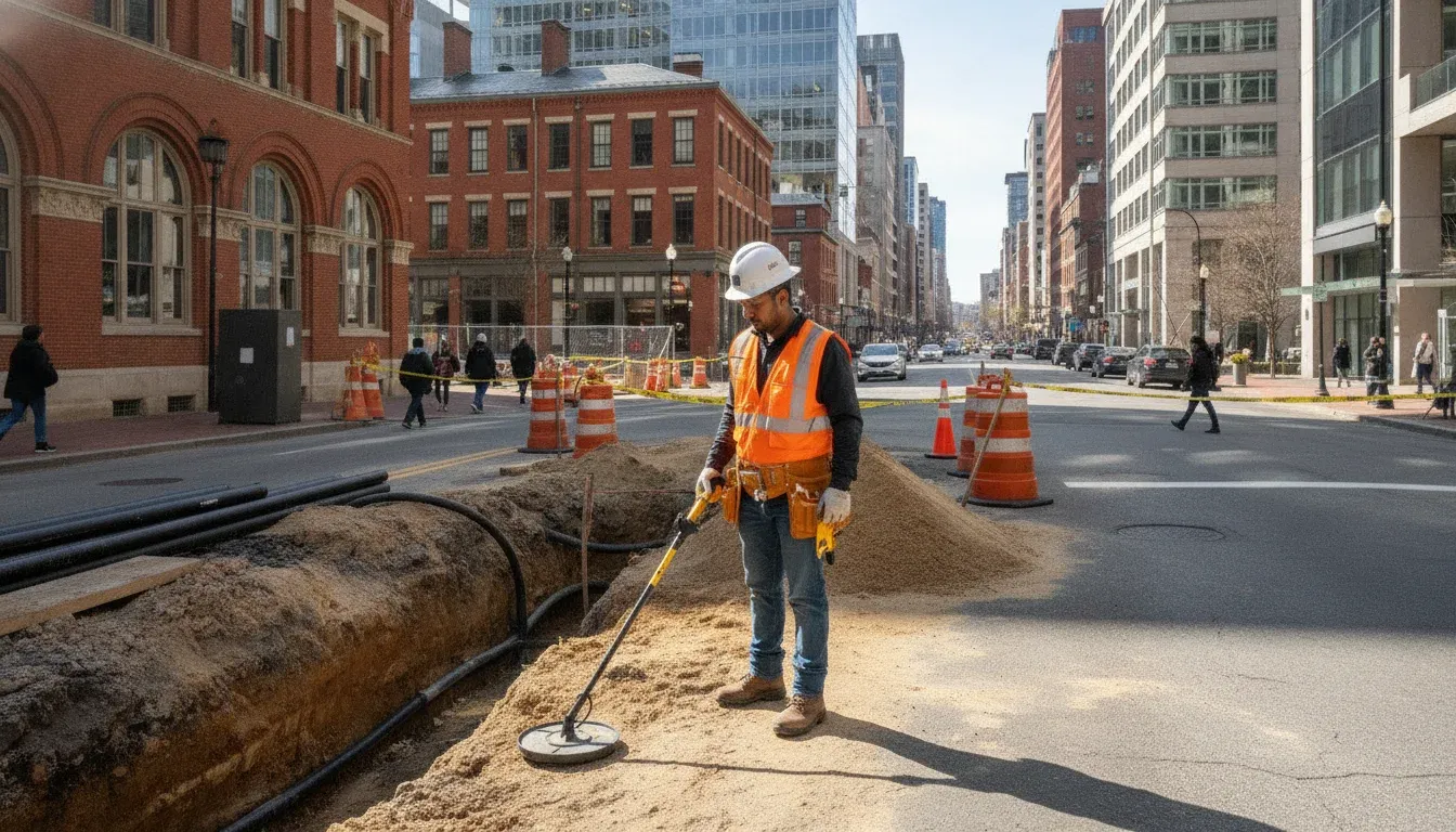
Before excavation, a project team needs more than a public utility markout. In Arlington and Alexandria, site additions, utility work, renovations, and new construction may involve private electric, water, communications, irrigation, or drainage lines that are not covered by 811. A location-specific subsurface investigation can give contractors, engineers, developers, and property owners clearer information for safer planning. For the broader local utility locating services across Virginia, DC, and Maryland, review SafeLine's regional service information.
Share your project details through SafeLine's contact form, including the location, scope, site access, and documentation you need.
For utility locating arlington virginia projects, SafeLine combines private utility locating with practical field information to help identify infrastructure beyond typical 811 marks. GPR and electromagnetic (EM) locating can be used as complementary methods, with field markings, reports, verification photos, mapping, or on-site guidance selected around the project. SafeLine serves Virginia and neighboring Mid-Atlantic states, so confirm Arlington or Alexandria coverage during project scoping through its Virginia utility locating service areas.
The first planning question is what 811 covers, what it may leave unmarked, and how private locating fits into the work before crews break ground.
Private Utility Locating for Arlington and Alexandria, Virginia Projects
For a contractor, engineer, developer, facilities team, or property owner preparing work in Arlington or Alexandria, the first question is not only whether utilities are present. It is whether the planned excavation area includes privately owned lines that may not appear in public utility markings. Early subsurface planning can help reduce uncertainty before site work, additions, renovations, or facility projects begin.
Private utility locating is the field investigation of underground infrastructure that is not covered by standard public utility marking. It often includes lines on private property or beyond the typical meter or property line. The work may combine records and site information with field methods such as electromagnetic (EM) locating and ground-penetrating radar (GPR), depending on the project and site conditions.
How private locating works with 811
811 and private locating serve different purposes. An 811 request generally addresses public utilities, typically up to the meter or property line. Private electric, gas, water, sewer, communications or fiber, irrigation, and storm drainage infrastructure may remain unmarked. A private locate adds investigation for those site-specific systems, but it does not replace a required 811 ticket or the responsibilities that come with it.
For a clear explanation of how the two services fit together, review private locating beyond 811. Keeping both parts of the process in view helps project teams avoid treating a complete public mark-out as a complete picture of the site.
Why the local project-planning angle matters
Dense, active sites often require utility information that can be used during design coordination, excavation planning, and communication with field crews. Contractors may need private lines marked before digging. Engineers and developers may need subsurface information to inform layouts or identify potential conflicts. Facilities teams and property owners may need a better understanding of buried infrastructure before an expansion, renovation, fence, or other ground-disturbing project.
SafeLine serves projects across Virginia, Maryland, Washington, D.C., and North Carolina. Availability for an Arlington or Alexandria project should be confirmed during scoping, based on the location, access, project requirements, and scheduling. The practical starting point is to share the site address, planned work area, available records, and desired timing through the contact form so the appropriate investigation can be discussed.
Services Available in the Arlington and Alexandria Area
SafeLine's private utility locating work can help identify buried infrastructure that may not appear on public 811 marks. For projects in Arlington, Alexandria, and surrounding Northern Virginia, the scope may include electric, gas, water, sewer, communications and fiber, irrigation, and storm drainage utilities. Availability is confirmed by project scope, access, and scheduling.
The investigation can combine electromagnetic (EM) locating with ground-penetrating radar (GPR). These methods are complementary rather than interchangeable. EM locating can help trace conducting metallic lines, while GPR can add subsurface information where the conditions and utility characteristics support its use. The Federal Highway Administration lists cable and pipe locators, electromagnetic methods, and GPR among technologies applicable to underground utilities. Review the FHWA technology overview for broader context.
| Source or method | What it can contribute | Where it fits |
|---|---|---|
| EM locating | Signals associated with conducting metallic lines can help indicate a utility path. | Useful for tracing compatible lines in the field. |
| GPR | Subsurface scanning can add information about features and conditions below the surface. | Used alongside EM locating when appropriate for the site. |
| Records and site context | Available plans, visible features, and project information provide context for interpreting field findings. | Supports planning, correlation, and documentation, but should not be treated as a substitute for field investigation. |
Depending on the assignment, deliverables may include field markings, clear reports, verification photos, mapping, and on-site guidance. That documentation can help contractors, engineers, developers, facilities teams, and property owners coordinate the next stage of work. The appropriate scope should be confirmed before mobilization, particularly when the site has limited access, incomplete records, or multiple utility types.
Explore utility locating and GPR services and share the project location, planned work, and documentation needs through the contact form so SafeLine can discuss the right investigation approach.
Urban Site Challenges: How SafeLine Handles Dense Infrastructure
Arlington and Alexandria projects often involve tight work areas, layered site improvements, and utilities installed at different times. Pavement, landscaping, additions, and previous repairs can make access and visual clues limited. Records are useful starting points, but they should not be treated as a complete picture. The Federal Highway Administration cautions that old site or as-built diagrams may be unreliable and that undocumented utilities can be encountered during construction. FHWA explains why early utility characterization matters.
SafeLine approaches a congested site as an investigation rather than a promise of perfect detection. Electromagnetic locating is useful for conductive metallic lines because it detects the field associated with alternating current along that line. Non-metallic, abandoned, poorly accessible, or difficult-to-trace infrastructure may require a different method or additional verification. GPR can provide complementary subsurface information, while records, visible features, and site access help put field findings into context.
A practical project sequence helps the locating work match the excavation risk and the information the team needs:
- Define the limits. Share the proposed excavation, building or improvement footprint, access constraints, known utility records, and the decisions the investigation must support. FHWA describes reviewing project limits before applying surface geophysical techniques to determine utility existence and horizontal position. See the FHWA SUE workflow.
- Review what is already known. Compare plans and visible site features with the requested work area. Mark assumptions that need field confirmation, especially where records conflict or stop at a property boundary.
- Apply complementary locating methods. Use EM locating where conditions support tracing conductive lines and GPR where it can add subsurface context. The method selection depends on material, depth, congestion, surface conditions, and access.
- Document uncertainty and next steps. Field markings, notes, photos, or mapping can help the project team coordinate excavation. FHWA notes that locating surveys reduce uncertainty, but not all utilities are detectable. If a critical conflict remains, discuss whether a more targeted verification investigation is appropriate before digging.
This process can improve planning without overstating what any technology can establish. Share the site conditions and available records during scoping so SafeLine can recommend an investigation suited to the project.
Coverage Areas in Arlington County and Alexandria
SafeLine's broader service territory includes Virginia, Maryland, Washington, D.C., and North Carolina, and its service-area information includes Northern Virginia. For projects in Arlington County or Alexandria, local availability should be confirmed during project scoping rather than assumed from a city name alone. Review the local utility locating services across Virginia, DC, and Maryland and the Virginia utility locating service areas, then share the project details directly with the team.
This project-based approach can support a range of commercial needs, including construction sites, site work, additions, large-scale projects, and facility expansions. Contractors, engineers, developers, facilities teams, and municipalities may need utility detection or mapping before excavation, design changes, or work around existing site infrastructure.
Residential property owners may also need private utility locating for digging, renovations, fencing, landscaping, or other improvements. The right investigation depends on what is planned, what information is already available, and which portions of the property or work area require review. SafeLine uses electromagnetic locating and GPR as complementary methods when appropriate, with potential deliverables such as field markings, reports, verification photos, and on-site guidance.
Before scheduling, provide the project location, work limits, access conditions, expected excavation or construction activity, and any available plans or records. These details help clarify whether the requested scope fits the site and what preparation may be needed. Access and scheduling also affect confirmation of coverage, so neither should be left implicit.
Private locating is intended to supplement, not replace, any required 811 process for public utilities. If you are comparing options or still defining the investigation, the utility locating project questions page can help you prepare the information needed for a useful discussion.
Schedule a Locate in Arlington or Alexandria
Good scheduling starts with enough project detail for the locating team to understand the site and the decisions that depend on the investigation. Before requesting utility locating in Arlington or Alexandria, gather the following:
- Exact site address, access instructions, and the areas that will be excavated or disturbed.
- Project type, such as site work, an addition, a fence, a renovation, or a facility expansion.
- Planned excavation dates, design milestones, and whether work is time-sensitive.
- Available plans, site drawings, prior utility records, and information about known private lines.
- Requested deliverables, including field markings, mapping, reports, verification photos, or on-site guidance.
Submit a required 811 ticket before excavation where applicable. Public 811 marking and private locating address different parts of a site. 811 typically covers public utilities up to the meter or property line, while private service lines and other site infrastructure may remain unmarked. A private locate does not replace an 811 ticket.
For urgent work, explain the deadline and project risk when you contact SafeLine. SafeLine lists 24/7 emergency availability for time-sensitive work, but actual coverage and scheduling must be confirmed for the project. Scope, site access, and available information all affect planning.
Early investigation can also support design decisions. The Federal Highway Administration notes that slight design adjustments may move excavation away from utilities, enhance safety, and avoid some relocations. That makes utility information useful before the crew is ready to dig, not only after a conflict appears.
Plan a subsurface investigation by sharing the location, scope, access details, schedule, and documentation needs.
Frequently Asked Questions
Does private utility locating replace calling 811 in Arlington or Alexandria?
No. Request the required 811 ticket for public utility marking. Then arrange private locating for lines and site infrastructure that may fall outside typical public coverage, such as utilities beyond the meter or property line. Using both steps creates a more complete excavation plan.
What methods are used to locate buried utilities?
SafeLine uses electromagnetic locating and Ground Penetrating Radar as complementary methods. EM equipment can help trace conductive utility lines, while GPR can provide additional subsurface information where conditions and utility materials allow. The appropriate approach depends on the site and project scope.
What should I share when requesting a locate?
Provide the project address or work area, excavation limits, planned activities, site access details, project schedule, available plans or as-built records, and the types of utilities you are concerned about. Photos, marked-up drawings, and information about prior work can also help define the investigation.
Can SafeLine locate utilities for an active construction or expansion project?
Yes, project types may include construction sites, site work, additions, large projects, and facility expansions. Deliverables can include field markings, reports, verification photos, mapping, and on-site guidance. Confirm availability, scope, access, and scheduling for your Arlington or Alexandria project during intake.
Contact SafeLine About Your Arlington or Alexandria Project
Clear project details help SafeLine understand where locating support may fit into your plans and what information your team needs. Share the project location, scope, site access details, and documentation requirements through the SafeLine contact form. This gives the team a practical starting point for discussing your utility locating needs and next steps.