
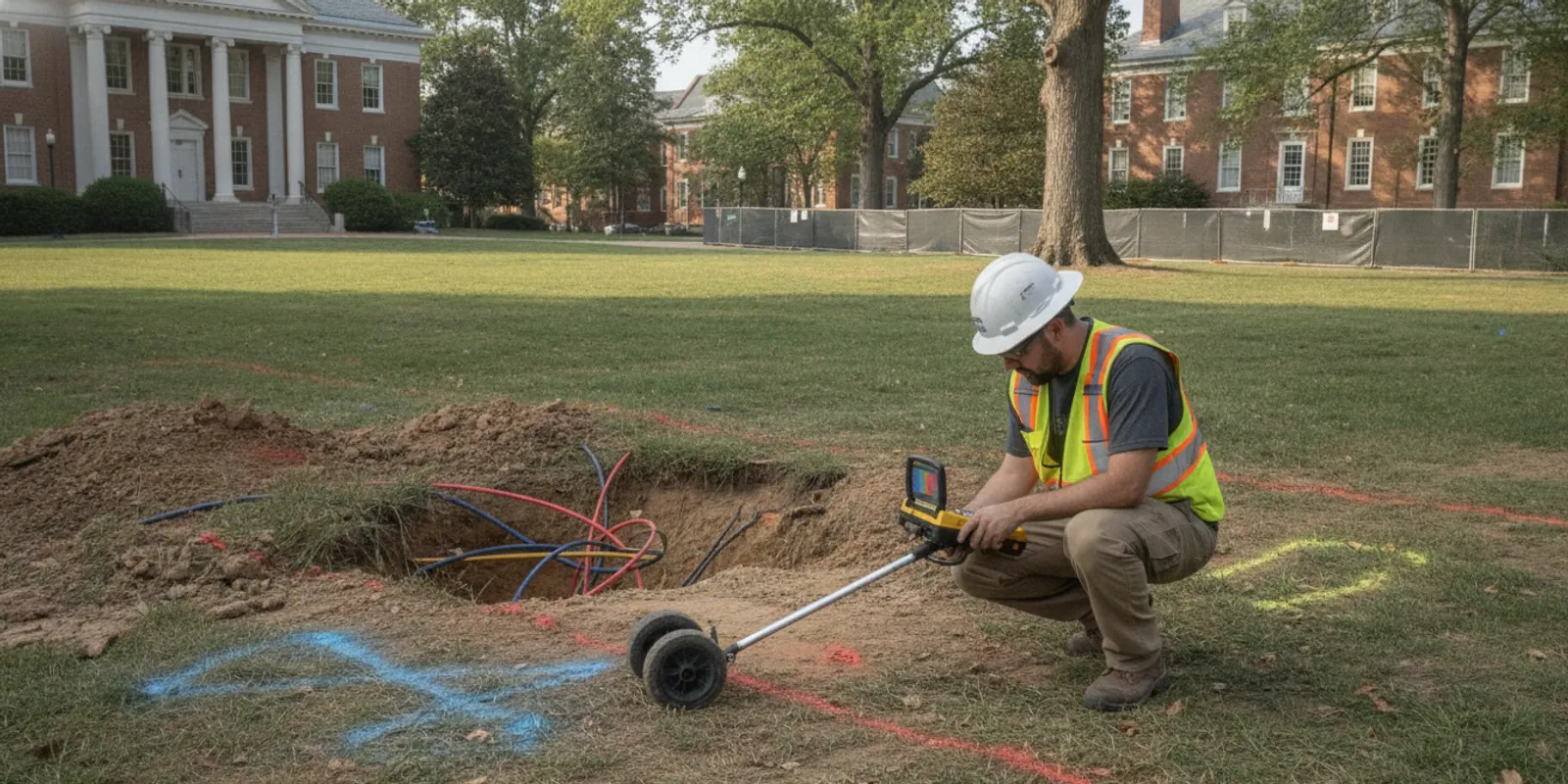
Planning utility locating charlottesville va begins with a clear picture of the work area and the excavation planned there. A fence, addition, utility connection, grading change, or redevelopment can bring digging close to buried infrastructure. Public utility marks are an important first step, but private lines on a property may require a separate investigation.
Why plan utility locating before excavation?
A locate is most useful when it informs decisions before crews mobilize or a design is fixed. Early information can help a team adjust an excavation route, identify areas needing follow-up, coordinate trades, and reduce avoidable delays. It also gives the project team time to gather records and define what the field crew needs to examine.
Charlottesville projects range from a homeowner's backyard improvement to a commercial site with multiple phases and existing services. The visible work area may not tell the whole subsurface story. A site may have private water or sewer laterals, irrigation, lighting circuits, feeds to detached structures, or abandoned lines that do not appear in public utility markings.
Start by defining the limits of planned disturbance, not just the property boundary. Note where excavation, boring, trenching, grading, post installation, or equipment access will occur. If the work shifts, update the scope so the investigation remains relevant to the actual plan. A locate of a proposed fence line does not automatically answer a later question about a new service trench several yards away.
How do 811 and private locating fit together?
Contact 811 before digging, following applicable notification requirements and waiting for the required response. The 811 system coordinates marks for participating public utility operators, generally up to their service point or the property boundary. It does not automatically identify every privately owned line on a parcel. The Call 811 resource is a starting point for understanding the public one-call process.
Private utility locating is a complementary step for infrastructure outside the public marking scope. It is not a replacement for an 811 ticket, and neither a private investigation nor paint on the ground guarantees that every buried feature has been found. Conditions, utility materials, depth, access, records, and interference can affect what can be detected. Treat marks and findings as information for planning and safe excavation, not permission to dig without following applicable procedures.
For a closer explanation of the distinction, see how private locating differs from 811. SafeLine's Virginia utility locating page describes the relevant service path for Virginia projects.
What should a Charlottesville project define in its scope?
A useful request explains the decision the locating work should support. “Find everything” is too broad to guide an investigation. Describe the planned activity, specific area, known concern, and form of information the project team needs.
- Work type: Identify the planned trench, footing, fence line, bore, grading, or other disturbance.
- Limits: Share a marked-up plan, dimensions, site address, and access points. Identify proposed and alternate work areas.
- Known infrastructure: List visible meters, valves, cleanouts, cabinets, hydrants, structures, and prior marks.
- Target features: Describe the suspected utility or conflict, such as a service feeding an outbuilding.
- Timing: State the target field date, construction sequence, and deadline affecting coordination.
- Deliverables: Ask whether the project needs field marks, photographs, a written report, mapping, or another record.
If the investigation supports design or a bid, clarify intended use before fieldwork. A contractor preparing to excavate may need clear field communication, while an engineer coordinating a broader site may need mapped observations and documentation. Review the investigation process and deliverables to frame expectations.
Separate the question into work packages when the project has distinct phases. For example, a first phase may require locating around a proposed addition, while a later phase covers a parking area. Identify whether each phase needs its own field visit, documentation, and timing. That avoids treating an early investigation as if it automatically covered later areas that were not part of its limits.
Which site information should the team gather?
Records and site context help the locating team focus its work. Gather available utility plans, as-built drawings, prior survey information, construction documents, and records of repairs or additions. Old drawings may be incomplete or inaccurate, so use them as clues rather than proof of exact location.
Walk the site and note visible evidence. Photograph service entrances, meters, exterior panels, irrigation controls, equipment pads, and connections to detached buildings. Note access restrictions or places where landscaping, stored materials, parked vehicles, or active operations may limit coverage. Include known abandoned or relocated lines.
Be explicit about the project boundary. A parcel-wide request may be unnecessary if planned work occupies a small area; conversely, investigating only a narrow trench corridor may miss a nearby line that influences design or staging. Include enough surrounding context to address the actual project decision.
For a residential project, the homeowner locating information can help clarify the private-locate question. Contractors can also review locating information for contractors when coordinating excavation planning.
How can locating methods support the investigation?
Different detection tools respond to different conditions. Electromagnetic locating is used to trace conductive utilities when a usable signal can be applied or detected. Ground penetrating radar (GPR) can help investigate subsurface features, including some non-metallic utilities, depending on ground conditions and the target. A method that works well for one target may not answer another question.
For that reason, the scope should describe suspected material, route, depth if known, and site conditions. Do not assume that a single instrument will identify every line in every environment. A locating plan may use more than one approach, and findings can still carry uncertainty. The utility locating and mapping services page outlines service options, while the guide to GPR investigations provides context on that method.
Ask what the method is intended to resolve. If a team is concerned about a conductive line with an accessible connection, electromagnetic tracing may be relevant. If the suspected feature is non-metallic or its route is unclear, ask whether GPR or another approach may add useful information. The answer depends on actual site and target conditions; naming a technology in the request should not substitute for describing the question.
How do common project needs compare?
| Project situation | Planning emphasis | Useful information to request |
|---|---|---|
| Fence, deck, or landscape work | Define post, footing, and trench locations; consider private services in the work zone. | Field marks and clear limits matching the planned work. |
| New building or site addition | Coordinate proposed foundations, utility connections, and access with design plans. | Investigation area, known records, photographs, and documented observations. |
| Trenching or directional boring | Define route, launch and receiving areas, and alternate alignment. | Route-specific findings and communication of unresolved uncertainty. |
| Redevelopment or phased construction | Account for prior site changes, multiple work zones, and sequencing. | Mapped information or reporting suited to design and coordination. |
This comparison is a planning aid, not a guarantee that a particular deliverable or detection method is appropriate. Confirm the scope against site conditions and project decisions. For larger coordination needs, review utility mapping and documentation.
How can a team turn a broad concern into a workable investigation?
Consider a homeowner planning a fence across a side yard. A useful request does not stop at the parcel address. It identifies the fence alignment, gate and post locations, where post holes or trenching are expected, and visible services crossing the yard. If the route can move around a suspected water service, flag that before the field visit so findings can inform a comparison of alternatives.
For a commercial addition, the project manager can overlay the proposed foundation, utility tie-ins, temporary access, and staging areas on a current site plan. That helps decide whether the locate should address only the footprint or nearby corridors that affect sequencing. If a design alternative is under review, include both options instead of assuming findings for one alignment apply to the other.
For a contractor preparing a narrow trench, write down the start point, end point, planned width, installation method, and any places where the alignment must turn. Include launch and receiving areas for a bore, not only the straight section. This gives the investigation a usable route and helps distinguish between a line that crosses the planned path and one merely visible elsewhere on the parcel.
Use a concise scope note: purpose, area, known features, available records, access constraints, timing, and intended output. Ask the field team to identify limitations or areas needing follow-up. This does not promise that every feature will be detected; it gives the team a shared basis for interpreting what was examined and what decisions remain open.
How should teams coordinate fieldwork and excavation?
Before the field visit, provide access instructions, a contact who can answer questions, and the latest work-area plan. Tell the locating team about gates, security procedures, active construction, traffic controls, pets, or other constraints. Keep the proposed work area accessible where possible.
After marks or findings are provided, brief the people who will perform or supervise the work. Make sure they understand marked limits, the intended meaning of the documentation, and areas where information remains uncertain. Preserve photographs or maps with project records and communicate changes in alignment or scope before digging in a different area.
Marks can be disturbed by weather, site traffic, or later construction. Keep the work area and marks visible, and confirm that the information is current and applicable before excavation. Follow safe excavation practices and applicable legal requirements. When field conditions, plans, and marks conflict, pause the affected work and resolve the discrepancy with appropriate parties.
A practical briefing can follow the work sequence. First confirm the crew is looking at the current plan and the correct excavation limits. Next identify the marks and documentation that apply to that work zone. Then name who will stop work and raise a question if an unexpected feature appears. Finally, confirm how any changed route will be checked before the crew proceeds outside the investigated area.
What can change the usefulness of a locate?
Field results are tied to conditions and scope during investigation. A parked vehicle, stored materials, locked area, dense landscaping, or ongoing site activity can restrict access or equipment use. Tell the field team about constraints in advance and arrange access where practical. If an area cannot be examined, record that limitation and decide whether it affects planned work.
Utility records vary in age and detail. A drawing may show a route that was later altered, while a repair or addition may have introduced infrastructure missing from the plan. Compare records with visible site evidence, but do not treat either as a definitive underground map. The aim is to give the investigation useful clues and help the project team recognize questions needing resolution.
Weather and surface conditions can also affect access or how efficiently a site can be examined. A muddy, obstructed, or active work area may require coordination or a revised visit plan. Tell the provider what will be happening on site and ask how the conditions may affect the proposed scope rather than assuming a drawing alone conveys the constraints.
Finally, protect the usefulness of field information after the visit. Markings can fade or be disturbed, and a design change can move excavation beyond the area examined. Keep dated photographs and documentation with the project file, communicate updates to field supervisors, and arrange a scope review when work limits materially change.
What should the team do with the findings?
Use investigation output to make a specific project decision: adjust a route, protect a feature, request further investigation, or coordinate with a utility owner. Keep the original plan and field documentation together so later reviewers can understand what area was examined and when. If the design changes, compare the new disturbance area with the original scope rather than assuming prior information covers it.
For a design team, this may mean placing findings on the current site plan and checking whether proposed foundations or connections overlap a marked route. For a construction supervisor, it may mean reviewing the field record with the crew before work begins and making sure the planned sequence still matches the investigated area. For a homeowner, it may mean shifting a post or asking for more information before committing to a location.
For contractors, a short pre-excavation briefing connects locating information to the work plan. Review where digging begins, what marks or records apply, who watches for discrepancies, and how crews escalate an unexpected condition. The private utility locate checklist offers another planning reference, and the subsurface resources page gathers related guidance.
When should a Charlottesville project request utility locating?
Request locating while the scope can still influence design, sequencing, and site preparation. Earlier planning is especially useful when work is near existing services, the parcel has changed over time, records are limited, or several contractors will work in the same area. Provide a realistic schedule and identify any urgent decision, but avoid waiting until equipment is ready to dig to define what needs investigation.
To discuss a site-specific request, use the project contact page. Include the Charlottesville project address, a plan or sketch, work area, intended excavation, known utility information, and desired timing. Review frequently asked questions before preparing your request.
Request a quote for your project
Frequently asked questions
Does 811 locate every underground line on a Charlottesville property?
No. 811 coordinates marks for participating public utility facilities within its scope. Private lines on the property may not be included, so identify whether a separate private investigation is needed for planned work.
Should I request a private locate if 811 has already marked the site?
It may be appropriate when work could affect privately owned lines beyond the public marking scope. The two steps serve different purposes; follow 811 requirements and define private-locate needs separately.
What should I send when asking for a quote?
Share the site address, work limits, a plan or sketch, type of excavation, known records or utilities, access constraints, desired deliverables, and schedule. Clear information helps define a useful project scope.
Can locating identify every buried utility?
No detection process should be treated as a guarantee that every buried feature will be found. Materials, depth, soil and site conditions, access, and available records can affect results. Ask what the proposed investigation can address and how uncertainty will be communicated.
When should the investigation happen?
Plan it early enough for findings to inform design and field coordination, and before excavation begins. If the work area or route changes, review whether the investigation scope needs to change as well.
Good utility locating planning connects the actual excavation plan with available records, the limits of public marks, and private infrastructure that may affect the site. Define the question early, communicate findings to the field team, and resolve uncertainty before work proceeds.