
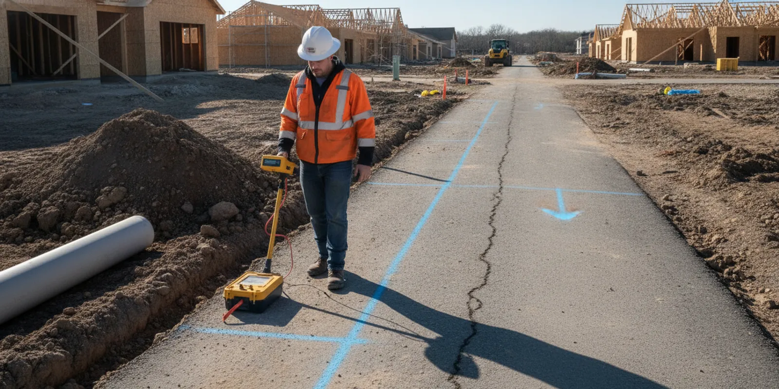
Quick answer: Utility locating for broadband installation helps project teams identify and document underground utilities along a proposed fiber route before excavation. It complements, but does not replace, the 811 process: public utility operators mark facilities in their scope, while a private locate can investigate privately owned lines and other features beyond that coverage. Share the route, work limits, schedule, and records with the locating team so fieldwork can focus on the actual excavation area.
Why plan utility locating for broadband installation before construction?
Fiber construction can involve trenching, directional drilling, hand digging, vault placement, and connections to existing infrastructure. Each method interacts with the ground differently, but all depend on understanding what may be present along the planned route. A route that looks clear on a surface plan may cross existing utilities, private service lines, or undocumented infrastructure.
Early locating gives the project team information to review before crews are mobilized. It can help identify areas needing coordination, route adjustments, additional investigation, or careful excavation planning. It does not eliminate uncertainty or replace safe excavation practices. Treat findings as project information to be reviewed against the scope and field conditions.
Broadband projects may cross public streets, commercial property, campuses, residential lots, and rights-of-way. Ownership and records can change across those boundaries. A plan that distinguishes the work area, route alternatives, and known facilities is a stronger starting point than a general request to locate an entire site.
The timing matters because route decisions affect more than the main cable alignment. A handhole, cabinet, splice point, service connection, bore pit, or temporary access area can create its own excavation footprint. If those features are omitted from the request, the field investigation may not address the locations where crews will actually disturb the ground. Add every planned excavation feature to the working map, even when the primary route appears straightforward.
How do 811 and private utility locating fit together?
Contact 811 before excavation as required by the applicable state process. The one-call system notifies participating utility operators, who mark facilities within their responsibility and the scope of the request. It is an essential part of excavation planning, but it does not mean every privately owned line on a property will be marked.
Private utility locating addresses a different coverage need: investigating underground infrastructure that is privately owned or otherwise outside the one-call marking scope. On a broadband project, that may matter on private parcels, around buildings, or where a customer-owned conduit or electrical feed intersects the proposed path. Confirm facility ownership and marking responsibilities with the relevant parties rather than assuming that a missing mark means the ground is clear.
The Wisconsin Public Service Commission describes utility locating as an important issue for broadband construction, highlighting the need to coordinate locating within that work. See its BEAD utility locating information. Project teams should also consult the applicable state 811 program and local requirements; procedures and responsibilities vary by jurisdiction.
A broadband route may also cross property boundaries where the answer changes from one parcel to the next. A public road segment, a utility easement, a commercial site, and a homeowner's property may have different records, owners, and access procedures. Make those transitions visible on the plan. The field team can then distinguish an 811 coordination area from a private investigation area instead of treating the entire route as one uniform assignment.
For a concise comparison of coverage, review SafeLine's guide to private utility locating versus 811. Keep the distinction clear in schedules and contracts: a private investigation is a complementary scope, not a substitute for the required one-call notice.
What should the broadband locating scope define?
A well-defined scope connects the proposed construction to the field investigation. Before requesting a locate, assemble the information that lets the team understand where and why excavation is planned.
- Route limits: Provide an alignment drawing or map, route alternatives, entry and exit points, and any changes since the drawing was prepared.
- Work footprint: Identify trench width, bore path, pits, handholes, cabinets, poles, and other planned excavation locations, as applicable.
- Depth and method: Explain anticipated excavation or bore depth and whether the work includes open trenching, directional drilling, or another method.
- Site access: Note gates, operating hours, traffic controls, active facilities, restricted areas, and site contacts.
- Existing information: Share available utility plans, as-builts, survey information, previous markups, and known facility-owner contacts. Label the source and date when possible.
- Timing and phasing: Give the anticipated field date, construction sequence, and locations where work may move forward first.
- Deliverables: State whether the project needs field marks, photographs, mapping, or a written record, and how the team will use each deliverable.
- Boundary conditions: Show parcel lines, easements, road crossings, railroad or waterway crossings, and areas where the crew may need permission before entering.
Use the private utility locate checklist to organize basic request information. If the alignment is still changing, identify the current version and flag the sections that are tentative. That helps avoid investigating a superseded route.
It is useful to separate confirmed design information from assumptions. For example, label a proposed bore path as proposed, identify a cabinet location as approved or pending, and note where a construction drawing relies on an older record. This simple distinction gives the project manager a way to prioritize follow-up questions. It also reduces the chance that a preliminary line is mistaken for a final construction limit.
Which locating methods may support a fiber route investigation?
Method selection depends on the site, target, access, surface conditions, and available information. Electromagnetic (EM) locating can detect conductive utilities when a suitable signal can be applied or traced. Ground penetrating radar (GPR) can help investigate subsurface features, including some nonmetallic targets, subject to soil and site conditions. The methods have different strengths and limitations; neither should be presented as a guarantee that every utility will be found.
Where practical, the team may use more than one approach to build a clearer picture. For example, EM may help trace a conductive line, while GPR can provide additional investigation where the target or configuration calls for it. Results still require interpretation and should be considered alongside records, visible evidence, and project constraints. Learn more about GPR investigation and the differences between GPR and electromagnetic locating.
Broadband routes can pass through varied surfaces and environments, so conditions may change over short distances. Pavement, landscaping, utility congestion, access restrictions, and signal interference can affect what is observable. The locating team should communicate the investigation scope and any limitations so the construction team can plan accordingly.
Method selection should follow the question the project needs answered. A route trace may require a different approach from a congested handhole location. A private parcel with limited records may need a broader investigation than a simple crossing with clear owner documentation. Ask the locating team to explain which areas were examined, which method was used, and where conditions limited the result. That explanation is more useful to the contractor than a method name without a defined scope.
How can the team coordinate locating with broadband construction?
Coordinate the investigation as part of preconstruction rather than as a last-minute field request. The project manager, designer, excavation contractor, site owner, and utility contacts should understand the route version, work limits, and timing.
- Confirm the alignment. Circulate one current route plan and identify unresolved alternatives. Mark intended bore paths, pits, and tie-in points clearly.
- Start the 811 process. Submit the one-call request within the required timeframe and confirm the ticket covers the intended work area. Track responses and follow the relevant local process.
- Identify private investigation needs. Determine which areas or facilities may not be covered by participating operators. Request a private locate for those defined areas as appropriate.
- Provide records and access. Share plans, site restrictions, contacts, and any safety or traffic coordination needs before the field visit.
- Review marks and deliverables. Walk the route with the field team or designated site representative. Ask questions about unclear areas and ensure documentation corresponds to the current alignment.
- Brief crews before digging. Communicate the locate information, project limits, and any areas requiring additional care. Keep relevant records available to supervisors and field crews.
For a long route, divide the work into manageable phases without losing the overall context. A route sheet can identify the stationing or segment, drawing revision, field date, open questions, and release status for each phase. This helps a crew working on one segment understand whether its information is current, while the project manager keeps track of later segments that still need review.
When the route changes, assess whether the new work area falls within the original one-call request and private investigation limits. A shift of only a few feet can change what facilities are relevant. Renew or revise requests as required, and do not treat marks for one alignment as automatically applying to another.
What should the project team compare when planning the investigation?
Different project conditions call for different coordination. This table is a planning aid, not a substitute for the applicable one-call rules or a site-specific scope.
| Project condition | Planning question | Useful next step |
|---|---|---|
| Public roadway or right-of-way | Which operators participate, and what permits or traffic coordination apply? | Submit the 811 request and coordinate with the responsible agency; define the actual excavation footprint. |
| Private property or campus | Are customer-owned lines or site utilities outside the one-call scope? | Confirm ownership and records with the owner, then define any private locating needed. |
| Directional drilling or boring | Where are the bore path, launch and receiving pits, and proposed depth? | Provide the design profile and pit locations so the investigation can address the full work area. |
| Route still under design | Which alignment is current, and what alternatives remain possible? | Identify alternatives clearly and coordinate the investigation around the decision schedule. |
| Construction already underway | Has the route, excavation footprint, or field condition changed? | Pause to review the change, confirm valid requests and marks, and arrange additional investigation when needed. |
For example, a short road crossing may require close coordination with the public utility marks and traffic plan, while a campus loop may require a private investigation across several buildings and service areas. A directional bore adds launch and receiving pits to the scope, even when the cable itself will remain underground between them. Comparing the construction condition before the request helps the project team avoid a scope that describes only the centerline.
What should crews review before excavation begins?
Before work starts, the supervisor should check that the ticket and markings correspond to the current location and scope. Confirm that private locate documentation, when obtained, covers the areas where the crew will work. Walk the route and reconcile marks with plans, visible structures, and site features. Raise inconsistencies before excavation rather than making assumptions in the field.
Keep route drawings, ticket information, photographs, field notes, and mapping together in an accessible project record. A clear handoff matters when crews change or work progresses in phases. SafeLine's overview of utility mapping and documentation explains the role of recorded findings, while its investigation process and deliverables page can help teams understand how to prepare for fieldwork.
Use a short pre-excavation review rather than relying on a single map. Confirm the physical marks, the latest plan revision, the one-call ticket information, the private locating limits, and the planned excavation method. Make sure the people who will direct the excavation have access to those records. If a mark is missing, unclear, or inconsistent with the plan, identify the question and resolve it through the proper project and utility contacts before proceeding.
Marks and records describe findings within a particular scope and time. They should not be treated as a blanket clearance for excavation. Follow applicable safe digging practices, expose facilities using approved methods when required, and contact the relevant parties when field conditions differ from expectations.
How should broadband teams manage route changes and phases?
Route changes are common when a permit condition, property access issue, design adjustment, or field constraint affects the original plan. Treat each change as a new coordination question. Compare the revised alignment with the limits of the existing 811 ticket and private investigation. Then determine whether the change adds a crossing, shifts a bore, changes a pit location, or moves work onto another parcel.
A practical change log can include the original drawing revision, revised drawing revision, date of the change, affected segment, reason for the change, and the person responsible for confirming coverage. Add the status of any updated request or field review. This creates a traceable handoff for the construction manager and gives later crews a way to distinguish current information from superseded marks.
Phased work deserves the same discipline. If one crew installs the main route and another later completes service drops or cabinet connections, the later work may have a different footprint. Carry the locate records forward, but verify that they still apply to the new task. A record made for a mainline trench should not automatically be treated as an investigation of every future service connection.
When should a broadband project request a new locate or review?
Revisit the locating plan when the route shifts, construction expands beyond the original limits, a new phase begins, markings are no longer usable, or unexpected evidence appears. The same applies when a design change adds a cabinet, handhole, crossing, or bore pit. Check the one-call rules and ticket validity for the jurisdiction, and arrange private investigation for changed areas as appropriate.
Teams can reduce confusion by tracking the drawing revision, request date, field date, and work limits together. Include those details in the handoff so the next crew can tell whether the available information matches its task.
Review is also appropriate when site conditions contradict the records. An uncovered conduit, abandoned-looking line, vault, patch, or structure that is not shown on the plan should become a documented question. Do not force an unexpected feature into the original design assumption. Record its location, notify the responsible project contacts, and determine whether additional locating or design review is needed.
What information should you provide when requesting broadband locating?
Share the project location, a readable route map, proposed construction method and depth, excavation features, schedule, access details, and available utility records. Identify the owner or site contact and note known utilities or areas of concern. If the work spans multiple parcels or jurisdictions, call out those boundaries and any separate coordination steps already underway.
For a project-specific conversation, use SafeLine's contact form and include the current route documents. You can also review the company's utility locating and mapping services to see the types of investigation and documentation available for project planning.
Before sending the request, check that the map is readable at the scale needed for fieldwork. Include north orientation, streets or building names, parcel references when relevant, and a clear indication of the proposed work area. If the route is too long for one page, provide an overall map plus detail sheets. Note whether the team should mark only the proposed construction corridor or also investigate nearby areas that could affect the design.
Frequently asked questions
Does a private locate replace an 811 request?
No. Follow the applicable 811 process before excavation. Private locating complements that process by investigating needs that may fall outside public utility operator marking.
Does GPR find every buried fiber line?
No method guarantees detection of every buried feature. Results depend on the target and site conditions, so GPR and EM findings should be interpreted within the investigation scope and alongside other information.
Should locating happen before the broadband route is final?
Early investigation can inform route planning, but the team should identify which alignment is being investigated. If the route changes, confirm whether the new area is covered and arrange updated requests or investigation as needed.
What records should contractors keep?
Keep the current route plan, one-call ticket details, private locating deliverables, field photographs or notes, and revisions together. Make them available to the supervisors and crews working in the relevant area.
Share your route and project scope
Careful coordination between 811, private locating, design records, and field crews gives broadband teams a more informed basis for planning excavation and responding to changing site conditions.