
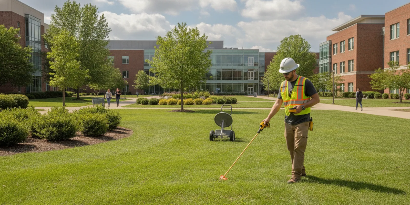
Utility locating for schools starts with one practical question: what is underground in the area where the project will disturb the ground? A campus may include public utility connections, privately owned lines, and site systems installed during different construction phases. A clear scope, coordinated field access, and a plan for using the findings can help facilities and project teams prepare before digging begins.
Plan a campus locating investigation
Why does utility locating for schools belong in project planning?
Schools are active sites, even when the work area looks quiet. Buildings may remain occupied during renovations. Buses, deliveries, maintenance crews, athletics, and after-school programs can all affect where and when a locating team can work. In summer, a project may move quickly between demolition, grading, and installation. A utility investigation is most useful when it is planned around those conditions rather than treated as a last-minute step.
Underground infrastructure can include electrical feeds, water and sewer lines, irrigation, site lighting, communications, gas lines, and lines serving athletic or support facilities. Some may be owned or maintained by public utilities; others may be private systems on campus. A public one-call request such as 811 is an important part of excavation planning, but it does not identify every privately owned line on a property. Teams can review the difference between private locating and 811 coverage before defining the investigation area.
When the project involves digging, boring, trenching, fence posts, playground equipment, lighting, drainage, or new site utilities, locating can inform the work plan. It does not replace design review, site-specific safety procedures, or required public utility notifications. Instead, it gives the team additional information to coordinate with plans and field conditions before excavation proceeds.
What should the campus locating scope answer?
A useful scope describes the planned work, the area to be investigated, and the information the project team needs back. A request to "locate the campus" may sound comprehensive. It can still be too broad to support a specific construction decision. A defined work zone and purpose help the investigator understand where to focus and help the project team make sense of the results.
- What is the planned activity? Identify the excavation, installation, or site change. Include approximate depth and dimensions when known, such as a trench alignment, pole location, or drainage feature.
- Where will the work happen? Provide a marked-up plan, drawing, or map with the limits of disturbance. Identify staging, access routes, and areas that must remain clear.
- What systems are suspected? Note known building services, irrigation, lighting, athletic-field systems, fuel or generator connections, and past repairs. Unknowns are useful information too.
- What records are available? Share campus utility plans, as-builts, prior survey information, renovation drawings, and known changes. Note the date and reliability of each record where possible.
- How will the findings be used? Tell the team whether field marks will guide exploratory work, support a design decision, inform a contractor, or become part of a project record.
For project-specific preparation, the private utility locate checklist can help collect scope details before requesting service. If the site requires records, linework, photographs, or another defined deliverable, state that before fieldwork is scheduled. The investigation process and deliverables page describes how to discuss those needs with SafeLine.
How do active campus conditions affect the investigation?
Campus access and operations are part of the locating plan. A team may need a facilities contact to unlock gates, identify restricted areas, or coordinate access to utility rooms and site features. The project lead should also identify sensitive areas, planned events, vehicle movement, and any work windows when the area can be kept clear.
Think through these details before setting a field date:
- Confirm the exact property entrance, check-in point, and an on-site contact who can answer questions.
- Mark the project limits and proposed excavation path on a current site plan. Avoid relying only on a verbal description.
- Identify occupied buildings, student routes, bus lanes, loading zones, athletic events, and other constraints near the work area.
- Tell the locating team about fencing, pavement, landscaping, stored materials, or other conditions that may limit access to the ground.
- Coordinate the investigation with the design and construction schedule. If the work area or project limits change, share the revision rather than assuming earlier findings apply.
Schools should follow their own access, safeguarding, and site-safety procedures. The locating scope should not ask a field crew to make decisions about student supervision or replace the school's normal controls. Instead, arrange an appropriate escort or access plan through the school's designated facilities or project contact.
How should campus teams coordinate timing and project phases?
School calendars shape construction, but the calendar alone does not define the best time to investigate. A summer break may give contractors more room to work, while design decisions often need underground information earlier. In other cases, a limited field visit during the school year may be feasible if the work area and access plan are clearly separated from daily activity. The project manager should connect the investigation date to the current design and construction milestones.
For a phased project, divide the site plan into useful work areas and identify which phase is ready for investigation. A broad campus plan can show context, while a focused drawing should show each area where ground disturbance is planned. Label proposed routes and locations, and distinguish confirmed design elements from options still under review. This helps avoid treating a preliminary alignment as the final excavation path.
When a project will proceed over an extended period, make a simple record of the investigation date, scope, plan revision, and planned work. Before a later phase begins, compare its layout with the investigated limits. If the work moves, the scope expands, or the site changes materially, ask whether the available information still addresses the current plan. The project team, not a mark alone, must decide what additional coordination is needed before digging.
How do EM locating and GPR support a campus investigation?
Electromagnetic (EM) locating and ground penetrating radar (GPR) are complementary methods, not a guarantee that every buried object can be found. EM equipment is used to trace conductive utilities when a signal can be applied or detected. GPR sends radar energy into the ground and interprets reflections that may indicate subsurface features, including some non-metallic utilities. What each method can reveal depends on the target, access, soil and site conditions, and the quality of available information.
On a campus, the question is not simply "Which instrument is best?" It is whether the method fits the specific target and decision. A known metallic feed may be a useful EM target. A suspected non-metallic line may call for a different approach or additional context. A technician can use more than one method when appropriate, while still documenting limits and uncertainty. Learn more about GPR investigation and how it differs from electromagnetic locating.
Existing plans and visible surface features can help guide fieldwork, but they should be treated as inputs to verify, not proof that a line is exactly where a drawing shows it. Campus systems may have been altered as buildings were added or renovated. A useful investigation brings together the work limits, available records, field observations, and appropriate locating methods.
How do common school project situations compare?
The amount of coordination and the useful output can differ by project. This comparison is a planning aid, not a substitute for defining the actual site scope.
| Project situation | Planning focus | Information to prepare | Useful field outcome |
|---|---|---|---|
| Fence, gate, or sign installation. | Post locations, gate operators, and nearby service routes. | Layout, post spacing, equipment locations, and the exact installation area. | Marks and notes that help the installer coordinate each planned disturbance. |
| Playground or athletic-area improvements. | Lighting, irrigation, drainage, and other site systems. | Equipment layout, limits of grading, known field systems, and the access window. | Findings focused on the planned work footprint and relevant routes. |
| Building addition or renovation. | Building feeds and connections between structures. | Design drawings, proposed tie-in points, work limits, and available as-builts. | Field information for coordination with design and construction plans. |
| Drainage, trench, or utility installation. | Proposed alignment, crossings, and excavation constraints. | Route, approximate depth and width, phasing, and the project schedule. | Marked routes and agreed documentation for the excavation area. |
When should a school request utility locating for schools?
Request locating early enough to clarify the scope and coordinate access, but close enough to the planned work that the information can be applied to the current design and field layout. For a project in design, an early investigation may help identify conflicts to review. Before excavation, confirm that the limits shown to the locating team match the work that will actually take place.
There is no single lead time that fits every campus. Project size, records, site access, scheduling, and urgency all affect planning. A small installation may have a compact work area, while a phased renovation may involve multiple buildings and changing limits. For emergency or time-sensitive work, explain the situation when contacting the locating provider. Do not assume an earlier locate covers a changed alignment or an area outside the original scope.
Keep public utility notification and private locating as separate coordination steps. A private investigation does not replace applicable 811 procedures. Likewise, completion of a one-call request does not establish that every private campus line has been identified. The project team should follow the requirements that apply to the site and excavation.
What should the team review when fieldwork is complete?
Before using the results, check that the marked area matches the current plan and that the intended users understand what the marks represent. Ask what areas were investigated, what methods were used, what records or site details informed the work, and what limitations were noted. If a requested area was blocked or could not be investigated as planned, make sure that gap is clear to the project team.
Coordinate the findings with the designer, facilities lead, and excavation contractor. Compare marked routes with proposed work, identify potential conflicts, and decide whether the design or work plan needs further review. The locating results are information for planning; they should not be treated as a universal clearance to dig or as confirmation that no other subsurface feature exists.
If the project needs records beyond field markings, discuss format and intended use in advance. A utility mapping and documentation scope may be appropriate when the team needs recorded findings to support coordination. Review the deliverable for coverage, date, scope limits, and stated uncertainty, then make it available to the people responsible for the work.
How should the findings be handed to the field team?
Turn the results into a clear handoff, not just a file saved in a project folder. Identify the plan version that corresponds to the fieldwork, explain the meaning of any marks or symbols, and point out areas that were outside the scope. If a contractor receives a plan or report after the original project team has reviewed it, include the relevant limitations and the date so the information is not separated from its context.
Before excavation, have the people doing the work compare the proposed disturbance with the investigated area. Walk the area where practical, confirm that marks can be seen and understood, and raise discrepancies with the project lead before proceeding. A conflict between a mark, a drawing, and the planned route is a reason to pause and clarify, not to assume that one source automatically overrides the others.
For a campus with multiple contractors or phases, designate who maintains the current locate documents and who communicates revisions. A simple version-control practice can help prevent an outdated drawing from circulating after the design shifts. Keep prior versions for project history, but make the current plan easy to identify.
What requirements should the project team verify?
Separate locating scope from the legal, procurement, and construction requirements that govern the project. School districts may have their own vendor, access, insurance, and project approval procedures, while excavation requirements can depend on jurisdiction and work type. Confirm the current requirements with the responsible authority and district team rather than relying on a general article or an old project file. As one state-specific example of a trade-profession resource, Wisconsin DSPS provides a utility contractor FAQ; it is Wisconsin information and does not establish requirements for a Mid-Atlantic campus.
Also clarify who is responsible for sharing the locating results with the designer, facilities staff, and excavation contractor. Identify the latest plan revision and keep the record with the project documents. This simple handoff can reduce confusion when a different crew or project phase uses the findings later.
What should a school provide when requesting a quote?
A concise request makes it easier to discuss the right scope. Include the campus address, project contact, desired timing, and a short description of the work. Attach the latest available site plan, drawing, or aerial image and clearly mark the proposed work zone. If the plan is preliminary, say so and identify what is likely to change.
Also include available utility records, known site features, access restrictions, and relevant construction milestones. Explain whether the school needs field markings, documentation, or both, and identify who will use the findings. If the project is divided into phases, show each phase and explain when each area is expected to be disturbed.
SafeLine's utility locating and GPR services page can help frame a service discussion. Campus project teams can also review the information for contractors planning subsurface work and the company's service areas. To discuss a particular project, share the work limits and timing through the contact form.
Request a campus project discussion
Frequently asked questions
Does a school still need 811 if it hires a private locating company?
Private locating and 811 serve different roles. Follow applicable one-call requirements before excavation, and use private locating to investigate relevant privately owned systems that may not be included in public utility marking. One step should not be assumed to replace the other.
Can a campus investigation find every buried line?
No locating method can promise detection of every buried feature in every condition. Results depend on the target, site conditions, access, available records, and methods used. Ask the provider to explain the investigation limits and how the findings should be used.
Can locating take place while school is in session?
That depends on the work area, access, and school operations. Coordinate the field visit with the facilities contact, identify restricted or busy areas, and agree on an access plan. A school should apply its own procedures for visitors and active campus areas.
What if the construction plan changes after the locate?
Share the revised work limits and alignment with the project team and locating provider. Findings for one area or layout should not automatically be applied to a different excavation route. The provider can help determine whether a return visit or revised scope is appropriate.
Good campus utility planning connects a defined work area, current project information, coordinated site access, and a clear understanding of investigation limits before excavation begins.