
Before a commercial crew breaks ground, the visible site plan is only part of the picture. Public 811 marks remain an important starting point. They may not show private infrastructure beyond a meter or property line, including private electrical feeds, irrigation, communications, or landscape lighting.
Need to plan work in Northern Virginia? Contact SafeLine about utility locating and mapping.
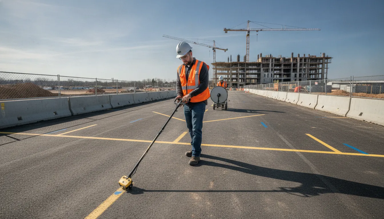
A utility locating service northern virginia project teams can rely on should identify and map relevant subsurface infrastructure using methods suited to the site. SafeLine combines electromagnetic (EM) locating for conductive lines with ground penetrating radar (GPR), which can support detection of metallic and non-metallic infrastructure. The result may include field markings, verification photos, reports, and site maps that help teams plan work more safely.
That distinction matters on additions, site work, developments, and capital projects, where incomplete utility information can affect excavation planning and coordination. The first step is understanding why commercial work needs a broader investigation than an 811 request alone.
Why Commercial Projects Need More Than 811
Calling 811 remains an important part of planning excavation. It helps address publicly owned utility facilities, but it may not identify every line serving a commercial property. A project team needs to understand the difference between public utility marking and a private investigation before excavation, site work, or construction begins. Private locating helps identify and map utilities that public 811 services may not mark, reducing uncertainty for contractors, developers, engineers, and facilities teams. utility locating and mapping can provide the additional site information needed to plan work responsibly.
Public marks do not define the entire site
Commercial properties often contain infrastructure that extends beyond the public utility network. Private electrical feeds, irrigation lines, pool equipment lines, private laterals, and landscape lighting are examples of infrastructure that 811 may not mark. The relevant boundary may be beyond the meter or property line, where privately owned or privately maintained utilities continue across the work area.
Private locating supports commercial project planning
Commercial utility locating supports construction sites, large-scale projects, site work, additions, and capital projects. It can also include independent verification of existing 811 marks, private utility mapping, and emergency locates. This gives the project team a way to investigate conditions that fall outside the scope of public marking or to check whether the available information matches the work area.
The need is not limited to one type of buyer. General contractors, construction companies, site developers, and facilities management teams may all need private utility information before work proceeds. A documented investigation can help different stakeholders work from the same understanding of the site. Depending on project scope, deliverables may include precise field markings, verification photos, clear reports, and site maps for future reference.
What Can a Utility Locating Service in Northern Virginia Identify?
Commercial sites rarely have only one type of underground infrastructure. A utility locating service can help project teams build a clearer picture of what may be present before excavation, site work, additions, or other construction begins. For a contractor, developer, engineer, or facilities team, the useful question is not simply whether a line exists. It is what kind of infrastructure may cross the work area, where the investigation should focus, and how the findings will be documented for the people using them.
Public and private utility infrastructure
Depending on the project scope and site conditions, locating work may address electric feeders. Gas mains and services, water and sewer, communications, fiber, storm drainage, and industrial process lines. These systems can serve a building, a larger campus, or specialized operations. They may also cross areas that are not obvious from surface features or older site plans.
Private infrastructure deserves particular attention. Public 811 services generally address public utility facilities, but they may not mark privately owned utilities beyond the meter or property line. On commercial property, those gaps can include private electrical feeds, irrigation, pool equipment lines, private laterals, and landscape lighting. A private investigation is complementary to the 811 process. It is not a replacement for requesting public utility marks when that process applies.
That distinction matters when the proposed work extends across parking areas, landscaped spaces, additions, service yards, or other portions of a developed property. A project team can review SafeLine's utility locating and mapping options to understand how private utility information may fit the site investigation.
Emergency locates and 811 verification
Not every locating request starts months before a project. Existing conditions can change, records may be incomplete, or an active site may need information quickly to support a time-sensitive decision. SafeLine's documented services include emergency locates for residential, commercial, and industrial projects. The appropriate scope still depends on the site and the question the project team needs answered. An emergency request should not be treated as a promise of a particular turnaround or result.
Independent verification of existing 811 marks is another practical use. The 811 marks remain important for public facilities, while independent locating can help investigate private infrastructure and compare field conditions with the information already available. This gives contractors and project managers another source of site information to consider before disturbing the ground. Especially where work areas include privately owned services or where existing marks do not answer the full project question.
Information the project team can use
Identification is most useful when the findings are communicated clearly. Depending on the scope, deliverables may include field markings, verification photos, clear reports, and site maps for future reference. Those materials can help project stakeholders understand the investigated area, coordinate excavation planning, and retain a record for later phases or maintenance decisions. They do not eliminate the need for safe digging practices or project-specific judgment. But they give the team documented information to use alongside plans, permits, records, and public utility marks.
SafeLine's stated service territory includes Virginia, Maryland, Washington, D.C., North Carolina, and the greater Mid-Atlantic region. Review the Northern Virginia project coverage page when determining whether the location and project scope are a fit.
How EM and GPR Work Together on Active Sites
Active construction sites rarely offer a clean, uniform surface for underground investigation. Equipment, traffic, existing structures, changing grades, and incomplete utility records can all affect how a locating team approaches the work. That is why EM locating and Ground Penetrating Radar (GPR) are best understood as complementary methods, not interchangeable technologies.
SafeLine combines GPR and EM locating to investigate subsurface conditions with the method selection guided by the site and the utility information needed. An EM instrument supports conductive-line detection. GPR can support the detection of both metallic and non-metallic infrastructure. Together, these capabilities give a project team more than one way to investigate potential utility paths before excavation, design changes, or other disruptive site work.
What EM locating contributes
EM locating is useful when a conductive path can be detected and traced. That may include certain metallic utilities or conductive materials associated with a line. The method can help a technician follow a signal across an area and relate the detected path to visible site features, records, and planned work. It is especially relevant when the investigation involves known or suspected conductive utilities.
EM results still require professional interpretation. A signal does not automatically establish every detail about a utility, and field conditions can affect what the instrument detects. Nearby utilities and other underground objects may also complicate the picture. The goal is to use the method as part of a documented investigation, rather than treat one instrument reading as a complete subsurface model.
What GPR adds to the investigation
GPR uses radar energy to investigate subsurface changes and can support detection of infrastructure that is metallic or non-metallic. That makes it a useful complement where an EM approach may not identify the material or configuration in question. For example, a project team may need to investigate a suspected non-metallic line, a buried feature. Or an area where records do not clearly show what is below the surface.
GPR is not appropriate for every underground detection task. Its suitability depends heavily on the ground type, so the findings must be interpreted in the context of the actual site. For a deeper look at how this method fits into a project investigation, review SafeLine's GPR investigation services.
Why the site determines the method mix
No single technology meets every underground utility location objective. Research on utility detection recommends selecting a combination of devices based on site conditions. Pipe material, environmental conditions, and the presence of nearby utilities or other underground objects all deserve consideration. Those factors can influence which method is appropriate, how an area is scanned, and how results should be documented.
For an active site, the practical workflow may involve reviewing available plans and visible evidence. Using EM to investigate conductive paths, and applying GPR where non-metallic infrastructure or broader subsurface conditions require additional examination. The exact sequence depends on the project scope. A congested utility corridor, paved work area, landscaped property, and building-adjacent excavation may each call for a different approach.
The resulting information can support field decisions without overstating what detection technology can prove. Depending on the scope, deliverables may include field markings, verification photos, reports, and site maps for future reference. Clear documentation helps contractors, engineers, developers, and facilities teams connect the investigation to the planned work and identify questions that need resolution before digging proceeds.
When Should You Schedule Locating Before Excavation?
Schedule utility locating before excavation plans are finalized and before crews mobilize, not after equipment is on site. The right timing gives the locating team enough information to review the work area, identify the project scope, and mark or document utilities that could affect digging. This applies to new construction, additions, grading, trenching, roadway work, landscaping, and other site work, as well as larger capital projects.
Coordinate 811 and private locating early
Start with the applicable 811 request for public utility marking, then determine whether the property also needs a private locate. These services address different parts of the risk. Public 811 services may not mark private infrastructure beyond the meter or property line, including private electrical feeds, irrigation, pool equipment lines, private laterals, and landscape lighting. A private utility locating investigation can help address those gaps and can also provide independent verification of existing 811 marks.
For a commercial project, make this coordination part of preconstruction rather than treating it as a last-minute field request. General contractors, developers, facilities teams, and engineering groups may need utility information while designs are still changing. Locating at that stage can help the team identify conflicts before excavation limits, access routes, foundations, or utility corridors are fixed.
Use a project milestone, not a calendar guess
For additions and smaller site projects, schedule the locate after the proposed work area is defined and before excavation staking or demolition begins. If the footprint changes, the locate may need to be reviewed or expanded. For large-scale construction and capital projects, consider locating in phases: first for design and planning. Then again to verify the active work area when construction is ready to proceed. This is especially useful when the project will continue over an extended period or multiple contractors will work in different zones.
Emergency locating may be necessary when a time-sensitive project cannot follow the normal planning sequence. It should not replace thoughtful pre-excavation coordination when the work can be scheduled in advance. Share the site address, drawings or limits of work, planned excavation areas, and expected start date so the locating scope matches the actual field conditions.
Allow time to act on the findings
Do not schedule locating for the same moment excavation begins. Build in time to review field markings, photos, reports, and site maps; resolve unexpected conflicts; and adjust the work plan if needed. The investigation may involve multiple utility types, such as electric, gas, water, sewer, communications, fiber, storm drainage, or industrial process lines. North Carolina law, for example, describes a public policy of identifying existing facilities before excavation or demolition and implementing safe-digging practices. And it names communications, electricity, gas, water, and sewage among protected underground facilities. That legal reference is specific to North Carolina. It should not be presented as a blanket statement of Virginia or Maryland requirements, so project teams should confirm the rules that apply to their location.
The practical standard is consistent across project types: coordinate public and private locating early. Update the scope when the design or work area changes, and give the team time to use the results before digging starts.
What Happens During the Investigation and What Do You Receive?
A professional investigation starts with the project area, planned work, and available site information. The locating team reviews where excavation, drilling, grading, installation, or other disturbance may occur, then selects methods suited to the site. The scope can support a construction site, addition, capital project, facilities activity, or another form of commercial work. It is not a promise that every possible feature will be identified on every visit. Ground conditions, utility materials, access, congestion, and the quality of existing records all affect what can be detected and documented.
That practical approach is part of SafeLine's utility locating process. The objective is to give the project team usable information before work proceeds. Including a clearer understanding of what is present, where it was observed, and what should be verified or coordinated next.
Field investigation and surface markings
During the field visit, the technician evaluates the work area and traces available utility signals and subsurface responses. Electromagnetic, or EM, locating equipment supports detection of conductive-line features. Ground Penetrating Radar, or GPR, can support detection of both metallic and non-metallic infrastructure. Using both methods can provide a broader investigation than relying on one instrument alone, although no detection method is appropriate for every site or utility condition.
The investigation may address infrastructure such as electric feeders, gas mains and services, water and sewer, communications, fiber, storm drainage, and industrial process lines. On private property, the scope may also involve private electrical feeds, irrigation, pool equipment lines, private laterals, or landscape lighting that a public 811 request may not mark. Existing 811 marks can also be independently verified when the project team needs additional confidence in the marked work area.
Where utilities are identified, the work may result in precise field markings. Utility designating uses color-coded, water-soluble spray paint to show surface locations. These marks give the crew a visible reference in the field, but they should be interpreted within the agreed scope and maintained as site conditions change. Markings are not a substitute for following the project's excavation controls or confirming the limits of the planned work.
Documentation that can support coordination
Depending on the scope and project requirements, deliverables may include verification photos, a clear report, and a site map for future reference. Photos can help document the marked area and provide context for people who were not present during the visit. A report can record the investigation's observations and relevant limitations. A map can give the project team a more durable record than paint alone, especially when several parties need to coordinate design, construction, facilities work, or future maintenance.
Surface marks may also be surveyed into design plans or existing site plans. That can help engineers, contractors, developers, and facilities teams compare field findings with the working documents used for the project. The exact file format, level of detail, and survey or mapping requirements should be discussed when the service is scoped. Deliverables vary by assignment, so a project manager should confirm what will be supplied before scheduling the investigation.
The strongest result is a shared record that connects field observations to the planned work. When the team understands which utilities were investigated, how they were marked, and which records are available, it can coordinate excavation and design decisions with better information. If conditions change or additional work is added. The existing documentation can also help identify what needs to be revisited rather than treating an old mark or map as universally complete.
Where SafeLine Works Across the Mid-Atlantic
SafeLine Private Locating is headquartered in Mechanicsville, Virginia. Its documented service territory extends across Virginia, Maryland, Washington, D.C., North Carolina, and the greater Mid-Atlantic region. That geographic footprint gives project teams a starting point for discussing private utility locating when work crosses property boundaries, jurisdictions, or multiple phases of development. Coverage should still be confirmed for the specific site, access conditions, and requested scope rather than assumed from a broad regional description. Review the service areas before planning field work.
Virginia is SafeLine's core market, with its base in the Richmond area. For Northern Virginia projects, the relevant question is not simply whether a provider lists the region. It is whether the provider can evaluate the private infrastructure and documentation needs associated with the work. A utility locating service may support construction sites, large-scale projects, site work, additions, and capital projects, depending on the requested investigation and site conditions.
Project types that fit regional service
SafeLine's documented commercial customers include general contractors, construction companies, site developers, and facilities management teams. These teams may need private utility information before excavation, foundation work, grading, additions, expansions, or other changes to an active site. Engineering firms and municipalities can also need subsurface data and mapping to support design and infrastructure planning. The practical fit is strongest when the project requires more than a public locate ticket. Especially where privately owned lines or site distribution systems may continue beyond the meter or property line.
Depending on the project scope, locating work can address private electrical feeds, irrigation, pool equipment lines, private laterals, and landscape lighting. It may also include utility mapping, emergency locates, or independent verification of existing 811 marks. These services complement 811 rather than replace it. Public 811 marking remains important for public utility facilities, but it may not identify every privately owned line serving a building, site feature, or facility.
Planning across state and district lines
Projects in Maryland, Washington, D.C., and North Carolina can involve different owners, records, site layouts, and excavation requirements. A regional scope should therefore identify the exact address or work area. The planned excavation or construction activity, known utility records, and the documentation the project team needs afterward. This helps keep the investigation aligned with the site instead of treating the Mid-Atlantic as a single uniform field environment.
SafeLine states that it maintains 24/7 emergency availability for time-sensitive residential, commercial, and industrial projects. That is an availability statement, not a guarantee of a particular arrival time or result. For an urgent project, confirm current scheduling, site access requirements, and deliverables before mobilization. Clear regional scoping gives contractors, developers, facilities teams, and property owners a more reliable basis for deciding whether private locating support fits the next phase of work.
How to Scope the Right Service for Your Project
A useful scope starts with the work your team needs to complete, not with a specific piece of equipment. Commercial utility locating supports construction sites, site work, additions, large-scale projects, and capital improvements, so the right engagement can look different from one property to the next. Before requesting a proposal, gather enough detail for the locating team to understand the project phase, the area at risk, and the decisions the field data must support.
Define the project phase and work limits
Start by stating whether the project is in planning, design, pre-construction, active excavation, or emergency response. Include the planned work, such as grading, trenching, drilling, foundation work, paving, utility installation, or an addition. Identify the limits of disturbance on a current site plan, then note staging areas, access routes, laydown areas, and any alternate work zones that could affect underground infrastructure.
Also explain the schedule pressure. A locate requested for design coordination may require a different level of documentation than an urgent field verification before a crew breaks ground. Private locating can complement the public 811 process by addressing utilities that may not be marked beyond the meter or property line. Services may also include emergency locates and independent verification of existing 811 marks. Utility locating and mapping services can be scoped more accurately when those objectives are stated up front.
List the infrastructure questions that need answers
Do not simply ask for "all utilities." Describe the questions the project team needs answered. For example: Where do private electrical feeds enter the building? Are communications or fiber lines crossing the proposed trench? Could water, sewer, storm drainage, gas, or industrial process lines conflict with the work? Private sites may also contain irrigation, pool equipment lines, private laterals, or landscape lighting that are outside the practical coverage of a standard public mark.
Share available utility records, as-built drawings, previous survey files, site plans, and information from facility staff. These references do not replace field investigation, but they help the locating team compare expected infrastructure with conditions observed on site. Identify known anomalies, abandoned systems, recent renovations, and areas where records conflict. That context is especially valuable when several utilities or underground objects are close together.
Match the method to the site and the deliverable
Ask how the proposed approach will address the conditions at your site. SafeLine combines electromagnetic (EM) locating and ground-penetrating radar (GPR). EM equipment supports conductive-line detection, while GPR can support detection of metallic and non-metallic infrastructure. No single technology meets every underground locating objective, and research recommends selecting a combination based on site conditions. Pipe material, environmental conditions, nearby utilities, and other underground objects all matter when planning detection.
Finally, specify how your team will use the results. Possible deliverables may include field markings, verification photos, clear reports, and site maps for future reference. Tell the provider whether the information will support excavation, design coordination, contractor handoff, facilities records, or an independent review of 811 marks. A clear end use helps define the area to investigate, the documentation to capture, and the questions the field team should resolve.
Scope checklist
- Share the exact address, work limits, site plans, and planned disturbance.
- Identify known utility records, private systems, and areas where records conflict.
- Explain the project phase, schedule, and decisions the findings must support.
- Confirm the field markings, photos, reports, maps, or other documentation your team needs.
| Project question | Scope detail to share |
|---|---|
| Where is the risk? | Limits of excavation, grading, drilling, paving, or installation. |
| What may be present? | Known public and private utilities, records, and site features. |
| How will results be used? | Field coordination, design review, contractor handoff, or facilities records. |
Frequently Asked Questions
Why do I need private utility locating if I already called 811?
811 generally addresses public utility facilities, but its marks may not cover private infrastructure beyond the meter or property line. A private locate can help identify lines such as private electrical feeds, irrigation, landscape lighting, private laterals, and pool equipment lines before site work or excavation begins.
What types of utilities can be identified on a commercial site?
The scope may include electric feeders, gas mains and services, water and sewer, communications and fiber, storm drainage, and industrial process lines. The appropriate investigation depends on the site, the planned work, available records, and the utility types expected in the work area.
When should a contractor schedule a utility locate?
Schedule locating during project planning, before excavation, drilling, grading, trenching, or other ground disturbance. Early field information gives the project team time to review findings, coordinate design or site work, and address conflicts before equipment is operating in the work area.
What is the difference between EM locating and GPR?
Electromagnetic equipment supports detection of conductive lines, while GPR can support detection of both metallic and non-metallic infrastructure. Because site conditions and underground materials vary, using the methods together can provide a more complete investigation than relying on one technology alone.
What deliverables can I expect after the investigation?
Depending on the project scope, deliverables may include field markings, verification photos, written reports, and site maps for future reference. Confirm the requested documentation before scheduling so the results align with your construction, design, facilities, or recordkeeping needs.
Contact SafeLine About Your Project
A clear project scope helps the locating team understand your site, planned work, and the type of utility information you need before excavation or construction. Contact SafeLine to discuss your project and determine the right next step. Call SafeLine at 866-677-2335 to request a utility locating quote or service call.