
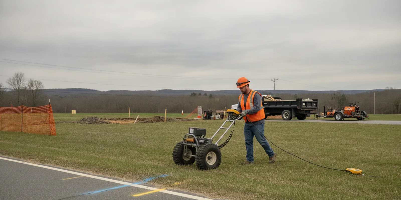
Municipal private utility locating helps a project team understand underground features that may not be included in public utility marking. For a road improvement, park upgrade, drainage project, or facility renovation, the useful question is not simply whether lines can be marked. It is which areas need investigation, what decisions the information must support, and how field findings will be carried into design and construction.
Discuss your municipal project scope
Why does municipal private utility locating belong in project planning?
Municipal work often touches several types of property and infrastructure at once. A project may cross a public right-of-way, a utility easement, a park, a school or civic facility, and land with privately owned services. Public utility marking is an important part of excavation preparation, but it does not necessarily provide a complete picture of every privately owned line or site feature within the project limits. The exact boundary of public and private responsibility depends on the utility and location, so the team should verify it rather than assume.
That gap can affect early design choices as well as field work. An unknown service may influence a proposed pole, tree, sign, drainage structure, sidewalk, or excavation route. If the team discovers a conflict late, it may have to reconsider the layout, coordinate with an owner, or revise the work sequence. The point of locating early is to give project staff usable information while choices are still open, not to promise that every buried feature will be identified.
Municipal teams can use private locating alongside 811, not as a replacement for the one-call process. Before excavation, follow applicable state law, ticket requirements, utility-owner instructions, and project specifications. A private investigation supplements those steps by addressing a defined scope of privately owned or otherwise unmarked infrastructure.
It is also useful to decide what the information will be used for. A preliminary planning survey, design coordination, conflict review, and field excavation support may need different coverage, documentation, or follow-up. A locate should be scoped around decisions that need to be made, not just around the availability of a particular instrument.
What should the municipal locating scope answer?
Before requesting fieldwork, write down the project question in plain terms. For example: “Identify detectable utilities in the proposed sidewalk and drainage work area so the design team can review potential conflicts.” That is more actionable than “locate utilities at the park.” Include the area, likely work activities, and the decision date for which the information is needed.
A useful scope typically addresses these points:
- Limits: Identify the investigation area on a plan or aerial image. Show the project boundary, proposed work, access points, and any offsite areas that may be affected. Indicate whether a buffer is needed around proposed excavation or structures.
- Purpose: State whether the results will support feasibility, design, bid documents, construction planning, or a specific conflict review. The purpose helps determine the appropriate level of detail and deliverable.
- Known systems: List the utilities and site features the team is concerned about, including water, sewer, storm drainage, electric, communications, irrigation, lighting, and services to buildings or outbuildings where relevant.
- Deliverables: Specify the format and level of documentation needed. The team may need field markings, photographs, a written summary, mapped observations, or files that can be reviewed with design plans. Confirm expectations before fieldwork.
- Schedule and access: Provide required milestones, site hours, security or escort procedures, traffic restrictions, and any dates when the area will be unavailable.
- Known limitations: Identify surface conditions, restricted zones, active operations, inaccessible areas, or uncertainty in old records that could affect the investigation.
The scope should distinguish a utility locate from a full subsurface utility engineering (SUE) program. A targeted private locate can help identify and mark detectable features within a defined area. A broader engineering investigation may involve additional records research, survey control, quality levels, test holes, or other services that must be separately specified. Municipal projects should match the scope and deliverables to the design or construction decision at hand.
For a fuller view of what a locating provider may document, review the investigation process and deliverables before writing the request. If the project needs mapped information for later coordination, consider whether a utility mapping and documentation scope is appropriate.
What records and site information should a municipality assemble?
Existing records help the field team understand the site and focus attention, but drawings should be treated as clues rather than proof of current field conditions. Plans may be incomplete, approximate, outdated, or based on a different construction phase. Include the source and date of records when known, and flag conflicting information instead of silently choosing one version.
Assemble what is available before the request is finalized:
- Current project plans, survey base, and an aerial image with the proposed work area marked.
- As-built drawings, utility maps, record plans, and prior locate or investigation reports.
- Known utility owner contacts, service information, and records for municipal facilities.
- Relevant construction history, including prior repairs, additions, abandoned lines, or phased development.
- Access details such as gates, permits, escort requirements, operating hours, and restrictions on equipment or vehicle movement.
- A municipal project contact who can answer questions and help resolve access or scope issues.
Walk the site, if practical, before sending the scope. Look for visible clues such as meters, valves, cleanouts, hydrants, cabinets, poles, drains, building service entries, and utility markers. Photograph or note their locations and relate them to the proposed work. These observations do not establish an underground route, but they can help the team identify questions that records do not answer.
Share site knowledge from maintenance staff and facility operators, too. The person who maintains a park irrigation system or municipal building may know about a service that is missing from the plan set. Record that information as reported or unverified so it is not mistaken for a surveyed fact.
SafeLine’s private utility locate checklist can help organize basic preparation. For a broader overview of how a private locate fits with public marking, see what 811 does not cover. These resources are useful starting points; the project team remains responsible for confirming its own requirements and records.
How do EM locating and GPR support the investigation?
Locating methods are selected according to the target, surface, site conditions, and project question. Electromagnetic (EM) locating is commonly used to trace conductive utilities, such as metallic lines or cables that can be accessed and energized or detected through an appropriate signal. Ground penetrating radar (GPR) can help investigate subsurface changes and may identify both metallic and non-metallic utility features under suitable conditions. No single method detects every buried line in every setting.
Surface materials, soil conditions, depth, congestion, access, and the condition or material of a utility can affect results. A signal may be weak, interrupted, or difficult to distinguish from nearby infrastructure. GPR responses also require interpretation and may be affected by conditions in the ground. Therefore, findings should be read as evidence gathered under stated conditions, not as a guarantee that every utility is present on a map or mark.
For many sites, more than one technique may be considered. EM can be helpful when a conductive target is accessible or can be traced; GPR may add information where the target is non-conductive or where the team needs to examine subsurface patterns. The methods can complement one another, but the scope should not specify technology as a substitute for defining the actual question. Read about the differences between GPR and EM locating to understand the general method roles.
The Federal Highway Administration’s site characterization and utility locating guidance discusses planning and procedures for utility locating surveys. For a municipal project, the practical lesson is to plan the investigation around the site and its intended use, and to communicate constraints and expectations before survey work begins.
Where a project requires a specific positional accuracy, survey coordinate system, quality level, or verification approach, state that need in the request and confirm the proposed scope can meet it. A field mark alone may not provide the mapped record or engineering certainty required by the design team. Use the GPR investigation service information and utility locating and mapping service overview as a starting point for discussing what may fit the site.
How do municipal project situations compare?
Different project types call for different boundaries, access plans, and deliverables. The table below is a scoping aid, not a fixed specification. The project owner and design team should confirm the actual need with the relevant utility owners and locating provider.
| Project situation | Useful scope focus | Information to prepare | Potential coordination need |
|---|---|---|---|
| Sidewalk or streetscape work | Proposed excavation, poles, trees, signs, ramps, and construction staging zones | Plan view, roadway limits, proposed features, traffic and pedestrian access constraints | Coordinate public utility ticketing, right-of-way access, and design review |
| Water, sewer, or drainage improvements | Trench routes, connections, structures, crossings, and tie-in areas | Existing and proposed utility plans, records, known system owners, anticipated depth or excavation locations | Resolve potential conflicts with operating systems and confirm owner requirements |
| Park or recreation project | Play areas, lighting, irrigation, shelters, courts, and new landscaping | Facility plans, maintenance knowledge, event schedules, restricted or sensitive areas | Coordinate with parks staff and protect access for public use |
| Municipal building renovation | Exterior service routes, additions, site lighting, and planned ground disturbance | Building service records, site plans, access and security procedures | Arrange escorts and work windows with facility operations |
| Roadway or capital project design | Project-wide limits, design alternatives, and locations where information can change layout | Current survey, design stage, alternatives, schedule, record sources | Align locating scope with design milestones and any separate SUE requirements |
When should a municipality request locating?
Request information early enough to act on it. If the locate is postponed until mobilization, the team may have little time to resolve conflicts or adjust plans. For early planning, a preliminary investigation may identify questions and areas that need more work. As the design advances, the municipality can refine the area and deliverables around the selected alternative.
A practical sequence is:
- During concept development: Identify the proposed work envelope and likely subsurface conflicts. Review available records and decide whether unknown private infrastructure could affect the choice of layout or site.
- Before design decisions are fixed: Investigate the areas where utility information could affect alignment, structure placement, or construction approach. Provide the current plan and explain which alternatives remain under consideration.
- Before bid and construction planning: Update the scope for selected work limits, confirm deliverable formats, and coordinate field access. Share findings with the design and construction teams in a form they can interpret.
- Before excavation: Complete required 811 notifications and follow applicable laws and utility-owner instructions. Reconcile public marks, private locate findings, project records, and actual site conditions before work proceeds.
The exact timing depends on the project and procurement process. Municipalities with capital programs can include subsurface information needs in early project development and consultant scopes rather than treating locating as a last-minute field task. If work changes, the project team should assess whether the locate area or information needs to be reviewed again.
What should the team review when fieldwork is complete?
Do not treat completion as simply “paint is on the ground.” Confirm that the fieldwork addressed the requested limits and that the deliverables answer the project question. If a portion of the site could not be accessed or a target could not be confidently traced, understand whether that limitation affects the planned work.
During review, check for:
- Coverage of the specified area and any locations excluded from the work.
- A clear explanation of markings, observations, and documented limitations.
- Photographs or mapped information, when included in the agreed deliverables, that can be related to the project plan.
- Unresolved conflicts, ambiguous responses, or areas that may warrant further investigation.
- Distribution to the municipal project manager, designer, field supervisor, and other people who need the information.
Bring findings into a coordination review. Overlay mapped information with the current design when the deliverable supports that use, identify potential conflicts, and assign an owner to each follow-up. If the design changes beyond the investigated limits, do not assume the previous findings cover new work areas. Similarly, field marks can change or become obscured. The construction team should follow project procedures for protecting, refreshing, and verifying information before digging.
Keep the records together with the project plan and note when and why the investigation was performed. That context helps future staff understand the boundaries of the work and prevents a limited locate from being treated as a complete record of all underground infrastructure.
How can a municipality request a useful locate?
A concise request can still be complete. Include the project name and location, a marked-up plan, scope limits, project purpose, records, site constraints, schedule, and requested deliverables. Name a project contact who can answer questions and arrange access. If the work is urgent or must fit a narrow window, state that early so availability can be discussed rather than assumed.
When comparing proposals, check whether each one describes the same coverage, methods or method-selection approach, assumptions, exclusions, deliverables, and schedule. A lower-cost proposal may not include the same area or documentation as another, so compare scope rather than price alone. Ask how the provider will communicate an inaccessible area or uncertain result and how the team can request clarification.
SafeLine provides private utility locating with EM and GPR methods, along with mapping and documentation options. The appropriate approach depends on project conditions and the requested scope. Municipal teams can review project support for contractors and use the frequently asked questions to prepare for a scope discussion. For coverage context, see the service area information.
Send your project details to discuss next steps
Frequently asked questions
Does municipal private utility locating replace an 811 ticket?
No. Private locating supplements the public one-call process; it does not replace required notification, utility-owner instructions, or applicable excavation rules. The municipality or its contractor should follow the requirements for the project location and timing.
Can GPR locate every private utility?
No single method can be expected to detect every utility in every condition. GPR may help identify subsurface features, including some non-metallic utilities, while site and material conditions can affect the results. EM locating is useful for conductive targets when conditions allow. The project scope should state the question and constraints, and findings should be interpreted with those limitations in mind.
Should the municipality provide existing utility plans?
Yes, provide available plans and identify their source or date when known. They help the field team understand the site, but records can be incomplete or outdated and should not be treated as proof of actual locations. Include conflicting drawings and reported site knowledge as such.
What information helps a provider prepare a proposal?
Send a site plan or aerial with the limits and proposed work marked, the project purpose, available records, schedule, access restrictions, and the deliverables the team needs. Also identify the municipal contact for site access and questions. Clear inputs make it easier to discuss a scope that fits the project.
When should locating be repeated or reviewed?
Review the need when project limits, design, excavation locations, site conditions, or schedule change in a way that could affect the original scope. The team should also address marks or information that are no longer visible or current before work proceeds, following its project procedures and utility-owner requirements.
Municipal teams get the most value from locating when they define the decision, share relevant records, plan access, and review findings with design and field staff. Treat the results as scoped project information, coordinate them with required 811 steps, and follow up wherever uncertainty could affect the work.