
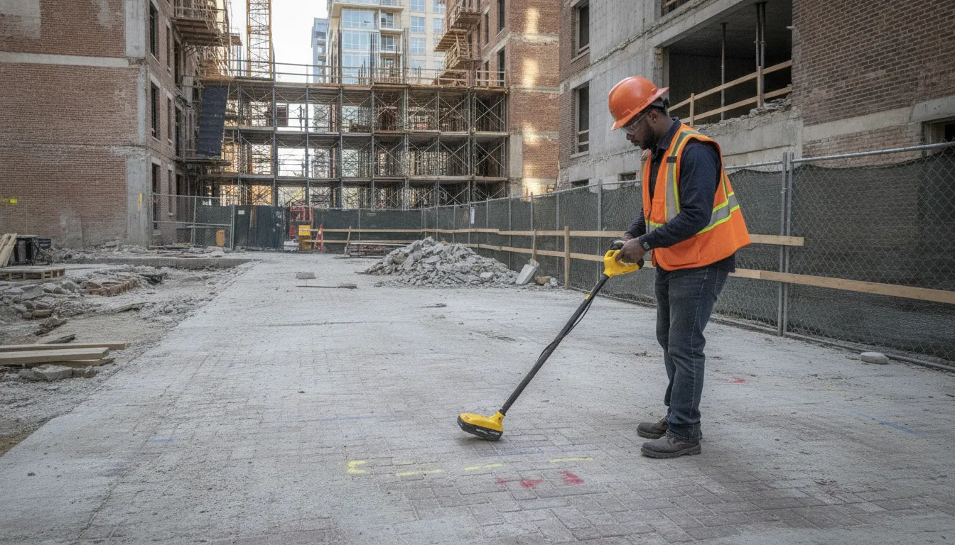
In Washington, DC, an excavation plan can intersect with private electric, gas, water, sewer, communications, or storm-drain lines that are not included in public 811 marks. Urban construction teams need a clear picture of both the planned work area and the underground infrastructure before site work, trenching, boring, or grading begins.
Ready to discuss your site? Contact SafeLine through the website form with the project location, work limits, and planned excavation.
Private utility locating in Washington, DC helps project teams identify privately owned or otherwise unmarked underground utilities and verify existing marks before construction. SafeLine combines field investigation, utility marking, and documentation to support safer planning. It supplements required 811 notification; it does not replace it.
The right scope depends on what your team plans to disturb, what records and marks are already available, and how congested the site may be. Start by understanding what private utility locating in Washington, DC covers and where it fits into the preconstruction process.
What Private Utility Locating in Washington, DC Covers
Private utility locating in Washington, DC identifies buried infrastructure that may fall outside public 811 marking coverage and helps project teams understand subsurface conditions before construction begins. It complements, rather than replaces, the required 811 notification and marking process.
For a commercial project, the work can include locating private lines, checking existing 811 marks, and documenting findings that support site work, additions, facility expansions, and larger construction projects. SafeLine's private utility locating in Washington, DC service is intended for this type of planning and field investigation.
How private locating complements 811
811 coordinates notifications to facility operators so they can mark the public utilities within a planned excavation area. Those marks remain an essential part of safe digging. Private locating addresses a different need: identifying privately owned or privately maintained lines that public 811 services do not mark, and independently verifying existing 811 marks when project conditions call for additional information.
This distinction matters on commercial sites because the planned work may extend across multiple areas, phases, or facility systems. A project team may need to account for buried infrastructure serving a building or site, not only utilities operated by public providers. The investigation should therefore be coordinated with the 811 process, existing site information, and the actual excavation limits.
Why it matters for commercial construction
Construction teams can use private locating to inform excavation planning, utility coordination, design decisions, and communication between owners, engineers, and contractors. It can support work on construction sites, site improvements, additions, and facility expansions without turning this informational step into a substitute for engineering judgment or required notifications.
For a broader planning framework, review SafeLine's private utility locating project-planning guide. The key question is not whether a team has called 811, but whether it has also addressed private utilities and verified the subsurface information relevant to the planned work.
Why Urban Construction Sites Need More Than a Basic Utility Mark
Urban construction needs more than a basic utility mark because roads, buildings, and active services can concentrate underground lines in a limited work area. A one-call request remains required, and private locating can add detail for lines outside public marking coverage.
In Washington, DC, work zones can change quickly. Road and highway maintenance, general construction, grading, trenching, and boring all create excavation risk. These activities may cross a planned corridor, occupy a narrow right-of-way, or pass near existing buildings and active infrastructure. PHMSA identifies road and highway maintenance and general construction among activities that can cause excavation damage, including damage associated with trenching and boring. PHMSA's excavation-damage guidance provides the underlying safety context.
One-call coordination is the starting point
Before digging, the project team should contact the applicable one-call center. The center collects the planned dig location and contacts facility operators that may have underground infrastructure in the area. Operators can then locate and visibly mark facilities before excavation begins. The safe-digging sequence includes making the required notification, waiting for marks, respecting those marks, and digging with care.
Private locating does not replace 811. It addresses a different need: identifying private lines that public 811 services may not mark and independently checking existing marks when the project requires additional information. Learn how private locating works with 811 before setting the field plan.
Why disruption risk matters beyond the work zone
A strike can affect more than the crew at the excavation. PHMSA notes that hitting an underground utility can harm people nearby and disrupt vital services for an entire neighborhood or community. It may also create fines and repair costs. That makes utility coordination important for service continuity, traffic planning, and sequencing, not only for marking the immediate dig area. A more complete investigation can help a team plan around crowded corridors before a trench, bore, or road cut begins.
For urban projects, the practical goal is a coordinated picture: complete the required one-call process, identify private utilities, verify relevant marks, and document the information the field team will use.
What Public Records and Surface Markers May Not Tell You
Public records, existing markings, and 811 results can provide important starting points, but they do not necessarily define every buried utility's exact route or depth. Private utility locating adds field verification, helping a project team compare available information with conditions observed at the site before excavation begins.
Surface markers are useful signals, not excavation boundaries. The Pipeline and Hazardous Materials Safety Administration explains that pipeline markers show a general pipeline location or right-of-way, not the precise location or burial depth. It also advises excavators not to rely solely on markers to decide where digging is safe. PHMSA's excavation-damage guidance supports treating markers as one part of a broader locating and damage-prevention process.
How the information fits together
Public records may show known infrastructure, easements, or historic site information. General surface markers can help orient a crew in the field. An 811 notification allows potentially affected facility operators to identify and visibly mark their facilities before excavation, where the applicable one-call process covers them. Those functions are different, and private locating does not replace the required 811 notification.
Records and marks are not automatically wrong. They may be accurate for the information and scope they represent, while still leaving uncertainty about later changes, private lines, service connections, or exact horizontal and vertical position. PHMSA notes that damage can occur when underground facility locations are not properly determined, and its damage-prevention summaries organize requirements around excavators, operators, and one-call centers.
A field investigation can therefore be the practical next step when planned work approaches marked utilities or when site information does not answer the crew's specific excavation question. SafeLine can locate private utilities and independently verify existing 811 marks. Read how private locating works with 811 before finalizing the work plan.
How SafeLine Uses EM and GPR for DC Utility Locating
SafeLine combines Ground Penetrating Radar (GPR) and Electromagnetic (EM) locating to investigate underground infrastructure in Washington, DC. GPR can support metallic and non-metallic detection, while EM is used for conductive lines. The methods provide complementary information, but site conditions still affect results.
GPR sends radar energy into the ground and reads changes in the subsurface to help identify buried features. That makes it useful when a project team needs to investigate infrastructure that may not provide a conductive signal, including some non-metallic utilities. It can also support detection of metallic infrastructure. GPR results depend on soil, surface conditions, depth, and the physical properties of the buried feature. Interpret the findings as part of a broader investigation, not as a guarantee of detection.
EM locating uses electromagnetic signals to trace conductive lines. A conductive utility or an accessible tracer wire may provide a signal that helps the locator follow its path. However, not every buried line is conductive, and a weak, interrupted, or unavailable signal can limit the result. This is why EM alone is not a complete answer for every site.
| Method. | Best suited to. | Important limitation. |
|---|---|---|
| EM locating. | Conductive lines that can carry or respond to an electromagnetic signal. | Non-conductive lines and weak or interrupted signals may not be traceable. |
| GPR. | Investigating metallic and non-metallic subsurface features. | Soil, depth, surface conditions, and utility properties affect detection. |
| Combined approach. | Cross-checking different types of underground information. | Neither method detects every utility in every condition. |
For a DC construction site, the practical value is choosing methods that match the suspected utility and site conditions, then documenting what the field investigation supports. Read the GPR and electromagnetic locating methods guide for a closer comparison. SafeLine's approach is private utility locating and subsurface investigation, not concrete scanning.
What a Washington, DC Utility Locating Project Can Deliver
A Washington, DC utility locating project may produce a field picture of buried infrastructure that supports safer planning, coordination, and excavation. Depending on site conditions and the requested scope, that picture can include marked utility routes, mapping, verification photos, and written documentation. The output should reflect what was investigated and observed, rather than promise a fixed format or level of accuracy for every site.
Utility categories to consider
Project teams may need to investigate more than the lines shown through public records or 811 coordination. Potential categories include electric feeders, gas mains and services, water and sewer infrastructure, communications and fiber, storm drainage, and industrial process lines. The relevant scope depends on the property, planned work, available records, and access to the area. SafeLine lists these categories as examples of commercial locating work, not as a guarantee that every category is present or detectable at a particular site.
Field findings and supporting records
On site, markings can communicate the interpreted path of a utility for coordination with excavation and construction crews. A project may also include private utility mapping, verification photos, and documentation that helps engineers, owners, and contractors review findings after field work. These materials can be useful when planning a work area, comparing field conditions with existing plans, or communicating subsurface information among project stakeholders.
Deliverables vary with the investigation request and site conditions. Ask for the documentation format that best fits your project workflow, and make sure the team understands which utilities, limits, and planned excavation areas are in scope. See SafeLine's utility mapping and documentation service for more detail on how these project records can support decision-making.
Share your project limits and utility locating needs through SafeLine's contact form.
How to Schedule Private Utility Locating Before Work Begins
To schedule private utility locating in Washington, DC, share the work area, planned excavation, existing plans, 811 information, access needs, and desired deliverables. SafeLine can then scope the investigation around the actual work.
- Define the site limits. Provide the site address and identify the specific work limits. A construction footprint, addition area, roadway segment, or facility expansion may not match the full property boundary. Marking the intended investigation area helps the team understand where private utilities could affect the planned work.
- Describe the planned work. Explain whether the project involves excavation, trenching, boring, grading, site work, an addition, or another subsurface activity. Include the approximate depth or alignment if known, along with the areas where equipment, foundations, or new utility connections are expected. SafeLine's commercial locating work covers construction sites, large-scale projects, site work, additions, and facility expansions.
- Share plans and 811 details. Send available utility plans, as-builts, surveys, prior mark-out information, and the 811 ticket details. Private locating supplements the required 811 notification; it does not replace calling the applicable one-call center before excavation. If public marks are already present, note that SafeLine can independently verify existing 811 marks as part of the investigation. For more detail, review how private locating works with 811.
- Flag access constraints. Tell the team about locked gates, occupied areas, traffic controls, restricted work hours, sensitive surfaces, active operations, or other conditions that could affect field access. Also identify who will provide site access and whether the work area must remain clear during locating.
- Specify the desired deliverables. Ask for the outputs that fit the project decision: field markings, private utility mapping, verification photos, or supporting documentation. SafeLine describes these as available service deliverables, but the appropriate format should be agreed during project scoping. You can also review the utility investigation process before submitting your request.
- Coordinate the field visit with the project team. Align the locating visit with the current plans, site access, and the people responsible for excavation or design decisions. SafeLine states that emergency availability is offered for time-sensitive work, but no response time should be assumed. Explain the urgency and site conditions through the contact form so the request can be evaluated accurately.
Share your Washington, DC project details through the contact form.
Frequently Asked Questions
Does private utility locating replace calling 811?
No. Private locating supplements the required 811 notification, rather than replacing it. The one-call process alerts participating facility operators so they can mark the buried facilities they own or operate. SafeLine can then investigate private lines outside public 811 marking coverage and independently verify existing 811 marks. Before excavation, follow the applicable one-call process, wait for marks, respect them, and dig with care. PHMSA outlines these safe-digging steps.
What utilities can be investigated on a DC project?
Depending on site conditions and the requested scope, a private investigation may include electric feeders, gas mains and services, water and sewer infrastructure, communications and fiber, storm drainage, and industrial process lines. SafeLine's commercial locating work supports construction sites, site work, additions, facility expansions, and larger projects. The appropriate scope depends on the planned excavation, available records, access, and the utilities expected within the work area.
When should a DC project team request private locating?
Request it during project planning, before excavation, trenching, boring, grading, or other intrusive work begins. It is especially useful when the site may contain privately owned lines, when existing 811 marks need independent verification, or when the team needs mapped documentation for coordination. Share the site limits, planned work, schedule, access constraints, existing plans, and 811 ticket details so the investigation can be scoped to the project.
How do EM and GPR work together?
Electromagnetic, or EM, locating is used for conductive lines. Ground Penetrating Radar, or GPR, can support detection of metallic and non-metallic infrastructure. Using both methods gives the field team complementary ways to investigate underground conditions, rather than relying on one signal type alone. Neither method detects every utility in every condition, so findings should be interpreted with site information and documented through appropriate markings, mapping, photos, or other project deliverables.
Contact us about your DC utility locating needs
Clear site details help project teams plan the next step for underground utility investigation before work begins. To request private utility locating in Washington, DC, contact SafeLine through the website form with your site limits, planned excavation, and any available plans or 811 ticket information. SafeLine can review the request and discuss the locating and documentation needs for your project.