
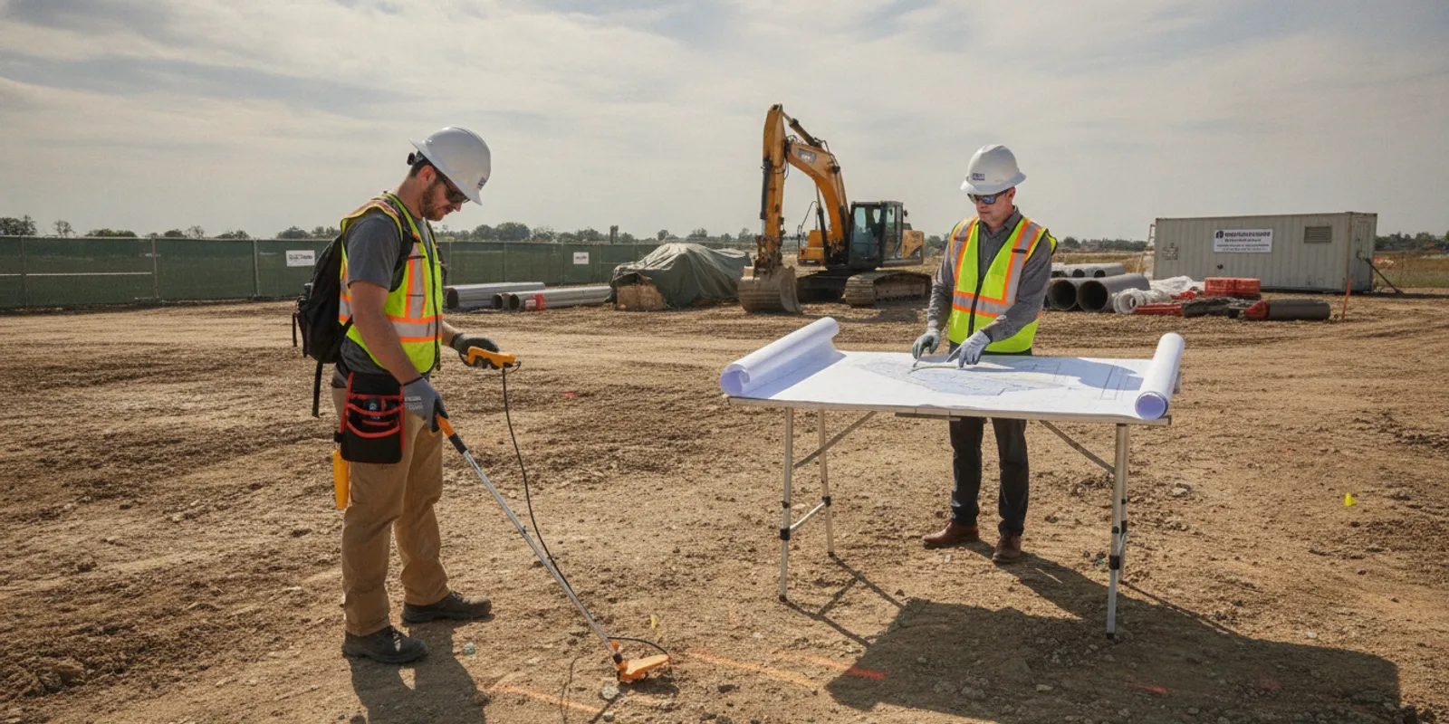
Utility locating for developers is most valuable when it informs a decision before that decision becomes expensive to change. Early information about buried infrastructure can help a project team review a site concept, coordinate design, plan access, and organize fieldwork. An underground electrical line locator may be part of that investigation, but electrical lines are only one part of the subsurface picture.
Why should developers plan utility locating before design is fixed?
A development site can contain public infrastructure, privately owned utilities, and older or abandoned lines. Records may be incomplete, routes may differ from drawings, and visible features rarely show the full underground network. If a project waits until excavation, an unexpected line can stop a crew, trigger a redesign, or require coordination while equipment and labor are already committed.
Early locating gives the team a chance to compare proposed work with indications of subsurface infrastructure. That information may influence building placement, access routes, utility corridors, drainage plans, landscape design, grading, or the sequence of construction. Findings are not a substitute for design decisions, engineering judgment, or field verification. They can, however, help the project team ask better questions while options remain open.
Begin with the decision the investigation must support. A broad site review during feasibility may need different coverage and documentation than a focused locate for a trench alignment. A useful scope names the work area, the planned activity, the information needed, and the point in the schedule when the team will use it. This keeps the request practical instead of treating every project as the same locating assignment.
What should the development locating scope answer?
A clear scope helps the locating provider understand the assignment and helps the developer evaluate whether the resulting information will be usable. Define these items before requesting fieldwork:
- Project limits: Identify the parcel, accessible areas, proposed limits of disturbance, and off-site connections that matter to the design.
- Planned work: Describe proposed buildings, grading, roadway work, utility installation, landscaping, demolition, or test excavations.
- Decision stage: Explain whether the investigation supports feasibility, design development, preconstruction planning, or a specific excavation.
- Known infrastructure: Share utility records, as-builts, site plans, previous surveys, and information from property or facilities staff.
- Required output: State whether field markings, photographs, mapping, or a written record are needed, and identify the people who must review it.
- Site constraints: Note access rules, active operations, paving, landscaping, traffic, security, vegetation, and areas that cannot be entered.
- Schedule: Provide the design milestone, mobilization date, or excavation date that makes the information useful.
A site-wide request without a defined objective can create mismatched expectations. The provider may investigate only the areas and methods permitted by the agreed scope, while the developer may assume the entire parcel was reviewed. If the design is changing, identify which plan is current and how the field team will receive updates. A marked-up concept drawing and a current civil plan may lead to different questions, so label each document by date and revision.
For larger developments, divide the scope into zones. For example, the first phase might cover a proposed building pad and its access road, while later work covers a detention area or utility extension. This lets the team connect each finding to a specific decision and makes it easier to revisit an area when the layout changes.
How do 811 and private locating fit together?
Contact 811 before excavation as required by applicable rules and the project schedule. The one-call process coordinates public utility marking within its coverage. It does not necessarily identify every privately owned line on a parcel. Private infrastructure can include electrical feeds serving site buildings or outbuildings, private lighting, irrigation controls, communication lines, and facilities installed by a previous owner or contractor.
For development work, make the public locate and private investigation complementary rather than treating one as a replacement for the other. Confirm the one-call ticket status and markings, then determine whether private facilities or additional project areas need separate investigation. Keep ticket information and private locating documentation with the current construction package so crews can distinguish the sources and dates of the information.
The Federal Highway Administration's utility locating guidance explains that successful detection depends primarily on the composition and construction of the line of interest. That is one reason a project should not assume a single locating approach will reveal every utility under every site condition. The guidance supports discussing target construction, site conditions, and method limits rather than requesting an undefined search.
Developers can also review how private locating differs from 811 and use the guide to what 811 does not cover when coordinating responsibilities. These resources do not replace the applicable one-call process or the project safety plan.
How can EM locating and GPR support an investigation?
Electromagnetic (EM) locating and ground penetrating radar (GPR) provide different kinds of information. The appropriate method depends on the target, site conditions, access, and investigation objective. Method choice should be discussed as part of the scope rather than assumed from the word “locate.”
EM equipment detects electromagnetic signals associated with conductive utilities, often by tracing a signal applied directly or indirectly to a line. It can be useful for tracing accessible conductive pipes, cables, or other metallic infrastructure. Its usefulness depends on whether a target can carry or transmit a detectable signal and whether nearby conditions interfere with tracing. A signal path may also require interpretation when several lines occupy a congested corridor.
GPR sends energy into the ground and records reflections from changes in subsurface materials. It can help investigate targets that do not provide a conductive path, including some non-metallic utilities, depending on material, depth, soil conditions, surface conditions, and access. GPR responses require interpretation; a response is not automatically proof of a specific utility type. A project team should ask how observations will be documented and what uncertainty remains.
Using both methods can provide complementary evidence in some settings, but neither method guarantees detection of every buried feature. Surface conditions, soil composition, depth, congestion, access, and target construction can affect results. The SafeLine resource on the difference between GPR and EM locating can help a project team frame that discussion. Developers can also review the GPR investigation service information when a project may involve non-metallic or difficult-to-trace targets.
How do common development scenarios compare?
The scope should reflect what the team plans to do. The table below is a planning aid, not a promise that every target will be detectable or that a particular method is always sufficient.
| Development situation | Planning question | Information to discuss | Useful next step |
|---|---|---|---|
| Early site feasibility | Could buried infrastructure affect the concept or usable area? | Parcel boundaries, known records, concept plan, access, and intended coverage. | Identify areas that could change the site concept and document open questions. |
| Building or road layout | Where might foundations, pavement, or access conflict with utilities? | Current design drawings, limits of disturbance, proposed grades, and decision dates. | Compare observed indications with the current plan before fixing the layout. |
| New utility corridor | What existing lines may cross or run near the proposed route? | Alignment, tie-in points, work width, known public marks, and required mapping. | Define the corridor and tie-in areas instead of requesting only a parcel-wide search. |
| Focused excavation | What is in the specific dig area before work proceeds? | Exact dig limits, depth and activity, ticket status, access, and timing. | Coordinate current markings and documentation with the excavation crew. |
| Phased construction | Which areas need investigation now, and what may change later? | Phase boundaries, construction sequence, current plans, and a revision process. | Track each phase separately and review new work against prior coverage. |
Consider a hypothetical mixed-use site where the first concept places a building near an existing service drive. A broad early investigation might reveal indications that cause the team to compare two access options. Later, once the building footprint and utility tie-in are fixed, a focused investigation can address the actual corridor and excavation area. The first exercise supports planning; it should not automatically be treated as the final locate for the later dig.
Similarly, a subdivision project may have different needs at the entrance, roadway, individual lots, and common utility corridors. Combining every area into one vague request can make the output harder to interpret. A zone-based plan can show which findings affect the road alignment, which affect a lot, and which require coordination with a public utility or design consultant.
What records and site information should a developer assemble?
Gather records that help the field team understand the site and help project staff interpret the results later. Useful material can include utility plans, previous survey or investigation reports, construction as-builts, property drawings, aerial images, and notes from facilities or maintenance personnel. Mark records as confirmed, approximate, or historical when their reliability is uncertain.
Provide a current plan with a recognizable scale or dimensions and identify the limits of work. If the work area is large, show the proposed investigation area distinctly from the full parcel. Include the person who can answer questions in the field and arrange access to locked, gated, occupied, or restricted areas. If an off-site connection matters, show it rather than assuming the provider will infer its route from the parcel boundary.
Tell the provider about paved surfaces, thick vegetation, standing water, construction activity, stored materials, parked equipment, and other obstructions. Share known restrictions on vehicle access or field markings. These conditions can affect where equipment can be used and how findings can be documented. Do not ask a field team to infer permission to enter an area.
The private utility locate checklist offers a preparation reference. If the work is contractor-led, the contractor locating information can help align the field request with construction needs. A developer should still confirm that the selected documents match the current design and intended disturbance.
How should teams coordinate locating around active site work?
Development sites often change between the time a request is made and the time fieldwork begins. Coordinate access and timing with the construction manager, site superintendent, property representative, and relevant design staff. Confirm that equipment or materials will not block the investigation areas and that escorts, inductions, traffic controls, or access permissions are arranged.
Before the visit, designate one person to resolve field questions and explain how the team should handle newly discovered work or inaccessible areas. If grading, clearing, or demolition is underway, state what has already changed. Ground disturbance can remove visible references or alter access, so sequence the investigation with site preparation where possible.
For phased work, treat the site plan as a controlled project document. Identify its date and revision, communicate changes, and avoid distributing an earlier mark-up as though it were current. If a new building, trench, or staging area is added after fieldwork, ask whether the existing investigation covers it or whether the scope needs review. A locate is tied to the area and conditions investigated; it should not be assumed to apply automatically to a changed layout.
Build a short coordination routine around the field date. Confirm the plan revision, access, visible public marks, work limits, and site contact. After the visit, confirm which areas were covered and which were not. This simple before-and-after check can prevent a project team from relying on a document that no longer matches the site.
What should the project team review after fieldwork?
Review the findings with the people who will use them: the designer, project manager, superintendent, excavation contractor, and others responsible for work in the affected area. Confirm coverage limits, date, methods used where documented, and any areas that could not be accessed or interpreted. Match field information to the current design rather than relying on a plan that has since changed.
Field markings can communicate findings at the site, while photographs and mapping can preserve context for planning and coordination. Ask how marks are represented in any deliverable, what symbols or colors indicate, and whether the documentation identifies uncertainty or limitations. SafeLine's investigation process and deliverables page describes the types of project information to discuss.
Record findings in the project file and brief crews before affected work begins. Keep relevant documentation accessible on site. If field conditions do not match the plan, or work exposes an unanticipated feature, stop the affected activity and follow the project's safety and utility coordination procedures. Do not treat an ambiguous indication as clearance to excavate.
It is useful to distinguish four questions in the review: What area was investigated? What was observed? What could not be confirmed? What action does the design or field team take next? Separating those questions helps prevent a field mark from being mistaken for a complete map or an interpretation from being treated as certainty.
When should a developer request utility locating?
Consider requesting an investigation when subsurface information could change a site decision or when the work area and scope are stable enough for useful field coverage. Early feasibility work can flag questions for design coordination. Design development can help compare an alignment or layout with observed indications. Preconstruction locating can then support a defined work area and excavation plan.
These stages are not interchangeable. An early site-wide investigation may not provide the focused information needed for a later excavation, especially if plans or site conditions have changed. Build time into the schedule to define the request, arrange access, conduct fieldwork, and review deliverables. If timing is compressed, state the deadline and the specific decision it affects when asking about availability.
Use SafeLine's utility locating and mapping services information to identify the relevant service discussion, and review service-area details for project coverage. Scope and site conditions determine what can be addressed for a particular request.
What should a developer include when requesting a quote?
A complete request makes it easier to discuss whether proposed work fits the project's needs. Include:
- Project address and a site plan that clearly identifies the area of interest.
- Project type, current phase, and the decision or field activity the information must support.
- Proposed buildings, roads, trenches, grading, tie-ins, or other planned disturbance.
- Known utility records, prior reports, public locate status, and information about private systems.
- Site access arrangements, surface conditions, active operations, and restricted areas.
- Desired timing and deliverables, such as field markings, photographs, or mapping.
- A project contact who can answer questions and approve scope clarifications.
- Any changed drawing or revision that makes an earlier investigation incomplete or uncertain.
For a development spanning multiple parcels or phases, identify priorities rather than assuming every area needs the same level of investigation at once. A provider can then discuss scope, methods, timing, and deliverables against actual site information. The SafeLine project contact page is the starting point for that discussion.
Frequently asked questions
Does a developer still need private locating after calling 811?
Often, the project may need additional investigation because 811 coverage does not necessarily include privately owned utilities beyond the public utility's responsibility. Confirm the ticket and its coverage, then discuss private facilities, project areas, and deliverables separately.
Should a developer request GPR or EM locating?
That depends on the target, its construction, site conditions, access, and the decision the investigation must support. EM can help trace conductive utilities, while GPR may provide information about some non-metallic or otherwise difficult-to-trace targets. A provider should discuss method fit and limitations for the site.
Is an early development locate valid for construction months later?
Not automatically. A later design revision, new construction, changed surface condition, or different excavation area can make a new review appropriate. Compare the current plan and work limits with the earlier investigation before relying on it.
What should happen if markings and drawings disagree?
Pause the affected planning or excavation activity and have the project team follow its utility coordination and safety procedures. Document the discrepancy, confirm the current records and scope, and resolve the question before treating the area as ready for work.
Planning utility locating early gives developers a clearer basis for coordinating design, site access, and excavation while keeping the limits of the investigation visible to everyone who will rely on its findings.