
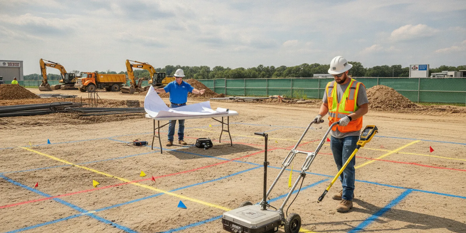
Utility locating for general contractors is most useful when it is planned around a specific construction decision: where crews can excavate, what conflicts need resolution, or what information belongs in the project record. A private investigation can complement public utility notifications by addressing privately owned lines and other features that may not be included in public markings.
Share your project details and request a locating plan
Why should general contractors plan private utility locating?
Construction teams often work with information from several sources: design drawings, owner records, site observations, and public utility marks. These sources serve different purposes and may not show every underground feature in a planned work area. A private locate can help investigate the portion of the site or infrastructure that is not covered by public marking, and help the project team plan work with a clearer view of potential conflicts.
Calling 811 remains an important step before excavation wherever required. Public one-call marking generally concerns facilities owned by participating utility operators up to a defined service boundary, such as a meter or property line. It does not automatically identify every privately owned utility on a site. For example, a project may involve private electrical feeds, irrigation, site lighting, or lines serving outbuildings. The exact assets and coverage depend on the property and project. For additional industry guidance on excavation damage prevention, see the Common Ground Alliance.
Private locating does not replace 811, design coordination, or safe excavation practices. Treat it as another information layer. For a deeper explanation of how the two services differ, see private utility locating vs. 811 and the guide to what 811 may not cover.
What should the locating scope answer?
A useful scope connects the field investigation to the next project decision. “Locate utilities” may be too broad to guide a field team or evaluate a proposal. Before requesting service, state what work is planned, where it will happen, and what information the contractor needs back.
- Define the work area. Identify the limits of excavation, grading, boring, trenching, foundation work, or other ground disturbance. Include access routes and staging areas if they matter to the investigation.
- Name the decision or conflict. Explain whether the team is planning a new alignment, checking a design conflict, preparing a phase of site work, or verifying an area before excavation.
- Describe the known utilities. Share owner records, existing plans, previous locate reports, visible structures, and public markings. Label information as confirmed, approximate, or unverified rather than treating all records as equally reliable.
- Identify required coverage. List the specific area or corridors to investigate and any known facilities that require attention. If the scope is phased, identify which phase needs fieldwork first.
- Specify the deliverable. State whether field markings are sufficient or whether the project also needs photographs, a written report, mapped observations, or digital documentation.
- Set schedule and access constraints. Provide target dates, site hours, escort requirements, active work zones, and any restrictions on vehicle or equipment access.
These details help the provider understand the field effort and help the general contractor compare proposals on a like-for-like basis. It also helps to separate confirmed project requirements from questions that still need review. A plan may show a utility route that is approximate, while the field team needs to focus on a proposed crossing. Note the source and date of important records when known, and mark the exact area where the conflict matters. If several work zones compete for attention, rank them by construction sequence or decision deadline. This lets the provider discuss whether the scope should be divided into priorities instead of treating the entire property as one undifferentiated area. SafeLine’s pre-excavation locate checklist can help organize the information before contacting a provider.
How should locating fit into the construction schedule?
Do not treat locating as a last-minute task that begins only when an excavation crew is ready. Plan it as a project activity with time for records review, site coordination, field investigation, marking or documentation, and follow-up questions. The right lead time depends on the site, access, investigation area, project schedule, and requested deliverables, so confirm timing when you request a quote.
During preconstruction, compare the proposed work area with available plans and identify where information is incomplete or where utility conflicts could affect design or sequencing. Arrange private locating early enough for the findings to inform decisions that are still open. If the design is changing, tell the locating provider which version of the plans is current and how the proposed limits may shift.
Before mobilization, confirm that the site will be accessible and that the requested area is available for investigation. Coordinate with the owner, site superintendent, and other trades so the crew can work safely without conflicting with active operations. If access is restricted or the site has changed since records were prepared, flag that in advance.
Build realistic handoffs into the schedule. A locating visit may depend on receiving usable plans, arranging an escort, clearing equipment from the work area, or obtaining access to a secured portion of the property. The project manager should identify who can resolve those dependencies and ensure that person is available. If the work area is split across multiple mobilizations, clarify whether marks and deliverables will be provided after each phase or after the full investigation. That distinction can affect when the superintendent can brief crews or release a work area.
Before excavation begins, make sure the field team understands what was investigated, where marks or observations apply, and what areas remain outside the scope. Preserve project documentation and communicate relevant findings to the foreperson and affected trades. If planned work moves beyond the investigated limits, do not assume the existing information covers the new area; clarify the additional scope.
When an unexpected line or discrepancy appears, pause the affected activity and use the project’s safety and escalation procedures. Compare the field condition with the available records and investigation deliverables, then determine what additional review or locating is appropriate before proceeding. A locate is information for planning; it is not permission to excavate without following applicable requirements and safe work procedures.
Which methods may be used on a contractor’s site?
Method selection depends on the target, site conditions, and the question the investigation needs to answer. Electromagnetic (EM) locating is used to trace conductive utilities or a signal applied to a conductive line. Ground penetrating radar (GPR) can support investigation of subsurface features, including some non-metallic utilities, but results depend on conditions such as soil, moisture, target characteristics, and site congestion. Neither method should be presented as a guarantee that every buried object will be detected.
For that reason, a combined approach may be appropriate: EM equipment can help trace conductive targets while GPR adds another means of investigating subsurface conditions. The provider should explain why the selected method fits the site and what limitations may affect the result. SafeLine describes its utility locating and subsurface investigation services and its GPR investigation approach online.
When the project needs more than field marks—for example, information to support design coordination or a record of mapped utilities—ask whether a broader subsurface utility engineering (SUE) scope or utility mapping deliverable is appropriate. SUE planning can align the investigation with the design question and the level of information the project needs. The SUE overview explains the general discipline, while the utility mapping and documentation service page describes mapping deliverables.
How do locating options compare?
The table below compares broad investigation choices, not fixed packages. A provider should confirm the suitable scope after reviewing the project details. For mobile readability, the comparison can be scrolled horizontally.
| Approach | Useful when | What to clarify | Typical project output |
|---|---|---|---|
| Public one-call notification | Required public utility notification and marking before covered excavation | Ticket limits, response status, marked facilities, and what is outside the operator’s scope | Operator markings or responses within the one-call process |
| Private utility locating | The project needs investigation of privately owned utilities or areas not addressed by public marks | Area limits, target priorities, access, methods, schedule, and marking/documentation needs | Field markings and any agreed photographs or report |
| GPR-supported investigation | Additional subsurface investigation is warranted, including where targets may not be conductive | Site conditions, intended targets, method limitations, and how findings will be reported | Observations and deliverables defined in the scope |
| SUE or mapping scope | Design or coordination decisions call for structured investigation and documented utility information | Project purpose, investigation limits, required detail, mapping format, and design needs | Agreed report, mapped information, or other project-specific documentation |
These approaches are not substitutes for each other in every situation. Public notification addresses participating operators and applicable requirements. A private locate investigates additional areas or assets within an agreed scope. More involved SUE and mapping work may be suitable when the project team needs structured information for planning or design. Discuss the project purpose first, then choose the level of work and documentation that matches it.
What should you provide when requesting a quote?
A clear request helps the provider assess the site and respond with fewer unanswered questions. Include the following information when available:
- Project location and contact. Give the address, a site contact, the person who can authorize access, and any gate or check-in instructions.
- Plan or sketch. Attach the latest site plan, proposed work limits, utility plan, or a marked aerial image. Identify the current drawing revision.
- Work description. State what construction activity is planned and when the work is expected to occur. Specify the decision the locate will support.
- Known site information. Share utility records, previous reports, public ticket details, visible structures, and known private lines. Note uncertainties rather than filling gaps with assumptions.
- Requested limits and priorities. Mark the boundaries and identify any critical corridors, crossings, or proposed excavation areas that should receive attention.
- Access and safety needs. Explain active operations, escorts, restricted areas, surface conditions, site orientation, and required safety coordination.
- Required output and deadline. Say whether you need surface marks, photos, a report, mapped documentation, or a combination, and when each is needed.
If the site is large, a phased approach may help align investigation with construction sequence. Identify the first work area and future areas separately. This gives the provider a practical starting boundary and lets the project team ask whether later phases can be added under a separate scope. Avoid assuming that information from one phase applies to an uninvestigated part of the property.
How should general contractors compare proposals?
Compare the work described, not just the headline price. One proposal may cover a defined corridor and field marks, while another may include a broader area, reporting, or mapping. Ask each provider to specify the limits, methods, assumptions, exclusions, schedule, and deliverables so the team can see what is included.
- Scope boundaries: Are the investigation limits clear and aligned with the planned work?
- Method rationale: Does the provider explain how EM locating, GPR, or other appropriate methods relate to the site and targets?
- Conditions and limitations: Are access constraints and factors that can limit detection or interpretation stated plainly?
- Field coordination: Who needs to be present, and what must be ready when the field team arrives?
- Deliverable detail: Are marks, photos, reports, or mapped documentation explicitly included rather than assumed?
- Schedule assumptions: Are the proposed field date and delivery timing clear, including any dependencies?
- Change handling: How will additional areas, revised plans, or unexpected site conditions be addressed?
A proposal that spells out limitations is easier to use responsibly than a promise without boundaries. Ask how results will be tied to the site plan and whether marked areas will be identified in a way that crews can recognize on the ground. Clarify whether the provider will document inaccessible areas or targets that could not be assessed as planned. Those notes help the contractor distinguish an investigated area from a gap in coverage. If the deliverable is intended for design coordination, ask who on the project team should review it and whether the proposed format will be usable with the team’s current plans. Confirm what the field markings represent and how the project team should interpret the documentation. If the contractor needs information for design, asset records, or a later construction phase, state that need before work is authorized. SafeLine’s investigation process and deliverables page can help you frame questions about fieldwork and documentation.
What should the field team do with the findings?
Make the locate information part of the project’s coordination process. Keep the report or photographs with the relevant plans, communicate the investigation limits, and brief crews whose work could approach the marked or documented features. Confirm that markings are visible and understandable before the affected activity starts. If markings are disturbed, become unclear, or no longer match current site conditions, ask for clarification rather than relying on an old assumption.
Use the deliverable for the purpose and area it covers. A marked line is not necessarily a surveyed position or a complete utility map. A report may document observations and limitations, not certify that nothing else is underground. Make sure the superintendent, foreperson, and relevant subcontractors know whether they are looking at public marks, private locate marks, design information, or another source.
For projects involving multiple parties, assign an owner for keeping the information current. That person can circulate revised drawings, preserve field records, and flag design changes that affect the investigated area. If construction uncovers a condition that differs from the locate information, follow the project’s stop-work and notification procedures and have the discrepancy evaluated before the work continues.
How can a project team start planning?
Start with a marked-up plan and a short description of the construction decision. Add the known utility records, public notification details if available, requested schedule, access constraints, and desired output. Then ask the locating provider to confirm the investigation limits, proposed methods, deliverables, assumptions, and any important limitations.
SafeLine Private Locating provides private utility locating, GPR, SUE, and underground utility mapping services across Virginia, Maryland, Washington, DC, and North Carolina. The company uses EM locating equipment alongside GPR where method context fits the investigation. To review regional coverage, visit the service areas page, or learn more about subsurface investigation for contractors.
Send your plans and request a project-specific scope
Frequently asked questions
Does private utility locating replace calling 811?
No. Follow applicable one-call requirements before excavation. Private locating can add investigation of private utilities or areas that public marking does not cover, but it does not replace the public notification process.
When should a general contractor schedule a private locate?
Schedule it early enough for the findings to inform the relevant construction or design decision, and confirm timing with the provider. Allow for site access, coordination, fieldwork, and any requested documentation rather than waiting until excavation is about to start.
Can GPR locate every underground utility?
No detection method should be treated as a guarantee that every buried object will be found. GPR results can depend on site and target conditions. Ask the provider what the selected method can address, what limitations may apply, and how results will be communicated.
What should a contractor send to get a useful quote?
Provide the site location, current plan or sketch, proposed work limits, project schedule, known utility information, site access requirements, and the deliverables needed. Identify the construction decision the investigation is meant to support.
A clearly defined scope, coordinated field visit, and understood deliverable help the project team use locating information as one part of a safe, well-coordinated excavation plan.