
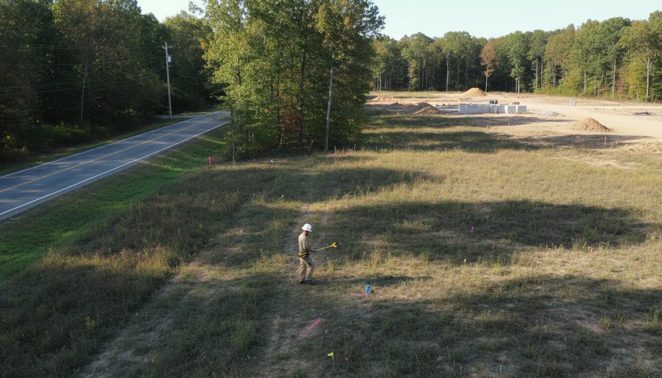
Planning to dig for a fence, addition, driveway, or utility connection in Loudoun County? A project can involve lines that are not included in standard public marking, especially infrastructure beyond a meter or property line. Confirming what is underground before excavation gives your team better information for safer planning.
Use the contact form to plan your locate
For utility locating loudoun county va projects, start by confirming 811 markings, then address private utilities that may require a separate investigation. SafeLine combines electromagnetic (EM) locating and Ground Penetrating Radar (GPR) as complementary methods, with the appropriate approach depending on the target and site conditions.
SafeLine's statewide private utility locating guide provides broader context. The local planning question is what a county-focused investigation can cover, how public and private locating fit together, and what information to gather before work begins.
What Utility Locating in Loudoun County, VA Involves
Utility locating in Loudoun County, VA is a project-specific investigation of underground infrastructure that may affect excavation, construction, landscaping, renovation, or site work. The scope begins with the work area, the planned disturbance, and the information already available about the property. That local context matters because the lines serving a home, commercial site, or facility may extend beyond the public utility marking process.
Private locating is especially relevant for infrastructure beyond a meter or property line. Depending on the property and planned work, the investigation may consider private electric, gas, water, sewer, communications, irrigation, and storm-drain systems. A project team may need field markings and documentation that can be used while coordinating excavation or refining site plans.
For commercial work, the scope can include utility detection and mapping for construction sites, additions, site work, and facility expansions. Contractors, developers, engineers, and facility teams can use the findings to identify questions that need to be resolved before digging begins. The right scope depends on the site, the target utilities, access, surface conditions, and the planned work area. It should be confirmed for the specific project address rather than assumed from a county name alone.
SafeLine uses electromagnetic (EM) locating and Ground Penetrating Radar (GPR) as complementary methods. EM equipment can support the investigation of conductive lines, while GPR can assist with metallic and non-metallic utility detection. Method selection depends on site conditions and the target, so EM and GPR are not interchangeable guarantees.
This county-focused page is different from a statewide overview. The statewide private utility locating guide explains the broader service context. Here, the focus is how project teams in Loudoun County and nearby Northern Virginia communities can define a useful locate. Separate public and private utility questions, and confirm whether a specific address fits the project scope.
Why 811 and Private Locating Both Matter Before Excavation
Calling 811 is an important first step before digging, but it does not necessarily identify every line on a property. Public utility marking and private locating address different parts of the subsurface picture. Using both when the project may affect private infrastructure gives the excavator better information for planning the work area.
Virginia's Positive Response System communicates the status of utility marking for a proposed excavation. Virginia law says excavators must review and heed that status before beginning excavation or demolition. In practice, that means checking the response, respecting the marks, and understanding what the response does and does not cover. Leesburg's published guidance also advises calling Miss Utility 48 hours before planned excavation.
| Public 811 | Private locating | Combined planning |
|---|---|---|
| Coordinates marking of utility lines operated by participating public utility companies near the proposed excavation. | Investigates private lines that may fall outside the standard Miss Utility process, including infrastructure beyond a meter or property line. | Uses public marks and private findings together to inform the planned excavation area, field coordination, and project documentation. |
| In Virginia, positive-response codes communicate the marking status. Code 12 indicates that a known private utility line is present. | Can address property features such as a water pipe from the meter to a building. A sewer lateral, irrigation, pet-fence wire, or power serving a lamp post or outbuilding. | Helps the project team identify which utilities require follow-up before work starts, without assuming that one request covers every line. |
These distinctions matter in Leesburg and throughout Northern Virginia. A positive response does not automatically mean that every privately owned line has been marked. When the response identifies a private utility, or when site history suggests one may exist. The Virginia State Corporation Commission directs the excavator toward the private utility owner or an appropriate locating resource. Leesburg likewise recommends contacting a private utility locating service for private underground utilities.
For a practical overview of planning and field work, see this Northern Virginia utility locating guide. The right next step depends on the planned excavation, known property improvements, and the target utilities. Public 811 notification and private locating are complementary safeguards, not interchangeable services.
How EM Locating and GPR Work Together on Northern Virginia Sites
EM locating and Ground Penetrating Radar (GPR) answer different questions in the field. Using them together can help a locating team choose an approach that fits the utility target and the conditions at a Northern Virginia property. Neither method should be treated as a universal guarantee, because surface conditions, access, utility construction, and other site factors affect what can be detected and interpreted.
When EM locating is a good fit
Electromagnetic locating is suited to conductive lines. The equipment can work with a signal associated with a conductive utility, helping the technician trace its likely route and identify changes that deserve further investigation. This approach is useful when the target can carry or receive the relevant signal and when the site allows the technician to work along the suspected alignment.
Where GPR adds information
GPR sends radar energy into the ground and reads subsurface responses. SafeLine describes GPR for detecting both metallic and non-metallic utilities, while EM equipment is used for conductive lines. That distinction matters when a project may involve materials or infrastructure that do not respond to an electromagnetic signal. GPR results still depend on soil, moisture, surface materials, depth, congestion, and other conditions, so the findings require experienced field interpretation.
How the method is selected
A practical investigation may consider both tools rather than assuming one replaces the other. Method selection typically follows the target and the site:
- Target: Consider whether the suspected utility is conductive, non-metallic, or not well documented.
- Site conditions: Review access, surface cover, soil conditions, congestion, and the area that must be investigated.
- Project purpose: Match the field work to planned excavation, construction, site work, or utility mapping needs.
- Deliverables: Use field markings and documentation to help the project team coordinate the next step.
For a project in Loudoun County, Prince William County, or another Northern Virginia location. Sharing the target area and planned work during scoping helps determine which combination of EM locating, GPR, and documentation is appropriate.
Growth-Area Construction: Why Subsurface Surveys Are Critical
Construction planning in Loudoun County often involves more than a building footprint. Grading, excavation, utility connections, site improvements, additions, and facility expansions can all affect areas where underground infrastructure may be present. A subsurface utility survey gives the project team better information before equipment and crews begin disturbing the ground.
Loudoun County states that residential and commercial construction requires permits from the appropriate county agencies. And its Department of Building and Development issues building and grading permits for the county. The county also notes that an approval does not eliminate other approvals required under federal, state, or local law. See the county's building and grading permit guidance for the applicable requirements.
Permits establish whether proposed work meets regulatory requirements. They do not replace field locating. Permit drawings and existing records may not show every privately owned line, later modification, abandoned segment, or connection serving a building. That distinction matters when a project moves from design into grading, trenching, foundations, paving, landscaping, or other excavation.
Coordinate locating with the work plan
Commercial locating work can support construction sites, general site work, additions, and facility expansions through utility detection and mapping. The practical objective is to connect subsurface information to the actual limits of disturbance, planned utilities, access routes, and excavation sequence. Field markings and documentation can then give contractors, developers, engineers, and facility teams a clearer reference during coordination and pre-excavation meetings.
For a proposed project, share the address, work area, drawings or site plan, and the type of ground disturbance being planned. SafeLine can review the scope and determine what utility locating or mapping approach is appropriate for the site.
What Utility Locating Services Include in Loudoun and Prince William
The right scope depends on what is being built, repaired, or excavated and which underground systems may cross the work area. For a residence, utility locating can address more than the lines a public marking request identifies. SafeLine's residential scope includes electric, gas, water, sewer, communications, irrigation, and storm drains. That range is relevant for projects such as additions, fencing, landscaping, drainage work, and other digging where private lines may extend beyond a meter or property line.
Commercial locating is often organized around the project rather than a single utility. Construction sites, site work, additions, and facility expansions may require utility detection and mapping that supports design decisions, excavation planning, and coordination among contractors. The requested work area, available site records, visible utility features, and project objectives all help determine the appropriate investigation scope.
Field locating and markings
Field work is intended to give the project team usable information at the site. Detected lines can be marked in the field so crews can relate underground findings to planned excavation and other work limits. SafeLine describes electromagnetic equipment for conductive lines and GPR for metallic and non-metallic utility detection. These methods are complementary, and the suitable approach depends on site conditions and the target. A site review helps determine how the methods should be applied rather than treating either technology as a guarantee.
Mapping and documentation for project teams
For larger or more coordinated work, field markings may need to be supported by organized records that can be reviewed after the crew leaves the site. Utility mapping and documentation can help homeowners, contractors, engineers, developers, and facility teams carry locate findings into planning conversations and future site decisions. Review SafeLine's utility mapping and documentation service to understand how those deliverables fit into a subsurface investigation.
When requesting a locate, describe the property, planned work, approximate limits, known utility connections, and the type of information your team needs. SafeLine can then discuss the project scope and confirm whether the specific Loudoun or Prince William address is serviceable.
Coverage Areas: Ashburn, Leesburg, Sterling, Manassas, and Woodbridge
Projects in Northern Virginia often reference a community before the project address is fully scoped. For planning purposes, Ashburn, Leesburg, and Sterling are Loudoun County examples. Woodbridge is in Prince William County. Manassas is an independent city and should be treated as part of the broader Prince William and Northern Virginia service context. Not as a subdivision of Prince William County.
SafeLine's stated service territory includes Virginia, Maryland, Washington, D.C., and North Carolina. That broad territory does not, by itself, confirm availability for every community or address. The customer context does not specifically confirm Loudoun County or Prince William County coverage, so project teams should request address-first confirmation before planning around a locate.
What to provide when confirming a project
Share the complete street address, municipality or community, county context, and a concise description of the planned work. For a multi-site project, identify each address rather than assuming that confirmation for one location applies to the others. This gives the team a clear basis to discuss whether the requested work fits the project location and scope.
Homeowners, contractors, developers, and facility teams can review the Virginia utility locating service areas page, then confirm the specific address directly. This approach keeps coverage language accurate while helping project planning start with the location that actually needs investigation.
How to Schedule a Locate in Loudoun or Prince William County
Good scheduling starts with a clear description of the work area. SafeLine uses project details to understand what needs to be investigated, confirm whether the address is within the available service area, and identify the right next steps. Availability for a specific Loudoun or Prince William County address should be confirmed before the field visit is planned.
- Submit the project details. Use the contact form to share the property address, county, site contact, and a concise description of the planned excavation or construction.
- Describe the work area. Include the approximate limits of excavation, proposed depth when known, work type, access conditions, and the date your team hopes to begin. A site plan, survey, utility sketch, or marked work zone can help clarify the request.
- Identify the utility questions. Note whether you need private electric, gas, water, sewer, communications, irrigation, storm-drain, or other underground infrastructure investigated. If public 811 markings are already present, mention that as well so the private investigation can be scoped appropriately.
- Review the proposed scope. SafeLine can explain whether electromagnetic locating, GPR, utility mapping, documentation, or a combination of methods fits the site and target. The subsurface investigation process provides additional context on scoping, field work, and deliverables.
- Confirm the quote and logistics. Pricing is quote-based and depends on the project scope, address, access, and requested deliverables. Confirm the approved scope, site access, markings or documentation needed, and scheduling details before work begins.
For excavation, complete any required 811 notification separately and allow the applicable marking period. Private locating supplements public utility notification; it does not replace it. Providing complete intake information helps keep the investigation focused and makes it easier to coordinate the field visit with your project schedule.
Schedule a subsurface investigation by submitting your project details and asking SafeLine to confirm address coverage and next steps.
Frequently Asked Questions
Do I still need private locating after calling 811?
Yes, when your project may affect utilities that are outside the public 811 scope. Standard public marking may not include lines beyond a meter or property line, such as a private water service, sewer lateral, irrigation system, or power serving an outbuilding. Start with 811, then arrange private locating for infrastructure that public marking does not cover. Virginia's positive-response system also identifies situations involving known private utility lines and directs attention to the private utility owner or locator. Review Virginia's positive-response guidance before excavation.
Will EM locating or GPR work better for my property?
That depends on the target and site conditions. Electromagnetic locating is used for conductive lines, while Ground Penetrating Radar can support detection of metallic and non-metallic utilities. The methods are complementary rather than interchangeable guarantees. A project review can help determine which approach, or combination of approaches, fits the utilities and ground conditions involved.
How far in advance should I schedule utility locating?
Build locating into your project schedule before excavation, grading, or other ground disturbance, and allow time to review the work area and scope. Leesburg's public guidance says to contact Miss Utility 48 hours before planned excavation, but that public notification does not replace private locating when private lines may be present. For a private locate, submit the project details through the contact form so the scope and timing can be discussed rather than assuming a response window.
How can I confirm coverage in Loudoun or Prince William County?
Confirm the specific project address when you request service. SafeLine lists Virginia within its service territory, but availability for an individual Loudoun County or Prince William County address should be verified directly. Include the municipality or community, site address, excavation area, project type, and desired timing in your inquiry. This helps determine whether the requested scope can be planned for your location.
Schedule Your Loudoun or Prince William Utility Locate
Confirming your project address and scope is a practical next step when you need to understand which locating support may fit your work. Complete the SafeLine contact form to discuss your project and request a utility locate for Loudoun or Prince William County. The team can review the details you provide and help clarify the appropriate next step for your site.