
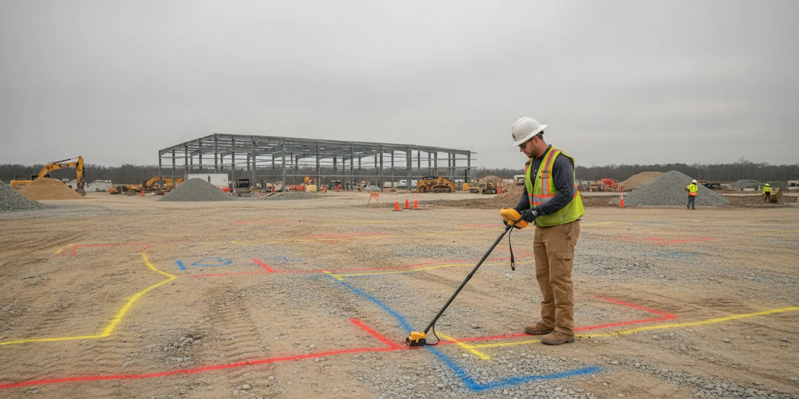
Planning utility locating in Mechanicsville, VA, starts with knowing what information your project needs and which underground facilities may not be shown by a public utility ticket. For a commercial site, defining the work area, excavation plan, available records, and required deliverables early can help the team coordinate investigation before ground disturbance.
Discuss your project locating needs
Why plan utility locating before Mechanicsville site work begins?
Construction and renovation can involve more than the visible service connections at a building. A site may include private electrical feeds, irrigation, lighting, communication lines, water or sewer laterals, gas lines serving site equipment, and abandoned infrastructure. The exact mix depends on the property and its history. Project drawings and recollections can be useful leads, but they may not show every route or reflect later changes.
Public one-call marking and private locating answer different questions. A Virginia 811 ticket is an essential step before excavation, but it does not necessarily identify every privately owned line on a property. For a Mechanicsville project, the practical question is not simply whether a ticket was placed; it is whether the planned work area and likely private facilities have been considered as well. SafeLine's overview of private locating compared with 811 explains how the two fit together.
Plan locating early enough to act on the findings. If a proposed trench, foundation, pole, or drainage feature conflicts with a suspected utility, the design or sequence may need review before crews mobilize. A locate does not eliminate all subsurface uncertainty, but it gives the project team information to consider alongside records, site observations, and safe excavation procedures.
How do 811 and private locating fit together?
Start the required public notification process before excavation and follow its timing, ticket, and marking requirements. Virginia's private utility locating information for Richmond likewise reminds excavators to call 811 before digging. Do not treat a private locate as a replacement for a one-call ticket, or the one-call ticket as a complete survey of private infrastructure.
After public markings are available, compare them with the site limits and proposed work. Ask which facilities are represented, whether the work extends beyond the public utility demarcation, and whether privately owned or unidentified lines could be in the excavation area. A private investigation may help address that remaining scope. SafeLine's guide to what 811 does not cover and its private utility locating overview provide additional context.
Marking conventions help crews interpret information in the field, but a color alone is not a substitute for understanding who marked a line, what area was covered, and when the work occurred. Keep the ticket details and private locate documentation available to the people planning and performing the excavation. Revisit the information if the excavation footprint changes or the project moves to a different area.
What should a Mechanicsville project scope define?
A clear scope gives the locating team a usable boundary and helps project stakeholders compare the requested work with the intended construction. Before requesting a project conversation, collect the following:
- Site location and access: Provide the street address, a site plan or marked aerial, access instructions, and any site contact details the team can share.
- Work limits: Outline the proposed excavation, drilling, grading, boring, foundation, or installation areas. Identify alternate alignments or phases when they are known.
- Depth and work type: Describe the anticipated excavation depth and methods, such as trenching, directional boring, or footing installation. These details help frame the investigation; they do not establish a safe excavation depth.
- Facilities of interest: Identify known or suspected utility types, service destinations, building connections, and any infrastructure shown in available records.
- Schedule: Share design milestones, planned mobilization, and when field information is needed. Allow time to review results before work reaches the affected area.
- Deliverable needs: State whether the team needs field markings, photos, a map, or other project documentation, and who will use it.
- Site conditions: Note paving, landscaping, fencing, equipment, restricted areas, or other access conditions that may affect fieldwork.
Use a plan with a readable scale and a clearly marked work area rather than sending an unannotated, large site drawing alone. If the project has several work zones, label each zone and its sequence. This small preparation step can reduce ambiguity about where investigation is requested and which areas remain outside the defined scope.
SafeLine's private utility locate checklist can help organize pre-request information. For questions about how fieldwork and documentation are handled, review the investigation process and deliverables.
Which records and site context should the team gather?
Collect available plans before fieldwork, but treat them as clues to verify rather than a definitive record of current conditions. Useful material may include utility as-builts, site plans, prior locate reports, construction drawings, maintenance records, and notes from facility staff who know the property. Record where each document came from and whether its date or accuracy is known.
Walk the work area, where access permits, and note visible features that may indicate a service route or utility connection. Examples include meters, valves, cleanouts, handholes, cabinets, poles, transformers, irrigation controls, and equipment pads. Photograph relevant features and mark their locations on the plan. A visible feature can suggest a route; it does not prove what lies between that feature and another point.
Share known changes to the site, such as additions, parking-lot reconstruction, landscaping, or utility repairs. Existing records may predate those changes. If drawings conflict with field markings or visible site features, call out the discrepancy for review rather than choosing one version without discussion. The project team should also record any part of the site that could not be accessed or investigated so later users understand the boundary of the available information.
How can locating methods support the investigation?
Different instruments respond to different subsurface conditions. Electromagnetic (EM) locating can help trace conductive utilities when a usable signal can be applied or detected. Ground penetrating radar (GPR) can help investigate subsurface features, including some non-metallic utilities, depending on site and material conditions. Neither method guarantees that every utility will be found in every setting.
Conditions such as congested infrastructure, surface materials, soil properties, depth, access, and signal quality can influence what can be detected and how confidently a feature can be interpreted. An investigation plan may use more than one method when appropriate to the scope. SafeLine describes its GPR investigation service and private utility locating service separately; the project conversation can clarify which service or combination may fit the question being asked.
When choosing a method, match it to the decision the team needs to make. A question about tracing a known conductive line is not identical to a broad search for undocumented utilities across a construction footprint. If the project also requires a coordinated record of identified facilities, ask whether utility mapping and documentation is appropriate. The site conditions and requested outcome should guide the scope, not a promise that any one instrument will reveal everything.
How do common project needs compare?
The table below is a planning aid, not a determination that a particular service is necessary. A project may involve more than one need, and the right scope depends on the work area, records, and intended use of the findings.
| Project situation | Planning question | Information to prepare | Possible next step |
|---|---|---|---|
| New trench or service route | Could private lines cross the proposed alignment? | Route plan, work limits, depth, and construction sequence | Coordinate 811 and assess whether private locating is also needed |
| Building addition or foundation work | What may be present around the footprint and tie-in points? | Foundation plan, existing utility plans, access limits | Define the footprint and investigation questions before mobilization |
| Site redevelopment with incomplete records | What information is missing or inconsistent? | Available as-builts, prior reports, visible features, and site history | Review records and agree on a bounded investigation scope |
| Multiple construction phases | Will crews need information in separate areas or at different times? | Phase limits, milestones, and intended users of the findings | Plan fieldwork and documentation to match the sequence |
| Unclear or congested subsurface conditions | Which method can reasonably address the project question? | Surface conditions, known utilities, access, and desired deliverable | Discuss whether EM, GPR, or a combined approach fits the scope |
How should fieldwork fit the construction schedule?
Build locating into preconstruction or design coordination rather than waiting until excavation is about to begin. Early planning gives the team time to gather records, confirm access, define work areas, and discuss documentation. It also creates a chance to review findings before a route or construction detail becomes difficult to change.
For phased work, map each phase separately and identify when each area needs to be investigated. A single visit may not answer later questions if the limits change, access is blocked, or new design information becomes available. Tell the locating team about changes to the plan. Confirm whether a change needs a revised scope or additional fieldwork instead of assuming earlier marks cover a newly expanded area.
Coordinate field access with site operations. Identify underground areas covered by stored materials or active work, and confirm who can provide access to restricted zones. Keep crews informed about the scope and limitations of the investigation. Before digging, use current markings and documents, follow applicable excavation requirements, and verify conditions using the appropriate safe practices. Locating information supports planning; it does not authorize excavation or replace required procedures.
How can project teams turn field findings into useful decisions?
Set a review point in the project schedule for the people who can act on the information. The requester, design lead, construction manager, and excavation supervisor may each need a different part of the record. A short review meeting or written handoff can identify whether the findings affect a proposed alignment, access route, staging area, or construction sequence. Share the same current plan revision with everyone so a mark or mapped feature is not compared with an outdated layout.
Separate confirmed information from assumptions and open questions. For example, note whether a feature was detected and traced, inferred from a visible connection, shown only on a drawing, or not resolved during the investigation. Use the actual project deliverable and its stated limitations as the reference. Do not convert an uncertain indication into a precise route on a construction drawing without an appropriate basis.
When the field information suggests a conflict, assign an owner to evaluate it and document the next step. That may mean coordinating with the designer, revisiting records, adjusting the work plan, or discussing whether further investigation is warranted. Keep the decision tied to the affected location and planned activity. This makes it easier for crews to understand what needs attention without treating every site condition as an automatic stop across the whole project.
How should a team manage changes to the work area?
Keep the investigation boundary connected to the latest scope. Design changes often shift a trench, extend a building footprint, add a new connection, or bring work closer to an area that was not initially included. Compare each revision with the limits shown in the locate documentation. If the new work lies outside those limits, ask whether additional locating is needed before treating the earlier results as applicable.
A simple change log can help: record the drawing revision, date, affected zone, change in excavation, and person who reviewed the effect on the investigation. Share revised plans with the locating provider and relevant site personnel. This is especially useful on phased projects, where one team may rely on older records while another is planning a later stage. Keep earlier documents for context, but clearly identify which plan and findings govern the current work.
Revisit field conditions if substantial site work has occurred since the investigation, if markings are no longer visible, or if the area has changed. Ask the responsible project lead how to verify current conditions and whether a new field review is appropriate. Managing these transitions is part of maintaining a clear handoff from planning to active construction.
What should the team review after fieldwork?
Make the results usable by reviewing them with the people responsible for design, construction, and excavation. Confirm the area covered, the features identified, the marking or mapping format, and any limitations or unresolved questions recorded in the deliverable. Check that the documentation corresponds to the correct work zone and project revision.
Compare the findings against the proposed design and known records. If an identified feature intersects the planned work, elevate that conflict to the appropriate project lead for evaluation. The design or construction team can then decide whether to adjust the layout, sequence, or investigation scope. If the team cannot reconcile a critical discrepancy, pause work in the affected area and seek clarification before proceeding.
Keep the final documentation accessible at the site or in the project's document system, as appropriate. Share relevant information with subcontractors and later crews, not just the person who requested the locate. If the project proceeds in a new location or the work limits change, make sure the team knows which prior findings apply and which do not.
What should project stakeholders agree on before requesting a locate?
Before sending a request, identify one person who can explain the work limits and answer questions about site access. On a larger project, the owner, engineer, general contractor, and excavation subcontractor may each hold different records. Decide who will collect those materials and who will review the resulting field information. This does not require every detail to be settled, but it helps prevent conflicting instructions about the area to investigate.
Agree on the immediate project decision the information needs to support. A team preparing a design may need utility information to evaluate a proposed layout, while an excavation crew needs current information for a specific work area. Explain the intended use when defining the scope. If the request covers several unrelated questions or distant work zones, consider listing them separately so their boundaries, timing, and deliverables can be discussed clearly.
Also note what is already known and what remains uncertain. Share the latest plan revision, distinguish confirmed site features from assumptions, and flag any deadline that depends on receiving information. If available records are incomplete, say so rather than waiting until every document is found. A focused conversation about the gaps can help the team decide what information is useful to assemble next.
What information helps when requesting a project conversation?
A concise request can start with the Mechanicsville-area site address, a marked plan, the type of work, excavation limits, anticipated schedule, and known records. Add the question the investigation is meant to answer: for example, whether the team needs help identifying private utilities in a defined work zone or documenting findings for project coordination.
SafeLine Private Locating is based in Mechanicsville and provides private utility locating across Virginia and the greater Mid-Atlantic region. If your project is outside the immediate area, share the location and scope so coverage can be discussed. The service areas page provides more about regional coverage, and the services overview outlines related investigation offerings.
Send your site details to discuss next steps
Frequently asked questions
Is a private utility locate the same as calling 811?
No. Call 811 before excavation and follow the applicable requirements. Private locating addresses privately owned or otherwise unmarked infrastructure that may fall outside the public one-call marking scope. The services are complementary, not interchangeable.
When should a commercial project request utility locating?
Include the need during design or preconstruction when possible, before the excavation schedule is fixed. Early coordination allows time to define the work limits, gather records, confirm access, and review findings. If work is imminent, provide the exact location and schedule when requesting a conversation.
Can GPR identify every underground utility?
No locating method can be assumed to detect every utility under all site conditions. GPR results depend on factors such as materials, depth, surface conditions, access, and the target itself. Discuss the project question and known conditions so the investigation approach and its limits can be considered.
What should I send with a request?
Send the site address, a marked plan showing work limits, the type and approximate timing of work, anticipated excavation details, available utility records, site access constraints, and any desired deliverables. Note uncertainty or conflicting information so it can be discussed while the scope is being developed.
A defined work area, coordinated 811 notification, useful site records, and a clear review plan help Mechanicsville project teams make underground utility information part of construction planning before excavation begins.