
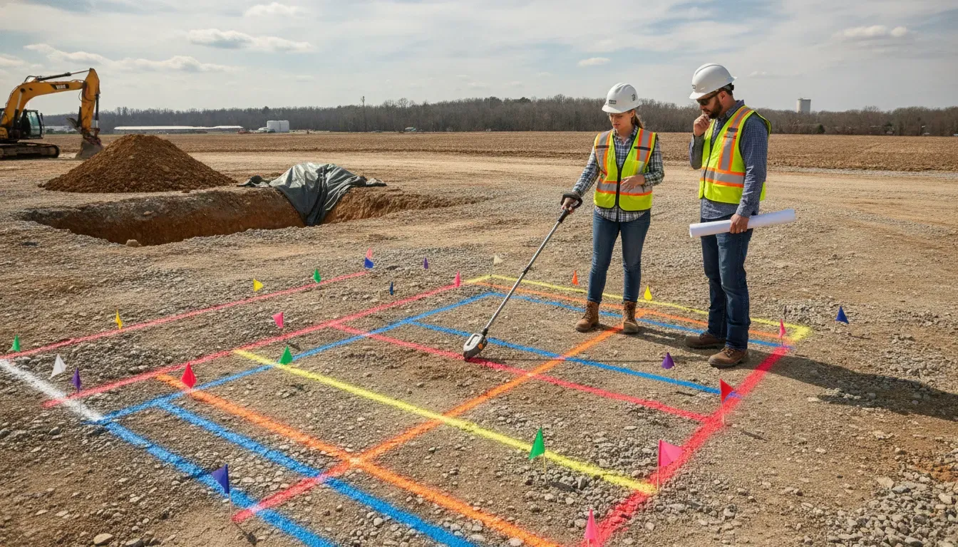
Underground utility marking colors turn an invisible subsurface into a field reference your crew can use before digging. But a red line is not a guarantee of depth, and a complete-looking 811 ticket is not always a complete picture of a property. This guide explains the APWA color code, what each mark represents, and how to use the information with the project controls in SafeLine's private utility locating guide.
Send SafeLine your project details before excavation begins.
Use the colors to understand the type of facility or activity that a mark is intended to show. Then confirm the mark's owner, scope, date, symbols, and relationship to your excavation plan. Call 811 where required, follow the applicable state and project requirements, and get additional locating help when private infrastructure may be outside the public locate scope.
What Are the APWA Underground Utility Marking Color Codes?
The APWA underground utility marking color code is a standardized visual language for temporary markings. The American Public Works Association guidelines use colors to identify utility types, proposed excavation, and temporary survey markings so contractors, utility operators, surveyors, and project teams can interpret field marks consistently.
Here is the practical reference most contractors need:
| Color | What it generally identifies |
|---|---|
| White | Proposed excavation or the route of a proposed subsurface line |
| Pink | Temporary survey markings or survey reference points |
| Red | Electric power lines, cables, conduit systems, or lighting cables |
| Yellow | Gas, oil, steam, petroleum, gaseous, or other dangerous-material lines |
| Orange | Communications, cable television, alarm, signal, or related conduit |
| Blue | Water, irrigation, and slurry lines |
| Purple | Reclaimed water |
| Green | Sewer and drain lines |
These are temporary surface markings, not a substitute for the locate ticket, plans, utility-owner information, or a safe excavation method. APWA's Uniform Temporary Marking guide also addresses mark visibility, offsets, multiple facilities in one trench, and identifying the facility owner. Local one-call rules and utility-owner practices can add requirements, so review the instructions that apply to your project.
Breaking Down Each Color: What Each Line Represents
Color is the first clue, not the entire message. Read the paint, flags, stakes, letters, arrows, offset marks, and any accompanying locate report together. The same work area may contain several colors because different facilities cross the excavation or because the field crew has marked both an existing utility and the proposed work limits.
White: proposed excavation
White lines, dashes, dots, flags, or stakes generally outline the proposed excavation or the route of a proposed subsurface facility. They show where the work is planned, not where an existing utility is located. A white outline can help utility owners and locators focus their response on the actual limits of disturbance.
Pink: temporary survey markings
Pink marks identify temporary survey work or make survey monuments and reference points easier to see. They should not be read as an electric, gas, water, or communications designation. Preserve them when they are part of the project's layout or control information.
Red: electric power
Red marks generally indicate electric power lines, cables, conduit systems, or lighting cables. Treat red markings as a serious electrical hazard and keep the excavation plan, equipment movement, and required exposure methods aligned with the applicable safety requirements.
Yellow: gas and other dangerous materials
Yellow marks generally identify gas, oil, steam, petroleum, gaseous, or other dangerous-material lines. Never assume that a yellow mark is shallow, abandoned, or safe to cross. If the field mark conflicts with a drawing or the planned work, stop the affected operation and get clarification before proceeding.
Orange: communications and signal lines
Orange marks generally identify communications, cable television, alarm, signal, or related conduit systems. These lines may include fiber or other communications infrastructure. Damage can interrupt critical services even when the line does not present the same visible hazard as an electric or gas facility.
Blue, purple, and green: water, reclaimed water, sewer, and drains
Blue marks generally identify water, irrigation, and slurry lines under the APWA guide. Purple marks identify reclaimed water. Green marks identify sewer and drain lines. The exact material, ownership, depth, and condition still require confirmation through the project records and the applicable locating or exposure process.
Who Is Responsible for Marking Utilities Before Digging?
Responsibility is shared across the damage-prevention process. The excavator or project owner must submit an accurate 811 request where required and wait for the required responses. Participating utility operators identify and mark the public facilities within their response scope. The project team must review the marks, keep them visible, and stop when field conditions do not match the information available.
Private utilities create an important gap. Lines serving a building, outbuilding, irrigation system, site light, pool, private sewer, or other property feature may be beyond the public utility owner's responsibility. That is why a contractor should not treat the presence of public marks as proof that every underground line has been identified.
A private utility locating company can investigate those additional areas using appropriate methods. SafeLine uses Electromagnetic (EM) locating for conductive lines and Ground Penetrating Radar (GPR) to support investigation of metallic and non-metallic features. The right method depends on the line, access, soil, surface, and site conditions. For more context, review what 811 does not mark before finalizing the excavation plan.
What Happens When Color Markings Are Faded or Missing?
Faded, damaged, covered, or inconsistent marks are a stop-and-verify condition. Do not guess from the original paint, continue because a line is only partly visible, or repaint a route from memory. Pause the affected work, protect the area, photograph the condition, and contact the appropriate utility owner, one-call center, project supervisor, or private locating resource.
Re-verification may be needed when:
- The excavation alignment, width, depth, or limits change.
- Grading, traffic, rain, spoil piles, or equipment have damaged the marks.
- A line appears outside the expected route.
- Plans, 811 responses, private locate results, or field conditions conflict.
- The marks are too old or unclear to support the current work phase.
- An unknown obstruction or unmarked facility is encountered.
OSHA's excavation requirements call for the estimated location of underground installations to be determined before an excavation is opened. As excavation approaches the estimated location, the exact location must be determined by safe and acceptable means. Follow the project's competent-person direction and applicable state requirements rather than treating paint color as permission to dig.
Private vs. Public Utility Markings: Key Differences
Public and private marks may use the same APWA colors, but they answer different questions about the site. Public marks usually represent the response of utility owners or operators participating in the one-call process. Private marks come from a separate investigation of infrastructure that may be owned by the property owner, facility, developer, or another private party.
| Question | Public utility marking | Private utility locating |
|---|---|---|
| Who typically initiates it? | Excavator or project owner through 811 or the applicable one-call center | Property owner, contractor, engineer, developer, or facility team |
| What is the focus? | Utility-owner facilities within the public response scope | Private lines and site features outside that public scope |
| What can the field output include? | Color marks, flags, response notes, and ticket information | Additional marks, photos, maps, reports, and site-specific guidance |
| What methods may be used? | Methods selected by the responding utility or locator | EM locating, GPR, or other methods selected for the site and target |
The distinction is not a choice between 811 and private locating. Call 811 where required, then determine whether the project needs a private investigation to address the areas or utility types that public marks may not cover. Keeping both records in the project file helps the supervisor explain what was checked, what was marked, and what remains uncertain.
How to Read a Utility Marking Before You Dig
Before excavation, read every marking in the context of the work plan. Start with the color, then check the line pattern, flags, arrows, letters, utility-owner identifiers, offsets, and the corresponding ticket or locate report. Compare the field marks with the proposed excavation limits and the latest drawings. If something does not make sense, stop and request clarification.
- Walk the entire work area. Do not inspect only the point where the excavator will start. Review access paths, staging areas, crossings, tie-ins, and any area affected by grading or drilling.
- Identify the mark type. Separate proposed excavation marks from utility marks. White may show the dig limits, while red, yellow, orange, blue, purple, or green may show existing facilities.
- Trace the route. Follow the line through the work area and look for flags, stakes, offset marks, and changes in direction. A single short paint mark is not a complete route.
- Confirm ownership and scope. Match the mark to the ticket, plan, report, or utility-owner information. Do not infer ownership from color alone.
- Review the limits with the crew. Brief operators and subcontractors on the colors, known conflicts, no-go areas, exposure plan, and the person authorized to stop work.
- Verify as you approach. Marks indicate an estimated route. Use the approved safe exposure or verification method as the excavation nears the estimated utility location.
Color markings help a crew communicate quickly, but they do not establish depth, condition, material, or exact centerline by themselves. A disciplined contractor treats them as one layer of evidence in a larger process that includes 811, records, private locating where needed, crew communication, and safe excavation practices.
Frequently Asked Questions
What color marks an underground electric line?
Red generally marks electric power lines, cables, conduit systems, and lighting cables under the APWA temporary marking color code. Always compare the mark with the locate ticket and project information, and follow the required safety and exposure procedures.
What color is used for underground gas lines?
Yellow generally marks gas, oil, steam, petroleum, gaseous, or other dangerous-material lines. Treat yellow marks as a serious hazard. If a yellow mark is missing, damaged, or inconsistent with the plan, stop the affected work and request re-verification.
What does white paint mean before excavation?
White paint, flags, or stakes generally show the proposed excavation area or route of a proposed subsurface line. White marks identify the planned work, not an existing utility. They help responders understand the scope of the locate request.
Does 811 mark every underground utility?
No. The public one-call process generally covers participating utility-owner facilities within its response scope. Private lines beyond a meter or property line may remain unmarked. Call 811 where required, then consider private utility locating for additional infrastructure on the property.
Can contractors dig based only on utility marking colors?
No. Colors provide a quick field reference, but they do not prove depth, exact centerline, condition, or safe clearance. Review the ticket and plans, brief the crew, protect the marks, and use an approved safe verification method as excavation approaches the estimated utility location.