
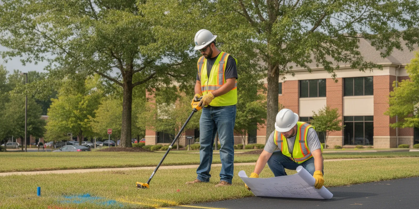
For project teams searching for utility locating Richmond Virginia, the key question is what may be underground beyond the public lines marked through 811. SafeLine Subsurface is based in Mechanicsville and provides private utility locating and subsurface investigation services across the Mid-Atlantic. Use our regional utility locating service guide to begin planning a project in the Richmond area.
Tell us about your Richmond-area project using the contact form
Private Utility Locating in the Richmond Metro Area
Before excavation, drilling, grading, or other ground disturbance, project teams need a clear picture of the site’s underground conditions. The 811 notification process is an essential step for public utility lines, but public marking does not necessarily identify privately owned lines on a property. Those may include site electrical feeds, irrigation, landscape lighting, private water or sewer lines, communications, and lines serving pools or outbuildings. What is present depends on the property and its history.
A private utility locate helps investigate that additional scope. It can be useful when public marks stop at a meter or property boundary, when the planned work is away from public infrastructure, or when a project needs more site-specific information before design or construction. Private locating complements, but does not replace, 811. Contact the appropriate one-call service and follow applicable notice and excavation requirements before digging. A private investigation is not a reason to disregard public marks or safe excavation practices.
SafeLine’s home base is in Mechanicsville, near Richmond. For work in Richmond City, Mechanicsville, Henrico, Chesterfield, and nearby communities, coverage and project fit should be confirmed for the specific site and requested scope. Site conditions, access, project schedule, and the information needed all affect how an investigation is planned. The broader regional utility locating service guide provides a useful starting point for understanding how local project needs fit into regional coverage.
On a typical property, the information available at the start may be incomplete. A homeowner may know where an irrigation controller or outbuilding is but not know the route of the connecting line. A contractor may have public marks and a site plan but no record of later private work. An engineering team may have older utility drawings whose level of detail varies. A useful investigation starts by identifying these gaps, defining the work area, and being explicit about what the field results can and cannot establish.
Services We Provide in Richmond and Mechanicsville
Underground conditions vary, so a useful investigation begins by understanding the question the project needs answered. SafeLine provides private utility locating, Ground Penetrating Radar (GPR), subsurface utility engineering (SUE), and underground utility mapping. Field methods may include GPR and electromagnetic (EM) locating equipment. They can be used together where the conditions and scope call for more than one method.
Private Utility Locating
Private locating focuses on underground infrastructure that may not be included in public utility marking. A property owner or project team can request an investigation for a proposed fence, addition, pool, landscaping, trench, or site improvement. The information sought can include the approximate route of detectable private lines in the area of planned work. Before scheduling, describe the proposed excavation area and the features or lines you already know about.
For example, if a new fence will cross a yard between a house and a detached garage, share the fence alignment, post locations, and any known electrical service to the garage. If the planned work is a planting bed or drainage improvement, mark its limits rather than requesting a vague check of the entire parcel. A defined area helps focus the discussion on the locations where underground information matters to the next step.
GPR and Electromagnetic Locating
GPR sends radar energy into the ground and records reflections that may indicate buried features. It can help investigate some non-metallic utilities and other subsurface anomalies, depending on soil, moisture, depth, material, and site conditions. EM equipment detects conductive lines or signals that can be traced under suitable conditions. It is particularly useful for locating conductive utilities, but a line that cannot carry or be given a signal may not be traceable by EM alone.
Neither technology finds every buried feature in every setting. A clear discussion of known utilities, available records, surface conditions, and project goals helps determine a suitable approach. For a closer look at method selection, read the guide to GPR and electromagnetic locating and the overview of GPR investigations.
The methods answer related but different questions. EM locating can trace a conductive line when a usable signal path is available. GPR can help investigate subsurface changes that may include non-metallic infrastructure, but its response is affected by ground conditions and can require interpretation. The choice is not simply a matter of one technology being better. It depends on the suspected material, accessible connection points, site surface, work limits, and what level of confidence or documentation the project needs. On some sites, using complementary methods can add information; on others, constraints may limit what is practical.
SUE and Utility Mapping
When a design or construction team needs documented information for planning, SUE and utility mapping can organize field findings into project deliverables. The right scope depends on the project stage and the decisions the information needs to support. A contractor preparing a limited excavation may need a focused locate around the work area; an engineering team planning a larger site may need broader investigation and mapped documentation.
Tell the locating provider what decisions depend on the results. That helps clarify the investigation limits, the expected deliverable, and any areas that could not be evaluated. Explore the utility mapping and documentation service or review the investigation process and deliverables when preparing a scope.
Need help defining your Richmond-area locate scope? Contact SafeLine through the project form.
For design coordination, useful planning questions include which utility routes could conflict with proposed foundations, grading, or new connections, and what information the design team needs in its base plan. For construction, the priority may be a defined excavation corridor, field markings, and a clear explanation of investigation limits. A mapped deliverable can help communicate findings among owners, designers, and contractors, but it should be read with its notes and scope rather than treated as a complete inventory of everything below the site.
Common Projects Requiring Utility Locating in Richmond
Private utility locating can be considered whenever a project will disturb the ground and the location of private infrastructure matters. Common situations include:
- Residential improvements: fence posts, decks, patios, sheds, pools, landscaping, irrigation work, and outdoor lighting.
- Commercial construction: site preparation, building additions, parking or access improvements, and new utility connections.
- Roadway and public works projects: planned excavation near existing site infrastructure, where project teams need to coordinate available utility information.
- Development and engineering: early site planning, design coordination, and utility conflict review.
- Repair or verification work: investigating a suspected private line or checking a route before a defined excavation.
These examples do not mean that every line can be detected or that all underground conditions can be confirmed. Old or abandoned lines, non-conductive materials, congested sites, and difficult ground conditions can affect what a field investigation can identify. If records, prior plans, or as-built drawings exist, share them. They may help target the investigation, but should not be treated as proof that the records are complete or that field verification is unnecessary.
A few practical examples show why the work area matters. A homeowner adding a short fence may need attention centered on the post line and gate area, while a pool project may involve a wider zone for excavation, equipment, and connections. A commercial tenant improvement could require coordination around existing site services near a planned addition. A civil design team may be at an earlier stage and need a broader map to identify possible utility conflicts before finalizing layout. These are different scopes, even when each request is described as “locating utilities.”
Utility marking colors can help crews distinguish types of marked facilities, but marks need to be interpreted in context and preserved during work. Review the guide to underground utility marking colors with the people who will use the field information. If you are new to the difference between public and private marking, see private locating versus 811.
Coverage Areas: Richmond City, Mechanicsville, Henrico, Chesterfield
SafeLine is headquartered in Mechanicsville and serves projects across Virginia and the greater Mid-Atlantic region, including Maryland, Washington, DC, and North Carolina. Richmond-area requests may come from homeowners, contractors, engineering firms, developers, municipalities, or utility teams. The exact address, schedule, and required services determine whether a particular request fits the available coverage and scope.
Richmond City, Mechanicsville, Henrico, and Chesterfield are useful starting points when describing where work is planned, but a county or city name alone is not enough to define a locate. Share the street address or site coordinates, the work limits, and the area where ground disturbance is expected. For larger sites, identify each phase or work zone rather than describing the whole property as one location. SafeLine’s service-area information can help start the conversation; confirm specific availability when you submit the project details.
For Richmond-area projects, identify the municipality, street address, parcel or site limits, and the specific work zone when you request service. These details help distinguish a focused locate from a broader mapping assignment and give the project team a clearer starting point for discussing availability and next steps.
When a site spans municipal boundaries or includes multiple parcels, list each address and explain whether the work is one coordinated project or separate phases. For a construction schedule, note any access windows, active traffic areas, occupied buildings, or other site coordination needs. These details do not determine whether a locate is possible, but they help make the initial scope conversation specific and avoid treating a large, changing site as a single undifferentiated work area.
What to Prepare Before Requesting a Locate
Clear project information makes it easier to discuss a suitable investigation. Before you complete the contact form, gather what you can from this list:
- Site location: Provide the project address, municipality, and a site plan or map if available. For a large property, mark the specific work area.
- Planned work: Explain whether the project involves a trench, footing, fence, pool, grading, boring, or another activity. Include approximate dimensions and intended depth when known.
- Schedule: State the desired field date, deadline, and whether the work is phased. Do not assume an urgent request can be scheduled until timing is confirmed.
- Existing information: Share 811 ticket details, utility plans, as-built drawings, previous markings, photos, or notes about known private lines. Public marks and records remain useful inputs, even when a private investigation is also needed.
- Access and site conditions: Note gates, restricted areas, traffic, surface cover, construction activity, and any access coordination required.
- Deliverable needs: Say whether the team needs field markings, documentation, mapping, or information for design coordination. Identify who will use the results and how they will be used.
These details are starting points, not a substitute for a project-specific scope. If you do not have a complete site plan or records, explain what is missing rather than delaying the inquiry. The project team and locating provider can discuss what information is available and what questions remain.
It also helps to distinguish confirmed facts from assumptions. For instance, note whether a line location comes from an old drawing, a visible structure, a previous mark, or a property owner’s recollection. Point out visible meters, utility cabinets, irrigation controls, pump equipment, or other known endpoints where relevant. Do not move or remove existing marks to make room for new work; tell the project team if marks are faded or have been disturbed so their status can be addressed appropriately.
For a phased project, send the first work area and the sequence of later areas separately. A locate request that covers an entire campus or development may need a different discussion than one limited to a single trench. If the design is still changing, identify what is fixed and what remains provisional. That helps align the investigation boundary and the expected documentation with the decisions currently being made.
How the Locating Methods Compare
The table below is a general comparison, not a guarantee of detection. A provider should select methods based on the site and the specific question being investigated.
| Method or service | Typical role | Important limitation | Useful project input |
|---|---|---|---|
| Electromagnetic (EM) locating | Trace conductive utilities or lines that can be energized or otherwise located with a signal. | Non-conductive lines or lines without a usable signal may not be traceable by EM alone. | Known line endpoints, accessible connection points, and existing utility information. |
| Ground Penetrating Radar (GPR) | Investigate subsurface reflections, including some non-metallic utilities and other features. | Results vary with soil, moisture, depth, material, and site conditions; not every feature is identifiable. | Defined work limits, surface access, and the question the project needs answered. |
| Private utility locating | Investigate privately owned lines that may fall outside public 811 marking. | Scope is site-specific; it does not replace 811 or guarantee every line is found. | Address, proposed excavation, known private systems, and 811 information. |
| SUE and utility mapping | Organize subsurface investigation information for planning, design, or construction coordination. | Deliverables and investigation limits depend on the agreed project scope. | Project phase, available records, map or plan needs, and intended use. |
Combining methods can provide complementary information, but it does not eliminate uncertainty. Ask how the investigation will be documented, what limits apply, and what the field results mean for the planned work. A locate is one part of a safe excavation plan; workers still need to follow applicable laws, utility-owner instructions, and safe digging practices.
When comparing a focused field locate with a broader mapping assignment, consider the decision the information must support. A small, well-defined excavation may call for attention to a limited corridor and clear communication of marks. A design project with several proposed improvements may need a wider area and a documented base for coordination. If the scope changes after field work, tell the project team. For example, a trench may move or expand. Existing information may not cover the revised limits, so do not assume marks or maps automatically apply to a changed work zone.
A useful deliverable conversation covers the investigation boundary, the methods used, the features or lines identified, and any limitations encountered. It should also establish who receives the results and how they will be shared with the crews or designers who need them. This kind of coordination is especially helpful when multiple companies work at the same site or when field findings need to inform a later design decision.
Schedule a Locate in the Richmond Metro
To request a Richmond or Mechanicsville project discussion, use SafeLine’s contact form and include the site address, planned work, desired timing, and any existing plans or utility information. Mention whether you are seeking private utility locating, GPR, SUE, mapping, or help defining the appropriate scope. SafeLine can review the request and follow up about fit, availability, and next steps.
For a faster first review, put the most important details near the start of your message: where the project is, what ground disturbance is planned, when the information is needed, and whether a map or other records are available. If the request covers several work zones, list them individually. You can note unknowns as well as confirmed details; an incomplete plan is more useful when its limitations are clearly stated than when assumptions are presented as facts.
Send your Richmond-area project details through the contact form
Frequently Asked Questions
Does 811 locate every underground utility on a property?
No. 811 coordinates public utility marking, and private lines on a property may not be included. Contact 811 before excavation and consider a private locate for additional site infrastructure that falls outside public marking.
Can GPR find every buried utility?
No method guarantees that every buried utility or feature will be found. GPR results depend on subsurface and site conditions, and EM locating also has limits, especially for lines that cannot be traced with a signal. The planned work and site conditions should guide the investigation approach.
Does SafeLine serve Mechanicsville, Henrico, and Chesterfield?
SafeLine is based in Mechanicsville and serves the Mid-Atlantic region. Share the specific project address and scope through the contact form to confirm service availability for your location and schedule.
What should I send when requesting a utility locate?
Include the address, work area, type of planned excavation, target timing, and any available site plans, utility records, or 811 information. Also explain whether you need field locating, mapping, or documentation for design or construction use.
Every site is different, so a clear scope and careful coordination help the project team make informed decisions before ground is disturbed.