
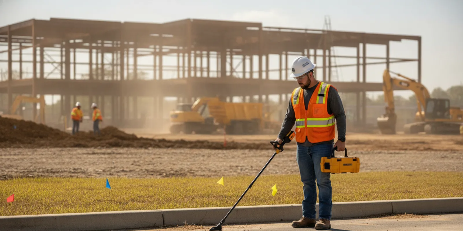
A utility locator helps a project team understand what may be underground before excavation, drilling, grading, or other ground disturbance begins. For Richmond-area contractors, the useful question is not only whether a site has been marked. It is whether the locating scope covers the work area, addresses the utilities that matter, and gives the crew information it can use to plan. Public 811 markings and private locating serve different purposes, so teams should consider both where applicable.
Plan a utility locating investigation
What does a utility locator do for a construction project?
A utility locator investigates a defined area for underground infrastructure and communicates findings so the project team can plan around potential conflicts. Depending on the agreed scope, the work may include field detection, surface markings, photographs, mapping, or other documentation. The phrase “utility locate” does not by itself specify the methods, coverage, accuracy, or deliverables. Confirm those details for the project.
For a contractor, the value is having more information before committing a crew to a trench, footing, pole, drainage feature, or new service route. Findings can prompt the team to review a proposed alignment, adjust sequencing, request additional investigation, or coordinate with an asset owner. A locate is a planning input. It does not authorize excavation or replace safe digging practices.
SafeLine provides private underground utility locating in the Mid-Atlantic, including Virginia. Its work uses electromagnetic locating and ground penetrating radar (GPR), methods that can contribute different types of information depending on site conditions and scope. Review the private utility locating service details, and consider whether utility mapping and documentation is also appropriate when project partners need a recorded picture of the findings.
How do 811 and private locating fit together?
An 811 request and private locating are not interchangeable. The one-call process coordinates participating utility owners and marks facilities within its scope. A site may also contain infrastructure that is privately owned or not represented by those public markings. A contractor should not treat an 811 response as a complete inventory of every underground line across a private property.
Possible private facilities can include irrigation, landscape lighting, private electrical feeds to outbuildings, pool connections, and private water or sewer lines. Which facilities exist depends on the property’s history and layout. A team should not assume a particular line is present—or absent—without suitable records and investigation.
Submit an 811 request as applicable to the work, allow for the required process and timing, and follow the site’s procedures. Then determine whether the planned work also calls for private locating. SafeLine explains the distinction in its guide to private locating versus 811 and its overview of what 811 may not cover. These steps can complement each other; one is not a substitute for the other.
For example, public markings may identify a utility service to a meter, while a privately installed line continues from that point toward a building, equipment pad, or site feature. If a proposed trench crosses the possible route, the contractor needs to account for the private portion as well. The team can check owner records, consult facility operators, and define an investigation area around the actual excavation rather than assuming the visible marks answer every question.
Which project conditions suggest that private locating is needed?
Consider a private locate when the planned work may intersect undocumented, privately owned, or otherwise unmarked infrastructure. Common planning triggers include:
- Excavation extends beyond the area represented by public utility marks.
- A fence, sign, bollard, light pole, foundation, or other feature is planned on a developed property.
- Trenching is planned for drainage, irrigation, electrical, communications, or water connections.
- Work is close to outbuildings, pools, site lighting, generators, or mechanical equipment.
- A redevelopment site has incomplete, old, or conflicting as-built information.
- The design, work limits, or construction route has changed since the previous investigation.
- The team needs to examine a suspected utility conflict before finalizing design or sequencing.
These are reasons to define the question, not guarantees that a particular line exists or that every target can be detected. Begin by reviewing available records and visible site features, then decide what the field investigation should help the team determine. SafeLine’s pre-excavation utility locate checklist can help organize the initial information.
What should a Richmond-area team define before requesting a locate?
A useful scope gives the locating team a clear target and lets the contractor judge whether the resulting information addresses the planned work. Prepare these details before requesting service:
- Work limits. Mark the excavation footprint, proposed route, access area, staging constraints, and nearby areas that may affect the investigation. A marked-up site plan is often more useful than a general description such as “the back lot.”
- Planned activity. Explain whether the crew will trench, bore, place a footing, install a pole, grade, or perform another task. Include approximate dimensions and planned depth when known. A locating scope should reflect the work being considered.
- Project timing. Share the design milestone, expected fieldwork window, and date when findings are needed. If one phase has a deadline, explain the specific constraint. Do not treat a requested date as confirmed until it has been coordinated.
- Available site information. Gather plans, surveys, utility records, earlier markups, photographs, and details from owners or facility managers. Identify the source and date where possible so the team can distinguish current records from old assumptions.
- Known assets and concerns. Point out visible meters, valves, cleanouts, cabinets, poles, structures, and suspected conflicts. These clues can guide questions, but they do not prove the location or path of an underground facility.
- Required output. Decide whether the crew needs field marks, photographs, mapping, a report, or information for design coordination. Confirm format, reference details, and intended users before fieldwork.
- Access and safety conditions. Identify gates, escorts, work hours, restricted areas, traffic, active operations, and site-specific safety requirements. Explain any limits on equipment access or areas that cannot be disturbed.
SafeLine’s investigation process and deliverables page can help teams understand what to clarify. If the project is still in design, share the decision the team needs to make and the drawings available now. Waiting until excavation is imminent can leave less time to review a conflict or refine the work plan.
How can EM locating and GPR support an investigation?
Locating is not just an instrument reading. A technician considers the project question, site conditions, available records, access, and the limitations of each method. Electromagnetic (EM) equipment can help trace conductive utilities when conditions allow. GPR can help investigate subsurface features, including some non-metallic utilities, depending on ground and target conditions. Using more than one method may provide complementary information, but no method should be assumed to identify every buried object.
EM locating uses a detectable signal associated with a conductive line. A direct connection may be possible in some circumstances; in others, a signal may be applied by induction. Access, line material, depth, nearby conductors, and signal conditions can affect interpretation. GPR sends energy into the ground and records reflections from contrasts in subsurface materials. Soil composition, moisture, surface conditions, target size, depth, and congestion can influence what the equipment shows. Findings require interpretation in context.
For a project-specific method discussion, read SafeLine’s guide to the difference between GPR and electromagnetic locating and its overview of ground penetrating radar investigation. The right scope depends on the question the contractor needs answered, rather than choosing a technology by name alone.
How should teams compare common locating approaches?
The table is a planning aid, not project-specific advice or a replacement for applicable requirements. It separates steps that have different purposes and indicates what a contractor should verify.
| Approach | What it can contribute | What the team should confirm |
|---|---|---|
| 811 one-call request | Coordinates notification and marking by participating utility owners within the one-call system’s scope. | Ticket limits, timing, response status, marked facilities, and requirements for the planned work. |
| Private utility locating | Investigates selected areas for privately owned or otherwise unmarked subsurface facilities. | Work limits, target questions, access, proposed methods, limitations, and field outputs. |
| Utility mapping and documentation | Organizes investigation findings into records that can support coordination and project decisions. | Format, detail, reference system, intended users, and how later updates will be handled. |
| Records review and site walk | Adds historical and visible context that may guide investigation planning. | Record age, completeness, source, and whether field verification is still needed. |
These approaches can work together. Records may inform a field scope, field investigation may test a design assumption, and documentation may help communicate observations to the broader team. None should be treated as a guarantee that a property has been completely cleared of subsurface risks. Ask how each output relates to the specific work area and decision.
How should the team use the findings?
Before work begins, review the findings with the people responsible for excavation, layout, safety, and design coordination. Make sure the group understands the investigated area, the work limits, and any uncertainties or exclusions in the deliverables. A technically useful result still needs to reach the people making field decisions.
- Compare the reported findings with the excavation plan and identify apparent conflicts.
- Make sure field marks remain visible and explain to the crew what they represent.
- Check that drawings, photographs, and reports correspond to the current work area and plan revision.
- Escalate discrepancies between field observations, records, and existing marks before proceeding.
- Revisit the scope if the excavation shifts, the design changes, or new information appears.
- Follow applicable excavation practices and directions from utility owners and responsible site personnel.
For workplace excavation safety, consult the requirements and guidance provided by the Occupational Safety and Health Administration and follow applicable rules for the work. A locate reflects an investigation under defined conditions and within a defined area. It is not a blanket clearance for later phases or every point on a property. SafeLine’s guide to coordinating to help prevent underground utility strikes covers broader project considerations.
How can contractors plan locating across project phases?
Utility information is most useful when it arrives before the team has committed to a decision that the information could change. A contractor can make the process manageable by connecting each request to a clear phase, work area, and responsible person. That also helps avoid carrying forward an old mark or drawing as if it automatically applied to later work.
- During design coordination: Identify proposed routes, building additions, new service connections, or grading areas that may conflict with existing infrastructure. Share the current plan and ask what information could help the designer compare alternatives. If the alignment is still conceptual, mark the corridor and note which parts are fixed and which may move.
- Before mobilization: Confirm the limits of the first construction phase, access arrangements, current drawing revision, and planned excavation. Check that public one-call steps and any private investigation have been addressed for the relevant area. Tell the field supervisor where the findings and documentation will be available.
- At a change or conflict: Pause to compare the changed work with the original scope when a trench shifts, a new feature is added, or field conditions do not match the plan. Identify the added area and ask whether the prior investigation covers it. Resolve questions with the responsible project personnel before treating the new route as investigated.
- At handoff: Keep the final findings with project records and communicate relevant limits to the next contractor, trade, or maintenance team. If later work is planned, verify that the scope, timing, and conditions remain relevant rather than assuming earlier marks provide a standing clearance.
Consider a site where a contractor first plans a short drainage trench, then adds a light pole and extends the route after reviewing grades. The new pole location and extended trench may fall outside the original work limits. The team should identify the changed footprint on the latest plan, compare it with the investigation area, and coordinate additional review where needed. This simple change-control step is more reliable than relying on memory of where marks appeared during an earlier visit.
For projects with several work packages, keep a simple log that records the investigated area, date, plan revision, deliverables received, and open questions. The log does not replace field marks or the locating provider’s documentation. It helps the project manager see which areas have been addressed, which are still pending, and whether a schedule or design change requires a scope review.
When should a project request utility locating?
Request locating early enough for the findings to inform the decision they are intended to support. During design, an investigation may help evaluate a route or flag a potential conflict before plans are fixed. During preconstruction, it can help the team coordinate work limits and sequencing. Before a specific excavation, a field investigation can address a defined area and planned activity.
Early planning is especially useful when records are limited, work is near existing buildings or services, multiple trades need the same area, or construction has several phases. A project may need more than one investigation as it moves from design to construction, but the scope should be tied to each decision and work area. If a route changes, review whether the original information still applies instead of assuming it covers the revised alignment.
SafeLine serves projects across Virginia and the broader Mid-Atlantic. Review its service area information and discuss the project location and requested scope with the team. Contractors can also review the dedicated subsurface information for contractors.
What information helps when requesting a quote?
For an initial discussion, provide the site address, project contact, a plan or marked-up drawing, approximate work limits, intended excavation, schedule, access details, and desired deliverables. Mention whether an 811 ticket has been requested and share its status if available. Include known site records, identify suspected conflicts, and describe the question the investigation should help answer.
Area, site conditions, technology needs, access, schedule, and documentation requirements can all affect project effort. Avoid assuming a standard price or turnaround for every site. Ask what the proposed scope includes, what is outside it, what the field team will provide, and how limitations will be communicated. Use the contact form to share the project details and request a discussion.
Discuss your Richmond-area project
Frequently asked questions
Does 811 mark every underground line on a commercial property?
No. The one-call process coordinates participating utility marking within its scope. Private facilities may not be included, so project teams should determine whether separate investigation is needed for the planned work area.
Should a contractor request a locate before design or before excavation?
It depends on the decision. An early investigation may inform routing and design coordination, while a pre-excavation investigation can address a defined work area. A project may need review at more than one stage, especially when its scope or conditions change.
Can GPR find every buried utility?
No. GPR response depends on the ground, target, depth, surface, and other site conditions, and interpretation is required. Discuss the project question and method limitations with the locating provider rather than treating any technology as a guarantee.
What should I send with a locating request?
Send the site location, work limits, proposed activity, schedule, drawings or records, access requirements, known concerns, and desired deliverables. Include the 811 request status if one has been submitted.
Does a locate clear the entire property for future digging?
No. Findings apply to the investigation scope and conditions. Work outside the investigated limits or changes made later should be reviewed before crews proceed.
A well-defined utility locator request gives a Richmond-area project team clearer information for coordinating excavation, while 811, private investigation, records, and safe work practices retain distinct roles. Define the work area and decision early, then confirm the scope and deliverables before fieldwork begins.