
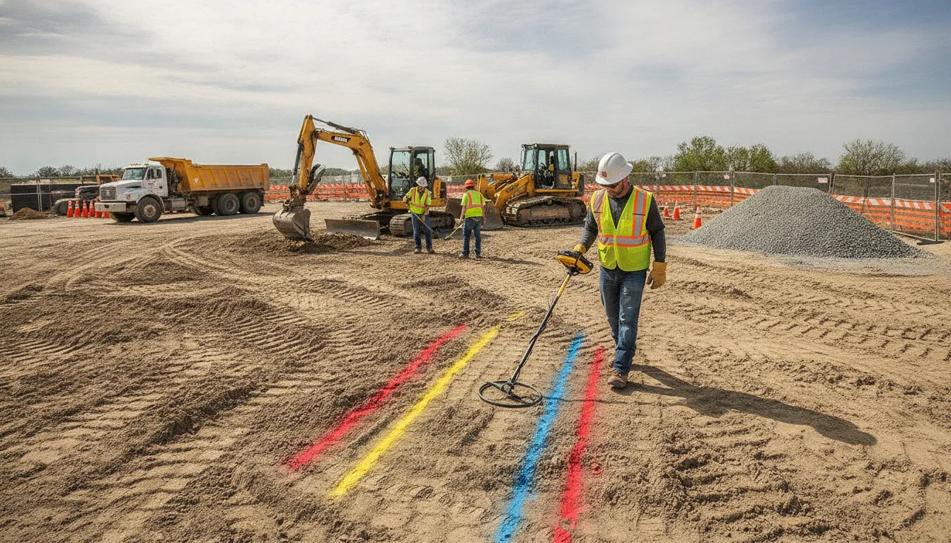
A utility strike rarely begins at the excavation edge. It usually reflects a gap in planning, incomplete utility information, or a crew working from marks that no longer match the site. Preventing that gap requires more than a single call before digging.
Send SafeLine your project details before excavation begins
A practical answer to how to prevent underground utility strikes is to use a layered process: notify 811 where required. Verify the ticket and public marks, identify private utilities separately, and brief the crew on cautious excavation near every marked line. Private locating can add field markings, photos, and reports to the project record.
That process matters because public 811 locating may not cover private infrastructure beyond the meter or property line. SafeLine combines EM locating and Ground Penetrating Radar (GPR) to help identify underground assets before work begins. Start with SafeLine's private utility locating project planning guide, then understand what a strike can cost your schedule, crew, and project controls.
How to Prevent Underground Utility Strikes on a Construction Site
An underground utility strike is not only a repair problem. It can expose workers to electrical, gas, or other site hazards, interrupt planned work, and force several teams to coordinate around an unexpected condition. OSHA identifies underground power lines as an excavation hazard and requires the estimated location of underground installations to be determined before an excavation is opened. OSHA's trenching guidance also highlights the need to manage related equipment and excavation hazards.
The schedule impact can extend beyond the moment of contact. Work may need to stop while the utility owner is notified, the area is made safe, and the line's location and condition are confirmed. Crews may need to revise the excavation plan, coordinate with the owner or other contractors, and update site records before work can resume. Even when the damaged line is not immediately visible, uncertainty about what happened can create additional planning and communication work.
Documentation is part of prevention, not just an after-the-fact response. Keep the 811 ticket details, available utility records, field marks, pre-excavation photographs, and changes to the work area together. Clear records help the project team understand what was checked, what was marked, and what conditions changed during the work. SafeLine's commercial locating process can provide field markings, verification photos, clear reports, and on-site guidance for construction projects, based on the customer's documented service capabilities.
The most reliable way to reduce this exposure is a layered process. Start by calling 811 within the applicable local requirements and confirming the response before excavation. Then account for privately owned infrastructure that public locating may not mark. Public 811 systems generally focus on public utilities, while private lines can remain unmarked. A private locating review can verify the site using methods such as EM locating and GPR before the crew moves into excavation. This combination of public notification, private locating, careful field coordination, and usable records gives the team more information for making safe decisions.
Step 1: Call 811 First (and Know Its Limits)
Before excavation begins, make the required call to 811 or your applicable state one-call center. Treat the ticket as the starting point for a documented damage-prevention process, not as a complete picture of everything below the site. OSHA requires the estimated location of underground installations to be determined before an excavation is opened. And utility owners should be contacted within the customary local response times before work starts. OSHA's excavation standard provides the federal baseline, but local notification rules and waiting periods still apply.
- Submit an accurate excavation scope. Describe the work area precisely, including the address, limits of disturbance, planned route, and the type of excavation. A vague ticket can produce incomplete responses. If the project expands, moves, or adds a new work area, update the ticket rather than assuming the original request covers it.
- Wait for the ticket responses and marks. Do not begin digging simply because the request has been submitted. Confirm which utility owners responded, review the marks at the site, and resolve any "no conflict" or incomplete response before mobilizing excavation equipment. Keep the ticket number, response details, and relevant photographs with the project records.
- Walk the site and compare the marks with the plan. Have the supervisor and excavation crew review the markings, proposed work, visible utility features, and any conflicts. If the marks do not make sense, stop and seek clarification. As excavation approaches an estimated utility location, the exact location must be determined by safe and acceptable means, according to OSHA.
- Identify what 811 may not cover. Public 811 locating generally focuses on utility-owner infrastructure. Privately owned lines beyond the meter or property line can remain unmarked, including some site lighting, irrigation, communications, water, sewer, and other facilities. Read what 811 does not mark before assuming the ticket is a complete site map. A private locating review supplements the public notification process; it does not replace 811, applicable laws, or required utility-owner responses.
When the scope includes private infrastructure, plan the additional investigation before crews arrive. That extra step helps the team distinguish confirmed public marks from privately located features and gives the excavation plan a more complete basis.
Step 2: Hire a Private Utility Locator
A public 811 ticket is an important starting point, but it may not identify every utility on a jobsite. Public locating generally focuses on utility infrastructure owned or maintained by participating utility companies. Privately owned lines can extend from a meter or property line to buildings, site features, or equipment and may remain outside that marking scope. A private investigation adds another layer of protection before excavation begins.
For the broader project-planning context, see SafeLine's private utility locating project planning guide. SafeLine's private utility locating service can help identify private electric, gas, water, sewer, communications, fiber optic, irrigation, storm, and other underground infrastructure. The right scope depends on the site and planned work. Share the excavation area, available drawings, known service connections, and project schedule so the locating team can focus the investigation where conflicts are most likely.
Use more than one locating method
No single technology should be treated as a guarantee that every buried feature will be found. SafeLine combines Electromagnetic (EM) locating with Ground Penetrating Radar (GPR) based on the utility and site conditions. EM methods support the identification of conductive lines, while GPR can support investigation of both metallic and non-metallic infrastructure. Together, these methods can provide a broader view than relying on visible records or assumptions about where a line should be.
This step matters for more than the main excavation footprint. Private lines may cross driveways, parking areas, landscaped spaces, additions, outbuildings, or routes that are missing from older plans. Ask the locator to address the full area affected by grading, trenching, drilling, foundations, or new utility connections.
Turn the investigation into field-ready information
A useful locate should give the crew information it can apply at the work face. SafeLine provides field markings, verification photos, clear reports, and on-site guidance for commercial projects. Markings help crews relate the investigation to the ground. Photos preserve visual context, while reports document the work and identified utility paths for supervisors, project managers, and later phases.
When the project calls for a lasting record, private utility mapping can create detailed site maps and permanent utility records for future reference. Keep those records with the project plan, and brief the excavation crew on what was located, what remains uncertain, and where work must proceed cautiously. The goal is not simply to obtain a locate. It is to convert underground information into decisions the crew can follow before and during digging.
Step 3: Use Safe Digging Practices Near Marked Lines
Utility marks are a field reference, not permission to excavate without a plan. Before equipment moves, make sure every person involved understands the excavation limits, the marked utility paths, the planned sequence, and the person responsible for coordinating questions. A short pre-start briefing can prevent a new operator or subcontractor from misreading marks or working from outdated information.
- Review the work area with the crew. Walk the planned excavation with the supervisor, equipment operators, and any subcontractors. Compare the field marks with the current drawings, locate report, photographs, and 811 information. Confirm which utilities are public marks and which were identified through private locating. OSHA requires the estimated location of underground installations to be determined before an excavation is opened, and utility owners should be contacted within the applicable local response times. OSHA's excavation standard provides the governing safety framework.
- Protect the marks throughout the work. Keep paint, flags, stakes, and reference points visible. Do not scrape them away with tires, grading equipment, spoil piles, water, or cleanup operations. Photograph the area before work and refresh or re-establish markings through the appropriate process if they become unclear. If the scope shifts, do not assume the original marks cover the new work area.
- Approach marked lines cautiously. As excavation nears the estimated location of a utility, use the project's approved exposure or verification method rather than relying on the mark alone. That may include careful hand exposure, potholing, or another safe and acceptable method selected for the site and utility conditions. OSHA states that the exact location must be determined by safe and acceptable means as excavation approaches the estimated location. Follow the project's method statement and competent-person direction.
- Keep equipment and excavation inside the plan. Operators should know the limits of the dig area and avoid swinging, drilling, driving, or placing loads where the approved plan does not allow. While an excavation remains open, underground installations must be protected, supported, or removed as necessary to safeguard employees. Coordinate utility support and protection with the responsible utility owner or qualified project personnel.
- Stop when the information no longer matches the ground. Pause work if a mark is missing, a line appears outside the expected path, records conflict with field conditions, the excavation scope changes, or an unknown obstruction is encountered. Secure the area, keep personnel and equipment clear as appropriate, and have the supervisor coordinate re-verification before digging resumes. Treat changing conditions as a reason to reassess, not as a reason to guess.
This disciplined sequence is how crews turn locating information into safer excavation. The goal is not simply to find a line once, but to keep the crew working from clear, current information from the pre-start briefing through the final excavation.
Best Practices for Excavation Crews and Contractors
Preventing a utility strike depends on decisions made before the excavator starts. Use this checklist to turn design information, field markings, and crew communication into controls that remain useful as site conditions change.
| Risk point | Crew control |
|---|---|
| Design plans may not show every underground asset or conflict. | Review records and excavation limits early. If the project needs design-phase utility data, coordinate subsurface utility engineering (SUE). Use the map to identify conflicts before mobilization. |
| Workers begin without understanding the marks, work limits, or known unknowns. | Hold a pre-excavation briefing. Review 811 responses, private locating results, mark colors, photos, planned crossing points, exposure requirements, and the person authorized to stop work. |
| Paint, flags, or stakes are damaged, moved, or covered during site work. | Protect marks from traffic and grading. Photograph the site, keep markings visible, and re-verify them when the work area changes or marks can no longer be trusted. |
| The excavation plan changes after locating is complete. | Treat a changed alignment, depth, access route, or staging area as a new review point. Update the crew briefing and obtain additional locating or verification before digging into the changed area. |
| A line appears where the crew did not expect it, or its path is unclear. | Stop affected work, keep people and equipment clear, and escalate to the supervisor and appropriate utility or locating resource. Do not rely on an assumption that an unmarked line is abandoned or harmless. |
Design review should not be treated as a substitute for field verification. OSHA requires the estimated location of underground installations to be determined before an excavation opens. And the exact location must be established by safe and acceptable means as excavation approaches it. That may require careful exposure or another approved verification method, based on the site plan and applicable requirements.
For complex sites, subsurface utility engineering can help the project team organize utility information during planning. Field locating may combine electromagnetic methods for conductive lines with GPR for metallic and non-metallic infrastructure. The crew should receive the resulting marks and documentation in a form they can use at the point of work, not only in a design file.
Finally, make escalation part of the normal process. A stop-work decision is a control, not a failure. Preserve the area, document what changed, and bring the right supervisor, utility owner, or locator into the decision before excavation resumes.
How Documentation Protects You After a Strike
Good records do not prevent every incident, and they are not a substitute for following applicable safety requirements. They do give the project team a clear timeline of what was known, what was marked, and what changed before work started. That context is especially valuable after a utility strike or near miss, when details can otherwise become difficult to reconstruct.
Keep the original 811 ticket, response details, mark-out dates, and any notes about utilities that were not included in the public response. Add the site plans, available utility records, and the defined scope of any private locate. If a private utility locating service investigates the site, retain its maps, field markings, verification photos, and report. A documented record of both public marks and private findings helps the crew understand the limits of each source.
Before excavation, record the crew briefing and the areas discussed as higher risk. During the work, photograph marks and exposed conditions from useful reference points. Note changes in excavation limits, weather, site access, design information, or other conditions that could affect the plan. If marks are disturbed, a line appears where it was not expected, or the crew cannot reconcile field conditions with the records, pause the work and escalate through the project's designated safety and utility contacts.
After an incident, preserve the ticket, plans, maps, photographs, briefings, and communications without altering the original record. OSHA requires utility locations to be determined before an excavation is opened and exact locations to be established by safe means as excavation approaches them: OSHA excavation requirements. Clear documentation supports a factual review and helps the team improve the next phase of work. For design-stage mapping and conflict planning, see subsurface utility engineering.
Plan your excavation with SafeLine's locating team
Frequently Asked Questions About Preventing Underground Utility Strikes
Is calling 811 enough to prevent an underground utility strike?
No. Call 811 wherever required, but confirm what the ticket covers and whether private utilities remain outside the public locating scope. Private locating can help identify infrastructure beyond the meter or property line before excavation begins.
What should a contractor do if field marks are unclear or damaged?
Pause excavation in the affected area and have the marks reviewed before work continues. Photographing the site, preserving the ticket information, and documenting changes helps the crew work from current information rather than assumptions.
Can GPR and EM locating find every underground utility?
No single locating method finds every line in every soil or site condition. GPR can support detection of metallic and non-metallic infrastructure, while EM locating supports conductive lines. Using the appropriate methods together can provide more complete site information.
How should crews excavate near a marked utility?
Brief the crew before work starts, protect the marks, and expose the line cautiously as the excavation approaches it. If the mark, alignment, depth, or utility identity does not match expectations, stop and verify the information before proceeding.
Ready to Plan a Safer Excavation
A clear locating and mapping plan can help your team identify private utilities, confirm field marks, and coordinate excavation before work begins. SafeLine can discuss private utility locating, EM locating, GPR, and underground utility mapping for your project. To get started, complete SafeLine's website contact form with your site details and planned excavation scope.