
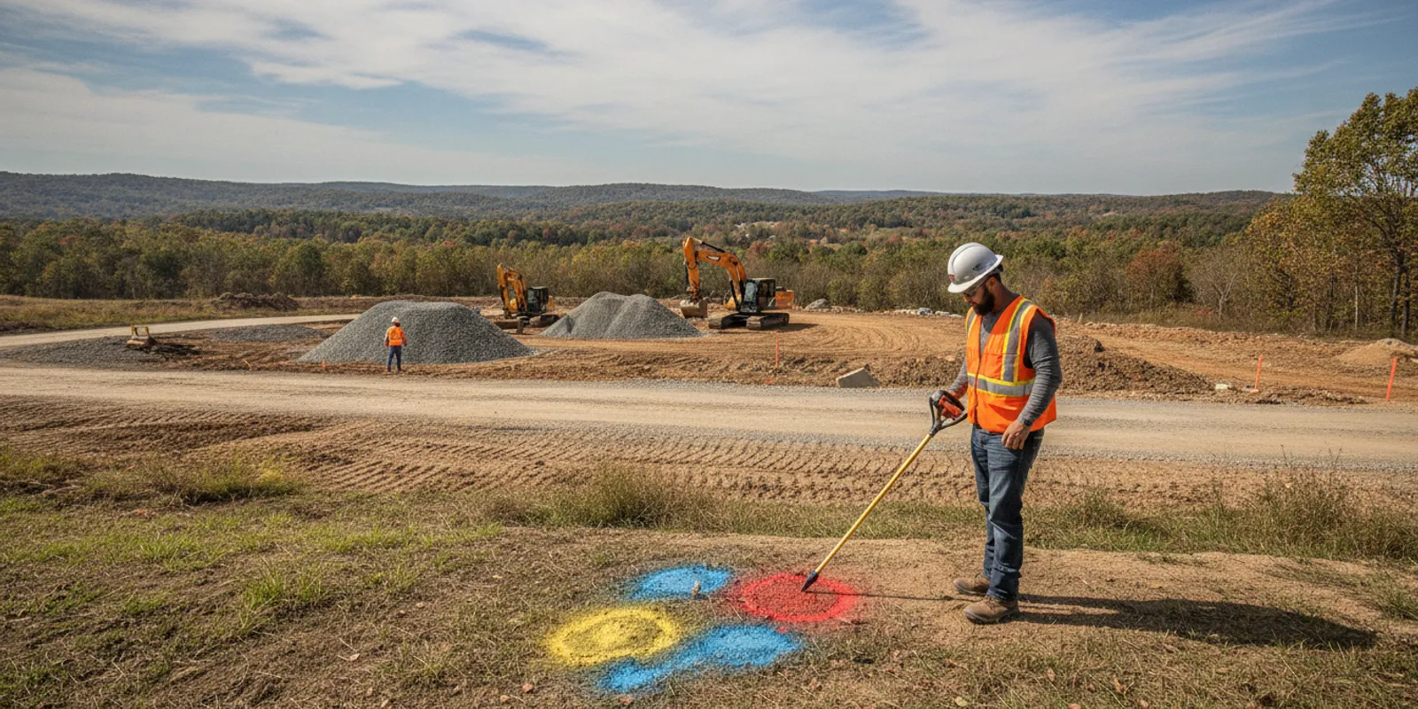
Utility mapping Stafford VA project teams can use begins with a clear question: what underground or embedded features must be located, documented, and considered before the next phase of work? For a redevelopment site, the answer depends on the planned disturbance, available records, site access, and how the project team will use the findings.
Discuss your Stafford project scope
Redevelopment rarely starts with a blank site. Existing buildings may have been altered, utilities may serve outbuildings or former uses, and old plans can show routes that no longer match field conditions. A thoughtful mapping plan helps the team identify questions early, coordinate fieldwork, and document findings for design and construction use. It is not a substitute for required 811 notifications, engineering decisions, or safe excavation practices.
Why plan utility mapping before redevelopment work?
Early planning gives the project team time to resolve conflicts before equipment and crews are committed to a work area. A proposed footing, trench, utility connection, retaining wall, pavement cut, or landscape improvement may intersect existing infrastructure. If the possible conflict is discovered only after work starts, the team may need to pause, revise the sequence, or gather more information.
Redevelopment sites can contain a mix of public and private infrastructure. The public one-call process addresses member utility facilities within its scope, but it does not provide a complete inventory of private lines across a property. For background on the distinction, see how private locating and 811 fit together and the overview of what 811 does not cover.
Local development activity can also make reliable site information valuable to project planning. A Stafford community organization reported a pipeline of data center projects in the county, including projects at different approval and construction stages. That report is one example of the varied commercial activity in the area; it does not establish conditions at any individual parcel. A project-specific investigation still needs to be based on the site and planned work.
What should the team define in the mapping scope?
Start with the planned work, not a general request to “map everything.” Describe where construction may disturb the site and what information the design or construction team needs. A focused scope helps the locating provider understand the question and helps the project owner evaluate whether the resulting documentation will be useful.
- Work limits: Identify the parcel, work areas, access routes, staging areas, and any off-site tie-ins. Attach a current plan or marked aerial if available.
- Planned disturbance: Describe demolition, excavation, boring, grading, new foundations, utility trenches, pavement work, or landscaping. Include anticipated depths or dimensions when the design has them.
- Features of interest: List known public and private utilities, abandoned or uncertain lines, site lighting, irrigation, building feeds, and other features that matter to the work.
- Decision use: State whether the team needs field markings, a mapped record, photographs, or a combination. Explain who will use the deliverable and at what project stage.
- Access and timing: Note occupied buildings, locked gates, traffic control, restricted areas, vegetation, surface conditions, and schedule constraints.
If the question is still being shaped, review the utility mapping and documentation service and its investigation process and deliverables. The project team can then frame a request around its work limits and information needs rather than assuming that every site requires the same approach.
Which records and site context should the team gather?
Records do not prove that a line is present, absent, or in the exact position shown. They are still useful for building a site picture and directing field attention. Gather relevant information before fieldwork and mark uncertain or conflicting details for review.
- Existing utility plans, as-built drawings, site plans, and prior locate or mapping reports.
- Building plans that show service entries, electrical rooms, mechanical equipment, and connections between structures.
- Records for irrigation, site lighting, private water or sewer lines, septic components where applicable, and outbuildings.
- Known repairs, additions, demolition, utility relocations, or changes in how the property has been used.
- Current design drawings with proposed excavation, foundations, tie-ins, and other areas of potential conflict.
Compare the records with what can be observed on site: utility meters, visible structures, valves, cleanouts, handholes, poles, transformers, and building entry points. Treat these as clues, not proof of a complete route. If drawings disagree, keep both versions in the project file and ask the relevant owner or design lead which should guide the investigation.
For a Stafford redevelopment, also clarify parcel boundaries and responsibility for facilities near adjoining properties or public rights of way. Property access does not automatically establish ownership or the right to alter a line. The project owner should resolve permissions and coordinate with applicable utility owners and authorities.
How do redevelopment conditions change the plan?
Not every parcel calls for the same work area or timing. A project that keeps an occupied building open may need to focus first on active services and planned tie-ins. A vacant property scheduled for demolition may need the team to distinguish lines that will be removed from those that must remain available for later phases. In both cases, explain the sequence so the investigation can be tied to real decisions rather than an abstract site boundary.
For a phased redevelopment, map the current disturbance and likely follow-on areas separately when the schedule or design is not settled. This helps users avoid treating a limited first-phase investigation as coverage for a future building pad or connection route that was outside the original limits. Keep the date, phase, and drawing reference with each record, and review the scope when a new phase is released.
Where a proposed route crosses a property line or connects to public infrastructure, identify the transition point and the responsible parties. A private locate may help clarify features on the property, while facility-owner coordination and the applicable one-call process address other parts of the work. Do not assume that a feature continues in a straight line beyond the area investigated.
For older sites, conflicting plans are common project inputs, not a reason to choose whichever drawing looks most complete. Compare the documents, note their dates and intended purpose, and provide the uncertainty to the project team. A design lead can then decide whether the available evidence is enough for the next step or whether a targeted field investigation or additional owner records are needed.
How can locating methods support the investigation?
Different methods respond to different materials and site conditions. Electromagnetic locating can help trace conductive utilities when a usable signal can be applied or detected. Ground penetrating radar (GPR) can help investigate certain subsurface features, including some non-metallic utilities, depending on soil, surface, depth, and other conditions. No single method identifies every feature in every environment.
Method selection should follow the project question and available site conditions. A field team may use one method or combine methods when appropriate. Obstacles such as reinforced pavement, congested corridors, access limits, surface clutter, and uncertain utility attributes can affect what can be detected and how confidently a route can be interpreted. A locate result should be understood as field information, not a guarantee that all underground infrastructure has been found.
On some redevelopment projects, the concern is inside or beneath an existing concrete slab rather than in the soil. Concrete scanning is a different investigation question from site utility mapping. The team should identify the slab area and planned drilling, cutting, or coring so the appropriate service and method can be considered. Learn more about GPR investigation and concrete scanning before drilling.
What does a practical planning sequence look like?
Consider a commercial property where the owner plans to remove an unused structure, add a building, and reroute a service connection. The team should not treat that as one undifferentiated request. First, mark the demolition boundary, proposed foundation, likely trench, and any occupied areas that must keep service. Then compare those limits with available plans and visible features, noting where routes are uncertain or records conflict.
Next, separate immediate decisions from later design questions. If excavation is planned near a known service, the team may prioritize a focused investigation of that area. If the proposed connection route is still moving, provide the alternatives and ask what can be investigated now versus what should wait for a stable alignment. If work also involves drilling or coring through an existing slab, identify those locations as a separate concrete scanning question.
After fieldwork, the project lead can overlay the documented findings with the current design, identify possible conflicts, and route questions to the designer or facility owner. If the design moves, compare the new disturbance limits with the investigated area. This simple review helps prevent an old mark or drawing from being treated as a current answer for a different location.
The sequence is useful because it links field effort to project decisions. It does not promise that every feature will be located or remove the need to verify conditions and follow safe excavation procedures. If the scope is unclear, share the preliminary plan and ask for a project conversation before treating the investigation as defined.
How do common mapping options compare?
The right scope depends on the decision the project needs to make. The table below describes planning choices, not fixed service packages or guaranteed outcomes.
| Project need | Possible focus | Useful output to discuss | Key limitation |
|---|---|---|---|
| Identify potential conflicts in a defined work zone | Targeted private utility locating around the proposed disturbance | Field markings and a record of the investigated area | Does not create a complete inventory of the entire parcel |
| Coordinate several work areas or design alternatives | Broader site investigation and mapping of agreed limits | Mapped findings with location references and supporting documentation | Coverage and detail depend on agreed scope and field conditions |
| Investigate a suspected non-metallic or uncertain route | Consider GPR alongside available records and other suitable locating methods | Field observations and interpreted findings for the target area | Detection and interpretation vary with material and site conditions |
| Plan an opening through an existing slab | Concrete scanning focused on the planned cut, core, or drilling area | Marked scan area and findings relevant to the planned opening | Slab scanning does not replace underground site utility mapping |
For planning background, the Stafford data center pipeline update reports projects at various stages in the county. The report is context only; it should not be used as evidence of utilities, site conditions, or construction plans for a particular redevelopment parcel.
How should teams coordinate fieldwork and construction?
Field access and communication shape the usefulness of an investigation. Assign one project contact who can confirm the work area, arrange access, and answer site questions. Before the visit, tell the field team about known restrictions, sensitive operations, traffic, active construction, and areas that should not be entered.
- Confirm the current plan. Send the latest drawing or marked aerial and identify the exact limits to investigate. Flag changes since earlier records were prepared.
- Coordinate access. Arrange entry to fenced, occupied, or controlled spaces. Identify escorts, site rules, and any required coordination with the property manager.
- Review visible evidence together. Point out known utility entries, previous repairs, uncertain features, and areas where records do not match observations.
- Protect field markings. Keep markings visible and communicate their location to the people planning or performing work. If markings are disturbed or the work area changes, pause to assess whether new information is needed.
- Connect findings to the design. Have the design or construction lead compare mapped information with proposed excavation and identify conflicts that require follow-up.
Mapping is a snapshot of investigated conditions and scope. Construction changes, new discoveries, weather, site activity, and time can make an earlier field record less useful for a later work area. The team should decide how it will manage revisions and when to request additional locating. For a practical preparation list, use the private utility locate checklist.
What should the team do with field findings?
Before work proceeds, make sure the project team understands what the deliverable includes and what it does not. A useful record should make the investigation area clear and help users relate findings to the project plan. Ask how field markings correspond to the mapped documentation, what date and scope the record represents, and how uncertainties or inaccessible areas are noted.
Maintain the report, drawings, photographs, and related records in the project file. Share the relevant information with the designer, superintendent, excavation contractor, and others who need it. Avoid copying a line onto a different plan without checking the reference, scale, orientation, and current work limits. If the team needs digital mapping or a particular file format, state that need before fieldwork and confirm what can be provided.
Utility mapping does not determine whether a design is safe or resolve a conflict by itself. The project team remains responsible for reviewing findings, coordinating with facility owners, following applicable requirements, and using safe excavation practices. A suspected conflict may call for further investigation, owner coordination, design adjustment, or carefully planned exposure by qualified personnel.
To understand the kinds of records a team may request, see underground utility mapping deliverables. Teams comparing the broader service scope can also review utility locating, GPR, and mapping services.
When should a Stafford project request utility mapping?
Bring the mapping question into planning as soon as proposed work limits are clear enough to discuss, ideally before finalizing excavation sequencing or mobilizing. Early planning is especially useful when a project includes new foundations, site utility connections, demolition near existing services, pavement work, or a change in use that depends on existing infrastructure.
A request does not have to wait for a perfect drawing set. A preliminary plan can help identify the work area and the information still needed. Tell the provider what is confirmed and what may change. If the site or design evolves, send the updated plan and ask whether the original scope still addresses the current work.
For service-area questions, consult SafeLine's service areas. To prepare for a conversation, include the site address, schedule, available records, work limits, and any specific concern such as an uncertain private line or a planned slab opening. You can also read the contractor project information before requesting a scoped discussion.
Frequently asked questions
Does utility mapping replace an 811 request?
No. Private utility locating and mapping do not replace required one-call notifications. Follow the applicable notification process and coordinate with facility owners. A private investigation can address project questions about private or otherwise uncovered features within the agreed scope.
Can one site visit find every utility on a redevelopment parcel?
No method or site visit should be treated as a guarantee that every underground feature has been identified. Coverage depends on the agreed work limits, access, detectable characteristics, records, and field conditions. Define the decision the team needs to make and ask how limitations will be documented.
Should mapping happen before demolition?
It can be useful when demolition or later excavation may affect existing services or when the project needs to plan around facilities that remain in use. The scope should distinguish areas being removed from areas that will be retained, and it should identify the planned disturbance as clearly as possible.
What information helps when requesting a project discussion?
Share the site location, current plan or aerial, proposed work area, anticipated schedule, available utility records, access constraints, and the question the team needs answered. Note whether the concern is an underground route, an embedded object in concrete, or both, since those are different investigation needs.
Request a conversation about your mapping needs
Clear scope, useful records, coordinated access, and careful review help a Stafford redevelopment team put field findings into context before work begins.