
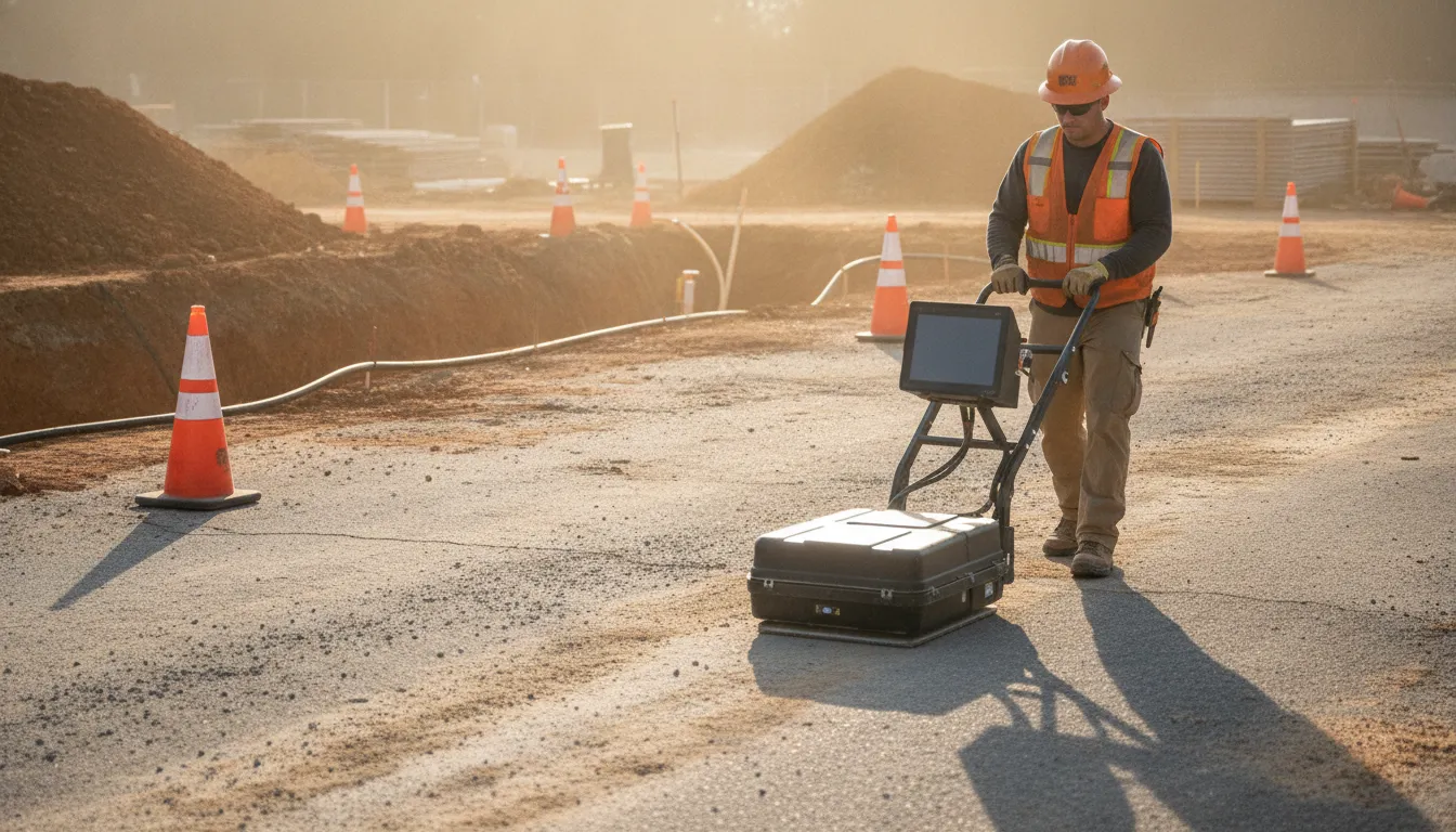
How does ground penetrating radar work? A cart sends a short radio pulse into the ground. A buried change in material sends part of that energy back, and the screen plots the return by time. The picture is a reflection record, not a labeled map of every pipe.
That distinction matters before a crew cuts pavement or opens a trench. A bright return can mark a utility, a soil change, or noise. SafeLine reads the trace against the site and states the confidence, rather than treating the screen as proof of an exact line or depth.
How does ground penetrating radar work on a pass
On a typical pass, the antenna sits close to the pavement or soil and fires a pulse that lasts only a few nanoseconds. The U.S. Environmental Protection Agency describes the pulse as a radio wave sent at a chosen center frequency. Most utility and concrete systems use frequencies somewhere in the 25 to 1,500 MHz range.
The wave spreads downward. When it meets a boundary with different electrical properties, part of the energy bounces back and the rest keeps going. A pipe wall, a change from fill to native soil, or the top of a wet layer can all do this. The receiver records two things: how strong the return is, and how long the round trip took.
Stack those returns as the cart moves and you get a cross-section. Distance along the ground runs one way. Time, which stands in for depth, runs the other. The EPA notes that a person can make a rough read in the field, then keep the file for a closer look later.
A single stroll across a lot is not a survey. The antenna has to cross the feature. A line parallel to a pipe can miss it, while a line across it draws the return. That is why a scoped job uses a grid or targeted passes tied to the dig, the bore, or the saw cut. It is not a random loop around the cones.
What has to change for a target to show up
GPR does not hunt for a pipe by name. It hunts for contrast. The EPA ties that contrast to dielectric permittivity, electrical conductivity, and, in special cases, magnetic permeability. If the buried object and the soil around it look alike electrically, the return is weak or missing.
A plastic water line in dry sand can show clearly because the plastic and the sand do not store electrical energy the same way. The same line in wet, conductive clay can fade because the ground soaks up the wave before a useful echo returns. Contrast, not the material label, decides the picture.
Two-way travel time is not a tape measure
The screen's vertical scale is time. Depth is a conversion. Radar moves at the speed of light in air, about 0.3 meters per nanosecond, or roughly 3.3 nanoseconds per meter of travel. In soil or concrete it slows down. The EPA gives the working relationship as velocity equals the speed of light divided by the square root of the material's relative permittivity.
Water has a relative permittivity near 80. Air is 1. Most soils sit between those ends, and they change with moisture. A wave that takes the same time to return will imply a shallower target in wet ground than in dry ground. That is why a depth number copied off the screen, with no velocity check, is a guess.
Field crews rarely measure velocity at every step. The EPA says analysts usually adopt an average from a reflector at a known depth, from a common-midpoint test, or from published values for that kind of ground. The number is good enough to plan. It is not a surveyed elevation of the crown of a pipe.
Why the top few inches can lie
The first energy on a trace is often the direct wave between the sending and receiving antennas, plus coupling with the surface. The EPA notes that this zone, about 1.5 times the wavelength, can hide shallow targets. A line just under a slab may need a higher-frequency antenna, or a different pass, before anyone should trust the shallow part of the record.
Frequency sets both depth and detail
Antenna choice is the main control a technician has. Higher frequency means a shorter wavelength, a sharper picture, and less depth. Lower frequency reaches farther and smears small targets together. The EPA states that tradeoff directly, and the EPA's CLU-IN technology page puts numbers on it.
| Antenna band | What the record can show | Where it fits |
|---|---|---|
| About 500 to 1,000 MHz. | A few centimeters of detail. Shallow reach. | Slabs, rebar, and shallow conduits. |
| About 200 to 400 MHz. | Centimeter-scale targets. Modest depth. | Utilities under pavement or shallow cover. |
| About 50 MHz or lower. | About a meter of resolution. Greater depth. | Deeper geology, not a tight utility mark. |
CLU-IN, citing Everett (2013), says a typical GPR survey is limited to about 10 meters. Hundreds of meters are possible only in very resistive material such as ice or salt. That is a geophysical extreme, not a promise for a Virginia construction site. Clay, wet fill, and reinforced concrete all cut the useful depth.
CLU-IN also notes that commercial antennas run from about 10 MHz to 1,000 MHz, with some concrete units up to about 7,000 MHz (ASTM 2019, as cited there). The right pick follows the question. A slab scan and a yard-wide utility search are not the same pass.
Switching antennas mid-job is normal, not a do-over. A crew may run a lower frequency to see whether anything deep crosses the corridor, then a higher frequency where the excavator will actually set the bucket. The two files answer different questions. Mixing them into one cleared stamp hides which target size was even visible.
How a technician reads the trace
A single return is a wiggle: a rise and fall in signal strength against time. Move the cart and those wiggles stack into a profile. A point target such as a pipe often draws a hyperbola, a curve that peaks when the antenna is closest and stretches as the antenna moves away. A flat soil boundary looks more like a continuous band.
Reading that shape still does not name the object. The EPA cites research showing no absolute link between a signal and a specific soil or water property. CLU-IN is just as plain: the results are non-unique. A trench, a boring, a record drawing, or a second method has to carry part of the identification.
- Mark the work area and the question the scan has to answer.
- Pick a frequency for the depth and the size of the target.
- Collect passes on a line or a grid, not a single wander across the site.
- Note surface clues: valves, patches, meters, and recent cuts.
- Mark only the returns that repeat and fit the site.
- Write the limit: what was covered, and what the ground would not show.
SafeLine's GPR work follows that sequence. Findings are confidence-classified. The deliverable says what the reflection supports and what it does not. It does not hand a crew a guaranteed clear-to-dig map.
See how a GPR investigation is scoped
What changes the picture before you dig
Conductive ground is the usual reason a scan goes quiet. CLU-IN explains that high electrical conductivity, including wet clay, attenuates the wave. Energy turns to heat in the soil instead of returning as a clear echo. Dry sand and gravel are kinder to the signal. A site can switch from one to the other in a single pad.
Target shape matters too. A metal pipe often reflects strongly, but GPR does not require metal. It needs a sharp change in permittivity. A PVC line, a void, or a concrete encasement can all return energy if the contrast is there and the boundary is abrupt. A gradual soil change may not.
Access and pattern matter as much as physics. Parked equipment, reinforcement in a slab, and a scan that never crossed the work zone all leave holes. SafeLine's service page lists the same limits: soil, moisture, pavement, fill, target size, orientation, depth, congestion, and the survey pattern.
Where this leaves the other methods
GPR is one tool in a locate, not the whole locate. Electromagnetic equipment can trace a conductive line that has an accessible connection. GPR can look for a return where that trace stops, including many non-metallic lines, when the ground allows it. Using both reduces the chance that one blind spot becomes the plan.
If you need the side-by-side comparison, read the guide to GPR and electromagnetic locating. For the moment a project should add radar to a private locate, see ground penetrating radar utility locating. A short definition and the common job-site uses live on what GPR scanning is.
What the reflection lets a project team decide
A useful GPR result answers a project question. It might show a linear return crossing a proposed trench, a clear band under a saw-cut, or an area where the record is too noisy to trust. Each of those is a decision, and none of them is a named utility at a certified depth.
Contractors use that decision to move a cut, hold a dig, or ask for a test hole. Engineers use it to see whether a drawing and the ground disagree. The scan does not replace private utility locating, and it does not assign an ASCE 38 quality level by itself. SafeLine is a private locating firm, not a full subsurface utility engineering practice.
Concrete is the same physics in a thinner space. A high-frequency pass can show rebar, post-tension cables, and conduits when the slab allows it. What those returns can and cannot prove is covered in what GPR can detect in concrete. How radar sits next to electromagnetic gear and other options is in the overview of underground utility locating methods.
Price follows the area, the access, and the question, not a single rate card. The cost guide is separate: how much ground penetrating radar costs. For a locate that has to designate private lines, start with private utility locating.
Bring the work limits, not a vague request to scan the site. A trench centerline, a bore path, or a slab that will be cored gives the antenna something to cross. Records, meter locations, and the 811 marks already on the ground make the reflection easier to judge. Without that frame, the file is only a set of curves.
Frequently asked questions
How far down can ground penetrating radar detect?
On many construction sites the useful depth is a few meters, and CLU-IN cites a typical limit near 10 meters. Ice and salt can allow much more. Wet clay can allow much less. Antenna frequency and soil conductivity set the real number, so no vendor can promise a depth before seeing the site.
What can ground penetrating radar not detect?
It misses targets with little electrical contrast, targets smaller than the wavelength, and targets in ground that absorbs the wave. It also cannot name a utility from the wiggle alone. A return still needs site context, and often a second method or a test hole, before anyone treats it as a specific line.
Does GPR give an exact depth?
No. Depth comes from travel time plus an assumed velocity. Change the moisture and the same time implies a different depth. SafeLine reports confidence-classified findings and does not guarantee an exact depth or an exact horizontal position from radar alone.
Is GPR the same as calling 811?
No. 811 notifies public utility owners. It does not mark every private line past the meter, and it does not run a radar survey. A private locate can add GPR when the project question calls for it. Public ticket timing is a separate rule and does not expire a private mark on a 15-day clock.
Plan the scan around the decision
GPR works by timing a radio echo and judging the contrast that produced it. The value on a job is a scoped pass, a stated limit, and a mark the crew can use. If you have a trench, a slab, or a private line that 811 will not trace, tell SafeLine the work area and the question.
Call 1-866-677-2335 or send the project details through the contact form. The team will say whether radar belongs in the scope, alone or with electromagnetic locating.