
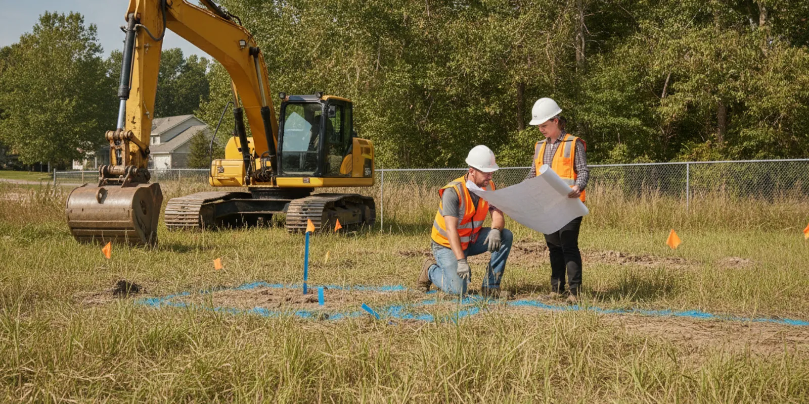
A utility locate for excavators is most useful when it is planned around the actual work area, digging method, and schedule—not treated as a quick paint-marking step. Before breaking ground, coordinate the public 811 ticket, identify private lines that may be outside its scope, and make sure the crew knows how marks relate to the planned excavation.
Plan a utility locating investigation
Why do excavators need more than an 811 ticket?
Excavation planning often involves utilities owned by different parties. The 811 process is an important starting point for notifying utility operators and obtaining public utility marks. But the public locate may not identify privately owned facilities on a property or beyond a utility’s service demarcation. Those can include private water and sewer lines, irrigation, site lighting, electrical feeds to outbuildings, fuel lines, and other owner-installed infrastructure.
That gap matters on more than large construction sites. A trench for drainage, a footing, a road widening, or a service connection can cross lines that are not obvious from surface features. Even a project with a current 811 response can have unanswered questions about private utilities, abandoned lines, or the precise route of a facility near the planned work.
Think of the public ticket and private locating as separate parts of a complete pre-excavation plan. Request the 811 marks required for the work, follow the applicable local process, and confirm the ticket status and validity before digging. Then determine whether the excavation area includes private facilities that need investigation. SafeLine’s overview of private locating versus 811 explains how the scopes differ.
For general damage-prevention information, excavators can also consult the Common Ground Alliance. A reference source does not replace the instructions of utility operators, the project’s safety plan, or applicable requirements.
How should excavators define the locate area?
A locate request is only as clear as its limits. Before scheduling fieldwork, mark out the full area affected by the work, not only the spot where the bucket will first enter the ground. Consider the trench alignment, access route, spoil placement, equipment movement, staging area, and any planned changes in grade. If the design may shift, tell the locating provider which parts are fixed and which are still under review.
Useful scope information includes:
- Work limits: A site plan, marked aerial image, or clearly identified boundaries and dimensions.
- Planned excavation: The proposed route, width, depth, method, and sequence where known.
- Schedule: The date field access is available and when excavation is expected to begin.
- Site conditions: Fences, pavement, landscaping, restricted areas, traffic controls, or other access constraints.
- Known features: Utility records, as-built plans, visible meters, cleanouts, valve boxes, poles, and prior marks.
- Deliverable needs: Field markings, photographs, mapping, or documentation needed for coordination.
A plan can help communicate intent, but it should not be assumed to show every buried facility or its exact position. Share available drawings as clues for investigation rather than proof that an area is clear. If the excavation expands or moves, pause and determine whether the locate coverage still matches the revised work.
SafeLine’s private utility locate checklist is one resource for organizing the information to provide. For projects involving several phases or stakeholders, the investigation process and deliverables page can help teams understand the planning and documentation conversation.
What information should you provide before fieldwork?
Give the locating team enough context to investigate the right place and coordinate access. Start with the project address, site contact, requested date, and a reliable description of the work area. Include the planned excavation depth and method if known; a shallow trench, drilled crossing, and large-area earthwork may call for different planning discussions.
Tell the provider what the crew already knows. Share current 811 ticket information and response status, utility records, previous survey or mapping files, and any known private infrastructure. Mention whether the site has changed since the records were created. Old drawings can help identify likely routes, but field conditions, undocumented work, and abandoned facilities may not be captured in them.
Access and timing are practical safety issues, too. Identify locked gates, escorts, work-hour limits, active traffic, site inductions, or areas that cannot be entered. Make sure the field team can reach the full requested area. If machinery, stored materials, standing water, or active construction blocks access, disclose it so the team can discuss how it affects coverage.
Finally, decide who will receive the findings and how the field crew will use them. The superintendent, equipment operators, subcontractors, and safety lead may all need a consistent explanation of the marks or documentation. SafeLine’s pages on utility locating, GPR, and mapping services and subsurface resources provide related information for planning that discussion.
Which locating methods may fit an excavation?
Detection methods have different strengths, and no single technology should be treated as a guarantee that every buried feature will be found. Electromagnetic (EM) locating is useful for locating conductive facilities or systems that can be traced with an appropriate signal. Ground penetrating radar (GPR) can help investigate subsurface features, including some non-metallic utilities, depending on site conditions and the material being sought.
What works depends on the target, soil and surface conditions, access, nearby interference, and the information available. The provider should explain which methods are appropriate for the requested scope and what limitations may affect the result. SafeLine’s guide to GPR and electromagnetic locating provides more detail on the methods. For a GPR-focused investigation, see the ground penetrating radar service information.
| Planning option | What it can contribute | What to confirm |
|---|---|---|
| Public 811 notification | Requests responses and marks for participating utility operators within the ticket scope. | Ticket boundaries, response status, validity period, and operator-specific instructions. |
| EM locating | Can help trace conductive utilities or lines that can be accessed and energized with a signal. | Whether the target is conductive or traceable, access points, signal conditions, and possible interference. |
| GPR investigation | Can help identify subsurface anomalies and may support locating some non-metallic facilities. | Soil and surface conditions, target characteristics, coverage limits, and how findings will be interpreted. |
| Combined investigation | Uses complementary approaches when the project scope and site conditions support them. | Specific targets, methods planned, areas covered, limitations, and documentation requested. |
The table is a planning aid, not a promise that every method is suitable on every site. Ask what the proposed work can reasonably address, what remains uncertain, and what additional records or investigation may be needed. Read how GPR supports utility locating for more context on the technology.
How do you coordinate locating with 811 and site operations?
Start early enough to allow for the public notification process, private investigation, access arrangements, and review of results. Avoid assuming that a private locate replaces 811 or that an 811 response covers the entire site. The two processes may involve different facilities, contacts, schedules, and instructions.
- Open or verify the 811 ticket. Follow the process applicable to the location and type of work. Confirm that the ticket describes the intended dig area and scope.
- Review operator responses. Note which operators have responded, any unresolved responses, and any instructions that apply before excavation.
- Identify possible private facilities. Compare the ticket scope and known site features with the full work area.
- Schedule private locating. Provide a plan, access details, relevant records, and the work date.
- Brief the field team. Review marks and documentation with the people who will operate equipment or direct excavation.
- Recheck before work changes. A moved alignment, expanded limits, expired ticket, or changed condition may require renewed coordination.
Work zones can be crowded. Coordinate with the superintendent or site contact so the locating team can access the area and so marks are not immediately covered or disturbed by traffic, grading, or material storage. If more than one crew will dig, establish how the findings will be shared and who can authorize a scope change.
For a deeper overview of common coverage questions, SafeLine’s article on what 811 does not cover can help teams identify where private locating may be relevant. Keep instructions from the 811 system and each utility operator available alongside the project’s own site procedures.
What should excavators review when marks are complete?
Do not treat a set of marks as a substitute for a crew briefing. Confirm that the locate covers the area and work planned, identify the markings and any associated photographs or map, and ask questions if the route or limits are unclear. A field technician’s explanation can help the crew understand what was investigated, the methods used, and what limitations were noted.
Before digging, check that:
- The marks or documentation correspond to the current work plan and site limits.
- Relevant 811 responses and private locating information have been reviewed.
- Equipment operators know where marks are and understand site-specific instructions.
- Marks remain visible and have not been covered, removed, or confused with other paint or flags.
- Any stated gaps, inaccessible areas, or unresolved questions have an assigned next step.
- The crew knows whom to contact if field conditions do not match the plan.
Markings can be disturbed by weather, traffic, grading, or other work. If a mark is missing, unclear, or no longer aligned with the scope, stop to resolve the question through the proper project and utility contacts before proceeding in that area. Do not infer a route from a partial line or assume that an unmarked area is free of underground facilities.
When mapping or reporting is part of the scope, confirm the requested format and intended use in advance. SafeLine’s page on utility mapping and documentation explains related deliverables. A useful record should help project participants understand the investigated area, the findings, and any qualifications—not just preserve an unexplained set of marks.
What changes should trigger a locate review?
Revisit the locate plan when the work area, design, or field conditions change. This includes shifting a trench, extending an excavation, changing depth or digging method, adding a bore or pit, moving equipment routes, or entering an area that was not included in the original scope. A new contractor or subcontractor joining the work is another reason to confirm that the information has been shared and remains current.
Also review the plan if markings have been disturbed or the project schedule has moved beyond the applicable ticket or project requirements. Follow the 811 process and utility operator instructions for renewals or updates. If the private investigation no longer matches the revised scope, discuss whether additional locating or documentation is appropriate before work continues.
Keep a simple record of the change: what changed, who identified it, which area is affected, and what response is needed. This keeps a scope issue from turning into an assumption on the ground. SafeLine’s guide to preventing underground utility strikes offers additional pre-excavation practices.
How can a contractor request a useful locate?
A complete request does not need to be complicated. Send the project location, a marked work-area plan, the anticipated excavation dates, depth and method if known, current 811 information, and any available utility records. Explain the decisions the locating information needs to support, such as setting a trench alignment, sequencing work, or reviewing a potential conflict.
Ask the provider to clarify the proposed scope, methods, access needs, deliverables, and known limitations. Find out how results will be communicated to the field team and what to do if the scope changes or a mark is disturbed. Do not assume that all providers include the same coverage or documentation; make the scope explicit before scheduling.
SafeLine serves projects in its stated Mid-Atlantic service area; teams can check the service areas page and share project details through its contact page. A clear request helps determine whether the work fits the available service and how to plan next steps. For homeowner-scale excavation rather than contractor work, the homeowner locating information offers a separate starting point.
Discuss your excavation scope with SafeLine
How can the crew keep locate information usable?
Make the locate information part of the daily work briefing, not a file that stays in an office trailer. Identify the person responsible for reviewing marks and communicating changes, and make sure operators and spotters can find the current plan. If several crews are working in different areas, show each crew which information applies to its work limits.
Protect marks from avoidable disturbance where practical. Coordinate grading, deliveries, traffic, and material storage so key markings remain visible until the relevant work is complete. When marks are covered or removed, use the agreed process to have the affected information checked again. Do not recreate a line from memory or from a photograph without confirming that it still matches the site and current scope.
Keep a dated record of the ticket details, field findings, site plan version, photographs, and any updates that affect the work. Make the record available to the people who may need it during later phases. If a utility is exposed or a condition differs from what the crew expected, follow the project’s applicable safety and notification procedures and document the issue for the project team. The point is not paperwork for its own sake; it is to help the next person understand what was checked, what changed, and what still needs attention.
Frequently asked questions
Does an excavator still need an 811 ticket if a private locate is scheduled?
A private locate should not be treated as a replacement for the public 811 notification process. Follow the applicable 811 process and utility operator instructions for the work, then determine whether private facilities also need to be located.
Can a private locate identify every underground utility?
No method can be assumed to find every facility under every site condition. The target, access, soil and surface conditions, available records, and method all matter. Ask the provider what was investigated and what limitations or unresolved areas remain.
When should locating be scheduled?
Schedule early enough to coordinate 811 responses, site access, private fieldwork, and review of findings before the planned excavation. Timing depends on the project and applicable processes, so confirm dates directly rather than relying on a standard turnaround assumption.
What should the crew do if a mark is missing or unclear?
Pause work in the affected area and resolve the question through the project’s designated contacts and applicable utility or locating instructions. Do not guess the route from incomplete markings or treat an unclear area as clear.
Good excavation planning connects the locate scope to the work the crew will actually perform, and keeps 811 coordination, private investigation, field communication, and scope changes in view from start to finish.