
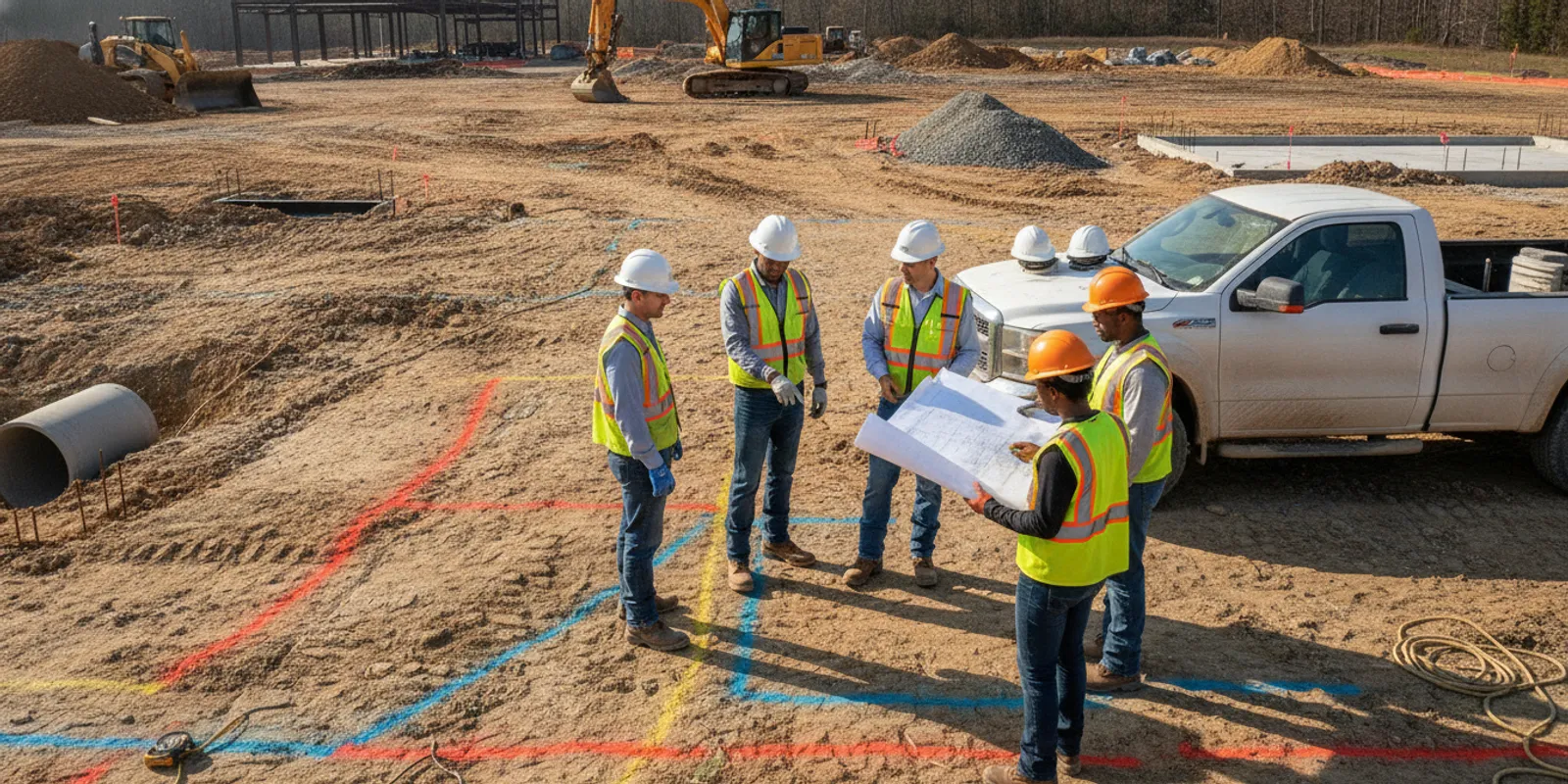
A utility locate virginia project teams can use effectively starts with a clear decision, not a request to find everything underground. Contractors, engineers, developers, and construction managers should plan around 811 marks, privately owned lines, access, schedule, and the deliverables people will rely on.
Private locating does not replace the required one-call process. It is a separate investigation of privately owned or otherwise unmarked infrastructure that may help a team understand site conditions before design, excavation, or other ground-disturbing work. SafeLine serves Virginia and the greater Mid-Atlantic region with private utility locating and related investigation services. No method can promise that every buried feature will be found or precisely characterized.
Why plan a utility locate before the project reaches the field?
Subsurface uncertainty becomes more expensive to manage after design decisions, procurement, and field sequencing are fixed. Planning an investigation early gives the team room to adjust the scope, coordinate access, and decide whether more information is needed. It also creates time to compare field observations with records instead of treating a last-minute mark as a complete site picture.
Begin by naming the decision that depends on subsurface information. A civil engineer might need to assess whether a proposed storm line conflicts with existing services. A contractor might need to plan a trench near a building. A developer could need information about a proposed building pad before finalizing grading. In each case, the investigation area and question differ. “Find everything” does not define a useful boundary or explain how findings will be used.
- During design: identify areas where utility information could affect layout, grading, foundation planning, or routing.
- Before mobilization: align investigation zones with proposed excavation, bore paths, equipment routes, and site access.
- During active work: address a defined conflict or unexpected feature while following site safety and verification procedures.
- For documentation: agree whether the team needs field markings, photographs, mapped information, or a written report.
Early planning does not replace field verification or safe excavation practices. It provides a structured basis for deciding what should happen next. The Virginia private locating overview offers related context for teams considering a project-specific investigation.
How do 811 and private locating fit together?
Virginia’s 811 process and a private investigation address different parts of the picture. Contact 811 before digging as required, follow the ticket instructions and timing, and comply with applicable rules. The one-call process notifies participating utility operators to mark facilities within their responsibility. It does not necessarily identify every private line or site feature beyond that scope.
Private infrastructure varies by property. Examples can include site lighting, irrigation, private electrical feeds to garages or other buildings, pool equipment lines, and privately maintained portions of water or sewer systems. The correct list depends on site ownership and history; do not assume a particular line exists just because it is common elsewhere. Records, when available, can help, but may be incomplete, outdated, or not drawn to field position.
For public mapping context, the Virginia Geographic Information Network provides access to the Virginia GIS Clearinghouse and information about VGIN programs. Public mapping is background information, not a project-specific locate or field confirmation. Keep that distinction clear when compiling site information.
Teams can also review how private locating and 811 differ and what 811 may not cover. Treat the processes as complementary: a private investigation does not cancel one-call obligations, and a ticket does not establish the location of every privately owned feature.
What should a Virginia project scope define?
A useful scope states the work limits, intended use of results, known site conditions, and the questions that remain. Provide a current plan if one is available. Mark areas of interest and planned ground disturbance. If the work has phases, distinguish what needs attention now from areas that may be investigated later.
- Set the boundary. Provide the site address, access point, limits of investigation, and any excluded or inaccessible areas. A plan with a highlighted work zone is more useful than a parcel outline alone.
- State the decision. Say whether the findings will support design, excavation coordination, conflict review, or documentation. Explain who will use the information.
- Share existing evidence. Include utility records, as-builts, prior reports, visible features, and known service connections. Note the source and date when known.
- Show proposed work. Identify structures, trenches, bore paths, grading, pavement cuts, or other planned disturbance. A revised alignment should be sent if it changes the area of interest.
- Describe site conditions. Note paving, fencing, traffic, landscaping, active operations, restricted access, security requirements, and the project contact.
- Specify the deliverable. State whether field markings, photographs, mapped information, or a report is needed, and name the intended users and format where known.
- Identify timing and dependencies. List milestones, access windows, site clearance needs, and other contractors whose work could affect the visit.
These details help determine whether the proposed area is suitably bounded and which questions need resolution before mobilization. SafeLine describes its investigation process and deliverables and its utility locating, GPR, and mapping services. Use a project discussion to clarify scope rather than assuming every job needs the same method or report.
How can EM locating and GPR support an investigation?
Different methods respond to different targets and site conditions. Electromagnetic (EM) locating is useful for conductive utilities that can be detected with an appropriate signal or access to a conductor. Ground penetrating radar (GPR) can help investigate subsurface changes and some non-metallic targets, depending on soil, moisture, surface, depth, target size, and site conditions. Neither method is a universal detector.
A field team may combine methods when the project has varied targets or unresolved questions. The choice should reflect the target, access, site conditions, and intended use—not a blanket belief that one instrument reveals every line. For example, a conductive service with a known access point raises a different method question than an undocumented non-metallic line beneath a complex paved area. Even then, the actual response and interpretation depend on field conditions.
Read about differences between GPR and EM locating and the GPR investigation service. The comparison below is a planning aid, not a performance guarantee.
| Approach | Potential use | Planning considerations | Questions to settle |
|---|---|---|---|
| EM locating | Conductive utilities that can be accessed or detected under suitable signal conditions | Continuity, access points, interference, and nearby conductive objects can affect results | Which targets are known? Is access available? How will findings be marked or recorded? |
| GPR investigation | Subsurface changes and some non-metallic or difficult-to-trace targets | Soil, moisture, surface materials, target depth, and site clutter can affect interpretation | What target question and area matter? How should observations be documented? |
| Combined investigation | Projects with varied target types or open questions | Needs a clear scope, coordinated methods, access, and interpretation | Which uncertainties remain, and is additional verification appropriate? |
| Records and site review | Context from drawings, visible features, and project knowledge | Records may be old, incomplete, or not verified in the field | What is the record source and date, and how does it compare with field results? |
Do not infer that the method comparison determines depth, ownership, or completeness. Ask how limitations will be communicated and what the deliverable will represent. A team can use the overview of common locating methods to prepare questions, then define the project’s specific target and conditions.
How should teams coordinate field access and construction?
Investigation work shares space with deliveries, equipment, trades, and facility or public operations. Assign a site contact who can arrange entry and explain restrictions. Confirm whether escorts, work-hour limits, traffic control, security procedures, or restricted equipment routes apply. These are practical scope details, not administrative extras: if an area cannot be reached, the team needs to know that before the visit.
Before fieldwork, confirm that the investigation limits can be identified on the ground. Clear movable obstructions where practical, but do not remove or alter infrastructure without authorization. If nearby work is active, agree on a safe sequence and make sure the field team knows where people and equipment will be operating. Tell the project contact how to reach the responsible site supervisor during the visit.
For a phased project, map the planned investigation areas to the construction schedule. A team might first address the proposed building footprint and initial utility corridor, then revisit a separate site zone before a later phase. This makes the sequence explicit and helps avoid treating one visit as coverage of areas that were never included. The field planning guide for excavators discusses related coordination points.
Include the investigation in the look-ahead schedule instead of waiting until excavation is ready to start. If the plan changes—a trench shifts, a bore path is added, or the excavation grows—compare the new footprint with the area actually investigated. Ask whether the original scope still answers the revised question before proceeding.
What should the team do with findings?
Make the deliverable usable to the people who will make design and field decisions. Confirm the plan reference or coordinate system, coverage area, feature representation, and any limitations or areas not investigated. If field markings are used, explain what they indicate and how site activity or weather could affect their continued usefulness. A marking on the ground and a mapped record serve different purposes, so agree on what the project needs.
Keep photographs, notes, maps, and reports with project records. Share findings with designers, supervisors, and subcontractors whose work could be affected. Include the coverage limits and relevant caveats when passing information along; a screenshot without context can be misunderstood as a complete record of every subsurface feature.
A locate is a point-in-time investigation. New construction, disturbed markings, changed site conditions, or altered plans may make older information less relevant. If a field crew encounters an unexpected feature or a conflict between marks and plans, pause the affected work and follow the project’s safety and verification procedures. Do not use a drawing alone to decide that a feature is safe to disturb.
When mapping is included, agree on the format and level of detail in advance. SafeLine’s page on utility mapping and documentation describes a related service area. The project should rely only on what the actual deliverable states; do not assume precision, depth, ownership, or completeness that was not documented.
How do common project situations change the plan?
The same general process can lead to different investigation boundaries. Consider three examples. A contractor preparing a short service trench may need a focused area along the proposed route, plus enough context near the tie-in to understand the question. An engineer laying out a new building may need information across a footprint and proposed utility corridors before design is fixed. A municipal team coordinating roadway work may need to sequence several zones around traffic management, existing records, and construction phases. These examples do not dictate a method; they show why the scope should follow the decision.
Use a simple decision sequence to keep the request practical:
- Map the proposed disturbance. Draw the footprint, route, or work zone, and identify where the design is still flexible.
- Compare known records and observations. Note visible features, record gaps, and any disagreement between drawings and site conditions.
- Separate public and private questions. Maintain the 811 process while listing additional privately owned or unmarked features the project needs to consider.
- Rank decisions by consequence and timing. Identify which unresolved areas could affect immediate work and which can be addressed in a later phase.
- Choose a usable output. Decide who needs markings, a map, photos, or written notes to make the next decision.
For instance, if a proposed alignment moves after the investigation, the team should not assume the old coverage follows the new route. If a plan shows a line but field conditions do not match, record the discrepancy and ask what further review is appropriate. If access is blocked on the day, document the excluded area and decide whether it affects the project decision. A clear exception is more useful than implying an area was covered when it was not.
When should a project request utility locating?
Start a project conversation when subsurface information could affect a decision and the team can identify an area or question. That may be during early planning, before design is fixed, in preconstruction, or after a specific field conflict appears. Earlier planning often leaves more options for coordinating access and adjusting scope, though the right timing depends on project milestones and site availability.
A Virginia site with public utility marks may still have private infrastructure that needs separate attention. A project without an obvious conflict may still benefit from comparing records with proposed ground disturbance. Conversely, a vague request with no limits or intended use may need scoping before a field visit can be planned.
For related project context, review subsurface information for contractors and the pre-excavation utility locate checklist. Use those resources as preparation, while keeping the investigation tied to the specific Virginia site and work area.
What information helps when requesting a project conversation?
Prepare basic facts so the discussion can focus on the site and decision rather than back-and-forth to establish the basics. A concise package can include:
- Site location and the person responsible for access.
- A plan or sketch with the investigation area and proposed work clearly marked.
- Project stage, schedule milestones, and access windows.
- Existing 811 ticket information, utility records, and prior reports, if available.
- Known target types, suspected conflicts, and the questions the team needs answered.
- Preferred documentation or mapping format and the intended users.
- Site conditions such as paving, traffic, active operations, or restricted zones.
It can help to distinguish confirmed facts from assumptions. For example, write “record drawing shows a service in this area” rather than “service is at this exact location” unless field verification supports that wording. Also identify what is not yet known: a missing plan, uncertain ownership, an unconfirmed connection, or a planned route that may still change.
Do not delay the 811 request while arranging a private investigation. Maintain the one-call process and coordinate any additional work separately. You can review SafeLine’s service areas when preparing to ask about a Virginia project. A focused request makes it easier to discuss coverage, method options, access, timing, and deliverables without assuming a standard scope applies to every site.
Frequently asked questions
Does a private locate replace calling 811 in Virginia?
No. A private investigation does not replace the one-call process or its applicable requirements. Contact 811 before digging and arrange private locating separately when the project needs information beyond participating operators’ marks.
Can one method find every underground utility?
No single method should be treated as universal. Results depend on the target, material, depth, access, ground and surface conditions, and other site factors. Define the question and conditions so the appropriate approach and limitations can be discussed.
Should the team provide existing utility plans?
Yes, if available. Plans, as-builts, prior reports, and known connection points provide useful context. Share their source and date, and treat them as records to compare with field information, not proof of exact position.
What if the construction plan changes after the investigation?
Compare the revised work limits with the area actually investigated. If a new trench, excavation, or layout extends beyond it or changes the target question, ask whether additional investigation or verification is appropriate before proceeding.
What should be agreed before the field visit?
Confirm the limits, purpose, access, schedule, site constraints, expected methods, and deliverable. Identify the project contact and how findings or limitations will be communicated to the people who will use them.
Careful scope definition, coordination with 811, and clear handling of findings help Virginia project teams make informed decisions before ground disturbance begins.