
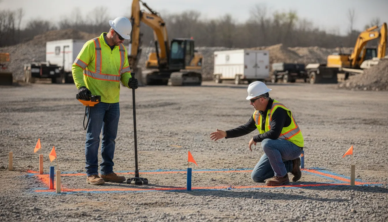
Utility locating for construction change orders starts with a simple question: did the revised plan change where, how, or when the crew will excavate? A shifted limit, deeper cut, different sequence, new access route, or expanded staging area can put the work closer to utilities than the original locate information anticipated. Treat the approved change order as a project coordination signal, not as proof that a new locate is automatically required by law.
Share your revised excavation limits and project details through SafeLine's contact form.
Review the revised drawings, excavation depth and method, sequence, access, existing marks, and utility records together. Confirm required 811 notifications and owner requirements, then determine whether private utility locating for construction change orders is needed before work resumes. A review supports informed planning, but no locate guarantees that every underground line has been identified or that excavation is safe.
The most useful starting point is to compare the old locate information with the exact area and activities introduced by the change. That comparison helps the team identify when a locate review should move from a paperwork check to field coordination.
When Should a Change Order Trigger a Locate Review?
A change order should prompt a locate review when it changes what the crew will disturb. How the work will proceed, or which parts of the site become accessible to excavation. The question is not whether every paperwork revision requires a new locate. It is whether the revised plan still matches the limits, assumptions, and field information behind the existing locate work.
Changes to limits, depth, or work sequence
Start with the physical footprint. If the excavation expands into an area that was not previously reviewed, compare that added area with existing marks, drawings, and utility records. A shift in alignment can matter even when the total quantity of work is unchanged.
Depth and method are equally important. Moving from shallow grading to trenching, boring, drilling, or deeper excavation can bring utilities into the work path that were not relevant to the original activity. The same applies when a change order moves a utility crossing earlier in the schedule, changes the excavation sequence, or adds a new tie-in. Treat these as decision points for asking whether additional locating or field verification is appropriate, rather than relying on a universal re-locate deadline.
Access, staging, and the real work area
Review the areas used for staging, access roads, spoil placement, dewatering, temporary facilities, and equipment movement. A revised work area can extend beyond the line shown on the excavation drawing. It may also expose private infrastructure serving a building, outbuilding, irrigation system, lighting, or other site feature. Public 811 markings and private locating address different scopes, so required one-call notification should remain part of the project plan while the team separately considers private utilities.
Use the change as a coordination checkpoint
OSHA requires the estimated location of underground installations reasonably expected in an excavation to be determined before the excavation opens. It also calls for contacting utility owners within customary local response times and determining exact locations by safe and acceptable means as work approaches them. Underground installations must be protected, supported, or removed as necessary while the excavation remains open. See the current eCFR excavation standard for the governing text.
Document the revised limits, depth, sequence, access, and staging changes, then ask the project team, utility owners, or a qualified locator to resolve any mismatch before excavation resumes. This practical review supports better decisions without treating a locate as a guarantee that every underground condition has been found or that excavation is automatically safe.
How to Compare the Revised Work Area With Existing Locate Information
A change order can alter more than the drawing title. It may move an excavation limit, change the planned sequence, add depth, or bring equipment into an area that was not part of the original locate request. Compare the revised plan with the field information before work resumes, and treat the result as a coordination decision rather than an automatic legal re-locate deadline.
- Mark the revised limits. Highlight the added, removed, and shifted portions of the work area on the latest drawing. Include access routes, staging areas, laydown areas, spoil locations, and any temporary excavation that the change order introduces. Then compare those boundaries with the area covered by the original locate request and site marks.
- Describe the excavation method and depth. Record whether the work will involve trenching, grading, boring, drilling, or another method. Note the planned depth, width, alignment, and equipment. A work area that previously required surface activity may need a closer review when the revised plan brings excavation nearer to known or suspected utility paths.
- Recheck the sequence. Compare the original construction sequence with the revised schedule. Ask whether earlier work will remove surface references, change access, cover marks, or require excavation before a utility owner or locator can clarify an uncertainty. Timing and mark-validity rules vary by state, so check the applicable one-call requirements, project specifications, and utility-owner instructions for the job location.
- Separate utility ownership and scope. Identify which information came from public one-call marking and which came from private records or a private locate. Public marks may not cover privately owned lines on the property, such as irrigation, private electrical feeds, landscape lighting, or private water and sewer laterals. If the revised area reaches those systems, review whether additional private locating is appropriate. This private utility locating service guide provides additional planning context.
- Check old marks and records against current conditions. Review locate tickets, sketches, maps, photographs, utility-owner responses, and field notes. Walk the revised area to see whether marks remain visible and whether site changes, grading, weather, or traffic have affected them. Existing records can inform the comparison, but they should not be treated as proof that every underground installation is identified.
- Document unresolved conflicts before digging. List discrepancies such as a line shown outside the revised limit but observed inside it. A mark with no matching record, or a drawing that does not identify ownership. Pause the affected activity while the project team obtains clarification through the appropriate one-call process, utility owner, or qualified private locator. When excavation approaches an estimated utility location, exact location and protection steps should follow applicable safety requirements.
This comparison gives the project team a defensible basis for deciding whether the existing information still matches the work that will actually occur. It does not replace required notifications or guarantee safe excavation.
How Utility Locating for Construction Change Orders Helps Contractors Recheck Scope
A change-order review should connect the revised scope to what is known about subsurface conditions. SafeLine's guidance is to compare the existing locate information with the revised work plan and ask whether additional locating is needed when limits. Sequence, or the work area changes. That review is not a guarantee that every utility has been identified. It is a practical checkpoint before the crew relies on old marks or records in a different field situation.
Confirm the new limits and private utility scope
Start by tracing the change order on the current plan and on the ground. Note whether the excavation boundary moved, expanded, or now includes staging, access, tie-in, landscaping, or temporary work areas. Then identify which utilities the existing information addresses and which privately owned lines may fall outside a public one-call scope. A private utility locating service can help evaluate privately owned utilities within the revised area.
Do not treat the original public notification or locate request as a substitute for checking the changed scope. Project teams should continue to follow applicable one-call requirements, owner instructions, and project specifications. If the revised work reaches areas that were not included in the original request, ask the responsible parties what additional notification or private locating is appropriate. The guide on private utility locate before digging provides related planning context.
Review marks, records, and field questions
Compare the location, age, and coverage of existing marks with the revised limits. Look for marks that end before the new excavation boundary, have been disturbed by traffic or weather, or no longer align with the drawings. Review available sketches, photos, maps, and utility-owner information alongside the field conditions. Industry locating guidance commonly treats clear field markings and documentation as useful parts of contractor coordination, but that is general industry support, not a SafeLine guarantee. See the industry discussion of utility markings and documentation for context.
Escalate questions before excavation resumes when a mark conflicts with the revised plan, a utility's ownership is unclear. The crew cannot identify the referenced mark, or the planned method and depth differ materially from the earlier work. Give the locator the revised limits, drawings, schedule, access constraints, and existing records. A focused reassessment can then address the actual change rather than repeating an unchanged request.
Why 811 and Private Locating Need Separate Checks
A change order can alter more than the excavation line on a drawing. It may extend the work area, change access or sequencing, or bring privately owned infrastructure into the path of construction. That is why public 811 notification and private utility locating should be treated as related but separate checks. One does not replace the other, and applicable one-call requirements should not be skipped.
| Check. | Typical scope. | Examples. | Project action after a change order. |
|---|---|---|---|
| Public 811 notification | Coordinates marking of public utility infrastructure within the one-call system's coverage. | Utility facilities associated with participating public owners and operators in the affected area. | Submit or update the one-call request as required for the revised limits, then follow the applicable state timing, mark-validity rules, and project specifications. |
| Private utility locating | Investigates privately owned lines and facilities that may fall outside public 811 coverage, including infrastructure beyond a meter or property line. | Private irrigation, electrical feeds, gas grill lines, pool equipment lines, water or sewer laterals, landscape lighting, and communications lines. | Have the revised work area reviewed for additional locating needs, especially where the new limits or sequence reach private infrastructure. |
The distinction matters on active construction sites. A public mark may help identify infrastructure covered by the one-call request, while a private service, lateral, feed, or site system can remain outside that request. Review the underground utility marking colors used on the site, but do not assume color alone identifies ownership or confirms that every relevant line has been located.
For a practical scope check, compare the revised drawings and excavation limits with the existing locate records, marks, and known utility ownership. The article on utilities 811 does not mark provides additional context for identifying gaps. The goal is not to treat either service as a guarantee. It is to make sure the changed work plan is evaluated through both the public notification process and a private locating review when the site conditions call for it.
How EM Locating and GPR Support Updated Field Decisions
When a change order shifts the excavation area, the project team may need more than a quick review of old marks. Electromagnetic (EM) locating and ground-penetrating radar (GPR) provide different types of subsurface information. Used together, they can help a locator and the project team decide what should be revisited, marked, documented, or clarified before work resumes.
EM locating generally works by applying or detecting an electromagnetic signal associated with a conductive utility. A transmitter can induce a radio-frequency signal onto a traceable conductor, while some electrical and telephone utilities produce an electromagnetic field that a receiver can detect. The signal can help the locator follow a utility's path, but the result depends on the utility, access, signal conditions, and the surrounding site.
GPR uses radar pulses to image changes in the subsurface. That makes it a useful complementary method when a line may not provide a usable electromagnetic signal, including some nonmetallic utilities. GPR data still requires interpretation. Soil, moisture, reinforcement, debris, pavement, depth, and site geometry can affect what the equipment records. It is not a universal substitute for EM locating, and neither method should be presented as a guarantee that every underground installation has been found.
For a changed work plan, method selection should follow the actual conditions. A locator may consider the utility material, suspected route, access points, excavation method, proposed depth. Surface conditions, and whether existing records or marks conflict with what is visible in the field. The review can then connect equipment findings with records, paint or flags, site observations, and the revised drawings rather than treating one scan as a standalone answer.
That broader process is consistent with the practical workflow described in the industry source on EM and GPR utility locating, which presents assessment, data collection, marking, reporting, and follow-up as related steps. The source is an industry example, not a guarantee of a particular result or deliverable for every project.
Teams with complex design changes may also benefit from reviewing subsurface utility engineering services as part of project planning. The key decision is not whether one technology is always best. It is whether the selected methods and field interpretation address the revised limits and leave the crew with current, clearly communicated information before excavation proceeds.
What Documentation Should the Project Team Preserve?
Good documentation gives the project team a shared record of what changed, what was reviewed, and what questions remain. It supports coordination between the owner, designer, contractor, utility owners, and locating provider. It is not a guarantee that every underground installation was found, and it does not automatically create legal protection for the project.
Start with the revised drawings and the approved change order. Keep the revision date, affected limits, excavation depth or method, changed sequence, staging areas, and any notes that explain why the work area moved. Pair those files with the locate request or scope confirmation so the field team can see what information the locating work was based on.
Preserve the field record
Retain clear photos of paint, flags, pins, and other site markings from useful angles. Include enough context to identify the location, nearby control points, and the work area. Record when the photos were taken and which drawing or request they relate to. If marks are disturbed, covered, or no longer aligned with the revised limits, note that condition rather than treating an old photo as current field confirmation.
Keep available map files, reports, sketches, depth information when provided, and any field notes. Documentation formats vary by project and provider, so do not assume that every locate produces the same fixed deliverable. A locating provider may mark utilities on site and provide documentation for contractor coordination, but the project team should confirm exactly what was requested and delivered.
Record decisions and unresolved questions
Save utility-owner responses, one-call records, emails, meeting notes, and written clarifications about ownership or conflicts. A response that says an installation is outside an owner's scope can be as important as a confirmed facility location. Track open questions, who owns the next action, and whether work must pause in a specific area while the conflict is reviewed.
As excavation approaches an estimated utility location, OSHA requires the exact location to be determined by safe and acceptable means. Underground installations must also be protected, supported, or removed as necessary while the excavation is open. See the OSHA excavation standard and follow applicable project, owner, and jurisdictional requirements. A complete record helps the team communicate those decisions in the field, but it never replaces careful verification and work practices.
A Field-Ready Checklist Before Excavation Resumes
Before the crew returns to the ground, pause long enough to confirm that the field plan still matches the work that will actually occur. A change order is a practical reason to compare existing locate information with the revised limits, sequence, and work area, then ask whether additional locating is needed.
- Confirm the changed scope. Mark the revised excavation limits on current drawings or site plans. Note changes to depth, access, staging, alignment, equipment, and the order of operations.
- Coordinate current 811 activity. Confirm that the applicable one-call notification has been made and that the response and mark-validity requirements for the project location are understood. Requirements vary by state and situation, so check the applicable rules and project specifications. Do not treat a private locate as a replacement for required 811 notification.
- Check private utilities. Identify lines that may fall outside public 811 coverage, such as private electrical feeds, irrigation, landscape lighting, communication lines, or private water and sewer laterals. If the revised work area reaches these features, arrange a private utility locating review. See this guide to utility locating before excavation for additional planning context.
- Inspect mark visibility. Walk the revised limits and confirm that paint, flags, stakes, records, and maps are visible, current, and easy for the crew to interpret. Replace or clarify marks that are faded, disturbed, incomplete, or outside the new work area.
- Resolve method and field questions. Ask whether electromagnetic (EM) locating, GPR, or both are appropriate for the utilities and conditions involved. Confirm how suspected lines will be verified as excavation approaches. OSHA states that employers must determine the estimated location of underground installations before opening an excavation and determine exact locations by safe and acceptable means as work approaches them: 29 CFR 1926.651.
- Escalate conflicts before digging. Stop and seek clarification when drawings, marks, records, utility-owner information, or field observations disagree. Document the question and identify who must resolve it.
- Brief the crew. Review the revised limits, mark meanings, known uncertainties, verification approach, equipment restrictions, and stop-work or escalation process during the pre-excavation briefing. While the excavation is open, underground installations must be protected, supported, or removed as needed to safeguard employees.
This checklist supports coordination; it is not a guarantee that every underground installation has been identified or that excavation is risk-free.
Frequently Asked Questions
What safety practice is required when excavating around utilities?
Before excavation, determine the estimated location of underground installations and contact the relevant utility owners or companies through the applicable notification process. As work approaches a utility, verify its exact location by safe and acceptable means, then protect, support, or remove the installation as needed while the excavation remains open. See OSHA's excavation standard. A change to limits, depth, access, or sequence is a practical reason to compare the revised plan with existing marks and records. It does not replace required 811 notification or guarantee that every utility has been identified.
Who should contractors call to mark private utility lines?
Contact a qualified private utility locating contractor for privately owned lines or facilities outside the typical public 811 marking scope. Give the locator the revised excavation limits, drawings, planned depth, access constraints, schedule, and existing locate records. Continue to follow the applicable 811 process for public utility notification, because private locating and one-call notification address different scopes. Ask the project owner or utility owner about facilities they control, and resolve conflicts before excavation resumes.
What can a construction change order change?
A change order can alter the work area, excavation limits, depth, sequence, access, staging, materials, or the type of work performed. Any of those changes can affect which utilities are relevant and whether existing marks, records, or prior review still match the planned operation. Treat the approved revision as a new coordination checkpoint: compare it with the field, identify unanswered utility questions, and update the locating request or documentation when needed. Check project specifications, owner requirements, and state one-call rules for any timing requirements.
Contact us to review your revised project scope
Changed excavation limits or sequencing can make it useful to revisit the locating information your team is working from. Share the revised work area, schedule, drawings, and existing records so the discussion can stay focused on the project details that matter. Contact SafeLine Subsurface through the contact form to discuss your revised excavation limits, sequencing, and locating information.